 Block
Darien, Wisconsin
19 topographic sheets cover this place, the earliest surveyed in 1893 and the latest in 1980. It stands in Darien town. It lies in ZIP code area 53114. The Survey maps it on the Sharon quadrangle. 1,573 people lived here at the 2020 count. It stands 925 feet above sea level.
On record in Darien
Buildings and businesses the archive holds for this place. Each opens its own page, with the source record it came from.
On the National Register 1 record
- Downtown Darien Historic Districtlisted 2013
Population over time
2 figuresDarien fell from 1,580 to 1,573 between 2010 and 2020. These are the recorded population figures Wikidata holds for this place, reached through the Geographic Names Information System number this page is keyed on rather than by name, so they belong to this place and not to another of the same name. Most are census counts, but not all are: an early figure may be a founding or settlement estimate, and an estimate published within five years of a census is left out. The change column is computed, and is left blank where more than 20 years separate a figure from the one before it, because a gap that long is not a change between two counts.
| Year | People | Change |
|---|---|---|
| 2010 | 1,580 | |
| 2020 | 1,573 | -7 (-0%) |
Topographic sheets covering this place
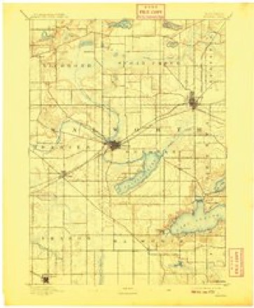
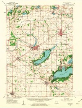
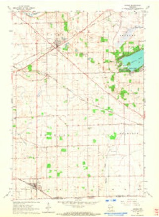
8 surveys from 19 printed sheetsMatched by testing this settlement's coordinate against the published boundary of every sheet in the United States Geological Survey's historical collection. Each opens the scanned sheet at the Survey.
- 1893 USGS Delavan quadrangle1:62500, 6 printings
- 1954 USGS Rockford quadrangle1:250000
- 1955 USGS Rockford quadrangle1:250000
- 1958 USGS Rockford quadrangle1:250000, 4 printings
- 1960 USGS Delavan quadrangle1:62500, 2 printings
- 1960 USGS Sharon quadrangle1:24000, 3 printings
- 1963 USGS Rockford quadrangle1:250000
- 1980 USGS Lake Geneva quadrangle1:100000





In the county-history sources
15,893 words on this townshipHistory of Walworth County, Wisconsin, Containing an Account of Its Settlement, Growth, Development and Resources...its War Record, Biographical Sketches, Portraits of Prominent Men and Early Settlers; the Whole Preceded by a History of Wisconsin...and an Abstract of Its Laws and Constitution.., published 1882 names this settlement in its chapter on Darien Town. These are the passages that mention it, exactly as the scans read.
When, by act of the Territorial Legislature, approved January 2, 1838, the town of Dela- -van was created, consisting of four townships, the one now forming Darien was among the number. By an act approved January 6, 1840, Town 2 north, in Rango 15 east, was formed into a separate town, by the name of Darien, from a town of the same name in New York, from -which most of the early settlers came. The surface of the town is generally quite level, the greater portion of the rolling land being near the central and northern part.
Passage source: History of Walworth County, Wisconsin, Containing an Account of Its Settlement, Growth, Development and Resources...its War Record, Biographical Sketches, Portraits of Prominent Men and Early Settlers; the Whole Preceded by a History of Wisconsin...and an Abstract of Its Laws and Constitution.., published 1882.
Salmon Thomas, with his family, and his brother, Trumbull D.. moved into the present town of Darien in June, 1837. Mr. Thomas' brother had made his claim in the fall of 1836, and paid a man to put a log house on it, but when the family arrived they found the logs rolled up and covered, but no door or windows. They were obliged to cut a door through before they could get in.
Passage source: History of Walworth County, Wisconsin, Containing an Account of Its Settlement, Growth, Development and Resources...its War Record, Biographical Sketches, Portraits of Prominent Men and Early Settlers; the Whole Preceded by a History of Wisconsin...and an Abstract of Its Laws and Constitution.., published 1882.
The most prominent settlers who came to the town of Darien previous to 1841 are as follows: In the spring of 1838, O. W. Carter, Jr., Leander Dodge, Jacob S. (;!ook, Jacob A. Sea, Lyman and Loren K. Jones, Asher Johnson, Hiram A. Johnson, Jared Fox and Charles Ellsworth in the summer and fall of 1838; William and C. Hollister, in the spring, and Ebenezer Chesebro, Elijah Belden, Rev. Mr. Kingsley, John V. AValker, Hugh Long and Chester D. Long in June of 1839; Nicholas Peny and two sons, Jabez B. Chesebro, Lyman H. Seaver, William A. Waterhouse, Alvah Johnson, Joseph Wilkins and Robert Lawson in the summer and fall of 1839; Archibald Woodard, John Curtis, Lemuel Hollister, Elisha McCollister, William G. Mavhaw, Jasper Griggs, Hiram A. Stone, John Wilkins. M. Woodhull and Robert A. Houston in" 1840.
Passage source: History of Walworth County, Wisconsin, Containing an Account of Its Settlement, Growth, Development and Resources...its War Record, Biographical Sketches, Portraits of Prominent Men and Early Settlers; the Whole Preceded by a History of Wisconsin...and an Abstract of Its Laws and Constitution.., published 1882.
Machine-read from a century-old scan, so expect the errors a machine makes: misspelled names, dropped words, stray characters.
Read the whole chapter on Darien Town - it names this place 65 more 65 times.
Fires near this place
14 since 2018Regional context, not property-specific evidence. The federal wildfire occurrence database lists 14 fires within 5 miles of Darien between 2018 and 2020, burning about 11 acres in total. None started naturally. None was recorded as arson. Distance is straight-line from the map coordinates, so a fire counted here may appear on a neighbouring settlement's page as well.
| Reported cause | Fires |
|---|---|
| Debris and open burning | 9 |
| Missing data/not specified/undetermined | 5 |
The most recent of them, most recent first, with the day each was reported and the service that recorded it.
| Date | Cause | Size | Reported by | Name on the report |
|---|---|---|---|---|
| 17 June 2018 | Missing data/not specified/undetermined | under an acre | Wisconsin Department of Natural Resources | 191 |
| 3 May 2020 | Missing data/not specified/undetermined | under an acre | Wisconsin Department of Natural Resources | 58 |
| 7 April 2018 | Missing data/not specified/undetermined | under an acre | Wisconsin Department of Natural Resources | 1804008 |
| 4 April 2019 | Debris and open burning | under an acre | Wisconsin Department of Natural Resources | 117 |
| 30 April 2018 | Debris and open burning | under an acre | Wisconsin Department of Natural Resources | 135 |
| 3 April 2019 | Debris and open burning | under an acre | Wisconsin Department of Natural Resources | 19126 |
| 29 April 2018 | Debris and open burning | 2.0 acres | Wisconsin Department of Natural Resources | 134 |
| 24 April 2018 | Debris and open burning | under an acre | Wisconsin Department of Natural Resources | 130 |
Settlements close enough to share some of these fires:
Mines and quarries near this place
7 within 5 milesRegional context, not property-specific evidence. The federal mineral resources record lists 7 workings within 5 miles of Darien: 4 past producers, 2 producers, 1 unknown. 2 still produce. What was taken out: Sand and Gravel, Construction, Stone, Crushed/Broken. Distance is straight-line from the map coordinates, so a quarry counted here may appear on a neighbouring settlement's page as well.
| Where | Site | Commodity | Status | Recorded |
|---|---|---|---|---|
| Braukoff Quarry | Stone, Crushed/Broken | Past Producer | ||
| Ames Pit | Sand and Gravel, Construction | Producer | ||
| Community Pit | Sand and Gravel, Construction | Past Producer | ||
| Harness Pit | Sand and Gravel, Construction | Past Producer | ||
| Koehl Pit | Sand and Gravel, Construction | Unknown | ||
| Schutt Pit | Sand and Gravel, Construction | Past Producer | ||
| Triebold Pit | Sand and Gravel, Construction | Producer |
Storms near this place
23 since 1996Regional context, not property-specific evidence. The National Weather Service names Darien in 23 storm reports between 1996 and 2026: 13 thunderstorm wind, 7 hail, 2 tornado, 1 heavy rain. No death or injury is recorded in these reports. Each account below is quoted exactly as the forecast office filed it, from the NOAA Storm Events Database, and each date opens the federal record of that event.
| When | Event | Place named | Harm | What the report says |
|---|---|---|---|---|
| August 1996 | Thunderstorm Wind | Darien | $150,000 | no account filed |
| April 2026 | Tornado (EF1) | Darien | $133,000 | The tornado appeared to start north of School Section Rd and west of Old 89 Rd with mainly tree damage going to the east-northeast. The tornado then tracked along State Road 11 going east toward Delavan. About 4 farmsteads had damage to them, including one empty silo that was blown down from about halfway up. The tornado then continued east-southeast along Hwy 11 and ended near Redwood Ct on the west side of Delavan where it caused some tree damage. |
| May 2024 | Tornado (EF1) | Darien | $100,000 | Brief tornado went through mainly rural lands, but did hit a horse barn where farmers were actively feeding their horses. No injuries occurred, but a door blew in and nearly hit one of the farm workers. |
| July 2008 | Thunderstorm Wind | Darien | $100,000 | Powerful thunderstorm wind gusts toppled several large trees and broke branches that brought down some power-lines. At least 6 homes sustained damage due to tree debris in the Walworth to Williams Bay area. |
| October 2002 | Thunderstorm Wind | Darien | $25,000 | no account filed |
| July 2006 | Thunderstorm Wind | Darien | $10,000 | Trees and power lines down. |
| June 2014 | Thunderstorm Wind | Darien | $5,000 | A path of sporadic trees down, some large. |
| June 1999 | Thunderstorm Wind | Darien | $5,000 | no account filed |
| August 2023 | Thunderstorm Wind | Darien | $2,000 | Some tree damage noted. |
| June 1998 | Thunderstorm Wind | Darien | $2,000 | no account filed |
| July 2015 | Thunderstorm Wind | Darien | $1,000 | A large tree snapped at its base. |
| June 1997 | Thunderstorm Wind | Darien | $1,000 | no account filed |
| July 1997 | Thunderstorm Wind | Darien | $900 | no account filed |
| March 2024 | Thunderstorm Wind | Darien | - | A video of a gustnado with dust airborne. No damage was noted after a ground survey via Emergency Management and NWS. |
| June 2011 | Thunderstorm Wind | Darien | - | Powerful thunderstorm winds pushed over several large trees. |
| July 2008 | Heavy Rain | Darien | - | Heavy rains of 1 to 2 inches resulted in minor urban and small stream flooding. Stationary water depths on some roads reached a foot which resulted in the closure of STH 11 and STH 14. |
| May 2018 | Hail | Darien | - | no account filed |
| September 2010 | Hail | Darien | - | no account filed |
| May 2006 | Hail | Darien | - | no account filed |
| October 2001 | Hail | Darien | - | no account filed |
| April 2000 | Hail | Darien | - | no account filed |
| June 2000 | Hail | Darien | - | no account filed |
| June 2000 | Hail | Darien | - | no account filed |
Nearest settlements
The eight closest, with where each one stands in the county. Distances are straight-line, computed from the Geographic Names Information System coordinates.
| Map | Place | Distance | Sheets |
|---|---|---|---|
| Pioneer Estates | 1.6 miles | 19 | |
| Allens Grove | 3.3 miles | 16 | |
| Delavan | 4.0 miles | 19 | |
| Delavan Lake | 4.2 miles | 19 | |
| Fairfield | 4.2 miles | 17 | |
| Lake Lawn | 6.2 miles | 19 | |
| Inlet | 6.7 miles | 19 | |
| Sharon | 6.9 miles | 19 |
Elsewhere
Matched on this settlement's Geographic Names Information System number rather than its name, so it cannot be a different place of the same name in another state.
| Wikipedia article on Darien | An encyclopaedic summary. Its text is share-alike, so it is linked here rather than copied. |
| Wikidata item Q2355352 | The structured record the population and elevation above come from. Public domain (CC0). |
Provenance
This settlement is recorded in the Geographic Names Information System as feature 1563712. The sheet list is computed by point-in-boundary test against the United States Geological Survey's historical topographic inventory. Both are works of the United States government and carry no copyright under 17 U.S.C. 105.
Wildfire. Short, Karen C. 2022. Spatial wildfire occurrence data for the United States, 1992-2020 [FPA_FOD_20221014]. 6th Edition. Fort Collins, CO: Forest Service Research Data Archive. https://doi.org/10.2737/RDS-2013-0009.6 Collected with United States Government funding and usable without additional permissions or fees.
Mines and quarries. USGS Mineral Resources Data System (MRDS) https://mrdata.usgs.gov/mrds/ A work of the United States government, no copyright under 17 U.S.C. 105.
Storms. NOAA National Centers for Environmental Information, Storm Events Database https://www.ncei.noaa.gov/stormevents/ A work of the United States government, no copyright under 17 U.S.C. 105. Narratives are quoted verbatim from the National Weather Service report and are not edited or summarised.