 Block
Delavan, Wisconsin
19 topographic sheets cover this place, the earliest surveyed in 1893 and the latest in 1980. It stands in Delavan City. It lies in ZIP code area 53115. The Survey maps it on the Delavan quadrangle. 8,505 people lived here at the 2020 count. It stands 925 feet above sea level.
On record in Delavan
Buildings and businesses the archive holds for this place. Each opens its own page, with the source record it came from.
On the National Register 8 records
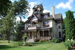 A. H. Allyn Houselisted 1985
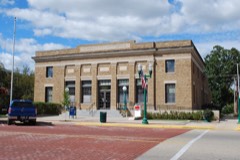 Delavan Post Officelisted 2000
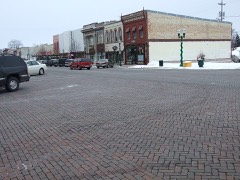 Delavan's Vitrified Brick Streetlisted 1996
 A.P. Johnson Houselisted 1982
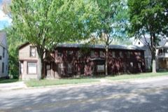 Israel Stowell Temperance Houselisted 1978
- George W. Borg Corporationlisted 2020
- Delavan Downtown Commercial Historic Districtlisted 2016
- Delavan Water Tower Park Historic Districtlisted 2016
Population over time
2 figuresDelavan grew from 8,463 to 8,505 between 2010 and 2020. These are the recorded population figures Wikidata holds for this place, reached through the Geographic Names Information System number this page is keyed on rather than by name, so they belong to this place and not to another of the same name. Most are census counts, but not all are: an early figure may be a founding or settlement estimate, and an estimate published within five years of a census is left out. The change column is computed, and is left blank where more than 20 years separate a figure from the one before it, because a gap that long is not a change between two counts.
| Year | People | Change |
|---|---|---|
| 2010 | 8,463 | |
| 2020 | 8,505 | +42 (+0%) |
Topographic sheets covering this place
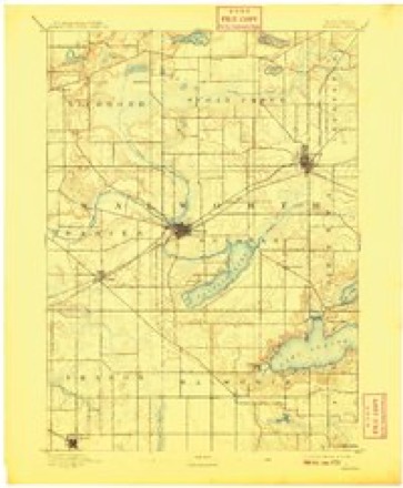
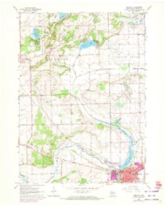
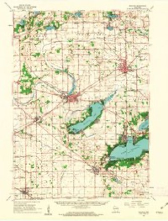
8 surveys from 19 printed sheetsMatched by testing this settlement's coordinate against the published boundary of every sheet in the United States Geological Survey's historical collection. Each opens the scanned sheet at the Survey.
- 1893 USGS Delavan quadrangle1:62500, 6 printings
- 1954 USGS Rockford quadrangle1:250000
- 1955 USGS Rockford quadrangle1:250000
- 1958 USGS Rockford quadrangle1:250000, 4 printings
- 1960 USGS Delavan quadrangle1:24000, 3 printings
- 1960 USGS Delavan quadrangle1:62500, 2 printings
- 1963 USGS Rockford quadrangle1:250000
- 1980 USGS Lake Geneva quadrangle1:100000





In the county-history sources
23,409 words on this townshipHistory of Walworth County, Wisconsin, Containing an Account of Its Settlement, Growth, Development and Resources...its War Record, Biographical Sketches, Portraits of Prominent Men and Early Settlers; the Whole Preceded by a History of Wisconsin...and an Abstract of Its Laws and Constitution.., published 1882 names this settlement in its chapter on Delavan City. These are the passages that mention it, exactly as the scans read.
The town of Delavan is one of the original towns into which the county was divided by act of the Territorial Legislature of January 2, 1838. By that act, it received its name, and, as then defined, embraced the southwestern quarter of the county, and comprised what are now the towns of Darieu, Sharon, Walworth and the present town. The original town was divided by setting of Towns No. 1, in Ranges 15 and IB east, in 1839, to which was given the name of Walworth. Subsequently, January B, 1840, Darien, lying immediately west of the present town, being Town No. 2, in Range 15 east, was set off, leaving the limits of Delavan as they now are, with the exception of a single section. No. 1, which was set off February 2, 1846, to help form the present town of Elkhorn. It was named Delavan in honor of E. C. Delavan, a prominent temperance advocate of Albany, N. Y.
Passage source: History of Walworth County, Wisconsin, Containing an Account of Its Settlement, Growth, Development and Resources...its War Record, Biographical Sketches, Portraits of Prominent Men and Early Settlers; the Whole Preceded by a History of Wisconsin...and an Abstract of Its Laws and Constitution.., published 1882.
The sm-face of the town is generally quite rolling, but a very small portion being flat and level. There is considerable marsh land, the greater portion of it lying in the vicinity of Delavan Lake. These marshes now constitute great natural hay meadows. Around Delavan Lake was originally a large amount of timber, mainly oak, with some hickory and a little red cedar and poplar. Extending nearly across the town, from the village of Delavan to Elkhorn, is a level tract of land known as Delavan Prairie, while in the western part is Blooming Prairie, which is smaller and of less importance.
Passage source: History of Walworth County, Wisconsin, Containing an Account of Its Settlement, Growth, Development and Resources...its War Record, Biographical Sketches, Portraits of Prominent Men and Early Settlers; the Whole Preceded by a History of Wisconsin...and an Abstract of Its Laws and Constitution.., published 1882.
The soil in all portions of the town is a heavy, rich, clay loam, varying only in its color, that in the southern and lower [jortious being of light color, while that on the prairies and higher portions is mixed with a rich alluvial deposit of a darker shade. In the southwestern part of the town and extending in a northeasterly direction, and covering principally Sections 22, 28 and 32, is Delavan Lake, a body of water about three miles in length by one and a half miles in width, in which abound the catfish, bass, pike, bull -head, pickerel and most other fish common to Western inland lakes. The stream constituting the inlet of the lake enters the town on Section 12, and, running in a general southwesterly direction, empties into the lake on Section 22. Nearly opposite this, about one mile west, Delavan Creek, the outlet of the lake, has its source. This stream runs in a westerly direction across Sections 21, 20 and 19, and, crossing the town line into Darien, takes an abrupt tiu'n and returns again to the town of Delavan and extends in a northerly direction.
Passage source: History of Walworth County, Wisconsin, Containing an Account of Its Settlement, Growth, Development and Resources...its War Record, Biographical Sketches, Portraits of Prominent Men and Early Settlers; the Whole Preceded by a History of Wisconsin...and an Abstract of Its Laws and Constitution.., published 1882.
Machine-read from a century-old scan, so expect the errors a machine makes: misspelled names, dropped words, stray characters.
Read the whole chapter on Delavan City - it names this place 72 more 72 times.
Fires near this place
12 since 2018Regional context, not property-specific evidence. The federal wildfire occurrence database lists 12 fires within 5 miles of Delavan between 2018 and 2020, burning about 10 acres in total. 1 started naturally. None was recorded as arson. Distance is straight-line from the map coordinates, so a fire counted here may appear on a neighbouring settlement's page as well.
| Reported cause | Fires |
|---|---|
| Debris and open burning | 6 |
| Missing data/not specified/undetermined | 5 |
| Natural | 1 |
The most recent of them, most recent first, with the day each was reported and the service that recorded it.
| Date | Cause | Size | Reported by | Name on the report |
|---|---|---|---|---|
| 17 June 2018 | Missing data/not specified/undetermined | under an acre | Wisconsin Department of Natural Resources | 191 |
| 1 June 2019 | Natural | 1.0 acres | Wisconsin Department of Natural Resources | 1906001 |
| 3 May 2020 | Missing data/not specified/undetermined | under an acre | Wisconsin Department of Natural Resources | 58 |
| 7 April 2018 | Missing data/not specified/undetermined | under an acre | Wisconsin Department of Natural Resources | 1804008 |
| 30 April 2018 | Debris and open burning | under an acre | Wisconsin Department of Natural Resources | 135 |
| 29 April 2018 | Debris and open burning | 2.0 acres | Wisconsin Department of Natural Resources | 134 |
| 24 April 2018 | Debris and open burning | under an acre | Wisconsin Department of Natural Resources | 130 |
| 23 April 2018 | Missing data/not specified/undetermined | under an acre | Wisconsin Department of Natural Resources | 108 |
Settlements close enough to share some of these fires:
Mines and quarries near this place
7 within 5 milesRegional context, not property-specific evidence. The federal mineral resources record lists 7 workings within 5 miles of Delavan: 5 past producers, 1 producer, 1 unknown. 1 still produces. What was taken out: Sand and Gravel, Construction. Distance is straight-line from the map coordinates, so a quarry counted here may appear on a neighbouring settlement's page as well.
| Where | Site | Commodity | Status | Recorded |
|---|---|---|---|---|
| Community Pit | Sand and Gravel, Construction | Past Producer | ||
| Harness Pit | Sand and Gravel, Construction | Past Producer | ||
| Hopkins Pit | Sand and Gravel, Construction | Past Producer | ||
| Hopkins Pit | Sand and Gravel, Construction | Past Producer | ||
| Koehl Pit | Sand and Gravel, Construction | Unknown | ||
| Mauritz Pit | Sand and Gravel, Construction | Past Producer | ||
| Triebold Pit | Sand and Gravel, Construction | Producer |
Storms near this place
44 since 1995Regional context, not property-specific evidence. The National Weather Service names Delavan in 44 storm reports between 1995 and 2026: 27 thunderstorm wind, 8 hail, 2 lightning, 2 flood. The reports record 1 injury. Each account below is quoted exactly as the forecast office filed it, from the NOAA Storm Events Database, and each date opens the federal record of that event.
| When | Event | Place named | Harm | What the report says |
|---|---|---|---|---|
| June 1999 | Thunderstorm Wind | Delavan | 1 hurt, $10,000 | no account filed |
| June 2008 | Flash Flood | Delavan | $525,600 | Heavy rains resulted in flash flooding across mostly the northeast part of Walworth County. Water depths on road surfaces reached 3 feet or more and there were gravel washouts. Soem roads were closed. Some farm fields remained flooded into early July. The breakdown for residential home losses were: 23 with minor damage (total of $183 thousand for home losses). There were no business losses. Crop losses were estimated at $4.254 million. Public sector damage was about $342.6 thousand. Some roads and bridges sustained damage. |
| May 2013 | Thunderstorm Wind | Delavan | $100,000 | Law enforcement officials reported 20 buildings were damaged and around 40 trees and numerous power lines downed by a thunderstorm microburst with wind gusts estimated at 70 mph (61 knots) along a 2 mile-long, 1/4 to 1/2 mile-wide path through the City of Delavan. |
| July 2011 | Thunderstorm Wind | Delavan | $100,000 | Local newspapers reported trees and power lines down in and around the town of Delavan due to damaging thunderstorm wind gusts estimated at 70 knots (80 mph). The severe wind gusts felled 40 trees and damaged roofs and gutters on buildings at Lake Lawn Resort on the northeast side of Delavan Lake. |
| April 2026 | Tornado (EF1) | Delavan | $99,000 | Tornado appeared to begin along Turtle Creek west of Klug Rd and south of County Road M. The tornado destroyed an open facing barn shed along Klug Rd. It then tracked to the northeast and caused damage to 3 barns, a garage and a house along County Road P. It then continued to the northeast and crossed Dam Rd before ending near Turtle Creek again. |
| August 2013 | Thunderstorm Wind | Delavan | $70,000 | A line of severe thunderstorms resulted in 6 trees downed, 52 large tree limbs down, 17 power lines down with some on fire. |
| August 2006 | Lightning | Delavan | $50,000 | Lightning struck a church steeple, setting it on fire. The remainder of the church building was saved. |
| March 2006 | Flash Flood | Delavan | $40,000 | no account filed |
| August 2010 | Thunderstorm Wind | Delavan | $25,000 | The Walworth County Emergency Manager reported tree damage caused by thunderstorm winds estimated at 50 knots (58 mph). |
| August 2009 | Thunderstorm Wind | Delavan | $25,000 | Numerous trees and power lines were blown down by thunderstorm wind gusts. The gusts were measured to 74 mph, with sustained winds of 59 mph, on weather equipment owned by a ham radio operator near Delavan. A television meteorologist estimated wind gusts in Lake Geneva of 52 knots. |
| October 1996 | Thunderstorm Wind | Delavan | $25,000 | no account filed |
| June 2019 | Thunderstorm Wind | Delavan | $15,000 | Numerous branches and trees down in Delavan and Fontana. Scattered tree damage over the remainder of the county. |
| August 2018 | Tornado (EF0) | Delavan | $15,000 | Damage was noted to flags, a large tree limb and metal casing from a US Bank |sign. A small dumpster was also tipped behind the bank. The tornado then tracked to the west northwest through the Wileman Elementary School grounds where numerous large tree limbs were downed. Rubber roofing material on a portion of the school building was lifted and set back in place. The tornado then tracked through residences to the west northwest downing numerous limbs and a rotted/damaged tree. Gutter and roofing damage was noted on one home. |
| June 1996 | Thunderstorm Wind | Delavan | $10,000 | no account filed |
| April 2017 | Thunderstorm Wind | Delavan | $5,000 | Several trees were downed by strong thunderstorm winds in the town of Delavan. |
| May 2024 | Thunderstorm Wind | Delavan | $4,000 | Scattered tree damage in Delavan. |
| July 1997 | Lightning | Delavan | $3,000 | Lightning struck a car on I-43, disabling vehicle completely. |
| July 2000 | Thunderstorm Wind | Delavan | $3,000 | no account filed |
| July 1998 | Thunderstorm Wind | Delavan | $2,000 | no account filed |
| August 2015 | Thunderstorm Wind | Delavan | $1,000 | A couple of windows blown out of a car dealership. |
| July 1997 | Thunderstorm Wind | Delavan | $1,000 | no account filed |
| June 1997 | Thunderstorm Wind | Delavan | $1,000 | no account filed |
| September 2021 | Hail | Delavan | - | Multiple reports of 1 to 1.5 inch diameter hail in the Delavan area. |
| June 2011 | Thunderstorm Wind | Delavan | - | Powerful thunderstorm winds pushed over several large trees. Roof damage was inflicted on some buildings, but the extent is unknown. |
| June 2010 | Thunderstorm Wind | Delavan | - | Ham Radio Operator reported estimated gusts up to 52 knots. |
| June 2008 | Thunderstorm Wind | Delavan | - | Powerful thunderstorms winds knocked down large trees. |
| June 2008 | Thunderstorm Wind | Delavan | - | Powerful thunderstorm winds knocked down a few large trees. |
| July 2007 | Thunderstorm Wind | Delavan | - | Powerful thunderstorm winds toppled several large trees. |
| September 2021 | Hail | Delavan | - | no account filed |
| August 2013 | Hail | Delavan | - | no account filed |
| August 2013 | Hail | Delavan | - | no account filed |
| May 2005 | Funnel Cloud | Delavan | - | no account filed |
| June 2005 | Thunderstorm Wind | Delavan | - | no account filed |
| June 2005 | Hail | Delavan | - | no account filed |
| September 2005 | Thunderstorm Wind | Delavan | - | no account filed |
| August 2004 | Thunderstorm Wind | Delavan | - | no account filed |
| July 2003 | Hail | Delavan | - | no account filed |
| July 2003 | Thunderstorm Wind | Delavan | - | no account filed |
| August 2002 | Hail | Delavan | - | no account filed |
| June 2001 | Thunderstorm Wind | Delavan | - | no account filed |
| June 1999 | Flood | Delavan | - | no account filed |
| September 1998 | Hail | Delavan | - | no account filed |
| August 1998 | Flood | Delavan | - | no account filed |
| July 1995 | Thunderstorm Wind | Delavan | - | no account filed |
Nearest settlements
The eight closest, with where each one stands in the county. Distances are straight-line, computed from the Geographic Names Information System coordinates.
| Map | Place | Distance | Sheets |
|---|---|---|---|
| Pioneer Estates | 2.6 miles | 19 | |
| Lake Lawn | 2.7 miles | 19 | |
| Inlet | 3.1 miles | 19 | |
| Delavan Lake | 3.4 miles | 19 | |
| Darien | 4.0 miles | 19 | |
| East Delavan | 4.7 miles | 19 | |
| Elkhorn | 5.9 miles | 19 | |
| Williams Bay | 6.6 miles | 19 |
Elsewhere
Matched on this settlement's Geographic Names Information System number rather than its name, so it cannot be a different place of the same name in another state.
| Wikipedia article on Delavan | An encyclopaedic summary. Its text is share-alike, so it is linked here rather than copied. |
| Wikidata item Q1570241 | The structured record the population and elevation above come from. Public domain (CC0). |
Provenance
This settlement is recorded in the Geographic Names Information System as feature 1563873. The sheet list is computed by point-in-boundary test against the United States Geological Survey's historical topographic inventory. Both are works of the United States government and carry no copyright under 17 U.S.C. 105.
Wildfire. Short, Karen C. 2022. Spatial wildfire occurrence data for the United States, 1992-2020 [FPA_FOD_20221014]. 6th Edition. Fort Collins, CO: Forest Service Research Data Archive. https://doi.org/10.2737/RDS-2013-0009.6 Collected with United States Government funding and usable without additional permissions or fees.
Mines and quarries. USGS Mineral Resources Data System (MRDS) https://mrdata.usgs.gov/mrds/ A work of the United States government, no copyright under 17 U.S.C. 105.
Storms. NOAA National Centers for Environmental Information, Storm Events Database https://www.ncei.noaa.gov/stormevents/ A work of the United States government, no copyright under 17 U.S.C. 105. Narratives are quoted verbatim from the National Weather Service report and are not edited or summarised.