 Block
Eldorado, Wisconsin
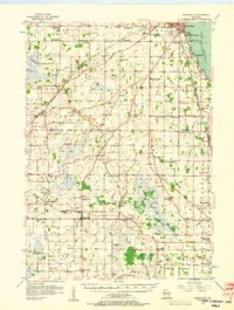
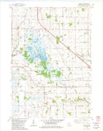
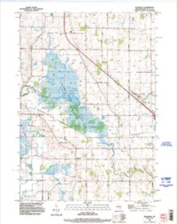
10 topographic sheets cover this place, the earliest surveyed in 1956 and the latest in 1992. It stands in Eldorado town. It lies in ZIP code area 54932. The Survey maps it on the Eldorado quadrangle. It stands 879 feet above sea level.
Topographic sheets covering this place
6 surveys from 10 printed sheetsMatched by testing this settlement's coordinate against the published boundary of every sheet in the United States Geological Survey's historical collection. Each opens the scanned sheet at the Survey.
- 1956 USGS Rosendale quadrangle1:62500, 2 printings
- 1957 USGS Madison quadrangle1:250000, 3 printings
- 1960 USGS Madison quadrangle1:250000, 2 printings
- 1980 USGS Eldorado quadrangle1:24000
- 1980 USGS Fond Du Lac quadrangle1:100000
- 1992 USGS Eldorado quadrangle1:24000



In the county-history sources
3,760 words on this townshipThe History of Fond Du Lac County, Wisconsin, published 1880 names this settlement in its chapter on Eldorado Town. These are the passages that mention it, exactly as the scans read.
MELrVIlV DUEL (deceased) was born in Hebron, Washington Co., N. Y., June 29,J824;^ he came to Wisconsin in 1848, and settled in the town of Eldorado, where he married, on the 27th of March, 1850, Laura Wolcott, daughter of W. C. and Mercy Wolcott, pioneer settlers and still honored citizens of the town of Eldorado, she was born in Trenton, Oneida Co., N. Y., Oct. 8, 1813 ;^ their children are Dirg, now of Brown Co., Minn.; Delia, wife of William Carpenter, of the town of Eldorado, he was a soldier during the war of the rebellion ; Dora, Delos, Strabo, Efiie M., Lewis, Arthur, Lottie B.,
Passage source: The History of Fond Du Lac County, Wisconsin, published 1880.
George (deceased) ; during the war of the rebellion, Mr. Duel served in Co. A, 2d W. V. C, was enrolled Oct. 2, 1861, and served until January 23, 1865, when he was honorably discharged ; the records of his regiment show that he was a gallant and brave soldier ; after his discharge, he returned to his home in Eldorado, where he died Jan. 8, 18S0 ; himself and his wife were the first couple married in the town of Eldorado; she owns 156 acres of land, and cheese factory, which was the first factory in Eldorado, was established by her husband in 1878.
Passage source: The History of Fond Du Lac County, Wisconsin, published 1880.
JA9IES K. SCRIBT^ER ; P. 0. Eldorado Mills; was born in Norwalk, Conn., in 1828 ; is the son of Joseph and Sarah Kellogg Scribner, a farmer. The subject of this sketch received a common-school and academic education in his native place ; at the age of 21 he came West to Ro-sendale, Wis., and settled on land previously purchased by his father, of 160 acres; in 1853, he purchased an undivided half of this farm of his father; in 1858, he came to Eldorado and located on property he owned, having, in 1857, bought Barnett's saw-mill, water-power lands, and privileges connected with them. Mr. Hiram Wheeler was connected with him in running the mill, and they afterward built a small grist-mill ; Mr. Wheeler died in the summer of 1859 ; Mr. Van Ostrand then bought Mr. Wheeler's interest ; in 1867, Mr. Scribner bought out Mr. Van Ostrand, and, in 1868, he rebuilt the mills, enlarging the capacity, and has ever since been engaged in milling ; his mill now has four run of stone ; he is also proprietor of the only general store in the village of Eldorado Mills, and is the present owner of fifty acres of land in Sec. 31, 32 and 29, besides his mill property. He married, in Rosendale, in January, 1857, Laura M., daughter of Hiram Wheeler; have had eight children - Winthrop, Walter, Lizzie L., Abbie L., Joseph H., Kittie M., Harry C. and Mabel W. They are members of the Congregational Chureh. Mr. Scribner was a member of the State Legislature in 1876, and is now the Chairman of the Town Board ; politically he is a Republican.
Passage source: The History of Fond Du Lac County, Wisconsin, published 1880.
Machine-read from a century-old scan, so expect the errors a machine makes: misspelled names, dropped words, stray characters.
Read the whole chapter on Eldorado Town - it names this place 11 more 11 times.
Fires near this place
12 since 1995Regional context, not property-specific evidence. The federal wildfire occurrence database lists 12 fires within 5 miles of Eldorado between 1995 and 2020, burning about 257 acres in total. None started naturally. 3 were recorded as arson. Distance is straight-line from the map coordinates, so a fire counted here may appear on a neighbouring settlement's page as well.
| Reported cause | Fires |
|---|---|
| Missing data/not specified/undetermined | 6 |
| Debris and open burning | 3 |
| Arson/incendiarism | 3 |
The most recent of them, most recent first, with the day each was reported and the service that recorded it.
| Date | Cause | Size | Reported by | Name on the report |
|---|---|---|---|---|
| 5 September 2005 | Missing data/not specified/undetermined | under an acre | Wisconsin Department of Natural Resources | not named |
| 4 September 2020 | Missing data/not specified/undetermined | under an acre | Wisconsin Department of Natural Resources | 90401 |
| 9 May 2014 | Missing data/not specified/undetermined | 72 acres | Leopold Wetland Management District | ROSENDALE |
| 24 May 1995 | Missing data/not specified/undetermined | under an acre | Wisconsin Department of Natural Resources | not named |
| 1 May 2018 | Debris and open burning | 1.0 acres | Wisconsin Department of Natural Resources | 51181 |
| 14 April 2006 | Missing data/not specified/undetermined | 41 acres | Wisconsin Department of Natural Resources | not named |
| 12 April 1998 | Arson/incendiarism | 35 acres | Wisconsin Department of Natural Resources | not named |
| 21 March 2018 | Debris and open burning | 3.0 acres | Wisconsin Department of Natural Resources | 17 |
Settlements close enough to share some of these fires:
Storms near this place
6 since 1994Regional context, not property-specific evidence. The National Weather Service names Eldorado in 6 storm reports between 1994 and 2008: 3 thunderstorm wind, 2 hail, 1 flash flood. No death or injury is recorded in these reports. Each account below is quoted exactly as the forecast office filed it, from the NOAA Storm Events Database, and each date opens the federal record of that event.
| When | Event | Place named | Harm | What the report says |
|---|---|---|---|---|
| August 2004 | Thunderstorm Wind | Eldorado | $200,000 | no account filed |
| June 2008 | Flash Flood | Eldorado | $25,000 | Heavy rains led to widespread flash flooding around the city of Fond du Lac. The river flowing through downtown rose out of its banks up to the bridges and most roads were under 2 to 4 feet of water. Several vehciles stalled in the deep water and sustained water damage. |
| June 1998 | Thunderstorm Wind | Eldorado | $5,000 | no account filed |
| September 1994 | Hail | Eldorado | - | A severe thunderstorm dropped hail up to one inch in diamater near Eldorado and nickel-size hail southwest of Oshkosh. |
| September 1994 | Hail | Eldorado | - | A severe thunderstorm dropped hail up to one inch in diamater near Eldorado and nickel-size hail southwest of Oshkosh. |
| May 2003 | Thunderstorm Wind | Eldorado | - | no account filed |
Nearest settlements
The eight closest, with where each one stands in the county. Distances are straight-line, computed from the Geographic Names Information System coordinates.
| Map | Place | Distance | Sheets |
|---|---|---|---|
| Rosendale | 3.0 miles | 9 | |
| Woodhull | 4.2 miles | 10 | |
| Rogersville | 5.2 miles | 10 | |
| West Rosendale | 5.5 miles | 9 | |
| Rosendale Center | 5.5 miles | 9 | |
| Lamartine | 6.9 miles | 10 | |
| North Fond du Lac | 7.4 miles | 13 | |
| Van Dyne | 7.6 miles | 10 |
Elsewhere
Matched on this settlement's Geographic Names Information System number rather than its name, so it cannot be a different place of the same name in another state.
| Wikipedia article on Eldorado | An encyclopaedic summary. Its text is share-alike, so it is linked here rather than copied. |
| Wikidata item Q5354090 | The structured record the population and elevation above come from. Public domain (CC0). |
Provenance
This settlement is recorded in the Geographic Names Information System as feature 1564499. The sheet list is computed by point-in-boundary test against the United States Geological Survey's historical topographic inventory. Both are works of the United States government and carry no copyright under 17 U.S.C. 105.
Wildfire. Short, Karen C. 2022. Spatial wildfire occurrence data for the United States, 1992-2020 [FPA_FOD_20221014]. 6th Edition. Fort Collins, CO: Forest Service Research Data Archive. https://doi.org/10.2737/RDS-2013-0009.6 Collected with United States Government funding and usable without additional permissions or fees.
Storms. NOAA National Centers for Environmental Information, Storm Events Database https://www.ncei.noaa.gov/stormevents/ A work of the United States government, no copyright under 17 U.S.C. 105. Narratives are quoted verbatim from the National Weather Service report and are not edited or summarised.