 Block
Lamartine, Wisconsin
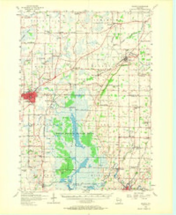
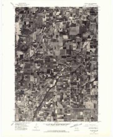
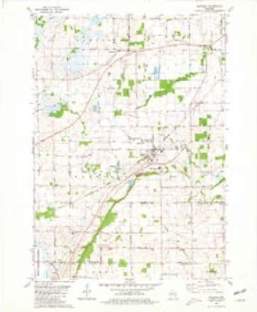
10 topographic sheets cover this place, the earliest surveyed in 1955 and the latest in 1980. It stands in Lamartine town. It lies in ZIP code area 53065. The Survey maps it on the Oakfield quadrangle. It stands 863 feet above sea level.
Topographic sheets covering this place
6 surveys from 10 printed sheetsMatched by testing this settlement's coordinate against the published boundary of every sheet in the United States Geological Survey's historical collection. Each opens the scanned sheet at the Survey.
- 1955 USGS Waupun quadrangle1:62500, 2 printings
- 1957 USGS Madison quadrangle1:250000, 3 printings
- 1960 USGS Madison quadrangle1:250000, 2 printings
- 1975 USGS Waupun NE quadrangle1:24000
- 1980 USGS Fond Du Lac quadrangle1:100000
- 1980 USGS Oakfield quadrangle1:24000



In the county-history sources
10,871 words on this townshipThe History of Fond Du Lac County, Wisconsin, published 1880 names this settlement in its chapter on Lamartine Town. These are the passages that mention it, exactly as the scans read.
WARREl* ANDERSOIV, farmer; P. 0. Eldorado Mills, Wis.; born in Lewis Co., N. Y., May l(j, 1827 ; his parenti, Harvey and Betsey Anderson, were also natives of York State; in the fall of 1845, he, with his father, in a w.igon, started from the town of Claytoq, Jefferson Co., N. Y., for Wisconsin, coming by the way of Erie, Pcnn., Cleveland, Ohio, and Chicago, 111.; they arrived at the village of Fond du Lac in December of that year ; they came at once to the residence of Mr. Sauburn in the town of Rosendale, where they made their home for a few days ; his father entered a quarter-section of land in Sec. 36, town of Roiseudale, and they at once began to build a pioneer shanty thereon ; here, he with his father, kept bach through the winter, and by the spring of 1846 they had twenty-five to thrity acres cleared up ; hi.', father then returned to Jefferson Co., N. Y., for the other members of the family, and with them reached their Western home late in June of that year ; ten years later, his father sold that farm and removed to another on Sec. 32 ; here his mother died Feb. 23, 1859, and his father on March 28 following, leaving four sons, two of whom are now living - Warren, the subject of our sketch, and Charles, now of the town of Eldorado. June 11, 1851, he was married to Miss Marrietta T., youngest daughter of Phineas and Ruth M. Randall, immigrants from Crawford Co., Penn., in 1848, to the town of Lamartine, Fond du Lao Co., Wis., where her father died in 1850 ; they have had nine children - Susie E.; Warren R., now of Eldorado Mills ; Bertinc H.; Nellie B.. deceased; Emma B., Josephine B., Efla and Eva (twins), and John G. They attend the Congregational Church. Mr. Anderson is a member of the Masonic Fraternity.
Passage source: The History of Fond Du Lac County, Wisconsin, published 1880.
REV. JABEZ B. COIjE, Pastor of the Lamartine Methodist Episcopal Church, was born in Lincolnshire, England, Feb. 12, 1845 ; ho is the son of Rev. Thomas Cole and Elizabeth Brown, and with them. May 4, 1845, set sail from Liverpool for America, and landed in New York City in June folowing ; they came thence to Sheboygan, Wis., where they arrived the 1st day of July ; his father purchased a farm in the town of Green Bush, Sheboygan Co,, Wis., where he devoted much of his time to farming, and was local minister of the First M. E. Church of that town; the subject of this sketch spent the first nineteen years of his life on his father's farm and attending the district school ; he united with the church at the age of 1 1, and when 1 9 he entered as a student of the classical course at Lawrence LTniversity of Appleton, Wis.; at the end of six years, on account of limited means and ill health, he was forced to leave off his studies at college; he soon joined the conference and was ordained local Deacon ; in October, 1871, he joined the conference at Milwaukee, and was assigned to the Clinton Circuit; while there he pursued the course of study prescribed by the canon ; in 1872, he was sent to the Wyocena Circuit in Columbia Co., Wis., for two years. Here, Oct. 13, 1873, he married Miss Cecelia E., daughter of A. A. and Ruth Cole, early sottlers of Welsh Prairie. Columbia Co.; in October, 1874, he was assigned to Shawano, Shawano Co., Wis., where he remained in charge of the church for three years; in 1877, he took charge of the church at Markesan, Green Lake Co., and, in 1S78, came to the Lamarline charge ; they have three children, as follows - Jessie E., born in 1874- ; Mary E., born in 1876; Charles F., born in April, 1S79.
Passage source: The History of Fond Du Lac County, Wisconsin, published 1880.
LAWRENCE EXNIS, "farmer, Sec. 8; P. 0. Woodhull ; is a native of County Wicklow, Ireland ; born April 15, ISol, and is the son of James Ennis and Winford Doyle, with whom he made his home in his native country until 19 years of age. In May, 1850, he emigrated to America, and landed in Quebec, where he followed teaming for five years. April 18, 1855, he married Mis.s Letetia, daughter of Patrick and iMary Greening, nee Finland, of Canada West, but a native of County Monahan, Ireland ; they then went to St. Louis, Mo., for a few months, thence to Jacksonville, 111., for a short time, and lastly to Fund du Lac, where they lived fourteen years In the fall of 1808, he bought a firm of eighty-five and one-half acres in Section 8, town of Lamartine, where he has since been a farmer. They hid one son - James, deceased,' and are members of St. Joseph's Catholic Church of Fond du Lac.
Passage source: The History of Fond Du Lac County, Wisconsin, published 1880.
Machine-read from a century-old scan, so expect the errors a machine makes: misspelled names, dropped words, stray characters.
Read the whole chapter on Lamartine Town - it names this place 41 more 41 times.
Fires near this place
16 since 1997Regional context, not property-specific evidence. The federal wildfire occurrence database lists 16 fires within 5 miles of Lamartine between 1997 and 2020, burning about 647 acres in total. None started naturally. 2 were recorded as arson. Distance is straight-line from the map coordinates, so a fire counted here may appear on a neighbouring settlement's page as well.
| Reported cause | Fires |
|---|---|
| Debris and open burning | 8 |
| Missing data/not specified/undetermined | 4 |
| Equipment and vehicle use | 2 |
| Arson/incendiarism | 2 |
The most recent of them, most recent first, with the day each was reported and the service that recorded it.
| Date | Cause | Size | Reported by | Name on the report |
|---|---|---|---|---|
| 4 August 2003 | Equipment and vehicle use | under an acre | Leopold Wetland Management District | NKING CHASE |
| 5 June 1997 | Debris and open burning | 5.0 acres | Leopold Wetland Management District | BRADLEY2 |
| 4 May 2019 | Arson/incendiarism | under an acre | Wisconsin Department of Natural Resources | 23 |
| 4 May 2003 | Debris and open burning | under an acre | Leopold Wetland Management District | SCHOENBERG |
| 21 May 1997 | Debris and open burning | 30 acres | Leopold Wetland Management District | BRADLEY RD |
| 2 May 2020 | Equipment and vehicle use | 3.0 acres | Wisconsin Department of Natural Resources | 2005016 |
| 3 April 2001 | Arson/incendiarism | under an acre | Leopold Wetland Management District | MANTHEYW |
| 28 April 2003 | Missing data/not specified/undetermined | 508 acres | Wisconsin Department of Natural Resources | MULLET CREEK |
Settlements close enough to share some of these fires:
Mines and quarries near this place
1 within 5 milesRegional context, not property-specific evidence. The federal mineral resources record lists 1 working within 5 miles of Lamartine: 1 unknown. None of them still produces. What was taken out: Stone. Distance is straight-line from the map coordinates, so a quarry counted here may appear on a neighbouring settlement's page as well.
| Where | Site | Commodity | Status | Recorded |
|---|---|---|---|---|
| Oakfield & Byron Quarries | Stone | Unknown |
Storms near this place
8 since 2002Regional context, not property-specific evidence. The National Weather Service names Lamartine in 8 storm reports between 2002 and 2025: 3 thunderstorm wind, 2 hail, 1 tornado, 1 lightning. No death or injury is recorded in these reports. Each account below is quoted exactly as the forecast office filed it, from the NOAA Storm Events Database, and each date opens the federal record of that event.
| When | Event | Place named | Harm | What the report says |
|---|---|---|---|---|
| April 2004 | Lightning | Lamartine | $20,000 | no account filed |
| September 2022 | Thunderstorm Wind | Lamartine | $3,000 | Numerous trees and branches down. |
| July 2016 | Thunderstorm Wind | Lamartine | $2,000 | A one foot diameter evergreen tree snapped about four feet above the ground. A two foot diameter, but hollow, Hickory tree was blown over. |
| June 2025 | Thunderstorm Wind | Lamartine | - | Several trees downed between Lamartine and Oakfield. |
| August 2002 | Tornado (F0) | Lamartine | - | A weak tornado spun up in the rural area north-northwest of Oakfield, just east-southeast of the intersection of Hwy 151 and TC. It moved east-southeast and crossed Hwy Y before dissipating. A few trees were uprooted and some grasses were flattened. Wind speeds, based on damage to vegetation, was estimated about 52 to 61 kts (60 to 70 mph). Amateur Radio operators who observed this weak tornado noted that one had to be within 100 yards of the vortex in order to see it due to rain-wrapping and haze. |
| July 2018 | Hail | Lamartine | - | no account filed |
| October 2007 | Funnel Cloud | Lamartine | - | no account filed |
| July 2003 | Hail | Lamartine | - | no account filed |
Nearest settlements
The eight closest, with where each one stands in the county. Distances are straight-line, computed from the Geographic Names Information System coordinates.
| Map | Place | Distance | Sheets |
|---|---|---|---|
| Woodhull | 3.1 miles | 10 | |
| Oakfield | 3.5 miles | 10 | |
| Rogersville | 3.5 miles | 10 | |
| Oak Center | 5.3 miles | 10 | |
| Ladoga | 5.7 miles | 10 | |
| Hamilton (historical) | 6.3 miles | 9 | |
| Eldorado | 6.9 miles | 10 | |
| Fond du Lac | 7.0 miles | 13 |
Elsewhere
Matched on this settlement's Geographic Names Information System number rather than its name, so it cannot be a different place of the same name in another state.
| Wikipedia article on Lamartine | An encyclopaedic summary. Its text is share-alike, so it is linked here rather than copied. |
| Wikidata item Q6480955 | The structured record the population and elevation above come from. Public domain (CC0). |
Provenance
This settlement is recorded in the Geographic Names Information System as feature 1567812. The sheet list is computed by point-in-boundary test against the United States Geological Survey's historical topographic inventory. Both are works of the United States government and carry no copyright under 17 U.S.C. 105.
Wildfire. Short, Karen C. 2022. Spatial wildfire occurrence data for the United States, 1992-2020 [FPA_FOD_20221014]. 6th Edition. Fort Collins, CO: Forest Service Research Data Archive. https://doi.org/10.2737/RDS-2013-0009.6 Collected with United States Government funding and usable without additional permissions or fees.
Mines and quarries. USGS Mineral Resources Data System (MRDS) https://mrdata.usgs.gov/mrds/ A work of the United States government, no copyright under 17 U.S.C. 105.
Storms. NOAA National Centers for Environmental Information, Storm Events Database https://www.ncei.noaa.gov/stormevents/ A work of the United States government, no copyright under 17 U.S.C. 105. Narratives are quoted verbatim from the National Weather Service report and are not edited or summarised.