 Block
Hustisford, Wisconsin
9 topographic sheets cover this place, the earliest surveyed in 1955 and the latest in 1991. It stands in Hustisford town. It lies in ZIP code area 53034. It stands on Wildcat Creek. The Survey maps it on the Hustisford quadrangle. 1,101 people lived here at the 2020 count. It stands 846 feet above sea level.
On record in Hustisford
Buildings and businesses the archive holds for this place. Each opens its own page, with the source record it came from.
On the National Register 2 records
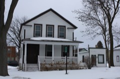 John Hustis Houselisted 1983
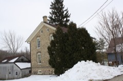 Ferdinand Schulze Houselisted 1996
Population over time
2 figuresHustisford fell from 1,123 to 1,101 between 2010 and 2020. These are the recorded population figures Wikidata holds for this place, reached through the Geographic Names Information System number this page is keyed on rather than by name, so they belong to this place and not to another of the same name. Most are census counts, but not all are: an early figure may be a founding or settlement estimate, and an estimate published within five years of a census is left out. The change column is computed, and is left blank where more than 20 years separate a figure from the one before it, because a gap that long is not a change between two counts.
| Year | People | Change |
|---|---|---|
| 2010 | 1,123 | |
| 2020 | 1,101 | -22 (-2%) |
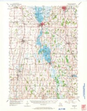
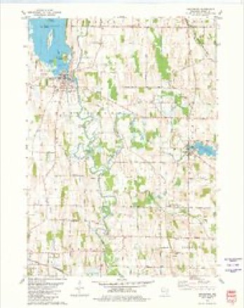
Topographic sheets covering this place
6 surveys from 9 printed sheetsMatched by testing this settlement's coordinate against the published boundary of every sheet in the United States Geological Survey's historical collection. Each opens the scanned sheet at the Survey.
- 1955 USGS Horicon quadrangle1:62500
- 1957 USGS Madison quadrangle1:250000, 3 printings
- 1960 USGS Madison quadrangle1:250000, 2 printings
- 1980 USGS Hustisford quadrangle1:24000
- 1984 USGS Oconomowoc quadrangle1:100000
- 1991 USGS Oconomowoc quadrangle1:100000


In the county-history sources
10,282 words on this townshipThe History of Dodge County, Wisconsin, Containing ... Its Early Settlement, Growth ... an Extensive and Minute Sketch of Its Cities ... War Record, Biographical Sketches, published 1880 names this settlement in its chapter on Hustisford Town. These are the passages that mention it, exactly as the scans read.
The first settlement of which we find record was in 1845, Caleb Northrup being the pioneer. G. Taylor, J. H. Warren, J. Loop, II. Mace and others came shortly after. The first school in the town was in 1846, located on Section 3. Rev. James W. Burton preached the first sermon in the township in 1846, and, in the following year, the German Lutherans built a house of worship on Section 35. There are now in the town eight churches. Much of the history of this town will be found in the history of the village of Horicon, and therefore we give a very brief notice of many things. The first mill was built by Larrabee & Co. in 1847, on Rock River, in the present village of Horicon. The town is traversed by two railroads - the Chicago, Milwaukee & St. Paul, and Fond du Lac, Amboy & Peoria, the history of which is given elsewhere. There are under cultivation in the town 21,205 acres of land, and some of the best in the county. Wheat is the principal product.
Passage source: The History of Dodge County, Wisconsin, Containing ... Its Early Settlement, Growth ... an Extensive and Minute Sketch of Its Cities ... War Record, Biographical Sketches, published 1880.
This town is bounded on the north by Le Roy, on the south by Hubbard, on the east by Theresa, and on the west by Burnett. It is in Town 12 north. Range 16 east, and is a timber country. Its first settlers were the Fosters, Mays, Palmers and others, and its history dates back to 1845. There are two villages in the town, Mayville and Kekoskee. The Fond du Lac, Amboy & Peoria Railroad traverses the eastern part from north to south, giving the farmers, merchants and others the conveniences incident thereto. There are subject to assessment 21,293 acres of land, valued at $602,915. In 1870, the population of the town was 2,305. In 1879, we find in cultivation, of wheat, 4,726 acres; corn, 785 ; oats, 694 ; barley, 398 ; rye, 140 ; potatoes, 102 ; apple orchards, 169 ; grasses, 1,223.
Passage source: The History of Dodge County, Wisconsin, Containing ... Its Early Settlement, Growth ... an Extensive and Minute Sketch of Its Cities ... War Record, Biographical Sketches, published 1880.
In the fall of 1845, Alfred Lamberson settled in the present town of Le Roy. He was followed shortly afterward by Rufus Cowles, Austin Graves, C. Holdridge, David Niles, C. and B. Parrish, Ira Hodge, H. Barnes, James Patrick and B. G. Gill. Together with their respective families, these gentlemen formed quite a respectable settlement.
Passage source: The History of Dodge County, Wisconsin, Containing ... Its Early Settlement, Growth ... an Extensive and Minute Sketch of Its Cities ... War Record, Biographical Sketches, published 1880.
Machine-read from a century-old scan, so expect the errors a machine makes: misspelled names, dropped words, stray characters.
Read the whole chapter on Hustisford Town - it names this place 51 more 51 times.
Fires near this place
3 since 1994Regional context, not property-specific evidence. The federal wildfire occurrence database lists 3 fires within 5 miles of Hustisford between 1994 and 1996, burning about 6 acres in total. None started naturally. 2 were recorded as arson. Distance is straight-line from the map coordinates, so a fire counted here may appear on a neighbouring settlement's page as well.
| Reported cause | Fires |
|---|---|
| Arson/incendiarism | 2 |
| Debris and open burning | 1 |
The most recent of them, most recent first, with the day each was reported and the service that recorded it.
| Date | Cause | Size | Reported by | Name on the report |
|---|---|---|---|---|
| 20 May 1994 | Arson/incendiarism | 2.0 acres | Wisconsin Department of Natural Resources | not named |
| 1 May 1996 | Arson/incendiarism | 1.2 acres | Wisconsin Department of Natural Resources | not named |
| 23 April 1994 | Debris and open burning | 2.5 acres | Wisconsin Department of Natural Resources | not named |
Settlements close enough to share some of these fires:
Mines and quarries near this place
5 within 5 milesRegional context, not property-specific evidence. The federal mineral resources record lists 5 workings within 5 miles of Hustisford: 5 past producers. None of them still produces. What was taken out: Sand and Gravel, Construction. Distance is straight-line from the map coordinates, so a quarry counted here may appear on a neighbouring settlement's page as well.
| Where | Site | Commodity | Status | Recorded |
|---|---|---|---|---|
| Allen Rudolph Pit | Sand and Gravel, Construction | Past Producer | ||
| Bartosch Pit | Sand and Gravel, Construction | Past Producer | ||
| Bohnert Pit | Sand and Gravel, Construction | Past Producer | ||
| Kranich Pit | Sand and Gravel, Construction | Past Producer | ||
| Roll Pit | Sand and Gravel, Construction | Past Producer |
Storms near this place
15 since 1999Regional context, not property-specific evidence. The National Weather Service names Hustisford in 15 storm reports between 1999 and 2025: 10 thunderstorm wind, 2 hail, 1 lightning, 1 flood. No death or injury is recorded in these reports. Each account below is quoted exactly as the forecast office filed it, from the NOAA Storm Events Database, and each date opens the federal record of that event.
| When | Event | Place named | Harm | What the report says |
|---|---|---|---|---|
| November 2013 | Thunderstorm Wind | Hustisford | $75,600 | A squall line produced an estimated 100 mph downburst just east of Hustisford.|An equipment building had its roof removed with some walls collapsed. A calf shed was destroyed with large items within the shed displaced. The town hall had minor damage to its roof and the flag pole was bent. A wooden power pole was snapped and some shingles were removed from a home. About a dozen trees were downed with some being snapped and some uprooted. One tree fell on a home and some corn was damaged. |
| June 2024 | Flood | Hustisford | $10,000 | Flooding of several basements and yards on the west side of Iron Ridge when a culvert became plugged. The electricity was shut off until the water receded. The flooding of a creek eroded the shoulder of County Highway AY near Madison Road, just east of Iron Ridge. A business dock was flooded in Horicon. |
| June 2016 | Thunderstorm Wind | Hustisford | $10,000 | Numerous large trees and branches down. |
| May 2011 | Thunderstorm Wind | Hustisford | $10,000 | Numerous trees and power lines were reported blown down by damaging thunderstorm wind gusts in the Hustisford area. A tree fell on a home damaging the roof. A tree fell on an occupied car, and the driver injured his shoulder (indirectly-related) exiting the car. Total damage in the area amounted to $10,000. |
| April 2023 | Thunderstorm Wind | Hustisford | $5,000 | Straight-line winds from a thunderstorm outflow boundary uprooted a few trees and blew a shed apart. |
| June 1999 | Thunderstorm Wind | Hustisford | $5,000 | no account filed |
| July 2015 | Thunderstorm Wind | Hustisford | $4,000 | A large tree fell on a home. |
| July 2023 | Thunderstorm Wind | Hustisford | $3,000 | A tree branch around 4-6 inches in diameter fell onto a residential structure. |
| July 2025 | Tornado (EF0) | Hustisford | $2,000 | Tornado developed south of Hustisford near the intersection of Hillcrest Road and County Road E where a corn field had a convergent path going north-northeast through mainly farmland. The tornado hit some trees south of Highway 60 and east of County Road E before tracking north and going through the intersection of Juneau Street and Oakwood Boulevard. The tornado appears to have ended over Sinissippi Lake. |
| June 2020 | Thunderstorm Wind | Hustisford | $2,000 | Tree and power line damage with a tree on fire. |
| July 2011 | Lightning | Hustisford | $2,000 | Newspapers reported a lightning strike that caused a minor fire at a home on State Highway 60, just west of Hustisford. The fire filled the basement with smoke. |
| May 2011 | Thunderstorm Wind | Hustisford | $500 | A second round of severe thunderstorms affected Hustisford with damaging winds. This round downed trees that damaged a fence and did $500 worth of damage to a house. |
| June 2006 | Thunderstorm Wind | Hustisford | - | Trees down. |
| May 2014 | Hail | Hustisford | - | no account filed |
| March 2007 | Hail | Hustisford | - | no account filed |
Nearest settlements
The eight closest, with where each one stands in the county. Distances are straight-line, computed from the Geographic Names Information System coordinates.
| Map | Place | Distance | Sheets |
|---|---|---|---|
| Woodland | 4.7 miles | 9 | |
| Neosho | 5.0 miles | 9 | |
| Iron Ridge | 5.2 miles | 10 | |
| Neda | 6.2 miles | 10 | |
| Clyman Junction | 6.4 miles | 9 | |
| Lebanon | 6.4 miles | 9 | |
| Clyman | 6.8 miles | 9 | |
| Juneau | 6.9 miles | 10 |
Elsewhere
Matched on this settlement's Geographic Names Information System number rather than its name, so it cannot be a different place of the same name in another state.
| Wikipedia article on Hustisford | An encyclopaedic summary. Its text is share-alike, so it is linked here rather than copied. |
| Wikidata item Q980802 | The structured record the population and elevation above come from. Public domain (CC0). |
Provenance
This settlement is recorded in the Geographic Names Information System as feature 1566830. The sheet list is computed by point-in-boundary test against the United States Geological Survey's historical topographic inventory. Both are works of the United States government and carry no copyright under 17 U.S.C. 105.
Wildfire. Short, Karen C. 2022. Spatial wildfire occurrence data for the United States, 1992-2020 [FPA_FOD_20221014]. 6th Edition. Fort Collins, CO: Forest Service Research Data Archive. https://doi.org/10.2737/RDS-2013-0009.6 Collected with United States Government funding and usable without additional permissions or fees.
Mines and quarries. USGS Mineral Resources Data System (MRDS) https://mrdata.usgs.gov/mrds/ A work of the United States government, no copyright under 17 U.S.C. 105.
Storms. NOAA National Centers for Environmental Information, Storm Events Database https://www.ncei.noaa.gov/stormevents/ A work of the United States government, no copyright under 17 U.S.C. 105. Narratives are quoted verbatim from the National Weather Service report and are not edited or summarised.