 Block
Lowell, Wisconsin
10 topographic sheets cover this place, the earliest surveyed in 1955 and the latest in 1991. It stands in Lowell town. It lies in ZIP code area 53557. It stands on Shaw Brook. The Survey maps it on the Reeseville quadrangle. 1,166 people lived here at the 2020 count. It stands 830 feet above sea level.
Topographic sheets covering this place
6 surveys from 10 printed sheetsMatched by testing this settlement's coordinate against the published boundary of every sheet in the United States Geological Survey's historical collection. Each opens the scanned sheet at the Survey.
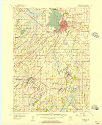
- 1955 USGS Beaver Dam quadrangle1:62500, 2 printings
- 1957 USGS Madison quadrangle1:250000, 3 printings
- 1960 USGS Madison quadrangle1:250000, 2 printings
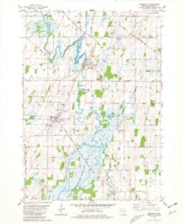
- 1980 USGS Reeseville quadrangle1:24000
- 1984 USGS Oconomowoc quadrangle1:100000
- 1991 USGS Oconomowoc quadrangle1:100000


In the county-history sources
11,815 words on this townshipThe History of Dodge County, Wisconsin, Containing ... Its Early Settlement, Growth ... an Extensive and Minute Sketch of Its Cities ... War Record, Biographical Sketches, published 1880 names this settlement in its chapter on Lowell Town. These are the passages that mention it, exactly as the scans read.
HOX. D. BI. COLEMAN, Sec. 1 ; P. 0. Lowell ; was born in Hector, Tompkins Co., N. Y., Sept. 16, 1816 ; in early life ho received a liberal education ; in 1849, came to Dodge Co., and settled in Lowell Township, which has been his home since; he owns 200 acres of land. He was elected to the
Passage source: The History of Dodge County, Wisconsin, Containing ... Its Early Settlement, Growth ... an Extensive and Minute Sketch of Its Cities ... War Record, Biographical Sketches, published 1880.
JOHN 1$. COIiKMAlV, retired farmer, Lowell; was burn in Hector, Tompkins Co., N. Y., JIareh 7, IS-'iO ; ho was educated in his native town ; in 1851, be came to Lowell, Dodge Co., Wis., where he married, in IS.ili, 3Iiss Jessie Bruce, who was born in Perthsbin', Scotland, April 28, 1831, and came to Dodge Co. in IS.il ; they have one daughter, Anna, now the wife of F. W. Benson, of Lowell. Mr. Coleman owns eighty-tive acre.s of land. In politics, he is a stanch Bepublican ; he takes an active inter- (.st iu public affairs; is public-spirited, and any enterprise that gives promise of general good meets with his hearty co-operation. Ilis f ither, Joshua Coleman, was a native of Morris Co., N. J.; he married, in his native county. Miss Betsy Budd ; both died in Tompkins Co., N. Y., of which county they were honored and respected citizens for a number of years.
Passage source: The History of Dodge County, Wisconsin, Containing ... Its Early Settlement, Growth ... an Extensive and Minute Sketch of Its Cities ... War Record, Biographical Sketches, published 1880.
J. M. (iiItKEN, farmer and manufiicturer of brick. Sec. 1 ; P. 0. Lowell ; was born in Lowell Township, Dodge Co., Wis., March 23, 1845. Aug. 21, 1873, he married, in Columbus, Wis., Miss Ella .M. Cramer, daughter of Marcus and Eliza Cramer, early settlers of this (Dodge) county; they have two .liildren - William H. and Clarence M. In politics, Mr. Green is a Republican. He owns a large and finely improved farm ; in addition to managing his farm, he is extensively engaged in the manuf.icture of brick, which are widely known for their excellent ijualities. He has been Chairman of the Township
Passage source: The History of Dodge County, Wisconsin, Containing ... Its Early Settlement, Growth ... an Extensive and Minute Sketch of Its Cities ... War Record, Biographical Sketches, published 1880.
Machine-read from a century-old scan, so expect the errors a machine makes: misspelled names, dropped words, stray characters.
Read the whole chapter on Lowell Town - it names this place 35 more 35 times.
Fires near this place
5 since 1994Regional context, not property-specific evidence. The federal wildfire occurrence database lists 5 fires within 5 miles of Lowell between 1994 and 2020, burning about 9 acres in total. 1 started naturally. 1 was recorded as arson. Distance is straight-line from the map coordinates, so a fire counted here may appear on a neighbouring settlement's page as well.
| Reported cause | Fires |
|---|---|
| Debris and open burning | 2 |
| Missing data/not specified/undetermined | 1 |
| Arson/incendiarism | 1 |
| Natural | 1 |
The most recent of them, most recent first, with the day each was reported and the service that recorded it.
| Date | Cause | Size | Reported by | Name on the report |
|---|---|---|---|---|
| 29 June 2020 | Natural | under an acre | Wisconsin Department of Natural Resources | 2006173 |
| 5 April 2019 | Arson/incendiarism | 5.0 acres | Wisconsin Department of Natural Resources | 405191 |
| 20 April 2019 | Debris and open burning | under an acre | Wisconsin Department of Natural Resources | 1904091 |
| 2 April 1994 | Missing data/not specified/undetermined | 4.0 acres | Wisconsin Department of Natural Resources | not named |
| 11 April 2018 | Debris and open burning | under an acre | Wisconsin Department of Natural Resources | 27 |
Settlements close enough to share some of these fires:
Mines and quarries near this place
1 within 5 milesRegional context, not property-specific evidence. The federal mineral resources record lists 1 working within 5 miles of Lowell: 1 producer. All of them still produce. What was taken out: Stone, Crushed/Broken. Distance is straight-line from the map coordinates, so a quarry counted here may appear on a neighbouring settlement's page as well.
| Where | Site | Commodity | Status | Recorded |
|---|---|---|---|---|
| Helen H Westphal Quarry | Stone, Crushed/Broken | Producer |
Storms near this place
15 since 1994Regional context, not property-specific evidence. The National Weather Service names Lowell in 15 storm reports between 1994 and 2025: 9 hail, 3 thunderstorm wind, 2 funnel cloud, 1 tornado. The reports record 1 injury. Each account below is quoted exactly as the forecast office filed it, from the NOAA Storm Events Database, and each date opens the federal record of that event.
| When | Event | Place named | Harm | What the report says |
|---|---|---|---|---|
| May 2025 | Tornado (EF2) | North Lowell | 1 hurt, $2,500,000 | Extensive damage path from this tornado which started southwest of Juneau, went through the north side of downtown Juneau, to the south of Horicon, hitting the Horicon Hills Golf Club, before ending east of Horicon along Highway 33. The most intense damage was in the city of Juneau where about 10 structures hit EF-2 levels of damage. The one minor injury from this tornado occurred in downtown Juneau where a man was sleeping in his bedroom when the roof blew off and a tree fell into the house. The Clearview facility had windows blown out and one housing building lost it's roof. Another residential building, which looked like a motel, lost a long section of its roof, but was poorly attached to the frame of the building. An empty silo was buckled on the east end of Home Rd with one cow having a two by four impaled into its back. At the Horicon Hill Golf Club, 165 trees were either uprooted or damaged extensively. Numerous golf carts were tipped or displaced and the main club house sustained extensive roof damage. |
| June 1999 | Hail | Lowell | $30,000 | no account filed |
| September 2012 | Thunderstorm Wind | Lowell | $10,000 | A trained spotter reported trees and power lines blown down by damaging thunderstorm wind gusts estimated at 52 knots (60 mph) in Lowell. |
| May 2005 | Hail | Lowell | $1,000 | Minor damage to a vehicle. |
| June 1997 | Thunderstorm Wind | Lowell | $1,000 | no account filed |
| August 2014 | Hail | Lowell | - | Wind driven small hail flattened some corn crop or stripped off the leaves to the corn crop. |
| April 2010 | Hail | Lowell | - | A trained spotter reported 7/8 hail. |
| August 2010 | Thunderstorm Wind | Lowell | - | County sheriff deputies reported trees were blown down in the Lowell area by the strong thunderstorm gusts. |
| May 2025 | Hail | North Lowell | - | no account filed |
| September 2025 | Hail | Lowell | - | no account filed |
| May 2014 | Hail | Lowell | - | no account filed |
| July 2010 | Funnel Cloud | Lowell | - | no account filed |
| March 2005 | Funnel Cloud | Lowell | - | no account filed |
| March 2000 | Hail | Lowell | - | no account filed |
| June 1994 | Hail | Lowell | - | no account filed |
Nearest settlements
The eight closest, with where each one stands in the county. Distances are straight-line, computed from the Geographic Names Information System coordinates.
| Map | Place | Distance | Sheets |
|---|---|---|---|
| North Lowell | 2.3 miles | 10 | |
| Reeseville | 2.8 miles | 10 | |
| Leipsig | 4.9 miles | 11 | |
| Oak Grove | 4.9 miles | 10 | |
| Clyman Junction | 5.4 miles | 9 | |
| Clyman | 5.5 miles | 9 | |
| Astico | 6.5 miles | 10 | |
| Richwood | 7.1 miles | 15 |
Elsewhere
Matched on this settlement's Geographic Names Information System number rather than its name, so it cannot be a different place of the same name in another state.
| Wikipedia article on Lowell | An encyclopaedic summary. Its text is share-alike, so it is linked here rather than copied. |
| Wikidata item Q2671325 | The structured record the population and elevation above come from. Public domain (CC0). |
Provenance
This settlement is recorded in the Geographic Names Information System as feature 1568711. The sheet list is computed by point-in-boundary test against the United States Geological Survey's historical topographic inventory. Both are works of the United States government and carry no copyright under 17 U.S.C. 105.
Wildfire. Short, Karen C. 2022. Spatial wildfire occurrence data for the United States, 1992-2020 [FPA_FOD_20221014]. 6th Edition. Fort Collins, CO: Forest Service Research Data Archive. https://doi.org/10.2737/RDS-2013-0009.6 Collected with United States Government funding and usable without additional permissions or fees.
Mines and quarries. USGS Mineral Resources Data System (MRDS) https://mrdata.usgs.gov/mrds/ A work of the United States government, no copyright under 17 U.S.C. 105.
Storms. NOAA National Centers for Environmental Information, Storm Events Database https://www.ncei.noaa.gov/stormevents/ A work of the United States government, no copyright under 17 U.S.C. 105. Narratives are quoted verbatim from the National Weather Service report and are not edited or summarised.