 Block
Richwood, Wisconsin
15 topographic sheets cover this place, the earliest surveyed in 1891 and the latest in 1991. It stands in Shields town. It lies in ZIP code area 53098. The Survey maps it on the Richwood quadrangle.
On record in Richwood
Buildings and businesses the archive holds for this place. Each opens its own page, with the source record it came from.
On the National Register within a mile 1 record
The National Register names another town for these. They stand within one mile of this settlement's coordinate.
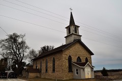 St. Joseph's Roman Catholic Churchlisted 1980 · 0.2 miles away
Topographic sheets covering this place
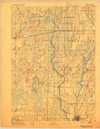
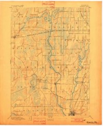
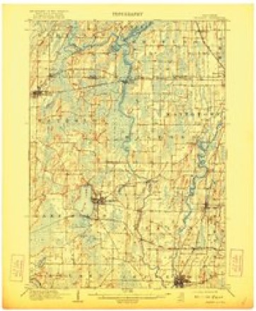
9 surveys from 15 printed sheetsMatched by testing this settlement's coordinate against the published boundary of every sheet in the United States Geological Survey's historical collection. Each opens the scanned sheet at the Survey.
- 1891 USGS Waterloo quadrangle1:62500
- 1894 USGS Waterloo quadrangle1:62500, 2 printings
- 1910 USGS Waterloo quadrangle1:62500, 2 printings
- 1957 USGS Madison quadrangle1:250000, 3 printings
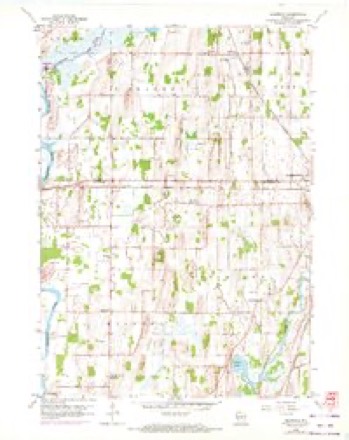
- 1959 USGS Richwood quadrangle1:24000, 2 printings
- 1959 USGS Waterloo quadrangle1:62500
- 1960 USGS Madison quadrangle1:250000, 2 printings
- 1984 USGS Oconomowoc quadrangle1:100000
- 1991 USGS Oconomowoc quadrangle1:100000


In the county-history sources
4,079 words on this townshipThe History of Dodge County, Wisconsin, Containing ... Its Early Settlement, Growth ... an Extensive and Minute Sketch of Its Cities ... War Record, Biographical Sketches, published 1880 names this settlement in its chapter on Shields Town. These are the passages that mention it, exactly as the scans read.
IILRICH HACiiMANN," telegraph operator and agent of the Chicago, Milwaukee & St. Paul Railroad, also express agent at Richwood; horn in Switzerland in 1843;'came to America in 18(54, locating soon afterat Arena. Wis.; in September. 1864, he went to Houston Co., Minn., working in a flouring-milluntil February, 1865, when he enlisted in the 1st Minn. Heavy Artillery, and was stationed at Chattanooga, Tenn., till the close of the war; on his return, on account of ill health, he paid a short visit to friends in Illinois, spending the winter at Arena af school ; worked the next summer on a fiirm in Sauk Co., Wis., attending the winter school in Sumpter Township ; after spending a short time in Chicago, Mr. Hagmann obtained a position as an assistant in the Jack.souville Insane Asylum. In 1872, he married Miss Friederika Paulus, of that city, soon after removing to Mazo Manie, Wis., going from there to Arena, where he did his first railroad work; was in the depot during the winters of 1872-73; he taught the school in Honey Creek, Sauk Co.. Wis.; the next fall he again obtained a place in the Arena depot, and by faithful attention to his business was, at the end of three years, made station agent ; Mr. Hagmann learned operating during the winter of 1879, and was appointed agent at Richwood in March, 1879. Mr. and Mrs. Hagmann have four children - Ulrich R., Bernard C., Carl H. and Meta C. Mr. Hagmann is a Republican in politics ; and a member of the Methodist Episcopal Church.
Passage source: The History of Dodge County, Wisconsin, Containing ... Its Early Settlement, Growth ... an Extensive and Minute Sketch of Its Cities ... War Record, Biographical Sketches, published 1880.
MICHAEE MeDONOUtiH, former. Sec. 34 ; P. O. Riehwood or Watertown ; born in County Clare, Ireland, in 1821 ; spent his early life in his native land, and came to America in 1845 ; resided seven and one-half years in Hampden Co., Mass., working for the whole-souled Yankee farmers, and earning money to get his start, earning his first thousand in this laborious way ; after taking a better half, he came to Shields in 1852, locating on eighty acres of land, of which ten were cleared, on which was a log shanty ; here the family lived fifteen years, clearing and breaking the land, pioneer fashion ; the eighty has grown to a well-improved farm of 200 acres ; the log house of pioneer days was replaced by a large modern brick house in 1868. Married Miss Mary Doyle, of County Clare, in 1852; they have five children ; Mary, the eldest, is the wife of Joseph Brooks, of Emmet ; then follow Margaret, Jane, Thomas and Katie. The family arc Catholics ; Mr. McDonough is an Independent Democrat in politics. Beginning at 25 years of age with nothing but health and a brave purpose, he may justly consider his life a success.
Passage source: The History of Dodge County, Wisconsin, Containing ... Its Early Settlement, Growth ... an Extensive and Minute Sketch of Its Cities ... War Record, Biographical Sketches, published 1880.
NICHOLAS O'CONNELE, former. Sees. 21 and 22 ; P. O. Riehwood ; born near New York City in i845; son of .Michael and Mary O'Connell, who came to Shields from New York in September, 1848, locating on the present homestead; N. O Connell was educated in Shields, living on the i'arm until he was 22 years of age, when he entered the store of E. Sweeney, Watertown, remaining nearly three years. He owns eighty acres of land on Sec. 22, his father owning the eighty-acre homestead on Sec. 21. Mr. O'Connell is Independent in politics, and has Jseen twice Treasurer of Shields; the family belong to the Roman Catholic Church. .Mr. O'Connell has paid much attention for some time past to improved stock, now owning full-blood and grade short-horns from the noted herds of J. Jones and J. Miles, of Waukesha Co. ; he also owns a flock of thoroughbred Leicester sheep from the flocks of J. Whittaker, Oconomowoc, John Jones and J. Smith ; Mr. O'Connell makes a specialty of the Poland- China hogs, selling to Northern Wisconsin breeders, having bought from D. Peck, of Dane Co., and H. Flynn, of Watertown.
Passage source: The History of Dodge County, Wisconsin, Containing ... Its Early Settlement, Growth ... an Extensive and Minute Sketch of Its Cities ... War Record, Biographical Sketches, published 1880.
Machine-read from a century-old scan, so expect the errors a machine makes: misspelled names, dropped words, stray characters.
Read the whole chapter on Shields Town - it names this place 9 more 9 times.
Fires near this place
17 since 1994Regional context, not property-specific evidence. The federal wildfire occurrence database lists 17 fires within 5 miles of Richwood between 1994 and 2020, burning about 1,181 acres in total. 1 started naturally. 3 were recorded as arson. Distance is straight-line from the map coordinates, so a fire counted here may appear on a neighbouring settlement's page as well.
| Reported cause | Fires |
|---|---|
| Missing data/not specified/undetermined | 12 |
| Arson/incendiarism | 3 |
| Natural | 1 |
| Debris and open burning | 1 |
The most recent of them, most recent first, with the day each was reported and the service that recorded it.
| Date | Cause | Size | Reported by | Name on the report |
|---|---|---|---|---|
| 30 May 2018 | Natural | under an acre | Wisconsin Department of Natural Resources | 1801057 |
| 9 April 2019 | Debris and open burning | under an acre | Wisconsin Department of Natural Resources | 1900740 |
| 30 April 2018 | Missing data/not specified/undetermined | under an acre | Wisconsin Department of Natural Resources | 1800842 |
| 2 April 2010 | Missing data/not specified/undetermined | 15 acres | Wisconsin Department of Natural Resources | not named |
| 2 April 1994 | Missing data/not specified/undetermined | 4.0 acres | Wisconsin Department of Natural Resources | not named |
| 19 April 2020 | Missing data/not specified/undetermined | 1.0 acres | Wisconsin Department of Natural Resources | 2000720 |
| 14 April 2003 | Arson/incendiarism | 1,100 acres | Wisconsin Department of Natural Resources | not named |
| 11 April 2011 | Missing data/not specified/undetermined | 3.0 acres | Wisconsin Department of Natural Resources | not named |
Settlements close enough to share some of these fires:
Mines and quarries near this place
6 within 5 milesRegional context, not property-specific evidence. The federal mineral resources record lists 6 workings within 5 miles of Richwood: 4 unknowns, 1 producer, 1 past producer. 1 still produces. What was taken out: Stone, Stone, Crushed/Broken, Sand and Gravel, Construction. Distance is straight-line from the map coordinates, so a quarry counted here may appear on a neighbouring settlement's page as well.
| Where | Site | Commodity | Status | Recorded |
|---|---|---|---|---|
| Schmidt Pit | Sand and Gravel, Construction | Unknown | ||
| Martin Kaddatz Gravel Quarry | Stone, Crushed/Broken | Producer | ||
| Sherwood Quarry | Stone, Crushed/Broken | Past Producer | ||
| City of Watertown Quarry | Stone | Unknown | ||
| Own Crews | Stone | Unknown | ||
| Watertown Quarry | Stone | Unknown |
Storms near this place
8 since 1997Regional context, not property-specific evidence. The National Weather Service names Richwood in 8 storm reports between 1997 and 2026: 5 hail, 3 thunderstorm wind. No death or injury is recorded in these reports. Each account below is quoted exactly as the forecast office filed it, from the NOAA Storm Events Database, and each date opens the federal record of that event.
| When | Event | Place named | Harm | What the report says |
|---|---|---|---|---|
| June 1997 | Thunderstorm Wind | Richwood | $100,000 | no account filed |
| April 2026 | Thunderstorm Wind | Richwood | $15,000 | A barn wall was blown down. |
| July 2005 | Thunderstorm Wind | Richwood | $1,000 | no account filed |
| October 2023 | Hail | Richwood | - | no account filed |
| July 2017 | Hail | Richwood | - | no account filed |
| May 2005 | Hail | Richwood | - | no account filed |
| May 2005 | Hail | Richwood | - | no account filed |
| July 1999 | Hail | Richwood | - | no account filed |
Nearest settlements
The eight closest, with where each one stands in the county. Distances are straight-line, computed from the Geographic Names Information System coordinates.
| Map | Place | Distance | Sheets |
|---|---|---|---|
| Reeseville | 5.5 miles | 10 | |
| Clyman | 5.9 miles | 9 | |
| Clyman Junction | 6.7 miles | 9 | |
| Lowell | 7.1 miles | 10 | |
| Old Lebanon | 8.2 miles | 19 | |
| Lebanon | 8.3 miles | 9 | |
| North Lowell | 8.9 miles | 10 | |
| Oak Grove | 10.2 miles | 10 |
Provenance
This settlement is recorded in the Geographic Names Information System as feature 1572296. The sheet list is computed by point-in-boundary test against the United States Geological Survey's historical topographic inventory. Both are works of the United States government and carry no copyright under 17 U.S.C. 105.
Wildfire. Short, Karen C. 2022. Spatial wildfire occurrence data for the United States, 1992-2020 [FPA_FOD_20221014]. 6th Edition. Fort Collins, CO: Forest Service Research Data Archive. https://doi.org/10.2737/RDS-2013-0009.6 Collected with United States Government funding and usable without additional permissions or fees.
Mines and quarries. USGS Mineral Resources Data System (MRDS) https://mrdata.usgs.gov/mrds/ A work of the United States government, no copyright under 17 U.S.C. 105.
Storms. NOAA National Centers for Environmental Information, Storm Events Database https://www.ncei.noaa.gov/stormevents/ A work of the United States government, no copyright under 17 U.S.C. 105. Narratives are quoted verbatim from the National Weather Service report and are not edited or summarised.