 Block
Lynn, Wisconsin
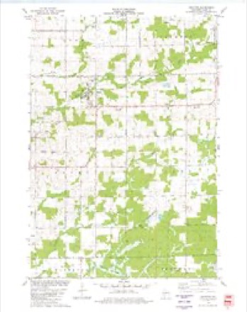
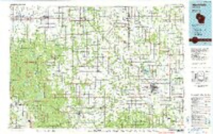
11 topographic sheets cover this place, the earliest surveyed in 1953 and the latest in 1984. It stands in Lynn town. It lies in ZIP code area 54436. The Survey maps it on the Granton quadrangle. It stands 1,171 feet above sea level.
Topographic sheets covering this place
6 surveys from 11 printed sheetsMatched by testing this settlement's coordinate against the published boundary of every sheet in the United States Geological Survey's historical collection. Each opens the scanned sheet at the Survey.
- 1953 USGS Eau Claire quadrangle1:250000, 4 printings
- 1954 USGS Granton quadrangle1:62500, 2 printings
- 1958 USGS Eau Claire quadrangle1:250000
- 1964 USGS Eau Claire quadrangle1:250000
- 1979 USGS Granton quadrangle1:24000
- 1984 USGS Marshfield quadrangle1:100000, 2 printings
In the county-history sources
2,762 words on this townshipHistory of Clark County Wisconsin, published 1918 names this settlement in its chapter on Lynn Town. These are the passages that mention it, exactly as the scans read.
George Ure and Gottlieb Sternitzky were the founders of the town of Lynn and the little village of the same name. The two pioneers came from Chicago in 1856, Mr. Ure paying $300 for an eighty, which he never saw, but which turned out to be a first class piece of land, now worth thirty or forty times the cost price. They drove through from Sparta with a team. Bartemus Brooks and sons Alonzo, Dan and Erwin, were also among the first comers, and Archibald Yorkston arrived shortly after, and Frederick Yankee with his sons August, William, Herman and Henry, all of whom are well known Clark County residents today.
Passage source: History of Clark County Wisconsin, published 1918.
Lynn is a station on the branch line of the Chicago, Milwaukee and St. Paul railroad up from Babcock where it connects with the main line. This line crosses the Omaha railroad a half mile from Lynn. The two roads were built at the same time and there was a sharp clash when the construction crews met at the junction. The Omaha was pushing through from Neillsville to Marshfield and the St. Paul had dreams of a through line to the Superior country, The St. Paul got to the crossing first and chained an engine to the tracks and had a carload of armed men guard the right of way and for several days excitement ran high although it subsided without any physical violence. The Wisconsin Central pushed through a line to Ashland about the same time and the St. Paul never completed its line, but the prompt work of the contractors in those early days gave it the right of way at the junction although it runs only three or four trains a week while the Omaha has several through trains daily.
Passage source: History of Clark County Wisconsin, published 1918.
The platted villages of Clark County in addition to those incorporated, are Weston's Rapids, Humbird, Willard, Osborn, Poznan, Columbia, Allison, Atwood, Lynn, Chili and Eidsvold. Weston's Rapids was platted Feb. 10, 1859, on lots 8 and 7, and the Northeast quarter of the Southeast quarter of Section 2, Township 24, Range 2 West. It was surveyed by Moses Clark for Samuel Weston. Humbird, formerly Rocky Mound, was platted on land of Almond Alderman, in 1869. Bidsvold was platted June 14, 1884, on land of Jacob Bye'& Co. Lynn was surveyed in Sections 5 and 8, Township 24, Range 1 East, Feb. 12, 1890, by George Ure on land of James G. and Henry Sternitzky. Chili was platted Nov. 13, 1891, on land owned by Ira, F. C. and S. E. Fike, and the Neillsville Manufacturing Co. Columbia was platted Aug. 4, 1893, for the Columbia Improvement Co. Poznan, Sections 34 and 35, Township 29, Range 3 West, was platted Aug, 16, 1895, on land of the Sterling Lumber Co. Willard was platted June 11, 1911, on land of the N. C. Foster Lumber Co. Atwood was platted May 15, 1910, on the northeast quarter of Section 27, Township 28, Range 1 West, for the Tri-State Land Co. Osborn was platted on the Northeast quarter of Section 17, Township 27, Range 1 East, Oct. 15, 1910, by the same company, Allison was platted Oct. 15, 1914, on lots 6 and 7, Township 23, Range 3 West, for the Wisconsin Railway Light & Power Co.
Passage source: History of Clark County Wisconsin, published 1918.
Machine-read from a century-old scan, so expect the errors a machine makes: misspelled names, dropped words, stray characters.
Read the whole chapter on Lynn Town - it names this place 2 more 2 times.
Fires near this place
2 since 2019Regional context, not property-specific evidence. The federal wildfire occurrence database lists 2 fires within 5 miles of Lynn in 2019, burning under an acre in total. None started naturally. 1 was recorded as arson. Distance is straight-line from the map coordinates, so a fire counted here may appear on a neighbouring settlement's page as well.
| Reported cause | Fires |
|---|---|
| Arson/incendiarism | 1 |
| Debris and open burning | 1 |
The most recent of them, most recent first, with the day each was reported and the service that recorded it.
| Date | Cause | Size | Reported by | Name on the report |
|---|---|---|---|---|
| 30 March 2019 | Debris and open burning | under an acre | Wisconsin Department of Natural Resources | 1903301 |
| 12 January 2019 | Arson/incendiarism | under an acre | Wisconsin Department of Natural Resources | 201902 |
Settlements close enough to share some of these fires:
Mines and quarries near this place
1 within 5 milesRegional context, not property-specific evidence. The federal mineral resources record lists 1 working within 5 miles of Lynn: 1 past producer. None of them still produces. What was taken out: Sand and Gravel, Construction. Distance is straight-line from the map coordinates, so a quarry counted here may appear on a neighbouring settlement's page as well.
| Where | Site | Commodity | Status | Recorded |
|---|---|---|---|---|
| Neadler Pit | Sand and Gravel, Construction | Past Producer |
Storms near this place
3 since 2007Regional context, not property-specific evidence. The National Weather Service names Lynn in 3 storm reports between 2007 and 2014: 1 thunderstorm wind, 1 lightning, 1 flash flood. No death or injury is recorded in these reports. Each account below is quoted exactly as the forecast office filed it, from the NOAA Storm Events Database, and each date opens the federal record of that event.
| When | Event | Place named | Harm | What the report says |
|---|---|---|---|---|
| August 2014 | Flash Flood | Lynn | $35,000 | Flash flooding along the South Branch of O'Neill Creek partially washed out a culvert on Meridian Road northeast of Granton. In addition, the flooding eroded between 300 and 350 feet along the side of the road adjacent to the culvert. |
| May 2007 | Thunderstorm Wind | Lynn | $1,000 | no account filed |
| November 2008 | Lightning | Lynn | $800 | A shed caught fire after it was struck by lightning. |
Nearest settlements
The eight closest, with where each one stands in the county. Distances are straight-line, computed from the Geographic Names Information System coordinates.
| Map | Place | Distance | Sheets |
|---|---|---|---|
| Granton | 2.8 miles | 11 | |
| Chili | 4.2 miles | 11 | |
| Kurth (historical) | 4.6 miles | 11 | |
| Nevins | 6.4 miles | 12 | |
| Veefkind | 7.8 miles | 11 | |
| Shortville | 8.3 miles | 12 | |
| Sherwood | 8.4 miles | 12 | |
| Spokeville | 9.1 miles | 11 |
Elsewhere
Matched on this settlement's Geographic Names Information System number rather than its name, so it cannot be a different place of the same name in another state.
| Wikipedia article on Lynn | An encyclopaedic summary. Its text is share-alike, so it is linked here rather than copied. |
| Wikidata item Q6708895 | The structured record the population and elevation above come from. Public domain (CC0). |
Provenance
This settlement is recorded in the Geographic Names Information System as feature 1568845. The sheet list is computed by point-in-boundary test against the United States Geological Survey's historical topographic inventory. Both are works of the United States government and carry no copyright under 17 U.S.C. 105.
Wildfire. Short, Karen C. 2022. Spatial wildfire occurrence data for the United States, 1992-2020 [FPA_FOD_20221014]. 6th Edition. Fort Collins, CO: Forest Service Research Data Archive. https://doi.org/10.2737/RDS-2013-0009.6 Collected with United States Government funding and usable without additional permissions or fees.
Mines and quarries. USGS Mineral Resources Data System (MRDS) https://mrdata.usgs.gov/mrds/ A work of the United States government, no copyright under 17 U.S.C. 105.
Storms. NOAA National Centers for Environmental Information, Storm Events Database https://www.ncei.noaa.gov/stormevents/ A work of the United States government, no copyright under 17 U.S.C. 105. Narratives are quoted verbatim from the National Weather Service report and are not edited or summarised.