Block
From the record
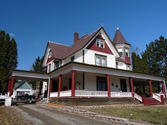
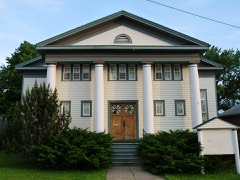
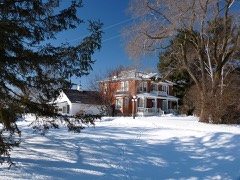
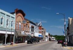
22 National Register listings published here.
Sources: the county history on the Internet Archive · the National Register database, National Park Service
68 topographic sheets cover 40 settlements here, and 22 properties are on the National Register of Historic Places.
22 National Register listings published here.
Sources: the county history on the Internet Archive · the National Register database, National Park Service
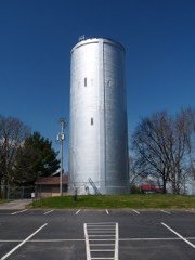
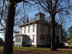
Every property in this county listed on the National Register of Historic Places, with the year it was listed and the federal nomination document.
Every wildfire the federal occurrence database records inside this county: 308 of them, burning about 1,232 acres. 6 started naturally and 33 were recorded as arson. Each settlement page carries the fires within five miles of it.
| Reported cause | Fires |
|---|---|
| Debris and open burning | 88 |
| Missing data/not specified/undetermined | 67 |
| Equipment and vehicle use | 61 |
| Arson/incendiarism | 33 |
| Recreation and ceremony | 14 |
| Other causes | 12 |
| Smoking | 11 |
| Power generation/transmission/distribution | 8 |
| Natural | 6 |
| Railroad operations and maintenance | 4 |
| Fireworks | 3 |
| Misuse of fire by a minor | 1 |
The five largest, by the area the report gives. One of them was set deliberately.
| Date | Cause | Size | Reported by | Name on the report |
|---|---|---|---|---|
| 18 May 2018 | Arson/incendiarism | 105 acres | Wisconsin Department of Natural Resources | HAY CREEK |
| 29 April 2018 | Missing data/not specified/undetermined | 90 acres | Wisconsin Department of Natural Resources | BRUCE MOUND |
| 24 April 1996 | Missing data/not specified/undetermined | 65 acres | Wisconsin Department of Natural Resources | not named |
| 18 May 2003 | Equipment and vehicle use | 60 acres | Wisconsin Department of Natural Resources | not named |
| 1 April 2010 | Equipment and vehicle use | 46 acres | Wisconsin Department of Natural Resources | CLOVERDALE |
| 5 October 1997 | Debris and open burning | 44 acres | Wisconsin Department of Natural Resources | not named |
| 3 May 2016 | Debris and open burning | 44 acres | Wisconsin Department of Natural Resources | WILLARD FIRE |
| 18 October 1995 | Equipment and vehicle use | 39 acres | Wisconsin Department of Natural Resources | not named |
Every settlement page carries the fires within five miles of it - see the settlement index below.
The NOAA Storm Events Database holds 488 reports for this county, causing 1 death, 12 injuries and about $18,926,500 in recorded property damage. Each settlement page carries the reports that name it.
| Kind of event | Reports |
|---|---|
| Thunderstorm Wind | 216 |
| Hail | 154 |
| Tornado | 44 |
| Flood | 23 |
| Heavy Rain | 19 |
| Funnel Cloud | 16 |
| Flash Flood | 13 |
| Lightning | 3 |
The most serious of them, by death, then injury, then recorded damage. The accounts are quoted exactly as the forecast office filed them.
| When | Event | Place named | Harm | What the report says |
|---|---|---|---|---|
| June 1950 | Tornado (F2) | not stated | 1 killed, $25,000 | no account filed |
| June 1969 | Tornado (F2) | not stated | 2 hurt, $2,500,000 | no account filed |
| August 2011 | Tornado (EF2) | Spokeville | 2 hurt, $1,400,000 | Two people were directly injured and there was an indirect loss of life from an EF2 tornado that tracked across the east central sections of Clark County near Chili. The death occurred when an oxygen machine stopped working due to a power outage caused by the tornado. The tornado was on the ground for just over 7 miles and destroyed four homes, damaged at least 19 others, destroyed four barns and 15 outbuildings with numerous other farm buildings damaged. One farmer lost several specialty birds including 12 peacocks and 16 guinea hens. Around 1500 residents across Clark County were without power after the storms moved through. Damages from the tornado are estimated to be around $1.5 million. |
| May 1959 | Tornado (F3) | not stated | 2 hurt, $250,000 | no account filed |
| June 2002 | Tornado (F1) | Abbotsford | 2 hurt, $100,000 | no account filed |
| August 2002 | Lightning | Willard | 2 hurt | no account filed |
| September 1971 | Tornado (F3) | not stated | 1 hurt, $250,000 | no account filed |
| July 2005 | Thunderstorm Wind | Humbird | 1 hurt, $5,000 | no account filed |
| June 1958 | Tornado (F4) | not stated | $2,500,000 | no account filed |
| September 2016 | Flash Flood | Eidsvold | $1,800,000 | Flooding from the South Branch of O'Neill Creek covered County Highway Y south of Chili. Standing water covered State Highway 73 in Christie. The emergency manager reported around 65 locations across the county had water over the road or culverts washed out. Fifteen homes were damaged by the flooding. A state of emergency was declared for the entire county. |
| September 2010 | Flood | Sherwood | $1,150,000 | Flooding caused numerous county and township roads as well as some state roads to be closed across the southern half of the county, mainly south of Greenwood. Many low-lying township roads were closed, while some culverts were damaged and needed replacing. The hardest hit areas included the townships of Hewitt, Lynn, Sherwood, and Washburn. Water surged out of Mead Lake into the South Fork Eau Claire River, which then overflowed County Road M. The River Road just southwest of Greenwood was closed as the Black River flowed over the road. A pickup tried to cross this portion of the road and was swept into the ditch. In Abbotsford, Lindon Street and Pickard Road were closed as the sewer plant briefly overflowed. Many schools were closed on Thursday and Friday including Loyal, Greenwood, Granton and Neillsville. A State of Emergency was declared in many towns and villages across the county. There were 45 homes across the county with minor damage. |
| September 2015 | Flash Flood | Greenwood | $1,100,000 | Flood waters from the Black River covered County Road G just west of Greenwood. Waters flowing through a drainage ditch undercut Chickadee Road near Gorman Avenue southwest of Willard. County Highway M was closed north of County Highway I when a culvert was washed out. This is the second time in three years that this section of County M has been washed out. County Highway B was undermined by water west of Humbird. The flood waters also prompted the closing of the county's ATV and horse trails. The flood waters damaged the dam at Emerson Lake with repairs estimated to cost almost a quarter of a million dollars. Highway damage along was estimated at $536,200. |
| May 2025 | Tornado (EF2) | Curtiss | $725,000 | This strong tornado developed in fields west of Unity before tracking northeast toward Colby. As it moved through rural areas of northeastern Clark County, it damaged multiple farm outbuildings, trees, numerous power poles, and a home. NWS Storm Survey indicated EF2 damage to this home as the majority of its roof was removed with the attached garage heavily damaged. The tornado continued into the southeastern edge of Colby where multiple outbuildings, a home, and a car dealership sustained damage. The tornado moved into Marathon County before it quickly dissipated. |
| June 2005 | Tornado (F1) | Loyal | $600,000 | no account filed |
| May 1996 | Thunderstorm Wind | Loyal | $500,000 | no account filed |
| June 2002 | Flash Flood | Northeast Portion | $345,000 | no account filed |
| May 2024 | Tornado (EF1) | Unity | $330,000 | A tornado touched down southwest of Unity, moved through the village, and ended northeast of town in Marathon County (NWS Green Bay's warning area). Besides damage to trees and power lines, several homes and garages had extensive damage, especially to roofs. |
| May 2024 | Tornado (EF1) | Longwood | $270,000 | This tornado occurred on the left flank of a broad area of downburst wind damage with the tornado path intermittent in nature as the downburst mixed in at times. Multiple farmsteads were hit with damage mainly to trees and outbuildings. |
| September 2019 | Tornado (EF1) | Globe | $255,000 | An EF1 tornado tracked across rural sections of central Clark County. The tornado touched down near the Black River southwest of Greenwood and then moved northeast before dissipating west of Loyal. Along its path, the tornado damaged trees, barns, silos, and crops. At least three cows were killed at one farm. |
| September 1986 | Tornado (F1) | not stated | $250,000 | no account filed |
| June 1984 | Tornado (F2) | not stated | $250,000 | no account filed |
| August 1983 | Tornado (F0) | not stated | $250,000 | no account filed |
| July 1983 | Tornado (F2) | not stated | $250,000 | no account filed |
| September 1971 | Tornado (F3) | not stated | $250,000 | no account filed |
| July 1967 | Tornado (F2) | not stated | $250,000 | no account filed |
| December 2021 | Tornado (EF2) | Sidney | $200,000 | This EF2 tornado developed southwest of Sidney and moved northeast across a heavily wooded area of southwest Clark County. Thousands of trees were damaged and one home was destroyed near Five Mile Creek. |
| December 2021 | Tornado (EF2) | Neillsville | $200,000 | This EF2 tornado developed northeast of Neillsville and moved northeast before dissipating after crossing State Highway 73 just north of Schofield Road. A farm took a direct hit from the tornado where a barn was shifted off its foundation, a truck moved almost 100 feet and roof damage to the house occurred. |
| December 2021 | Tornado (EF1) | Greenwood | $160,000 | This EF1 tornado formed west of Greenwood near the intersection of County Highways G and O. The tornado was only on the ground for about a mile but caused extensive damage to two farms. A barn roof was removed, a pole shed destroyed, power pole snapped and roof damage to an outbuilding. |
| June 2004 | Flash Flood | South Portion | $143,000 | no account filed |
| May 2024 | Tornado (EF1) | Humbird | $140,000 | This stronger EF1 tornado leveled trees and powerlines along an intermittent track that was mixed with downburst winds. The tornado was overtaken by a downburst, which caused pockets of tree and outbuilding damage for another 7 miles. |
| December 2021 | Tornado (EF2) | Eidsvold | $120,000 | This EF2 tornado developed in Chippewa County and crossed into Clark County after moving through Stanley. After moving into Clark County, the tornado moved across rural areas damaging farm outbuildings and trees. |
| September 2016 | Flood | Junction | $100,000 | Widespread flooding occurred across much of Clark County with numerous roads impassable. Emergency officials had to respond to two incidents where vehicles became stuck in the flood waters. One person had to be rescued from the waters but no injuries were reported. |
| May 2024 | Tornado (EF1) | Christie | $88,000 | This tornado damaged several farmsteads, powerlines, and trees. It was strongest to the west of Loyal, with the path becoming weaker and less defined to the north of town. |
| May 1996 | Lightning | Neillsville | $80,000 | no account filed |
| May 2024 | Thunderstorm Wind | Sidney | $75,000 | Emergency management reported power poles and lines down on Highway 10. |
| May 2024 | Tornado (EF1) | Spokeville | $70,000 | This was a brief tornado that damaged a farmstead and trees. |
| June 2024 | Thunderstorm Wind | Eidsvold | $60,000 | County dispatch reported power lines down in Thorp. |
| July 2019 | Thunderstorm Wind | Withee | $60,000 | West of Withee, two barns, a garage and silo were blown down. |
| December 2021 | Thunderstorm Wind | Sidney | $50,000 | A path of wind damage occurred across southwest Clark County from east of Humbird to near Globe. Most of the damage was uprooted or snapped trees but the roof was ripped off a metal pole shed and a wooded power pole was broken. |
| December 2021 | Tornado (EF2) | Humbird | $50,000 | This EF2 tornado developed in Jackson County and moved into the southwest part of Clark County east of Humbird. The tornado continued to move northeast before dissipating along County Highway B west of Sidney. This part of Clark County is heavily forested and thousands of trees were damaged. |
| December 2021 | Thunderstorm Wind | Greenwood | $50,000 | A large tree was blown on to a business in Greenwood. Branches from the tree went through parts of the roof and the owner was temporarily trapped inside the business when the exit was blocked. |
| September 2010 | Flood | Christie | $50,000 | County Road H washed out just west of the intersection with State Highway 73. |
| September 2010 | Flood | Neillsville | $50,000 | O'Neill Creek was flooding in downtown Neillsville. This flooding impacted a few homes and businesses as the water made it to the base of four homes and was just inches from flooding a shopping center. |
| June 1998 | Flash Flood | Chili | $50,000 | no account filed |
| July 1997 | Thunderstorm Wind | Curtiss | $50,000 | no account filed |
| May 1993 | Thunderstorm Wind | Neillsville | $50,000 | no account filed |
| May 2025 | Tornado (EF1) | Loyal | $45,000 | This tornado touched down southeast of Loyal and tracked to the east-northeast, damaging one residence in addition to trees and powerlines before quickly dissipating. |
| August 2013 | Thunderstorm Wind | Withee | $40,000 | The roof was blown off a pole barn and silo near Withee. Several trees were also blown down with two vehicles damaged by the falling trees. |
| July 1997 | Thunderstorm Wind | Loyal | $40,000 | no account filed |
| August 2014 | Flash Flood | Lynn | $35,000 | Flash flooding along the South Branch of O'Neill Creek partially washed out a culvert on Meridian Road northeast of Granton. In addition, the flooding eroded between 300 and 350 feet along the side of the road adjacent to the culvert. |
| May 2024 | Tornado (EF0) | Riplinger | $33,000 | This was a weak and brief tornado that damaged a farmstead and a grove of trees. |
| August 2022 | Thunderstorm Wind | Thorp | $30,000 | In Thorp, a camper was flipped over and several trees were snapped or uprooted. |
| December 2021 | Thunderstorm Wind | Neillsville | $30,000 | Power lines and trees were blown down across Neillsville. The winds also scattered debris from damaged roofs. |
| May 2020 | Thunderstorm Wind | Owen | $30,000 | Trees and power lines were blown down in and near Owen. One tree landed on a house and over 1,100 customers were without power after the storms moved through. |
| July 2019 | Tornado (EF1) | Withee | $30,000 | A brief tornado occurred north of Withee. The tornado touched down in a field, crossed Center Road before dissipating in a wooded area. Trees were blown onto a mobile home and numerous power poles along Center Road were snapped or bent. |
| July 2019 | Tornado (EF0) | Withee | $30,000 | A brief tornado occurred west of Withee. The tornado touched down near a farm where the roof was partially torn off a barn, the top of a silo was ripped off, pole barns were damaged along with between 15 and 20 trees. The tornado then crossed County Highway O before dissipating. |
| August 2014 | Thunderstorm Wind | Granton | $30,000 | Numerous trees were blown down or uprooted in Granton. Some of these trees landed on houses and across roads. Power lines were also down causing around 200 customers to loose power. |
| September 1998 | Hail | Thorp | $30,000 | no account filed |
| April 2026 | Hail | Humbird | $25,000 | The public reported 2 inch diameter hail near Humbird. |
| August 2006 | Hail | Humbird | $25,000 | no account filed |
The Survey's mineral resources record lists 26 workings inside this county. 6 still produce and 20 are closed or unrecorded. Each settlement page carries the workings within five miles of it.
| Commodity | Workings |
|---|---|
| Sand and Gravel, Construction | 13 |
| Stone, Crushed/Broken | 10 |
| Flagstone | 1 |
| Stone, Crushed/Broken, Sand and Gravel, Construction | 1 |
| Clay | 1 |
The least common of them first, because a county's hundredth gravel pit says nothing its first ten did not.
| Where | Site | Commodity | Status | Recorded |
|---|---|---|---|---|
| Coles Corner Road Clay Pit | Clay | Past Producer | ||
| Dorchester Quarry | Flagstone | Past Producer | ||
| Tyndall Granite & Gravel Deposit | Stone, Crushed/Broken, Sand and Gravel, Construction | Occurrence | ||
| Clark County Operations | Stone, Crushed/Broken | Producer | ||
| Hardwick Shale Quarry | Stone, Crushed/Broken | Past Producer | ||
| High Hill Quartz & Rhyolite Deposit | Stone, Crushed/Broken | Occurrence | ||
| Kurasz Pit | Stone, Crushed/Broken | Producer | ||
| Matti Shale Quarry | Stone, Crushed/Broken | Past Producer | ||
| Pit Road Rhyolite Quarry | Stone, Crushed/Broken | Past Producer | ||
| Rennock Granite Deposit | Stone, Crushed/Broken | Occurrence | ||
| Rock Creek Road Quartzite Quarry | Stone, Crushed/Broken | Past Producer | ||
| Small Creek Quartz Deposit | Stone, Crushed/Broken | Occurrence | ||
| Todd Road Granite Deposit | Stone, Crushed/Broken | Occurrence | ||
| Clark County Highway Dept. Pits | Sand and Gravel, Construction | Past Producer | ||
| Clark County Operations | Sand and Gravel, Construction | Producer | ||
| Frey Pit | Sand and Gravel, Construction | Past Producer | ||
| Greenwood Pit | Sand and Gravel, Construction | Producer | ||
| Lidner Pit | Sand and Gravel, Construction | Past Producer | ||
| Lone Pine Pit | Sand and Gravel, Construction | Past Producer | ||
| Neadler Pit | Sand and Gravel, Construction | Past Producer | ||
| Opelt Brothers Sand and Gravel Pit | Sand and Gravel, Construction | Producer | ||
| Own Crews | Sand and Gravel, Construction | Unknown | ||
| Plautz Bros Inc Withee & Roder Pits | Sand and Gravel, Construction | Past Producer | ||
| Plautz Brothers, Inc. | Sand and Gravel, Construction | Past Producer | ||
| Robertson Pit | Sand and Gravel, Construction | Producer | ||
| Schuering Pit | Sand and Gravel, Construction | Past Producer |
History of Clark County Wisconsin devotes a chapter to each township: its boundaries and streams, who settled it and when, the mills, the schools and the churches. All 12 are reproduced here in full. Each row shows the township's own shape and where it lies in the county, drawn from the Census Bureau's boundary. Which settlements belong to which township is computed from that same boundary, not taken from the book.
| Shape and position in the county | Township | Settlements in it | Length | Sections |
|---|---|---|---|---|
| Colby City | Colby | 1,696 words | 0 | |
| Curtiss Village | Curtiss | 2,380 words | 0 | |
| Dorchester Village | Dorchester | 1,039 words | 0 | |
| Granton Village | Granton | 1,117 words | 0 | |
| Greenwood City | Greenwood | 1,795 words | 0 | |
| Loyal Town | Loyal | 1,764 words | 0 | |
| Lynn Town | Lynn | 2,762 words | 2 | |
| Neillsville City | Neillsville | 2,987 words | 0 | |
| Owen City | Owen | 1,587 words | 0 | |
| Thorp Town | Eadsville, Eidsvold, Junction | 2,050 words | 0 | |
| Unity Town | Riplinger | 1,172 words | 0 | |
| Withee Town | Lombard | 738 words | 0 |
One book written about this county, cut here where the book itself is cut, at its printed chapters: 22 chapters in all. Every chapter is public domain, machine-read from the scan and reproduced complete. A chapter already given under one of the county's towns is not repeated in this list.
| Chapter | Length |
|---|---|
| Chapter 1: Early Wisconsin | 8,297 words |
| Chapter 2: Physical Features. | 4,563 words |
| Chapter 3: The Indians | 2,695 words |
| Chapter 4: Governmental Jurisdiction | 2,293 words |
| Chapter 5: First Settlement | 4,194 words |
| Chapter 6: Original Entries | 7,473 words |
| Chapter 7: Early County Government | 6,118 words |
| Chapter 8: County Buildings and Offices | 3,349 words |
| Chapter 9: Township Organization | 3,279 words |
| Chapter 10: Political Contests | 6,514 words |
| Chapter 11: The Unpaid Tax Problem | 4,787 words |
| Chapter 12: Lumbering | 8,170 words |
| Chapter 13: Agriculture | 3,325 words |
| Chapter 14: Transportation | 4,447 words |
| Chapter 15: Journalism | 2,500 words |
| Chapter 16: Banks and Banking | 5,131 words |
| Biographical sketches | 282,414 words in 18 parts |
| Chapter 19: Historical Contributions | 25,029 words in 2 parts |
| Chapter 20: The Circuit Court | 1,534 words |
| Chapter 21: The Public Schools | 2,259 words |
| Chapter 22: Military Record | 2,585 words |
| Chapter 23: Religious Life | 11,121 words |
Named settlements recorded in the Geographic Names Information System, each with the topographic sheets covering it. Villages, hamlets and abandoned places alike. Each is shown with the nearest named watercourse or landform and the survey quadrangle it falls on.
Green Grove town · 54460 · On East Fork Popple River · Curtiss quadrangle
11 sheets, 1953 to 1984
Grant town · 54436 · On Middle Branch O'Neill Creek · Granton quadrangle
11 sheets, 1953 to 1984
No longer a settlement
Neillsville city · 54456 · On O'Neill Creek · Neillsville quadrangle
11 sheets, 1953 to 1984
Washburn town · 54456 · On Hay Meadow Creek · Hatfield NE quadrangle
12 sheets, 1953 to 1985
Dewhurst town · 54456 · On Trow Mounds · Merrillan quadrangle
13 sheets, 1924 to 1985
No longer a settlement
The vanished settlements of Clark County: the places named above that are no longer on the map.