 Block
Mifflin, Wisconsin
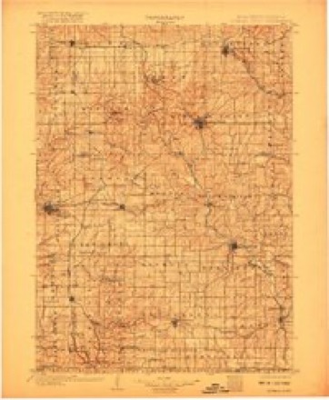
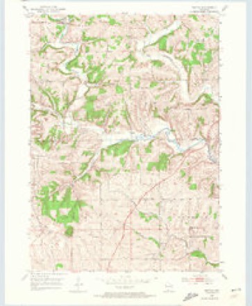
13 topographic sheets cover this place, the earliest surveyed in 1902 and the latest in 1984. It stands in Mifflin town. It lies in ZIP code area 53580. It stands on Livingston Branch. The Survey maps it on the Mifflin quadrangle. It stands 1,004 feet above sea level.
Topographic sheets covering this place
7 surveys from 13 printed sheetsMatched by testing this settlement's coordinate against the published boundary of every sheet in the United States Geological Survey's historical collection. Each opens the scanned sheet at the Survey.
- 1902 USGS Mineral Point quadrangle1:125000, 4 printings
- 1952 USGS Mifflin quadrangle1:24000, 2 printings
- 1959 USGS Dubuque quadrangle1:250000
- 1961 USGS Dubuque quadrangle1:250000
- 1962 USGS Dubuque quadrangle1:250000, 2 printings
- 1976 USGS Dubuque quadrangle1:250000
- 1984 USGS Dubuque North quadrangle1:100000, 2 printings
In the county-history sources
39,439 words on this townshipHistory of Iowa County, Wisconsin, Containing an Account of Its Settlement, Growth, Development and Resources...biographical Sketches.., published 1881 names this settlement in its chapter on Mifflin Town. These are the passages that mention it, exactly as the scans read.
In June, 1851, a number of citizens, resident in Mineral Point and surrounding districts, organized the pioneer agricultural society of this county. The officers were H. L. Leffingwell, President; Henry M. Billings, Levi Sterling, P. O'Dowd, John Hand, F. J. Dunn and George Goldthorp, Vice Presidents ; William R. Smith, Secretary ; Samuel Crawford, Treasurer. The new association held its inaugural fair in October of the same year. C. C. Washburn and Francis J. Dunn delivered addresses on that occasion, and the exhibition was characterized as an unqualified success. However that may be, the October meeting was the first and last gathering under the above auspices. Individual exertion revived the defunct society in June, 18.5(3, when, at a "mass convention " in Dodgeville, re-organization was effected. H. M. Billings, John Ellwood and Joseph Mortell were appointed to report and draft a constitution. In the interim the following officers were elected: Hon. H. M. Billings, President; Samuel Hendy, Levi Sterling and L. W. Joiner, Vice Presidents; George Messersmith, Recording Secretary; L. H. D. Crane, Corresponding Secretary ; Phillip Eddy, Treasurer. The committee on a constitution reported, and, in accordance with their report, the appended names of Representatives were added to the Executive Committee; John James, Waidvvick ; John Baker, Linden; (Jaleb Sylvester, Mifflin ; David McFarland, Highland ; Watkin Watkins, Dodgeville ; Jo.seph Roberts, Ridgeway; W. A. Brisbane, Arena; 0. F. Savage, Wyoming; David Bigelow, Clyde; Asa Patterson, Pulaski, Thomas Berry, Mineral Point.
Passage source: History of Iowa County, Wisconsin, Containing an Account of Its Settlement, Growth, Development and Resources...biographical Sketches.., published 1881.
In 1844, Diamond Grove, which include<l what are now the towns of Linden and Mifflin, was changed to Peddler's Creek Precinct. During the same year, the territory now known as Waldwick and Moscow Towns, was also constituted a precinct called Yellow Stone. In 1845, the precinct of Peddler's Creek was divided, that part which is now Mifflin being erected into a precinct entitled Dallas. In 1846, a precinct called Rcevesville was set off in the northeast part of the county, the present town of Arena, and one called Percussion, now the town of Wyoming. That section of the county now known as Pulaski, was constituted a precinct called Wisconsin, in 1848, and at the same time the precinct of Otter Creek wa.s erected, what is nowknown as the town of Clyde. The precinct of Mineral Point was erected in 1836, and was first called Pecatonica, atul then constituted the chief polling place in the county.
Passage source: History of Iowa County, Wisconsin, Containing an Account of Its Settlement, Growth, Development and Resources...biographical Sketches.., published 1881.
Diamond Grove, well known as an early smelting point, still retains the name, probably given on account of the shape of the clump of timber. Peddlers Creek was the original name of the village of Linden, and received the appellation from a peddler having first discovered mineral there. Dallas was the name of a small hamlet in the town of Mifflin, now extinct. Blue River, the name of a stream in the west part of the county. Dodgeville, so called after Gov. Dodge, who was one of the very first to locate in that section. Porter's Grove, so designated from a grove named after the first settler at that point. Helena, the name given in honor of some lady, by one of the early founders, to the first laid-out village in the county. Percussion, so styled, owing to the appearance of a rock which stands in the town of Wyoming, and which resembles a percussion furnace. Otter Creek, after the principal stream that traverses the town of Clyde. Yellow Stone, the name of a hamlet in the north part of what is now La Fayette County. Reevesville and Arena, the former after the name of the manager of the British Emigration Society, Charles Reeves, the latter meaning a sandy place.
Passage source: History of Iowa County, Wisconsin, Containing an Account of Its Settlement, Growth, Development and Resources...biographical Sketches.., published 1881.
Machine-read from a century-old scan, so expect the errors a machine makes: misspelled names, dropped words, stray characters.
Fires near this place
3 since 2020Regional context, not property-specific evidence. The federal wildfire occurrence database lists 3 fires within 5 miles of Mifflin in 2020, burning about 1 acre in total. None started naturally. None was recorded as arson. Distance is straight-line from the map coordinates, so a fire counted here may appear on a neighbouring settlement's page as well.
| Reported cause | Fires |
|---|---|
| Missing data/not specified/undetermined | 2 |
| Debris and open burning | 1 |
The most recent of them, most recent first, with the day each was reported and the service that recorded it.
| Date | Cause | Size | Reported by | Name on the report |
|---|---|---|---|---|
| 4 July 2020 | Missing data/not specified/undetermined | under an acre | Wisconsin Department of Natural Resources | 7042001 |
| 4 July 2020 | Missing data/not specified/undetermined | 1.0 acres | Wisconsin Department of Natural Resources | 704201 |
| 15 January 2020 | Debris and open burning | under an acre | Wisconsin Department of Natural Resources | 734 |
Settlements close enough to share some of these fires:
Mines and quarries near this place
10 of 77 shownRegional context, not property-specific evidence. The federal mineral resources record lists 77 workings within 5 miles of Mifflin: 47 past producers, 25 unknowns, 3 producers, 2 occurrences. 3 still produce. What was taken out: Lead, Zinc, Lead, Zinc, Stone, Crushed/Broken. Distance is straight-line from the map coordinates, so a quarry counted here may appear on a neighbouring settlement's page as well.
| Where | Site | Commodity | Status | Recorded |
|---|---|---|---|---|
| Negro Jim Mine | Lead, Barium-Barite, Zinc | Past Producer | Galena | |
| Unnamed Prospect Along East Pecat | Copper | Occurrence | ||
| Unnamed Prospect Along East Pecat | Copper | Occurrence | ||
| Dell Needham Various Quarries | Stone, Crushed/Broken | Producer | ||
| Ivey Construction Co. Quarry | Stone, Crushed/Broken | Past Producer | ||
| Johnston Quarry | Stone, Crushed/Broken | Producer | ||
| Knight Quarry | Stone, Crushed/Broken | Producer | ||
| Bickford Mine | Lead, Zinc | Past Producer | ||
| Depot Mine | Lead, Zinc | Past Producer | ||
| Ebenezer Mine | Lead, Zinc | Past Producer |
Nearest settlements
The eight closest, with where each one stands in the county. Distances are straight-line, computed from the Geographic Names Information System coordinates.
| Map | Place | Distance | Sheets |
|---|---|---|---|
| Rewey | 2.9 miles | 14 | |
| Linden | 5.3 miles | 12 | |
| Cobb | 6.8 miles | 12 | |
| Edmund | 8.2 miles | 12 | |
| Mineral Point | 9.3 miles | 14 | |
| Highland | 12.2 miles | 10 | |
| Dodgeville | 13.4 miles | 14 | |
| Waldwick | 16.9 miles | 13 |
Elsewhere
Matched on this settlement's Geographic Names Information System number rather than its name, so it cannot be a different place of the same name in another state.
| Wikipedia article on Mifflin | An encyclopaedic summary. Its text is share-alike, so it is linked here rather than copied. |
| Wikidata item Q6843992 | The structured record the population and elevation above come from. Public domain (CC0). |
Provenance
This settlement is recorded in the Geographic Names Information System as feature 1569453. The sheet list is computed by point-in-boundary test against the United States Geological Survey's historical topographic inventory. Both are works of the United States government and carry no copyright under 17 U.S.C. 105.
Wildfire. Short, Karen C. 2022. Spatial wildfire occurrence data for the United States, 1992-2020 [FPA_FOD_20221014]. 6th Edition. Fort Collins, CO: Forest Service Research Data Archive. https://doi.org/10.2737/RDS-2013-0009.6 Collected with United States Government funding and usable without additional permissions or fees.
Mines and quarries. USGS Mineral Resources Data System (MRDS) https://mrdata.usgs.gov/mrds/ A work of the United States government, no copyright under 17 U.S.C. 105.