 Block
Muscoda, Wisconsin
10 topographic sheets cover this place, the earliest surveyed in 1905 and the latest in 1985. It stands in Muscoda Village. It lies in ZIP code area 53573. The Survey maps it on the Muscoda quadrangle. 1,307 people lived here at the 2020 count. It stands 725 feet above sea level.
On record in Muscoda
Buildings and businesses the archive holds for this place. Each opens its own page, with the source record it came from.
On the National Register 1 record
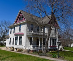 John Young Houselisted 1994
Topographic sheets covering this place
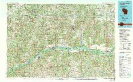
8 surveys from 10 printed sheetsMatched by testing this settlement's coordinate against the published boundary of every sheet in the United States Geological Survey's historical collection. Each opens the scanned sheet at the Survey.
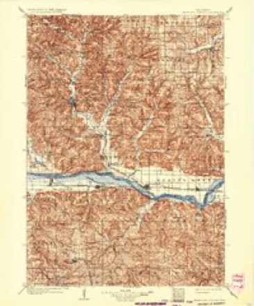
- 1905 USGS Richland Center quadrangle1:125000, 2 printings
- 1958 USGS La Crosse quadrangle1:250000, 2 printings
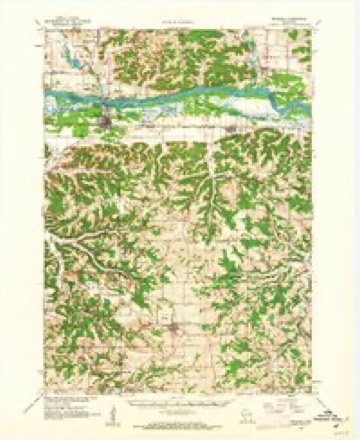
- 1960 USGS Muscoda quadrangle1:62500
- 1961 USGS La Crosse quadrangle1:250000
- 1965 USGS La Crosse quadrangle1:250000
- 1976 USGS La Crosse quadrangle1:250000
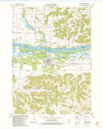
- 1983 USGS Muscoda quadrangle1:24000
- 1985 USGS Richland Center quadrangle1:100000




What happened here
An account from the chapter on Muscoda village. The inset identifies its exact source book and publication year.
Early History And Growth
There is a tradition that some English immigrants settled on the site of this village at a very early day and were massacred by the In¬ dians. Nothing definite is known about it, but on the strength of the tradition the place was called English Prairie until about 1840. The present name was evidently taken from Longfellow's Hiawatha in which is mentioned 44 the muscoda, the meadow." The place was also called Savannah.
In the county-history sources
9,009 words on this townshipHistory of Grant County, Wisconsin, published 1881 names this settlement in its chapter on Muscoda Village. These are the passages that mention it, exactly as the scans read.
The town of Muscoda, occupying the extreme northeast corner of the county, claims a priority in history which is ante-dated by but few of the corporate divisions of the county. Tradition hath it that the feet of the first explorers, who, with dauntless hearts, penetrated the mysterious wilderness, and with unswerving faith pushed the sharp prow of their birch canoe through the lapping waters of the beautiful " Ouisconsin," that the feet of these explorers pressed the soil of the present town at a date cotemporaneous with their first appearance in search of the great river of which such wonderful tales had been told them by the dusky aborigines. Yet all this is mere tradition. The probabilities are that the excellent landing-place afibrded at this point might have attracted the attention of Marquette, Joliet, or, later on, Hennepin ; but there is nothing in the writings of these explorers or their biographers that places the fact even within the widest boundary of certainty.
Passage source: History of Grant County, Wisconsin, published 1881.
The first authentic knowledge possessed of any actual residents at this point gives this honor to parties by the name of Armstrong, who had a trading-post here, probably at a date immediately succeeding the Black Hawk war. But it is not until 1835 that the present town of Muscoda begins to take form and substance. During this year, Col. William S. Hamilton came in and erected a diamond blast furnace near what is now the intersection of Main and Seventh streets. The excellent landing-place and favorable facilities afforded for shipment appear to have induced this movement on the part of the Colonel. It did not, however, prove to be a paying investment, and was subsequently abandoned. The chimneys of the old furnace were standing so late as 1847, and the antiquarian of to-day may even still discover traces of the foundation near the river bank. The new settlement, as it appeared a few years later, is thus described by Mr. Charles Rodolf, at present living at Muscoda, enjoying the blessings of a green old age near the scene of his early hardships and trials :
Passage source: History of Grant County, Wisconsin, published 1881.
Muecoda, and I remember many evenings noticing some of the younger squaws sitting on the river bank singing Indian and French melodies. I remember one time, one Indian sold to F. J. Parrishone musk-rat skin for corn fifteen times. Parrish bought the skin of the Indian and threw it into a loft, and went for a few ears of corn. In the meantime, the Indian stole the skin and put it under his coat, so when Parrish returned he sold it to him again. This was repeated several times, Parrish each time going for corn, which was carried away each time by a squaw. Parrish all the time thought he was making a good trade.
Passage source: History of Grant County, Wisconsin, published 1881.
Machine-read from a century-old scan, so expect the errors a machine makes: misspelled names, dropped words, stray characters.
Read the whole chapter on Muscoda Village - it names this place 19 more 19 times.
Fires near this place
127 since 1992Regional context, not property-specific evidence. The federal wildfire occurrence database lists 127 fires within 5 miles of Muscoda between 1992 and 2020, burning about 450 acres in total. None started naturally. 14 were recorded as arson. Distance is straight-line from the map coordinates, so a fire counted here may appear on a neighbouring settlement's page as well.
| Reported cause | Fires |
|---|---|
| Debris and open burning | 41 |
| Equipment and vehicle use | 24 |
| Missing data/not specified/undetermined | 21 |
| Arson/incendiarism | 14 |
| Railroad operations and maintenance | 9 |
| Smoking | 7 |
| Recreation and ceremony | 4 |
| Power generation/transmission/distribution | 3 |
| Other causes | 2 |
| Fireworks | 1 |
| Misuse of fire by a minor | 1 |
The most recent of them, most recent first, with the day each was reported and the service that recorded it.
| Date | Cause | Size | Reported by | Name on the report |
|---|---|---|---|---|
| 5 August 2015 | Debris and open burning | under an acre | Wisconsin Department of Natural Resources | JACUZZI FIRE |
| 4 August 2015 | Debris and open burning | under an acre | Wisconsin Department of Natural Resources | BUFFALO FIRE |
| 25 August 2003 | Missing data/not specified/undetermined | 3.9 acres | Wisconsin Department of Natural Resources | not named |
| 22 August 2003 | Equipment and vehicle use | under an acre | Wisconsin Department of Natural Resources | not named |
| 20 August 2003 | Missing data/not specified/undetermined | under an acre | Wisconsin Department of Natural Resources | not named |
| 2 August 2008 | Missing data/not specified/undetermined | under an acre | Wisconsin Department of Natural Resources | not named |
| 13 August 1995 | Equipment and vehicle use | under an acre | Wisconsin Department of Natural Resources | not named |
| 10 August 2015 | Debris and open burning | under an acre | Wisconsin Department of Natural Resources | 600 BLOCK FIRE |
Settlements close enough to share some of these fires:
Mines and quarries near this place
2 within 5 milesRegional context, not property-specific evidence. The federal mineral resources record lists 2 workings within 5 miles of Muscoda: 1 producer, 1 past producer. 1 still produces. What was taken out: Sand and Gravel, Construction, Stone, Crushed/Broken. Distance is straight-line from the map coordinates, so a quarry counted here may appear on a neighbouring settlement's page as well.
| Where | Site | Commodity | Status | Recorded |
|---|---|---|---|---|
| Adams Gravel Pit | Sand and Gravel, Construction | Producer | ||
| Hogskin Quarry | Stone, Crushed/Broken | Past Producer |
Storms near this place
28 since 1998Regional context, not property-specific evidence. The National Weather Service names Muscoda in 28 storm reports between 1998 and 2026: 9 flood, 7 thunderstorm wind, 4 hail, 3 funnel cloud. No death or injury is recorded in these reports. Each account below is quoted exactly as the forecast office filed it, from the NOAA Storm Events Database, and each date opens the federal record of that event.
| When | Event | Place named | Harm | What the report says |
|---|---|---|---|---|
| June 2008 | Flood | Muscoda | $750,000 | Water was reported over numerous roads across the county. |
| June 2008 | Flash Flood | Muscoda | $750,000 | Numerous mudslides were reported, along with high water in valleys. |
| August 2005 | Tornado (F1) | Muscoda | $100,000 | no account filed |
| July 2020 | Lightning | Muscoda | $50,000 | A building near Muscoda was destroyed in a fire started by a lightning strike. Isolated thunderstorms moved across southwest Wisconsin during the evening of July 28th. It is believed that lightning hit a nearby pine tree with the resulting fire spreading to the building. The fire was not discovered until the following morning. |
| July 2017 | Thunderstorm Wind | Muscoda | $50,000 | In the Muscoda industrial park, a roof was blown off a commercial building and a semi trailer was blown over. |
| July 2012 | Thunderstorm Wind | Muscoda | $50,000 | Several trees fell on houses and a church in Muscoda causing significant roof damage. |
| June 1998 | Hail | Muscoda | $50,000 | no account filed |
| July 2009 | Thunderstorm Wind | Muscoda | $30,000 | Power lines and trees were down throughout town. |
| March 2019 | Flood | Muscoda | $15,000 | Runoff from melting snow caused flooding to occur across Grant County. Numerous roads were closed county wide. |
| June 2013 | Thunderstorm Wind | Muscoda | $2,000 | Several trees were blown down in Muscoda. |
| March 1998 | Flood | Muscoda | $2,000 | no account filed |
| April 2004 | Hail | Muscoda | $800 | no account filed |
| July 2003 | Thunderstorm Wind | Muscoda | $750 | no account filed |
| August 2007 | Thunderstorm Wind | Muscoda | $500 | Trees were knocked down along Ridge Road. |
| April 2026 | Flood | Muscoda | - | Heavy rainfall from multiple rounds of thunderstorms during the middle of April resulted in the Wisconsin River at Muscoda rising into flood stage during the early morning hours on April 18th. The river crested in minor flood stage on April 19th during the early morning before falling below flood stage during the morning on April 21st. |
| August 2024 | Thunderstorm Wind | Muscoda | - | The public reported a large tree branch down in Muscoda. |
| August 2021 | Funnel Cloud | Muscoda | - | A funnel cloud was sighted in Muscoda. |
| April 2019 | Flood | Muscoda | - | Runoff from rain and melting snow pushed the Wisconsin River out of its banks in Muscoda. The river crested around a half foot above the flood stage at 9.55 feet on April 24th. |
| June 2014 | Flood | Muscoda | - | Runoff from heavy rain caused street flooding to occur in Muscoda. |
| April 2014 | Heavy Rain | Muscoda | - | South of Muscoda, 2.95 inches of rain fell. |
| June 2013 | Heavy Rain | Muscoda | - | South of Muscoda, 5.4 inches of rain was reported. |
| May 2013 | Funnel Cloud | Muscoda | - | Funnel clouds were sighted near Muscoda. |
| May 2013 | Funnel Cloud | Muscoda | - | A funnel cloud was sighted southwest of Muscoda. |
| May 2012 | Hail | Muscoda | - | Pea to dime sized hail fell in Muscoda. |
| April 2011 | Flood | Muscoda | - | The combination of melting snow and rainfall in late March and early April pushed the Wisconsin River out of its banks at Muscoda for a short period on the 16th. The river crested less than a tenth of a foot above the flood stage at 9.07 feet. |
| October 2010 | Flood | Muscoda | - | The flooding that began in late September along the Wisconsin River at Muscoda came to an end as the river went below flood stage. |
| September 2010 | Flood | Muscoda | - | Heavy rains in the middle part of September across parts of Wisconsin produced flooding along the Wisconsin River at Muscoda. The river exceeded the flood stage from September 28th through the remainder of the month. The river crested over a half foot above the flood stage at 9.56 feet. This was the first time since 1993 that the Wisconsin River at Muscoda had exceeded the flood stage. |
| June 2009 | Hail | Muscoda | - | no account filed |
Nearest settlements
The eight closest, with where each one stands in the county. Distances are straight-line, computed from the Geographic Names Information System coordinates.
| Map | Place | Distance | Sheets |
|---|---|---|---|
| Evergreen Terrace | 0.4 miles | 10 | |
| Blue River | 6.6 miles | 10 | |
| Hickory Grove | 9.9 miles | 10 | |
| Castle Rock | 10.6 miles | 10 | |
| Homer | 11.5 miles | 10 | |
| Centerville | 11.6 miles | 10 | |
| Boscobel | 14.3 miles | 10 | |
| Montfort | 14.7 miles | 13 |
Elsewhere
Matched on this settlement's Geographic Names Information System number rather than its name, so it cannot be a different place of the same name in another state.
| Wikipedia article on Muscoda | An encyclopaedic summary. Its text is share-alike, so it is linked here rather than copied. |
| Wikidata item Q2159614 | The structured record the population and elevation above come from. Public domain (CC0). |
Provenance
This settlement is recorded in the Geographic Names Information System as feature 1570054. The sheet list is computed by point-in-boundary test against the United States Geological Survey's historical topographic inventory. Both are works of the United States government and carry no copyright under 17 U.S.C. 105.
Wildfire. Short, Karen C. 2022. Spatial wildfire occurrence data for the United States, 1992-2020 [FPA_FOD_20221014]. 6th Edition. Fort Collins, CO: Forest Service Research Data Archive. https://doi.org/10.2737/RDS-2013-0009.6 Collected with United States Government funding and usable without additional permissions or fees.
Mines and quarries. USGS Mineral Resources Data System (MRDS) https://mrdata.usgs.gov/mrds/ A work of the United States government, no copyright under 17 U.S.C. 105.
Storms. NOAA National Centers for Environmental Information, Storm Events Database https://www.ncei.noaa.gov/stormevents/ A work of the United States government, no copyright under 17 U.S.C. 105. Narratives are quoted verbatim from the National Weather Service report and are not edited or summarised.