 Block
New Prospect, Wisconsin
12 topographic sheets cover this place, the earliest surveyed in 1955 and the latest in 1999. It stands in Auburn town. It lies in ZIP code area 53010. The Survey maps it on the Kewaskum quadrangle. It stands 984 feet above sea level.
Topographic sheets covering this place
6 surveys from 12 printed sheetsMatched by testing this settlement's coordinate against the published boundary of every sheet in the United States Geological Survey's historical collection. Each opens the scanned sheet at the Survey.
- 1955 USGS Kewaskum quadrangle1:62500, 4 printings
- 1957 USGS Madison quadrangle1:250000, 3 printings
- 1960 USGS Madison quadrangle1:250000, 2 printings
- 1974 USGS Kewaskum quadrangle1:24000
- 1980 USGS Fond Du Lac quadrangle1:100000
- 1999 USGS Kewaskum quadrangle1:24000
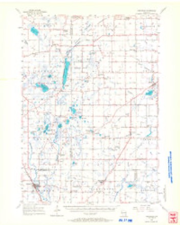


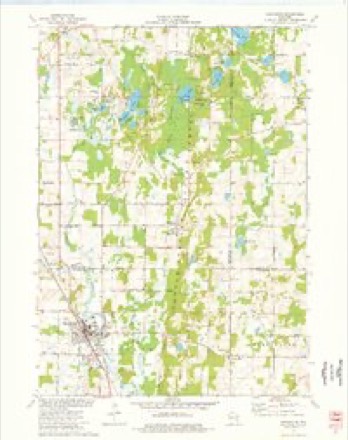

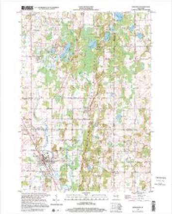
In the county-history sources
5,281 words on this townshipThe History of Fond Du Lac County, Wisconsin, published 1880 names this settlement in its chapter on Auburn Town. These are the passages that mention it, exactly as the scans read.
New Prospect. - This is called "Jersey" because its first settlers came from New Jersey. The first Postmaster was B. Romaine, who held the office twenty years, being appointed probably in 1859. He was with Gen. Scott in the Mexican war. In 1877, a two-story building for a schoolhouse and church was built on Mr. Van Blarcom's farm. The church is non-sectarian.
Passage source: The History of Fond Du Lac County, Wisconsin, published 1880.
The Baptist Church society is comparatively an old one. The first services were held in the fall of 1846, in H. Barnett's house, by Rev. H. A. Sears. In 1852 an organization was formed in the schoolhouse at the five corners, town of Auburn. R. F. Adams was elected Deacon and Clerk. In 1866, the present edifice, costing $2,200, was built under the supervision of J. E. Helraer, Henry Barnett and C. Yancy, Building Committee. The first preacher in the town, Rev. H. A. Sears, is the present Pastor. The Trustees are F. W. Tanner, President and Treasurer; F. Borchert, Clerk, and William Scheid.
Passage source: The History of Fond Du Lac County, Wisconsin, published 1880.
The Roman Catholic Church is now the richest in New Cassel. The first services were held by Father Dael, of Fond du Lac, in Owen Bannon's house. James Kramer, J. Guippe, C. Becker, 0. Bannon, T. Hoy, M. McCulloch and others composed the ' first organization. The first attempt to build a house failed. In 1866, however, the congregatioii having been re-organized in 1865, the church edifice was erected; soon after, a pastoral residence was built by Father Michels. Since 1872, when Father A. Michels took charge, additions costing $1,800 have been made, the debt of $1,100 cancelled, and in 1874, St. Joseph's Convent built, at a cost of $10,000. This was erected for the Sisters of St. Francis, who numbered eighty-five. They teach a boarding-school in the Convent building, and a parochial school in a building near the church. They also teach music, needlework and all useful branches. The church numbers ninety fimilies. A new parochial school building, 30x54 feet, two stories high, will be built during 1880.
Passage source: The History of Fond Du Lac County, Wisconsin, published 1880.
Machine-read from a century-old scan, so expect the errors a machine makes: misspelled names, dropped words, stray characters.
Read the whole chapter on Auburn Town - it names this place 6 more 6 times.
Fires near this place
16 since 2004Regional context, not property-specific evidence. The federal wildfire occurrence database lists 16 fires within 5 miles of New Prospect between 2004 and 2020, burning about 7 acres in total. None started naturally. 2 were recorded as arson. Distance is straight-line from the map coordinates, so a fire counted here may appear on a neighbouring settlement's page as well.
| Reported cause | Fires |
|---|---|
| Missing data/not specified/undetermined | 9 |
| Equipment and vehicle use | 2 |
| Arson/incendiarism | 2 |
| Debris and open burning | 2 |
| Recreation and ceremony | 1 |
The most recent of them, most recent first, with the day each was reported and the service that recorded it.
| Date | Cause | Size | Reported by | Name on the report |
|---|---|---|---|---|
| 7 July 2019 | Debris and open burning | under an acre | Wisconsin Department of Natural Resources | 1956 |
| 4 July 2018 | Debris and open burning | 1.0 acres | Wisconsin Department of Natural Resources | 201856 |
| 4 July 2018 | Missing data/not specified/undetermined | under an acre | Wisconsin Department of Natural Resources | 201858 |
| 25 July 2018 | Missing data/not specified/undetermined | under an acre | Wisconsin Department of Natural Resources | 201865 |
| 14 June 2018 | Missing data/not specified/undetermined | under an acre | Wisconsin Department of Natural Resources | 201849 |
| 1 May 2018 | Missing data/not specified/undetermined | under an acre | Wisconsin Department of Natural Resources | 201836 |
| 1 May 2018 | Missing data/not specified/undetermined | under an acre | Wisconsin Department of Natural Resources | 201839 |
| 30 April 2018 | Missing data/not specified/undetermined | under an acre | Wisconsin Department of Natural Resources | 201834 |
Settlements close enough to share some of these fires:
Mines and quarries near this place
2 within 5 milesRegional context, not property-specific evidence. The federal mineral resources record lists 2 workings within 5 miles of New Prospect: 2 producers. All of them still produce. What was taken out: Sand and Gravel, Construction. Distance is straight-line from the map coordinates, so a quarry counted here may appear on a neighbouring settlement's page as well.
| Where | Site | Commodity | Status | Recorded |
|---|---|---|---|---|
| Ebert Pit | Sand and Gravel, Construction | Producer | ||
| Southwest Area Operation | Sand and Gravel, Construction | Producer |
Storms near this place
1 since 2023Regional context, not property-specific evidence. The National Weather Service names New Prospect in 1 storm report in 2023: 1 thunderstorm wind. No death or injury is recorded in these reports. Each account below is quoted exactly as the forecast office filed it, from the NOAA Storm Events Database, and each date opens the federal record of that event.
| When | Event | Place named | Harm | What the report says |
|---|---|---|---|---|
| August 2023 | Thunderstorm Wind | New Prospect | $4,000 | Tree branches down. Power outages reported. |
Nearest settlements
The eight closest, with where each one stands in the county. Distances are straight-line, computed from the Geographic Names Information System coordinates.
| Map | Place | Distance | Sheets |
|---|---|---|---|
| Dundee | 2.8 miles | 13 | |
| New Fane | 4.2 miles | 12 | |
| Chinatown | 4.8 miles | 13 | |
| Waucousta | 5.0 miles | 9 | |
| Campbellsport | 5.5 miles | 9 | |
| Armstrong | 6.6 miles | 13 | |
| Elmore | 7.2 miles | 9 | |
| Graham Corners | 8.1 miles | 13 |
Elsewhere
Matched on this settlement's Geographic Names Information System number rather than its name, so it cannot be a different place of the same name in another state.
| Wikipedia article on New Prospect | An encyclopaedic summary. Its text is share-alike, so it is linked here rather than copied. |
| Wikidata item Q14714565 | The structured record the population and elevation above come from. Public domain (CC0). |
Provenance
This settlement is recorded in the Geographic Names Information System as feature 1570230. The sheet list is computed by point-in-boundary test against the United States Geological Survey's historical topographic inventory. Both are works of the United States government and carry no copyright under 17 U.S.C. 105.
Wildfire. Short, Karen C. 2022. Spatial wildfire occurrence data for the United States, 1992-2020 [FPA_FOD_20221014]. 6th Edition. Fort Collins, CO: Forest Service Research Data Archive. https://doi.org/10.2737/RDS-2013-0009.6 Collected with United States Government funding and usable without additional permissions or fees.
Mines and quarries. USGS Mineral Resources Data System (MRDS) https://mrdata.usgs.gov/mrds/ A work of the United States government, no copyright under 17 U.S.C. 105.
Storms. NOAA National Centers for Environmental Information, Storm Events Database https://www.ncei.noaa.gov/stormevents/ A work of the United States government, no copyright under 17 U.S.C. 105. Narratives are quoted verbatim from the National Weather Service report and are not edited or summarised.