 Block
Pardeeville, Wisconsin
12 topographic sheets cover this place, the earliest surveyed in 1902 and the latest in 1990. It stands in Wyocena town. It lies in ZIP code area 53954. It lies near Sheep Island. The Survey maps it on the Pardeeville quadrangle. 2,074 people lived here at the 2020 count. It stands 810 feet above sea level.
On record in Pardeeville
Buildings and businesses the archive holds for this place. Each opens its own page, with the source record it came from.
On the National Register 3 records
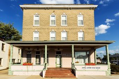 Bellmont Hotellisted 1993
 Angie Williams Cox Librarylisted 1990
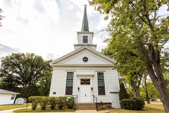 Pardeeville Presbyterian Churchlisted 1980
Population over time
2 figuresPardeeville fell from 2,115 to 2,074 between 2010 and 2020. These are the recorded population figures Wikidata holds for this place, reached through the Geographic Names Information System number this page is keyed on rather than by name, so they belong to this place and not to another of the same name. Most are census counts, but not all are: an early figure may be a founding or settlement estimate, and an estimate published within five years of a census is left out. The change column is computed, and is left blank where more than 20 years separate a figure from the one before it, because a gap that long is not a change between two counts.
| Year | People | Change |
|---|---|---|
| 2010 | 2,115 | |
| 2020 | 2,074 | -41 (-2%) |
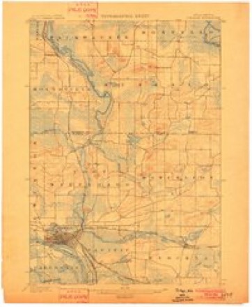
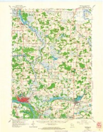
Topographic sheets covering this place
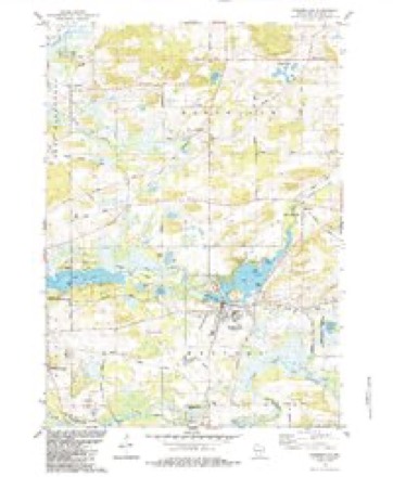
7 surveys from 12 printed sheetsMatched by testing this settlement's coordinate against the published boundary of every sheet in the United States Geological Survey's historical collection. Each opens the scanned sheet at the Survey.
- 1902 USGS Portage quadrangle1:62500, 3 printings
- 1957 USGS Madison quadrangle1:250000, 3 printings
- 1960 USGS Madison quadrangle1:250000, 2 printings
- 1962 USGS Portage quadrangle1:62500
- 1984 USGS Pardeeville quadrangle1:24000
- 1985 USGS Wisconsin Dells quadrangle1:100000
- 1990 USGS Wisconsin Dells quadrangle1:100000


In the county-history sources
41,340 words on this townshipThe History of Columbia County, Wisconsin, Containing an Account of Its Settlement .., published 1880 names this settlement in its chapter on Wyocena Town. These are the passages that mention it, exactly as the scans read.
In the fall of 1848, John S. Pardee, then merchandising in Milwaukee, sent out Mr. Reuben Stedman to build a store in this neighborhood, and in December following, Yates Ashley came out with goods and commenced trading for Mr. Pardee, and getting out timber to build mills. In 1849, the saw and grist mills were built and commenced operations. This was the beginning of Pardeeville.
Passage source: The History of Columbia County, Wisconsin, Containing an Account of Its Settlement .., published 1880.
J. S. Pardee commenced the erection of the large grist-mill, in 1849 ; in the same year he transferred his interest in Pardeeville to Joseph Utley, who, about the year 1853, turned the whole property over to John Pardee, father of the original proprietor, who took possession of the property (the mill being unfinished), and completed the mill in the latter part of 1856.
Passage source: The History of Columbia County, Wisconsin, Containing an Account of Its Settlement .., published 1880.
Post Office. - The first mail route was established here in 1849, from Madison to Fort Winnebago, thence to Pardeeville and Wyocena. Yates Ashley was first appointed Postmaster in 1843, served two years. In 1852, Jose])b Utley, who served one year. In 1853, Hubble West, Sr., who served two years. In 1855, Darius Coman, who served four years. In I860. John Pardee, who served one year. In 1861, Ira Atkins, who served six years ; died in 1867, when Luman A. Gilbert was appointed, who .«erved si.x years. In 1873, Newton W. Gilbert was appointed, served five years. In 1878, Mrs. Susan Falconer was appointed, who now holds the office as Mrs. Susan Yan Schaick.
Passage source: The History of Columbia County, Wisconsin, Containing an Account of Its Settlement .., published 1880.
Machine-read from a century-old scan, so expect the errors a machine makes: misspelled names, dropped words, stray characters.
Read the whole chapter on Wyocena Town - it names this place 4 more 4 times.
Fires near this place
172 since 1992Regional context, not property-specific evidence. The federal wildfire occurrence database lists 172 fires within 5 miles of Pardeeville between 1992 and 2020, burning about 296 acres in total. 3 started naturally. 10 were recorded as arson. Distance is straight-line from the map coordinates, so a fire counted here may appear on a neighbouring settlement's page as well.
| Reported cause | Fires |
|---|---|
| Debris and open burning | 67 |
| Equipment and vehicle use | 34 |
| Missing data/not specified/undetermined | 23 |
| Railroad operations and maintenance | 14 |
| Arson/incendiarism | 10 |
| Smoking | 6 |
| Fireworks | 5 |
| Recreation and ceremony | 5 |
| Power generation/transmission/distribution | 4 |
| Natural | 3 |
| Misuse of fire by a minor | 1 |
The most recent of them, most recent first, with the day each was reported and the service that recorded it.
| Date | Cause | Size | Reported by | Name on the report |
|---|---|---|---|---|
| 23 September 2004 | Debris and open burning | under an acre | Wisconsin Department of Natural Resources | not named |
| 2 September 2011 | Natural | under an acre | Wisconsin Department of Natural Resources | SILVER MAPLE |
| 13 September 2000 | Natural | 2.0 acres | Wisconsin Department of Natural Resources | not named |
| 1 September 2008 | Arson/incendiarism | under an acre | Wisconsin Department of Natural Resources | not named |
| 31 August 2008 | Recreation and ceremony | under an acre | Wisconsin Department of Natural Resources | not named |
| 31 August 2008 | Arson/incendiarism | under an acre | Wisconsin Department of Natural Resources | not named |
| 3 August 1993 | Missing data/not specified/undetermined | under an acre | Wisconsin Department of Natural Resources | not named |
| 22 August 2012 | Debris and open burning | under an acre | Wisconsin Department of Natural Resources | PARDEEVILLE ROAD |
Settlements close enough to share some of these fires:
Mines and quarries near this place
5 within 5 milesRegional context, not property-specific evidence. The federal mineral resources record lists 5 workings within 5 miles of Pardeeville: 4 past producers, 1 producer. 1 still produces. What was taken out: Sand and Gravel, Construction. Distance is straight-line from the map coordinates, so a quarry counted here may appear on a neighbouring settlement's page as well.
| Where | Site | Commodity | Status | Recorded |
|---|---|---|---|---|
| Helmer Pit | Sand and Gravel, Construction | Past Producer | ||
| Manthey Pit | Sand and Gravel, Construction | Producer | ||
| Quality Sand and Gravel Pit | Sand and Gravel, Construction | Past Producer | ||
| Schultz Gravel Pit | Sand and Gravel, Construction | Past Producer | ||
| Wyocena Dump Pit | Sand and Gravel, Construction | Past Producer |
Storms near this place
43 since 1997Regional context, not property-specific evidence. The National Weather Service names Pardeeville in 43 storm reports between 1997 and 2025: 26 thunderstorm wind, 13 hail, 1 lightning, 1 tornado. The reports record 6 injuries. Each account below is quoted exactly as the forecast office filed it, from the NOAA Storm Events Database, and each date opens the federal record of that event.
| When | Event | Place named | Harm | What the report says |
|---|---|---|---|---|
| June 2008 | Tornado (EF2) | Pardeeville | 6 hurt, $2,500,000 | This tornado was extremely wide since the thunderstorm cloud base was very low and the meso-cyclone that is usually aloft was well-formed all the way to the ground. Within a broad 1 to 2 mile wide area of EF0 to EF1 damage, there were several small swaths of EF2 damage due to multiple votices. The accompanying graphic shows this effect. With respect to residential homes this tornado resulted in very minor damage to 150, minor damage to 30, major damage to 10, and 2 were destroyed (total residential damage of $2 million). With respect to agricultural buildings ($500K in total damage), this tornado resulted in minor damage to 20, and major damage to 2 buildings (inlcuding silos). Tens of thousands of trees were uprooted or chewed-up, and many power-lines and power-poles were either toppled or damaged. About 4000 to 6000 trees on a tree farm were destroyed at a location about 3 miles east-southeast of Pardeeville. This tree-farm loss was treated as a crop loss. Additionally, some corn and soybean crops were damaged. This tornado started just southeast of the intersection of CTH P and Pardeeville Road, and moved southeastward for about 4 miles and then traveled east-southeast to end just northeast of the western intersection of STH 146 and CTH A. The specific starting point and ending point lat/long numbers were 43.53333/-89.26306 and 43.49556/-89.09878, respectively. Additional mid-point pairs of number include: 43.51603/-8922394, 43.50728/-89.20151, and 43.50208/-89.17679. DI#24 (ELT), DOD4. The wind speeds were estimated at about 120 mph. Average path length was about 1760 yards (1 mile). |
| August 2004 | Thunderstorm Wind | Pardeeville | $400,000 | no account filed |
| June 2002 | Lightning | Pardeeville | $100,000 | no account filed |
| June 2022 | Thunderstorm Wind | Pardeeville | $70,000 | Numerous large trees and branches snapped on the golf course and surrounding neighborhood adjacent to Swan Lake. A large porch roof and overhang of a large and new lake home was ripped off and deposited on the other side of the house. |
| July 1997 | Thunderstorm Wind | Pardeeville | $35,000 | no account filed |
| October 2017 | Thunderstorm Wind | Pardeeville | $25,000 | Several large trees uprooted or snapped. Large branches also down. Structural damage to several homes from trees landing on them. Two pontoon boats that were resting on boat lifts were overturned into the lake. |
| June 2009 | Thunderstorm Wind | Pardeeville | $25,000 | Thunderstorm wind gusts toppled several large trees down near STH 44 and STH 33 in the area northeast of Pardeeville. Roof damage to a home was noted near intersection of Vaughn and Atkinson roads. Nearby, a barn roof was torn off. |
| June 2001 | Thunderstorm Wind | Pardeeville | $25,000 | no account filed |
| July 2022 | Thunderstorm Wind | Pardeeville | $12,000 | Multiple tree limbs down on the roof of a home. |
| June 2022 | Thunderstorm Wind | Pardeeville | $5,000 | Metal carport blown across the road and knocked down a power pole. |
| July 2016 | Thunderstorm Wind | Pardeeville | $5,000 | Branches down 6-8 inches in diameter. Reports of trees and branches down across northern Columbia County. |
| July 2015 | Flash Flood | Pardeeville | $5,000 | Street flooding in many communities. Reports of driveways flooded up to the garages in Fall River. Some shoulder washouts on rural roads. Rainfall totals of 4-6 inches. |
| August 2007 | Thunderstorm Wind | Pardeeville | $5,000 | Powerful thunderstorm wind gusts to around 52 knots (60 mph) toppled saeveral large trees and branches. A car-port was damaged by the tree debris. |
| July 2004 | Thunderstorm Wind | Pardeeville | $5,000 | no account filed |
| June 2025 | Flood | Pardeeville | $3,000 | Street flooding and some yard flooding throughout Pardeeville. |
| June 1997 | Thunderstorm Wind | Pardeeville | $3,000 | no account filed |
| August 2025 | Thunderstorm Wind | Pardeeville | $2,000 | A few tree limbs down on campsites near Pardeeville. |
| May 2012 | Thunderstorm Wind | Pardeeville | $1,000 | A trained spotter reported a 10-inch diameter tree was downed by severe thunderstorm wind gusts. |
| June 2018 | Thunderstorm Wind | Pardeeville | $500 | Top half of tree sheared off. |
| July 2022 | Thunderstorm Wind | Pardeeville | - | Law enforcement estimates wind gusts of 60-65 mph. |
| July 2016 | Thunderstorm Wind | Pardeeville | - | Many tree branches down in Pardeeville. |
| August 2010 | Thunderstorm Wind | Pardeeville | - | The Columbia County emergency manager reported tree damage caused by thunderstorm wind gusts estimated at 56 knots (65 mph). |
| June 2008 | Thunderstorm Wind | Pardeeville | - | Powerful thunderstorm winds gusts, measured at 56 knots (65 mph) occurred at the DNR RAWS weather observation site. |
| October 2006 | Thunderstorm Wind | Pardeeville | - | Powerful thunderstorm winds knocked down large trees. |
| October 2006 | Thunderstorm Wind | Pardeeville | - | Powerful thunderstorm winds knocked down large trees. |
| October 2006 | Thunderstorm Wind | Pardeeville | - | Powerful thunderstorm winds knocked down large trees. |
| August 2020 | Hail | Pardeeville | - | no account filed |
| May 2014 | Hail | Pardeeville | - | no account filed |
| April 2014 | Hail | Pardeeville | - | no account filed |
| May 2012 | Hail | Pardeeville | - | no account filed |
| May 2012 | Hail | Pardeeville | - | no account filed |
| June 2008 | Thunderstorm Wind | Pardeeville | - | no account filed |
| June 2006 | Hail | Pardeeville | - | no account filed |
| July 2006 | Hail | Pardeeville | - | no account filed |
| July 2006 | Thunderstorm Wind | Pardeeville | - | no account filed |
| August 2006 | Hail | Pardeeville | - | no account filed |
| September 2006 | Hail | Pardeeville | - | no account filed |
| October 2006 | Hail | Pardeeville | - | no account filed |
| September 2005 | Thunderstorm Wind | Pardeeville | - | no account filed |
| June 2002 | Hail | Pardeeville | - | no account filed |
| June 2001 | Thunderstorm Wind | Pardeeville | - | no account filed |
| June 2001 | Hail | Pardeeville | - | no account filed |
| March 2000 | Hail | Pardeeville | - | no account filed |
Nearest settlements
The eight closest, with where each one stands in the county. Distances are straight-line, computed from the Geographic Names Information System coordinates.
Elsewhere
Matched on this settlement's Geographic Names Information System number rather than its name, so it cannot be a different place of the same name in another state.
| Wikipedia article on Pardeeville | An encyclopaedic summary. Its text is share-alike, so it is linked here rather than copied. |
| Wikidata item Q1885200 | The structured record the population and elevation above come from. Public domain (CC0). |
Provenance
This settlement is recorded in the Geographic Names Information System as feature 1571029. The sheet list is computed by point-in-boundary test against the United States Geological Survey's historical topographic inventory. Both are works of the United States government and carry no copyright under 17 U.S.C. 105.
Wildfire. Short, Karen C. 2022. Spatial wildfire occurrence data for the United States, 1992-2020 [FPA_FOD_20221014]. 6th Edition. Fort Collins, CO: Forest Service Research Data Archive. https://doi.org/10.2737/RDS-2013-0009.6 Collected with United States Government funding and usable without additional permissions or fees.
Mines and quarries. USGS Mineral Resources Data System (MRDS) https://mrdata.usgs.gov/mrds/ A work of the United States government, no copyright under 17 U.S.C. 105.
Storms. NOAA National Centers for Environmental Information, Storm Events Database https://www.ncei.noaa.gov/stormevents/ A work of the United States government, no copyright under 17 U.S.C. 105. Narratives are quoted verbatim from the National Weather Service report and are not edited or summarised.