 Block
Rubicon, Wisconsin
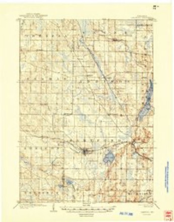
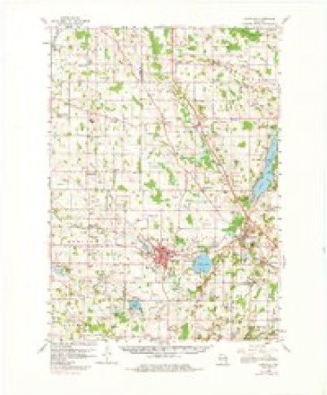
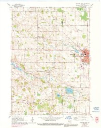
15 topographic sheets cover this place, the earliest surveyed in 1904 and the latest in 1991. It stands in Rubicon town. It lies in ZIP code area 53078. It stands on Butler Creek. The Survey maps it on the Hartford West quadrangle. 235 people lived here at the 2020 count. It stands 1,007 feet above sea level.
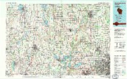
Topographic sheets covering this place
7 surveys from 15 printed sheetsMatched by testing this settlement's coordinate against the published boundary of every sheet in the United States Geological Survey's historical collection. Each opens the scanned sheet at the Survey.
- 1904 USGS Hartford quadrangle1:62500, 3 printings
- 1957 USGS Madison quadrangle1:250000, 3 printings
- 1959 USGS Hartford quadrangle1:62500, 2 printings
- 1959 USGS Hartford West quadrangle1:24000, 3 printings
- 1960 USGS Madison quadrangle1:250000, 2 printings
- 1984 USGS Oconomowoc quadrangle1:100000
- 1991 USGS Oconomowoc quadrangle1:100000


In the county-history sources
5,044 words on this townshipThe History of Dodge County, Wisconsin, Containing ... Its Early Settlement, Growth ... an Extensive and Minute Sketch of Its Cities ... War Record, Biographical Sketches, published 1880 names this settlement in its chapter on Rubicon Town. These are the passages that mention it, exactly as the scans read.
The village of Rubicon is situated on part of Sections 10, 11, 14 and 15, Town 10 north. Range 17 east, town of Rubicon. It was first platted in 1866, though previous to this and about the time of the completion of the present Chicago, Milwaukee & St. Paul Railroad, the formation of a village was begun. The survey of the present plat was made by W. M. Morse.
Passage source: The History of Dodge County, Wisconsin, Containing ... Its Early Settlement, Growth ... an Extensive and Minute Sketch of Its Cities ... War Record, Biographical Sketches, published 1880.
MAX Al/BER, proprietor Western Hotel, Rubicon ; born in Germany in 1842 ; came to Wisconsin in 1868, locating at Rubicon, where he opened a blacksmith-shop in the village of Rubicon and also purchased two acres of land ; in 1878, he started the Western Hotel, which business he is at present engaged in. Married, in 1869, Miss Mary Hahn, a native of Wisconsin; they have had three children - Mary J., born in 1870; Frederick A., 1877; Francisco, 1879. Democrat in politics; family are members of the Catholic Church.
Passage source: The History of Dodge County, Wisconsin, Containing ... Its Early Settlement, Growth ... an Extensive and Minute Sketch of Its Cities ... War Record, Biographical Sketches, published 1880.
JOSEPH ARMITAGE, farmer. Sec. 24, Hustisford, Sees. 19 and 30, Rubicon ; P.O. Necsho ; born in England in 1811; came to Wisconsin in 1846, locating in Hustisford. where he purchased 40 acres, afterward adding 280, his present homestead ; Mr. A. is one of the old settlers, and a very successful farmer, raising both stock and grain. Married, in 1830, Jliss Mary Sykes, a native of England; have hud eleven children, nine living. Assessor, Treasurer School District twenty-five years, also a member of the Masonic Lodge, No. 108, Neosho ; Justice of the Peace twelve years. Republican in politics.
Passage source: The History of Dodge County, Wisconsin, Containing ... Its Early Settlement, Growth ... an Extensive and Minute Sketch of Its Cities ... War Record, Biographical Sketches, published 1880.
Machine-read from a century-old scan, so expect the errors a machine makes: misspelled names, dropped words, stray characters.
Read the whole chapter on Rubicon Town - it names this place 27 more 27 times.
Fires near this place
11 since 2018Regional context, not property-specific evidence. The federal wildfire occurrence database lists 11 fires within 5 miles of Rubicon between 2018 and 2020, burning about 23 acres in total. None started naturally. None was recorded as arson. Distance is straight-line from the map coordinates, so a fire counted here may appear on a neighbouring settlement's page as well.
| Reported cause | Fires |
|---|---|
| Debris and open burning | 6 |
| Missing data/not specified/undetermined | 4 |
| Recreation and ceremony | 1 |
The most recent of them, most recent first, with the day each was reported and the service that recorded it.
| Date | Cause | Size | Reported by | Name on the report |
|---|---|---|---|---|
| 2 June 2018 | Debris and open burning | 1.0 acres | Wisconsin Department of Natural Resources | 366 |
| 1 May 2018 | Debris and open burning | under an acre | Wisconsin Department of Natural Resources | 229 |
| 6 April 2019 | Debris and open burning | 1.0 acres | Wisconsin Department of Natural Resources | 403 |
| 30 April 2018 | Debris and open burning | 15 acres | Wisconsin Department of Natural Resources | 223 |
| 29 April 2018 | Debris and open burning | under an acre | Wisconsin Department of Natural Resources | 216 |
| 26 April 2018 | Missing data/not specified/undetermined | under an acre | Wisconsin Department of Natural Resources | 3618010 |
| 24 April 2018 | Missing data/not specified/undetermined | under an acre | Wisconsin Department of Natural Resources | 20 |
| 24 April 2018 | Debris and open burning | under an acre | Wisconsin Department of Natural Resources | 1822 |
Settlements close enough to share some of these fires:
Mines and quarries near this place
1 within 5 milesRegional context, not property-specific evidence. The federal mineral resources record lists 1 working within 5 miles of Rubicon: 1 past producer. None of them still produces. What was taken out: Sand and Gravel, Construction. Distance is straight-line from the map coordinates, so a quarry counted here may appear on a neighbouring settlement's page as well.
| Where | Site | Commodity | Status | Recorded |
|---|---|---|---|---|
| Sanitary Transfer & Landfll Inc Pit | Sand and Gravel, Construction | Past Producer |
Storms near this place
15 since 1996Regional context, not property-specific evidence. The National Weather Service names Rubicon in 15 storm reports between 1996 and 2026: 5 thunderstorm wind, 4 hail, 2 tornado, 2 flood. No death or injury is recorded in these reports. Each account below is quoted exactly as the forecast office filed it, from the NOAA Storm Events Database, and each date opens the federal record of that event.
| When | Event | Place named | Harm | What the report says |
|---|---|---|---|---|
| June 2001 | Tornado (F0) | Rubicon | $25,000 | A weak (F0) tornado spun up 1 mile north/northwest of Rubicon in southeast Dodge County, and moved southeast before exiting the county at a point 2 miles east/southeast of Rubicon. While in Dodge County, it pulled down or uprooted many trees. This tornado then moved through Washington County, giving a glancing blow to the city of Hartford. Associated winds were in the 52 to 61 knot range (60 to 70 mph). |
| April 2026 | Thunderstorm Wind | Rubicon | $15,000 | Dozens of trees uprooted or snapped. |
| June 2000 | Flash Flood | Rubicon | $15,000 | no account filed |
| April 2026 | Flood | Rubicon | $5,000 | Flooding of Butler Creek flowing over a bridge on County Highway N. |
| August 2024 | Thunderstorm Wind | Rubicon | $2,000 | Trees down on roads in the Rubicon area. |
| March 2017 | Thunderstorm Wind | Rubicon | $1,000 | A tree down near the town of Rubicon. |
| July 1996 | Thunderstorm Wind | Rubicon | $1,000 | no account filed |
| August 2024 | Funnel Cloud | Rubicon | - | Multiple phone calls reporting a funnel cloud north of Rubicon. A picture and video of the storm revealed a funnel cloud. |
| June 2022 | Flood | Rubicon | - | Flooding on County Road N at the bottom of the hill. |
| July 2007 | Thunderstorm Wind | Rubicon | - | Powerful thunderstorm wind gusts to around 52 knots (60 mph) toppled several large trees. |
| June 2006 | Tornado (F0) | Rubicon | - | A tornado spun up at 1326CST at a location 1.5 SSE of Rubicon about 0.2 mile south of the intersection of STH 60 and Resthaven Rd. It tracked east-southeast and exited Dodge County at 1327CST about 2.4 southeast of Rubicon (or about 0.6 mile south of where STH 60 goes east into Washington Co.). Only some minor tree damage was noted with this segment of the tornado track, which was rated F0 with winds of 35-63 knots (40-72 mph). |
| April 2023 | Hail | Rubicon | - | no account filed |
| April 2023 | Hail | Rubicon | - | no account filed |
| April 2014 | Hail | Rubicon | - | no account filed |
| June 2011 | Hail | Rubicon | - | no account filed |
Nearest settlements
The eight closest, with where each one stands in the county. Distances are straight-line, computed from the Geographic Names Information System coordinates.
| Map | Place | Distance | Sheets |
|---|---|---|---|
| Saylesville | 2.9 miles | 15 | |
| Huilsburg | 3.0 miles | 15 | |
| Neosho | 3.8 miles | 9 | |
| Woodland | 3.8 miles | 9 | |
| Herman Center | 5.1 miles | 15 | |
| Iron Ridge | 5.7 miles | 10 | |
| Neda | 7.0 miles | 10 | |
| Hustisford | 7.6 miles | 9 |
Elsewhere
Matched on this settlement's Geographic Names Information System number rather than its name, so it cannot be a different place of the same name in another state.
| Wikipedia article on Rubicon | An encyclopaedic summary. Its text is share-alike, so it is linked here rather than copied. |
| Wikidata item Q7376070 | The structured record the population and elevation above come from. Public domain (CC0). |
Provenance
This settlement is recorded in the Geographic Names Information System as feature 1572703. The sheet list is computed by point-in-boundary test against the United States Geological Survey's historical topographic inventory. Both are works of the United States government and carry no copyright under 17 U.S.C. 105.
Wildfire. Short, Karen C. 2022. Spatial wildfire occurrence data for the United States, 1992-2020 [FPA_FOD_20221014]. 6th Edition. Fort Collins, CO: Forest Service Research Data Archive. https://doi.org/10.2737/RDS-2013-0009.6 Collected with United States Government funding and usable without additional permissions or fees.
Mines and quarries. USGS Mineral Resources Data System (MRDS) https://mrdata.usgs.gov/mrds/ A work of the United States government, no copyright under 17 U.S.C. 105.
Storms. NOAA National Centers for Environmental Information, Storm Events Database https://www.ncei.noaa.gov/stormevents/ A work of the United States government, no copyright under 17 U.S.C. 105. Narratives are quoted verbatim from the National Weather Service report and are not edited or summarised.