 Block
Sugar Grove, Wisconsin
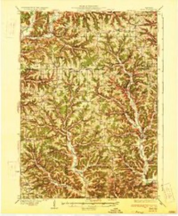
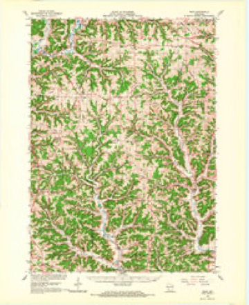
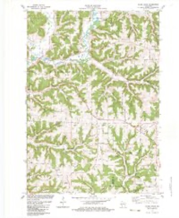
10 topographic sheets cover this place, the earliest surveyed in 1933 and the latest in 1985. It stands in Kickapoo town. It lies in ZIP code area 54655. The Survey maps it on the Sugar Grove quadrangle. It stands 1,227 feet above sea level.
Topographic sheets covering this place
8 surveys from 10 printed sheetsMatched by testing this settlement's coordinate against the published boundary of every sheet in the United States Geological Survey's historical collection. Each opens the scanned sheet at the Survey.
- 1933 USGS Boaz quadrangle1:62500, 2 printings
- 1958 USGS La Crosse quadrangle1:250000, 2 printings
- 1961 USGS La Crosse quadrangle1:250000
- 1965 USGS La Crosse quadrangle1:250000
- 1966 USGS Boaz quadrangle1:62500
- 1976 USGS La Crosse quadrangle1:250000
- 1983 USGS Sugar Grove quadrangle1:24000
- 1985 USGS Richland Center quadrangle1:100000




In the county-history sources
10,278 words on this townshipHistory of Vernon County, Wisconsin .., published 1884 names this settlement in its chapter on Kickapoo Town. These are the passages that mention it, exactly as the scans read.
The first meetings of the Sugar Grove Christian Church were held at the residence of Zac'iariah Smith, in 1857. Rev. Daniel Parkerson was the first minister. This society was organized at the school house on section 13 in 1857 by George H. Babb. Abram Williams and Zachariah Smith were chosen elders and William Shore and Henry Davis, deacons. 'J'he original membership was composed of about fourteen persons, among whom were Zachariah Smith and wife, George Spurrier and wife, Reuben Drake and wife, Henry Davis and wife, William Shore and wife and Elmira Newman. Rev George H. Babb was the first regular preacher after the organization of the society. He was succeeded by Rev. Hurd, who, in turn, was followed by Rev. Henry Howe. 'I'he society has never had a regular settled pastor, but has been supplied by preachers from other points. Worship was continued in the school house some four or five years, when services were held in Richland county until 1875, when a neat frame building was erected on section 13, town 11, range 3, town of Kickapoo. A Sabbath school was organized at the school house soon after the organization of the society. William Powell was the first superintendent. The present superintendent is Rutson Drake. The Methodist Episcopal Conference has sent ministers to Readstown since the time the village was laid out. The first meetings were held in the school house, Rev. Schooley being among the first preachers. No class was organized here until 1876, when Rev. McMillan organized one with about eight members, among whom were James Treseder and wife, Martha McKittrick and Mrs. Sylvia Bliss. James Treseder was appointed class-leader. In the winter of 1881-82 a revival was held, when several persons were added to the membership. In the spring of 1882 a house of worship w as
Passage source: History of Vernon County, Wisconsin .., published 1884.
Josiali Adams, one of the settlers of Vernon county, was born in the town of Somerset, Somerset Co., Penn., Jan. 25, 1822. When he was quite young his parents moved to Ohio and bceame early settlers of Stark county, where be grew to manhood. In 1845 he went to the Maumee valley and bought timber land in Ileniy county. In 1849 he came to Wisconsin and spent the summei' in Lafayette county. In tl.e fall of that year he came to Bad Ax county and halted at Liberty Pole, which was at that time called Bad Ax. He made a claim on section 32, of town 12 north, of range 5 west. In the fall of 1850 he returned to Ohio and spent the winter and sold his land there, returning to this county in 1852. On the 3d of April, 1853, he started for California, going across the plains with ok teams. He arrived at Spanish Ranch the 8lh day of September, liaving been over five months on the way. He engaged in mining and remained in California until 1855, when he returned to Liberty Pole, coming by way of the Isthmus of Panama and Xew York. He then settled down and engaged farming, remaining in Franklin town until 18W1, when he sold out and came to Kickapoo and bought land on section 33, of town 12 north, of range 3 west, where he now lives. He was married in 1860 to Mary Wright, of Ohio. They have one child, named Cyrus. Ilis second and present wife was Rosetta Hooks, who was born in Mercer Co., Ohio, Feb. 5, 1833. Her father, Thomas Hooks, settled in Lafayette Co., Wis., in 1847.
Passage source: History of Vernon County, Wisconsin .., published 1884.
Henry B Hopkins, one of the early settlers of Kickapoo town, was born in Newiugton, Hartford Co., Conn., May 18, 1817. He was the son of Horace and Fannie (Root) Hopkins, natives of Connecticut. When Henry was eight years of age, his parents moved to Ohio, settling in Portage county, where he grew to manhood, learning the carpenter trade. He was married May 30, 1839, to Emeline Dean, born in 'Irunibull Co., Ohio. They settled in Portage county, where Mr. Hopkins worked at his trade until 1848, when he came to Wisconsin, locating in Grant county. In 1853 he came to Vernon county, and entered the land where he now lives. He built a log house in which he lived until 1873, when he built the frame house in which he now lives. Mrs. Hopkin's motlier died in December, 1837. Of tlie seven children born to Mr. and Mrs. Hopkins, four are living - Albert, Delia, George and Elsie. Harriet, born May 27, 1840, married Henry Henthorn, died Nov. 6, 1873 ; Eluell D., born May 27, 1858, died Nov. 2, 1880 ; Alfred H., born Oct. 6, 1852, died at Esof ea. Wis., June 18, 1883. Mr. Hopkins second wife, to whom he was married May 6, 1875, was Nancy Holcomb, widow of Charles Allen. He was the first justice of the peace in the town, and was repeatedly elected to that office as long as his health was such that he could attend to the duties of it. He was also first postmaster of Sugar Grove postoffice, holding the position many years and resigning on account of his ill health.
Passage source: History of Vernon County, Wisconsin .., published 1884.
Machine-read from a century-old scan, so expect the errors a machine makes: misspelled names, dropped words, stray characters.
Read the whole chapter on Kickapoo Town - it names this place 6 more 6 times.
Fires near this place
40 since 1992Regional context, not property-specific evidence. The federal wildfire occurrence database lists 40 fires within 5 miles of Sugar Grove between 1992 and 2020, burning about 72 acres in total. 3 started naturally. None was recorded as arson. Distance is straight-line from the map coordinates, so a fire counted here may appear on a neighbouring settlement's page as well.
| Reported cause | Fires |
|---|---|
| Debris and open burning | 19 |
| Equipment and vehicle use | 10 |
| Missing data/not specified/undetermined | 5 |
| Natural | 3 |
| Smoking | 2 |
| Recreation and ceremony | 1 |
The most recent of them, most recent first, with the day each was reported and the service that recorded it.
| Date | Cause | Size | Reported by | Name on the report |
|---|---|---|---|---|
| 27 September 2012 | Equipment and vehicle use | under an acre | Wisconsin Department of Natural Resources | HWY 61 FIRE |
| 19 September 2004 | Debris and open burning | 1.1 acres | Wisconsin Department of Natural Resources | not named |
| 24 August 2006 | Natural | under an acre | Wisconsin Department of Natural Resources | not named |
| 3 July 2012 | Natural | under an acre | Wisconsin Department of Natural Resources | LIGHTNING FIRE |
| 24 June 1995 | Debris and open burning | under an acre | Wisconsin Department of Natural Resources | not named |
| 14 June 1992 | Natural | under an acre | Wisconsin Department of Natural Resources | not named |
| 5 May 2014 | Debris and open burning | 11 acres | Wisconsin Department of Natural Resources | SOLDIERS GROVE |
| 1 May 2018 | Missing data/not specified/undetermined | under an acre | Wisconsin Department of Natural Resources | 2018013 |
Settlements close enough to share some of these fires:
Mines and quarries near this place
2 within 5 milesRegional context, not property-specific evidence. The federal mineral resources record lists 2 workings within 5 miles of Sugar Grove: 1 past producer, 1 producer. 1 still produces. What was taken out: Stone, Crushed/Broken. Distance is straight-line from the map coordinates, so a quarry counted here may appear on a neighbouring settlement's page as well.
| Where | Site | Commodity | Status | Recorded |
|---|---|---|---|---|
| Benson Quarry | Stone, Crushed/Broken | Past Producer | ||
| Bosstown Quarry | Stone, Crushed/Broken | Producer |
Storms near this place
2 since 2016Regional context, not property-specific evidence. The National Weather Service names Sugar Grove in 2 storm reports in 2016: 1 thunderstorm wind, 1 hail. No death or injury is recorded in these reports. Each account below is quoted exactly as the forecast office filed it, from the NOAA Storm Events Database, and each date opens the federal record of that event.
Nearest settlements
The eight closest, with where each one stands in the county. Distances are straight-line, computed from the Geographic Names Information System coordinates.
| Map | Place | Distance | Sheets |
|---|---|---|---|
| Readstown | 4.3 miles | 10 | |
| Liberty | 6.8 miles | 12 | |
| Folsom | 8.2 miles | 10 | |
| Ross | 8.8 miles | 14 | |
| La Farge | 10.5 miles | 12 | |
| Brookville | 10.6 miles | 14 | |
| Liberty Pole | 12.7 miles | 10 | |
| Avalanche | 13.2 miles | 14 |
Elsewhere
Matched on this settlement's Geographic Names Information System number rather than its name, so it cannot be a different place of the same name in another state.
| Wikipedia article on Sugar Grove | An encyclopaedic summary. Its text is share-alike, so it is linked here rather than copied. |
| Wikidata item Q7634819 | The structured record the population and elevation above come from. Public domain (CC0). |
Provenance
This settlement is recorded in the Geographic Names Information System as feature 1577844. The sheet list is computed by point-in-boundary test against the United States Geological Survey's historical topographic inventory. Both are works of the United States government and carry no copyright under 17 U.S.C. 105.
Wildfire. Short, Karen C. 2022. Spatial wildfire occurrence data for the United States, 1992-2020 [FPA_FOD_20221014]. 6th Edition. Fort Collins, CO: Forest Service Research Data Archive. https://doi.org/10.2737/RDS-2013-0009.6 Collected with United States Government funding and usable without additional permissions or fees.
Mines and quarries. USGS Mineral Resources Data System (MRDS) https://mrdata.usgs.gov/mrds/ A work of the United States government, no copyright under 17 U.S.C. 105.
Storms. NOAA National Centers for Environmental Information, Storm Events Database https://www.ncei.noaa.gov/stormevents/ A work of the United States government, no copyright under 17 U.S.C. 105. Narratives are quoted verbatim from the National Weather Service report and are not edited or summarised.