 Block
Liberty, Wisconsin
12 topographic sheets cover this place, the earliest surveyed in 1926 and the latest in 1985. It stands in Liberty town. It lies in ZIP code area 54664. It lies near Norris Hollow. The Survey maps it on the La Farge quadrangle. It stands 771 feet above sea level.
Topographic sheets covering this place
8 surveys from 12 printed sheetsMatched by testing this settlement's coordinate against the published boundary of every sheet in the United States Geological Survey's historical collection. Each opens the scanned sheet at the Survey.
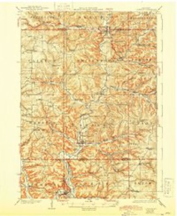
- 1926 USGS La Farge quadrangle1:62500, 3 printings
- 1958 USGS La Crosse quadrangle1:250000, 2 printings
- 1961 USGS La Crosse quadrangle1:250000
- 1965 USGS La Crosse quadrangle1:250000
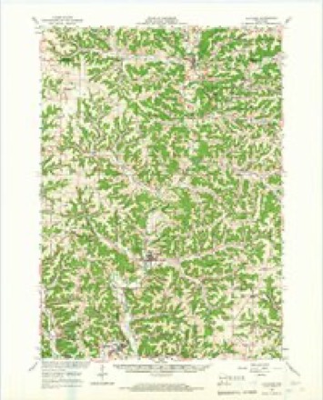
- 1965 USGS La Farge quadrangle1:62500
- 1976 USGS La Crosse quadrangle1:250000
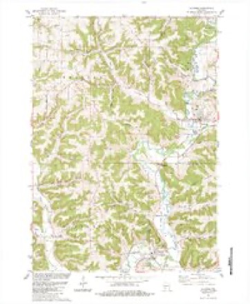
- 1983 USGS La Farge quadrangle1:24000
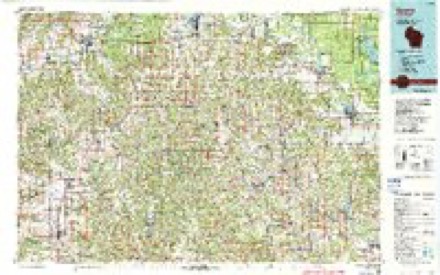
- 1985 USGS Sparta quadrangle1:100000, 2 printings




In the county-history sources
4,143 words on this townshipHistory of Vernon County, Wisconsin .., published 1884 names this settlement in its chapter on Liberty Town. These are the passages that mention it, exactly as the scans read.
Tliat part of Vernon county known as the town of Liberty,i8situated in congressional township 12, range 3 west, and contains about twenty-four sections of land. It is bounded on the north by the town of Webster, on the east by Kichla;id county, on the south by the town of Kickapoo, and on the west by the town of Viroipia. This town is watered by the Kickapoo river and its braiiches,which flow in a southerly direction. In the eastern part of the town there is a very heavy growtii of timber, while in tin u-estern there are more prairie openings. On( of the striking features of the town is its numei ous springs which gush out from the sides o the high bluffs and rocky ridges, their water finally terminating in streams having sufficieM fall to give fine mil! power.
Passage source: History of Vernon County, Wisconsin .., published 1884.
Among what may be termed the early set tiers of the town of Liberty, are the following: G. W. Wise, Allen Rusk, George P. Martin, Jonas Groves, John R. Joseph, James Gilman, Samuel Graham, Samuel Fish, Stephen A. Fish, James Schoolery, James W. Hunter, John W. Church, Frederick Groves and Stanley Stout. The first settler was James Gilman, who settled on section .5, in 1853, where he lived for many years, and then moved to Viro(|ua, where he died.
Passage source: History of Vernon County, Wisconsin .., published 1884.
In December, 1S.52, Allen Rusk, then a resident of Lancaster, Grant county, hauled a load of merchandise to Liberty Pole, for Henry McCiulley, who kept a store at the latter phut . ACter delivering the goods, Mr. Rusk went to Virocjua to visit some of his old acquaintaMces who had settled there some time previous. While on this visit, accompanied by some of his friends, he started out to look up a location for his future home. They went east as far as the Kickapoo, then followed the stream down to the mouth of Bishop branch, and the latter stream back to Viroqua. Mr. Rusk did not select any particular piece of land at this time, but concluded that in the near future he would become a resident of the county. He then returned to Lancaster, and in October, 1853, removed his family to Viroqua. In the spring of 1 J54 he pre-empted the southeast quarter of section 10, town 12, range 3 west, of the iouith principal meridian and at once commenced improviiig the same but did not settle here until .\|iril, lsr)5. Allen Rusk is a brother of Gov. .1. M. Rusk, and was born in Perry Co., Ohio, on the 6th day of February, 1S25. When he u as three years of age, the family removed to Morgan county, where the subject of this sketch received a common school education, helped till the soil, and also worked at p'astering. Oct. 23, 1843, he married Mary Newton. She was born in Harrison Co., Va., Nov. 6, 1818. In IsjJ he emigrated to Lancaster, Grant Co., Wis., fidm whence he came to Vernon county, as above stated. Mr. Rusk is a man of considerable natural ability, and no sooner hail he scttiiMl in ihe county, than he was looked ui)on as a leading citizen. It was through his efforts that the territory in which he resides was set off from Viroijua, and organized as the town of Liberty. The n.ame was suggested by Mr. Rusk, and at the first election he was elected chairman of the town board and justice of the peace; he has since held various local offices, and for two terms represented his district in the Assembly. In liJ80 he took the census of the town of Liberty, and is at present postmaster at Liberty Thus it can be seen tliat he possesses the confidence of his fellow men and is highly esteemed, which is far more desirable than riches. In September, 1864, he enlisted in company I, 42d regiment, Wisconsin Volunteer Infantry, and served until mustered out of service, participating in all the engagements of his regiment. He is a republican in politics, to which party he has adhered since its organization. The children are - Henry M., Hannah Jane, deceased ; Albert J., Jasper B., Jeremiah N. and Romulus A.
Passage source: History of Vernon County, Wisconsin .., published 1884.
Machine-read from a century-old scan, so expect the errors a machine makes: misspelled names, dropped words, stray characters.
Read the whole chapter on Liberty Town - it names this place 16 more 16 times.
Fires near this place
23 since 1995Regional context, not property-specific evidence. The federal wildfire occurrence database lists 23 fires within 5 miles of Liberty between 1995 and 2020, burning about 81 acres in total. None started naturally. 3 were recorded as arson. Distance is straight-line from the map coordinates, so a fire counted here may appear on a neighbouring settlement's page as well.
| Reported cause | Fires |
|---|---|
| Debris and open burning | 8 |
| Missing data/not specified/undetermined | 7 |
| Arson/incendiarism | 3 |
| Equipment and vehicle use | 3 |
| Smoking | 1 |
| Power generation/transmission/distribution | 1 |
The most recent of them, most recent first, with the day each was reported and the service that recorded it.
| Date | Cause | Size | Reported by | Name on the report |
|---|---|---|---|---|
| 31 July 2012 | Equipment and vehicle use | 1.4 acres | Wisconsin Department of Natural Resources | ROUND BALER |
| 21 June 2000 | Power generation/transmission/distribution | under an acre | Wisconsin Department of Natural Resources | not named |
| 19 May 2012 | Debris and open burning | under an acre | Wisconsin Department of Natural Resources | RIVER ROAD |
| 1 May 2018 | Missing data/not specified/undetermined | under an acre | Wisconsin Department of Natural Resources | 2018013 |
| 4 April 2006 | Equipment and vehicle use | under an acre | Wisconsin Department of Natural Resources | not named |
| 30 April 2020 | Smoking | under an acre | Wisconsin Department of Natural Resources | 2020008 |
| 26 April 2020 | Debris and open burning | 1.0 acres | Wisconsin Department of Natural Resources | 2020007 |
| 26 April 2018 | Debris and open burning | under an acre | Wisconsin Department of Natural Resources | 18053 |
Settlements close enough to share some of these fires:
Mines and quarries near this place
1 within 5 milesRegional context, not property-specific evidence. The federal mineral resources record lists 1 working within 5 miles of Liberty: 1 past producer. None of them still produces. What was taken out: Stone, Crushed/Broken. Distance is straight-line from the map coordinates, so a quarry counted here may appear on a neighbouring settlement's page as well.
| Where | Site | Commodity | Status | Recorded |
|---|---|---|---|---|
| Lawton Quarry | Stone, Crushed/Broken | Past Producer |
Storms near this place
10 since 2005Regional context, not property-specific evidence. The National Weather Service names Liberty in 10 storm reports between 2005 and 2025: 3 flood, 3 hail, 2 heavy rain, 1 tornado. No death or injury is recorded in these reports. Each account below is quoted exactly as the forecast office filed it, from the NOAA Storm Events Database, and each date opens the federal record of that event.
| When | Event | Place named | Harm | What the report says |
|---|---|---|---|---|
| June 2008 | Flood | Liberty | $800,000 | Highway 56 was closed between Viroqua and Viola due in part to flooding of Bishop Branch. |
| August 2005 | Tornado (F2) | Liberty | $800,000 | no account filed |
| August 2021 | Flood | Liberty | $100,000 | Runoff from heavy rains pushed the West Fork of the Kickapoo River out of its banks near Liberty. State Highway 56 was reduced to one lane because of the flooding. State Highway 162 was closed in Chaseburg because of flood waters from Coon Creek. Numerous county and township roads and bridges were also impacted or closed from flooding. |
| July 2020 | Heavy Rain | Liberty | $20,000 | One person was killed in a single vehicle accident east of Liberty. The accident occurred during a thunderstorm with heavy rain. The driver was believed to have lost control in the heavy rain with the vehicle leaving the road, rolling and ejecting the driver. |
| August 2021 | Thunderstorm Wind | Liberty | $5,000 | Trees and power lines were blown down along State Highway 56 near Liberty. |
| May 2025 | Hail | Liberty | - | A trained spotter reported penny sized hail 1 mile southeast of Liberty. |
| September 2016 | Heavy Rain | Liberty | - | The COOP observer in Viola measured 4.70 inches of rain. |
| July 2015 | Hail | Liberty | - | Quarter sized hail fell in Liberty. |
| August 2010 | Flood | Liberty | - | Locally heavy rains pushed the Kickapoo River out of its banks in Viola from August 14th through the 16th. The river exceeded the flood stage by over three feet, cresting at 17.25 feet. |
| April 2013 | Hail | Liberty | - | no account filed |
Nearest settlements
The eight closest, with where each one stands in the county. Distances are straight-line, computed from the Geographic Names Information System coordinates.
| Map | Place | Distance | Sheets |
|---|---|---|---|
| Ross | 2.0 miles | 14 | |
| Readstown | 4.8 miles | 10 | |
| Brookville | 6.2 miles | 14 | |
| La Farge | 6.4 miles | 12 | |
| Avalanche | 6.4 miles | 14 | |
| Sugar Grove | 6.8 miles | 10 | |
| Folsom | 7.7 miles | 10 | |
| Viroqua | 8.7 miles | 14 |
Elsewhere
Matched on this settlement's Geographic Names Information System number rather than its name, so it cannot be a different place of the same name in another state.
| Wikipedia article on Liberty | An encyclopaedic summary. Its text is share-alike, so it is linked here rather than copied. |
| Wikidata item Q6541564 | The structured record the population and elevation above come from. Public domain (CC0). |
Provenance
This settlement is recorded in the Geographic Names Information System as feature 1577703. The sheet list is computed by point-in-boundary test against the United States Geological Survey's historical topographic inventory. Both are works of the United States government and carry no copyright under 17 U.S.C. 105.
Wildfire. Short, Karen C. 2022. Spatial wildfire occurrence data for the United States, 1992-2020 [FPA_FOD_20221014]. 6th Edition. Fort Collins, CO: Forest Service Research Data Archive. https://doi.org/10.2737/RDS-2013-0009.6 Collected with United States Government funding and usable without additional permissions or fees.
Mines and quarries. USGS Mineral Resources Data System (MRDS) https://mrdata.usgs.gov/mrds/ A work of the United States government, no copyright under 17 U.S.C. 105.
Storms. NOAA National Centers for Environmental Information, Storm Events Database https://www.ncei.noaa.gov/stormevents/ A work of the United States government, no copyright under 17 U.S.C. 105. Narratives are quoted verbatim from the National Weather Service report and are not edited or summarised.