 Block
Waterloo, Wisconsin
16 topographic sheets cover this place, the earliest surveyed in 1891 and the latest in 1991. It stands in Waterloo City. It lies in ZIP code area 53594. The Survey maps it on the Waterloo quadrangle. 3,492 people lived here at the 2020 count. It stands 810 feet above sea level.
On record in Waterloo
Buildings and businesses the archive holds for this place. Each opens its own page, with the source record it came from.
On the National Register 3 records
 City of Waterloo Carousellisted 1997
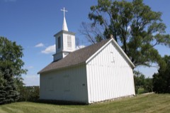 St. Wenceslaus Roman Catholic Churchlisted 1975
 Waterloo Downtown Historic Districtlisted 2000
Population over time
2 figuresWaterloo grew from 3,333 to 3,492 between 2010 and 2020. These are the recorded population figures Wikidata holds for this place, reached through the Geographic Names Information System number this page is keyed on rather than by name, so they belong to this place and not to another of the same name. Most are census counts, but not all are: an early figure may be a founding or settlement estimate, and an estimate published within five years of a census is left out. The change column is computed, and is left blank where more than 20 years separate a figure from the one before it, because a gap that long is not a change between two counts.
| Year | People | Change |
|---|---|---|
| 2010 | 3,333 | |
| 2020 | 3,492 | +159 (+5%) |
Topographic sheets covering this place
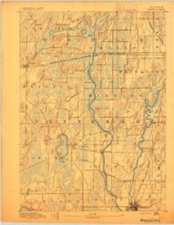
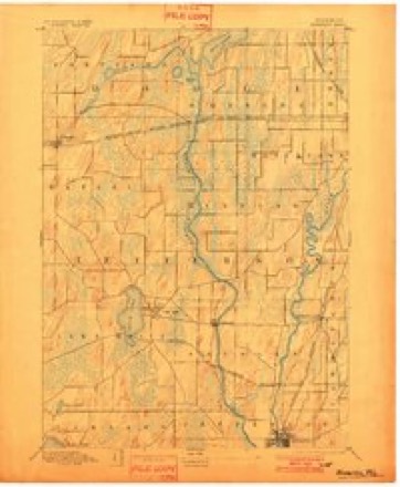
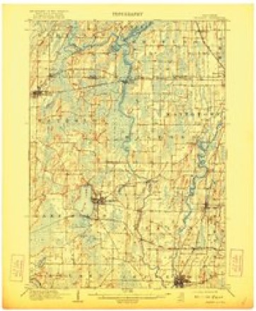
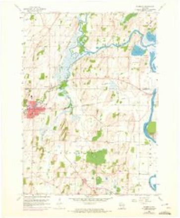
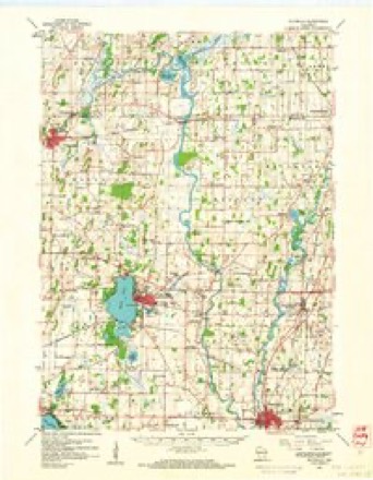
9 surveys from 16 printed sheetsMatched by testing this settlement's coordinate against the published boundary of every sheet in the United States Geological Survey's historical collection. Each opens the scanned sheet at the Survey.
- 1891 USGS Waterloo quadrangle1:62500
- 1894 USGS Waterloo quadrangle1:62500, 2 printings
- 1910 USGS Waterloo quadrangle1:62500, 2 printings
- 1957 USGS Madison quadrangle1:250000, 3 printings
- 1959 USGS Waterloo quadrangle1:24000, 3 printings
- 1959 USGS Waterloo quadrangle1:62500
- 1960 USGS Madison quadrangle1:250000, 2 printings
- 1984 USGS Oconomowoc quadrangle1:100000
- 1991 USGS Oconomowoc quadrangle1:100000


Fires near this place
20 since 2003Regional context, not property-specific evidence. The federal wildfire occurrence database lists 20 fires within 5 miles of Waterloo between 2003 and 2020, burning about 461 acres in total. None started naturally. 3 were recorded as arson. Distance is straight-line from the map coordinates, so a fire counted here may appear on a neighbouring settlement's page as well.
| Reported cause | Fires |
|---|---|
| Debris and open burning | 9 |
| Missing data/not specified/undetermined | 7 |
| Arson/incendiarism | 3 |
| Recreation and ceremony | 1 |
The most recent of them, most recent first, with the day each was reported and the service that recorded it.
| Date | Cause | Size | Reported by | Name on the report |
|---|---|---|---|---|
| 8 July 2019 | Debris and open burning | under an acre | Wisconsin Department of Natural Resources | 19092 |
| 13 July 2019 | Debris and open burning | under an acre | Wisconsin Department of Natural Resources | 19095 |
| 10 July 2019 | Debris and open burning | under an acre | Wisconsin Department of Natural Resources | 172 |
| 8 June 2019 | Debris and open burning | under an acre | Wisconsin Department of Natural Resources | 19079 |
| 9 May 2020 | Debris and open burning | 1.0 acres | Wisconsin Department of Natural Resources | 137 |
| 19 May 2018 | Arson/incendiarism | 1.0 acres | Wisconsin Department of Natural Resources | 128 |
| 7 April 2020 | Missing data/not specified/undetermined | 1.0 acres | Wisconsin Department of Natural Resources | 111 |
| 6 April 2020 | Recreation and ceremony | 1.0 acres | Wisconsin Department of Natural Resources | 20042 |
Settlements close enough to share some of these fires:
Mines and quarries near this place
3 within 5 milesRegional context, not property-specific evidence. The federal mineral resources record lists 3 workings within 5 miles of Waterloo: 2 past producers, 1 unknown. None of them still produces. What was taken out: Sand and Gravel, Construction, Stone, Crushed/Broken. Distance is straight-line from the map coordinates, so a quarry counted here may appear on a neighbouring settlement's page as well.
| Where | Site | Commodity | Status | Recorded |
|---|---|---|---|---|
| John Hensen Quarry | Stone, Crushed/Broken | Past Producer | ||
| Duwe Pit | Sand and Gravel, Construction | Past Producer | ||
| Marlin Shalitzly Pit | Sand and Gravel, Construction | Unknown |
Storms near this place
40 since 1995Regional context, not property-specific evidence. The National Weather Service names Waterloo in 40 storm reports between 1995 and 2026: 16 hail, 15 thunderstorm wind, 2 lightning, 2 tornado. No death or injury is recorded in these reports. Each account below is quoted exactly as the forecast office filed it, from the NOAA Storm Events Database, and each date opens the federal record of that event.
| When | Event | Place named | Harm | What the report says |
|---|---|---|---|---|
| August 2018 | Flash Flood | Waterloo | $943,000 | Approximately 100 911 calls related to flash flooding in Watertown. Numerous streets in Watertown flooded and closed. Some neighborhoods completely flooded with streets, yards, and driveways filled with water. Basement flooding common. A portion of Jefferson Rd. washed out at the bridge where a creek flows into the nearby Rock River. Other road damage or washouts as well. Three vehicle water rescues involving 4 citizens performed by the fire department. A section of track ballast was washed away compromising the railroad ties and tracks. The flooding caused a sanitary sewer overflow/bypass around 10 AM. Additional street flooding and basement flooding in Waterloo, Ixonia, and northern Jefferson County with some city streets and county roads closed and damaged. Overall, 93 homes sustained affected damage and 66 homes with minor damage. 5 businesses also sustained minor damage. |
| July 2003 | Thunderstorm Wind | Waterloo | $175,000 | no account filed |
| May 2013 | Thunderstorm Wind | Waterloo | $100,000 | The public reported numerous trees and power lines downed by thunderstorm wind gusts estimated at 75 mph (65 knots). The damage, in a 6-mile wide swath from 2 miles south of Waterloo to 2.5 miles east of Ixonia, included the destruction of a large pole barn, which had 4-inch by 4-inch support posts ripped out of the ground by the winds. Other homes, barns and sheds were reported to be damaged by the severe thunderstorm wind gusts. |
| April 2026 | Thunderstorm Wind | Waterloo | $80,000 | A swath of scattered tree, power line, and structural damage across northern Jefferson County. This included many uprooted and snapped trees, power lines down, and fallen trees on vehicles especially in Waterloo and Watertown. Eight power poles were snapped on East Clarkson Rd. in Waterloo. A farm on highway B east of Johnson Creek suffered severe silo damage, and a grove of trees were knocked down nearby. |
| July 1997 | Lightning | Waterloo | $50,000 | Lightning struck a home causing significant damage to the second story. |
| July 1997 | Lightning | Waterloo | $50,000 | A bolt of lightning struck a home, starting a fire that made the upper story unlivable until repair. |
| June 2024 | Tornado (EF0) | Waterloo | $25,000 | An EF-1 rated tornado developed south of Marshall near Highway 73, proceeding northwestward, damaging several farms and large areas of trees, before dissipating on the south side of Waterloo. This portion of the path was toward the end of the tornado and didn't do too much additional damage in Jefferson county besides a few trees being uprooted. |
| September 2011 | Thunderstorm Wind | Waterloo | $15,000 | Law enforcement officials reported damage from severe thunderstorm wind gusts estimated at 65 knots (75 mph) in a 3-mile wide swath from Waterloo to northeast of Ixonia. The damaging winds downed numerous trees and power lines. |
| June 2017 | Thunderstorm Wind | Waterloo | $10,000 | A large tree was snapped at the trunk as a bow echo moved through northern Jefferson county. |
| July 2016 | Thunderstorm Wind | Waterloo | $10,000 | Sporadic trees and power lines down throughout the county. |
| July 2015 | Thunderstorm Wind | Waterloo | $10,000 | Trees down throughout the county, including a couple large trees down just southwest of Palmyra. Wires down in Aztalan and Lake Mills. |
| June 2013 | Thunderstorm Wind | Waterloo | $10,000 | The Jefferson County Emergency Manager reported many trees and power lines were blown down in Waterloo from damaging thunderstorm wind gusts that were estimated up to 65 mph ( knots). |
| February 2018 | Flood | Waterloo | $5,000 | Widespread flooding of lowland and agricultural land including some roads. |
| July 2006 | Thunderstorm Wind | Waterloo | $5,000 | Trees and power lines down. |
| June 2024 | Thunderstorm Wind | Waterloo | $1,000 | Multiple reports of 2-3 inch branches down in downtown Waterloo. |
| June 2022 | Thunderstorm Wind | Waterloo | $1,000 | Downed branches around 1.75-2.75 inches in diameter. |
| July 1998 | Thunderstorm Wind | Waterloo | $1,000 | no account filed |
| July 1997 | Thunderstorm Wind | Waterloo | $700 | no account filed |
| April 2026 | Hail | Waterloo | - | Public report of 1 inch diameter hail in Waterloo. |
| April 2026 | Hail | Waterloo | - | Trained spotter reports 1 inch diameter hail in Waterloo. |
| March 2025 | Thunderstorm Wind | Waterloo | - | Several reports of tree and powerline damage in the Waterloo area. |
| August 2018 | Flood | Waterloo | - | Flooded roads, yards, fields, and basements continued the remainder of the day with some improvement after 5 to 8 inches of rain. The cities of Watertown and Waterloo were most impacted by the flood waters. The Rock River in Watertown briefly reached minor flood stage from 11:10 AM CST to 12:00 PM CST. Lowland areas and parks near the Rock River were flooded throughout northern Jefferson County. |
| July 2010 | Tornado (EF0) | Waterloo | - | An EF0 tornado began about 3.5 miles southwest of Waterloo on Veith Road, about a mile west of the intersection of VeIth Road and CTH O. The tornado moved east-southeast before dissipating just east of STH 89, about 2 miles north of the interchange of STH 89 and I-94. Damage was mostly to trees along an intermittent path, which averaged 20 yards in width. No structural damage was found. The EF-rating was based on DI 27 (TH) DOD2 which suggests maximum winds speeds of 65 mph. The exact start location is Lat 43.135917 and Lon -89.013528. The exact end location is 43.120889 and Lon -88.901667. |
| October 2023 | Hail | Waterloo | - | no account filed |
| July 2010 | Funnel Cloud | Waterloo | - | no account filed |
| June 2008 | Hail | Waterloo | - | no account filed |
| July 2007 | Hail | Waterloo | - | no account filed |
| May 2006 | Hail | Waterloo | - | no account filed |
| August 2006 | Hail | Waterloo | - | no account filed |
| March 2005 | Hail | Waterloo | - | no account filed |
| May 2005 | Hail | Waterloo | - | no account filed |
| May 2005 | Hail | Waterloo | - | no account filed |
| March 2004 | Hail | Waterloo | - | no account filed |
| August 2003 | Heavy Rain | Waterloo | - | no account filed |
| June 2001 | Hail | Waterloo | - | no account filed |
| September 2001 | Hail | Waterloo | - | no account filed |
| March 2000 | Hail | Waterloo | - | no account filed |
| June 1999 | Hail | Waterloo | - | no account filed |
| June 1995 | Hail | Waterloo | - | no account filed |
| August 1995 | Thunderstorm Wind | Waterloo | - | no account filed |
Nearest settlements
The eight closest, with where each one stands in the county. Distances are straight-line, computed from the Geographic Names Information System coordinates.
| Map | Place | Distance | Sheets |
|---|---|---|---|
| Portland | 1.3 miles | 16 | |
| Hubbleton | 5.7 miles | 16 | |
| Lake Mills | 8.2 miles | 16 | |
| Hoopers Mill | 8.3 miles | 16 | |
| Kroghville | 8.5 miles | 23 | |
| Milford | 9.4 miles | 15 | |
| Aztalan | 10.2 miles | 15 | |
| Grellton | 11.1 miles | 15 |
Elsewhere
Matched on this settlement's Geographic Names Information System number rather than its name, so it cannot be a different place of the same name in another state.
| Wikipedia article on Waterloo | An encyclopaedic summary. Its text is share-alike, so it is linked here rather than copied. |
| Wikidata item Q1569723 | The structured record the population and elevation above come from. Public domain (CC0). |
Provenance
This settlement is recorded in the Geographic Names Information System as feature 1576289. The sheet list is computed by point-in-boundary test against the United States Geological Survey's historical topographic inventory. Both are works of the United States government and carry no copyright under 17 U.S.C. 105.
Wildfire. Short, Karen C. 2022. Spatial wildfire occurrence data for the United States, 1992-2020 [FPA_FOD_20221014]. 6th Edition. Fort Collins, CO: Forest Service Research Data Archive. https://doi.org/10.2737/RDS-2013-0009.6 Collected with United States Government funding and usable without additional permissions or fees.
Mines and quarries. USGS Mineral Resources Data System (MRDS) https://mrdata.usgs.gov/mrds/ A work of the United States government, no copyright under 17 U.S.C. 105.
Storms. NOAA National Centers for Environmental Information, Storm Events Database https://www.ncei.noaa.gov/stormevents/ A work of the United States government, no copyright under 17 U.S.C. 105. Narratives are quoted verbatim from the National Weather Service report and are not edited or summarised.