
BlockBefore
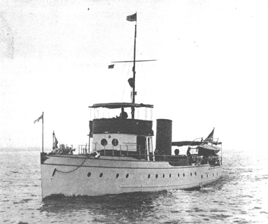
Photograph of Rosinco
Photograph by Unknown, Public domain. Via Wikimedia Commons.

Rosinco

Listed on the National Register of Historic Places in 2001.

From the record

“Rosinco was a diesel-powered luxury yacht that sank in Lake Michigan off the coast of Kenosha, Wisconsin in 1928. The yacht was built in 1916 as Georgiana III and served during World War I as USS Georgiana III, a Section patrol craft, under a free lease to the Navy by her owner and commanding officer.”

Wikipedia article Rosinco, CC BY-SA 4.0.

One of 25 National Register listings published here for Kenosha County · listed in 2001 · category: Site.

Sources: the Wikipedia article · the case file at the National Archives · the National Register database, National Park Service
The listing

  • What is counted as historic. The nomination lists 1 site as contributing to the listing.
  • Address. 12 mi. E of Kenosha, Lake Michigan
  • When was it listed? July 2001
  • Category. site
  • National Register reference number. 01000737 - the number the National Park Service assigned this property when it was listed, and the key its nomination file is catalogued under at the National Archives.

Map coverage status

No historic map-sheet match is published for this property yet. That does not mean no map exists. This record needs a coordinate-quality review before it can be joined to a sheet boundary. Browse the county's mapped places while that work is pending.

Listed places nearby

1 within 8 miles

Other National Register properties close enough to walk or drive between, ordered by distance from this one. Both positions come from the same geocoding pass that matched these properties to their map sheets.

Photograph PropertyDistance Listed
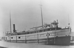
WISCONSIN shipwreck (iron steamer)7.2 miles2009

Sources for this property

National Archives recordThe nomination case file for reference 01000737 in Record Group 79.
Wikipedia articleCommunity-written account of this property, licensed CC BY-SA.
Kenosha CountyAll 25 listed properties in this county.

Provenance

  • Listing record. National Park Service National Register of Historic Places, listed-properties dataset, current to 2026-05-22.
  • Map join. Address geocoded through the United States Census geocoder, then tested against the published boundary of every sheet in the USGS Historical Topographic Map Collection.
  • How this page is made. Listing fields come from federal records; map-sheet coverage is a labelled coordinate-to-boundary calculation, not a source-field claim.