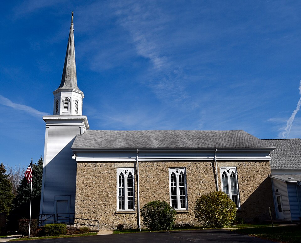
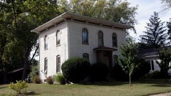
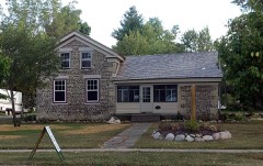
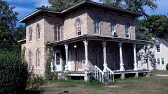
Built in 1850 (Greek Revival architecture). Listed on the National Register of Historic Places in 1976.
From the record
“Shopiere Congregational Church is a historic Congregational church in Shopiere, Wisconsin, United States. It was built in 1853 and was added to the National Register of Historic Places in 1976.”
Wikipedia article Shopiere Congregational Church, CC BY-SA 4.0.
One of 141 National Register listings published here for Rock County · listed in 1976 · category: Building · built in 1850, Greek Revival architecture.
National Register reference number.76000078- the number the National Park Service assigned this property when it was listed, and the key its nomination file is catalogued under at the National Archives.
The trophies consisted of three rakes, one fork, one pail of rations, : containing four yankee johnnyeakes, eight cold pota.toes, one jug of w;hisky, &c. From the above mentioned battle the place was ever after known as Waterloo, until changed: - on the establislynent of a Post OflBce - to the present name of Shopiere.
1855 at the age of 82. Adam Bell married Jane Yates, daughter of Cornelius Yates, in New York; have had eight children - William D. (went to Washington at his own expense and enlisted in the McClellan Dragoons and served his time faithfully until he was taken sick and came home and died Oct. 11, 1863 ; he was of a most patriotic spirit; the last word he uttered was liberty, and desired to see the stars and stripes), Nettie (died at the age of 27), Samuel (is now a prominent physician in Beloit), Andrew L. (is in Shelby Co., Iowa), Mary M. (is at home), Francellia (died when an infant), Emma (married W. Swingle), Charles E. (is in Iowa teaching school), another died in infancy. Mr. Adam Bell came from Montgomery Co., N. Y.,to Waterloo (now called Shopiere) Jan. 21, 18491; worked at his trade of carpenter most of his life ; now has forty acres of land, a pleasant home and is in comfortable circumstances ; near his house is an immense specimen of the willow-tree, which he set out in 1850 from a little sprout not bigger than a straw ; it has grown to be nine feet nine inches in circumference two feet from the ground, extends north and south fifty-two feet, east and west forty-six and a half feet ; height, fortyfive feet. A singular coiacidence in the life of William D. Bell is that he was born in October, enlisted in October, was discharged in October and died in October.
Regional context, not property-specific
evidence. The
federal wildfire occurrence database
lists 13 fires within 5 miles of Shopiere Congregational Church
between 2018 and 2020, burning about 61 acres in total. None started naturally. 1 was recorded as arson.
Distance is straight-line from the map coordinates, so a fire counted
here may appear on a neighbouring settlement's page as well.
Reported cause
Fires
Missing data/not specified/undetermined
7
Debris and open burning
3
Smoking
1
Arson/incendiarism
1
Recreation and ceremony
1
The most recent of
them, most recent first, with the day each was reported and the service
that recorded it.
Regional context, not property-specific
evidence. The federal mineral resources record lists
13 workings within 5 miles of Shopiere Congregational Church: 8 producers, 5 past producers.
8 still produce. What was taken out: Sand and Gravel, Construction, Stone, Crushed/Broken, Stone. Distance is straight-line from the
map coordinates, so a quarry counted here may appear on a neighbouring
settlement's page as well.
Regional context, not property-specific
evidence. The National Weather Service names
Shopiere, the town this property stands in, in 4 storm reports between 2001 and 2024: 1 funnel cloud, 1 thunderstorm wind, 1 tornado, 1 hail.
No death or injury is recorded in these reports. Each account below is quoted exactly as the forecast office
filed it, from the NOAA Storm Events Database, and each date
opens the federal record of that event.
A brief tornado spun up 1.4 miles due south of Shopiere, or about 3.8 miles west-southwest of Clinton, very near the intersection of Hart Road and Butterfly Road. It resulted in some minor corn crop damage and tree damage, and was observed by 3 spotters. This very weak tornado spun up on a wind shift boundary that extended from near Racine to near Beloit. Showers and isolated thunderstorms developed along this boundary and produced several funnel clouds, and locally heavy rains. The tornado apparently developed from from the ground up since there wasn't any mesocyclone evidence on the WSR-88D Doppler radar. Atmospheric wind shear profiles were not supportive of rotating updrafts in thunderstorms.
No historic map-sheet match is published
for this property yet. That does not mean no map exists. This record needs
a coordinate-quality review before it can be joined to a sheet boundary.
Browse the county's mapped places while that work is
pending.
Listed places nearby
6 within 8 miles
Other National Register properties close
enough to walk or drive between, ordered by distance from this one. Both
positions come from the same geocoding pass that matched these properties
to their map sheets.
Listing record. National Park Service National Register of Historic Places, listed-properties dataset, current to 2026-05-22.
Map join. Address geocoded through the United States Census geocoder, then tested against the published boundary of every sheet in the USGS Historical Topographic Map Collection.
How this page is made. Listing fields come from federal records; map-sheet coverage is a labelled coordinate-to-boundary calculation, not a source-field claim.
Wildfire. Short, Karen C. 2022. Spatial wildfire occurrence data for the United States, 1992-2020 [FPA_FOD_20221014]. 6th Edition. Fort Collins, CO: Forest Service Research Data Archive. https://doi.org/10.2737/RDS-2013-0009.6 Collected with United States Government funding and usable without additional permissions or fees.
Mines and quarries. USGS Mineral Resources Data System (MRDS) https://mrdata.usgs.gov/mrds/ A work of the United States government, no copyright under 17 U.S.C. 105.
Storms. NOAA National Centers for Environmental Information, Storm Events Database https://www.ncei.noaa.gov/stormevents/ A work of the United States government, no copyright under 17 U.S.C. 105. Narratives are quoted verbatim from the National Weather Service report and are not edited or summarised.
 Block