 Block
From the record
One of 36 National Register listings published here for Dodge County · listed in 1979 · category: Building.
Sources: the case file at the National Archives · the National Register database, National Park Service
Listed on the National Register of Historic Places in 1979.
One of 36 National Register listings published here for Dodge County · listed in 1979 · category: Building.
Sources: the case file at the National Archives · the National Register database, National Park Service
The chapter on Lebanon Town in The History of Dodge County, Wisconsin, Containing ... Its Early Settlement, Growth ... an Extensive and Minute Sketch of Its Cities ... War Record, Biographical Sketches, published 1880 names Watertown. This is what it says, exactly as the scans read.
Wilhclmina, Herman, Erdman, Michael, Sophia and John (deceased;. On the 17th of November, 1859, he married Miss Mary L. Dammbaeh ; they have nine ceildrcn - Louisa, Albert, Adolph, Anna, Oswald, Eva, Paulina, Agnes and Angela ; Wilhelmina is married and lives in Nort'ulk, Neb. ; Herman is a photographer in Marshfield, VVis. ; Erdman is Pastor of Lutheran congregations in Tomah and llidgeville, living at Ridgeville, Wis.; Micliael is Pastor of the Lutheran flock at Norfolk, Neb.; Sophia is married and lives in Tomah ; Albert and x\dolph are students at the Northwestern Univcr.sity, Watertown, and the other children are on the farm of eighty-five acres. Sec. 19, where Mr. Pankow built a pleasant home in 1858; he still owns the old Government claim on Sugar Island.
Passage source: The History of Dodge County, Wisconsin, Containing ... Its Early Settlement, Growth ... an Extensive and Minute Sketch of Its Cities ... War Record, Biographical Sketches, published 1880.
CHARLE$!i ARESfRERG, cooper, Sixth Ward, Dodge Co.; born in Brunswick, Germany, Oct. 8, 1832: came to America in July. 1854; located in Milwaukee; came to Watertown in May, 1856. He was married in Milwaukee, in June, 1855, to Mary Dittes; she was born in Baden, Germany ; they have had three children ; one died in infancy ; the living are Otelle and Ernst. Mr. Arenberg is one of the oldest coopers in the State ; he has been engaged in the business ever since he came to the country ; he is one of the leading citizens of the city ; he has been Supervisor ; is now President of Concordia Musical Society, having held that position several times. He has been President of the Northwestern Saengerbund, and is at present a member of that society ; he is a member of the Sons of Hermann and has been President of the same, also has held presidency of the Grand Lodge.
Passage source: The History of Dodge County, Wisconsin, Containing ... Its Early Settlement, Growth ... an Extensive and Minute Sketch of Its Cities ... War Record, Biographical Sketches, published 1880.
Machine-read from a century-old scan, so expect the errors a machine makes: misspelled names, dropped words, stray characters.
Read the whole chapter on Lebanon Town - 2,507 words on its settlement, mills, schools and churches.
Regional context, not property-specific evidence. The federal wildfire occurrence database lists 14 fires within 5 miles of Schoenicke Barn between 2018 and 2020, burning about 12 acres in total. None started naturally. None was recorded as arson. Distance is straight-line from the map coordinates, so a fire counted here may appear on a neighbouring settlement's page as well.
| Reported cause | Fires |
|---|---|
| Debris and open burning | 9 |
| Missing data/not specified/undetermined | 4 |
| Power generation/transmission/distribution | 1 |
The most recent of them, most recent first, with the day each was reported and the service that recorded it.
| Date | Cause | Size | Reported by | Name on the report |
|---|---|---|---|---|
| 5 August 2018 | Debris and open burning | under an acre | Wisconsin Department of Natural Resources | 33 |
| 18 June 2018 | Power generation/transmission/distribution | 1.0 acres | Wisconsin Department of Natural Resources | 29 |
| 12 June 2019 | Debris and open burning | under an acre | Wisconsin Department of Natural Resources | 1923 |
| 1 May 2018 | Debris and open burning | 4.0 acres | Wisconsin Department of Natural Resources | 1831 |
| 8 April 2018 | Debris and open burning | under an acre | Wisconsin Department of Natural Resources | 20 |
| 8 April 2018 | Debris and open burning | under an acre | Wisconsin Department of Natural Resources | 1817 |
| 7 April 2019 | Debris and open burning | 3.0 acres | Wisconsin Department of Natural Resources | 11 |
| 27 April 2018 | Missing data/not specified/undetermined | under an acre | Wisconsin Department of Natural Resources | 23 |
No historic map-sheet match is published for this property yet. That does not mean no map exists. This record needs a coordinate-quality review before it can be joined to a sheet boundary. Browse the county's mapped places while that work is pending.
Other National Register properties close enough to walk or drive between, ordered by distance from this one. Both positions come from the same geocoding pass that matched these properties to their map sheets.
| Photograph | Property | Distance | Listed |
|---|---|---|---|
| Meissner Store | 3.8 miles | 2024 | |
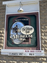 | Neosho Village Hall | 5.0 miles | 2018 |
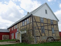 | Kliese Housebarn | 5.3 miles | 2008 |
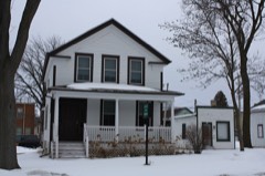 | John Hustis House | 6.5 miles | 1983 |
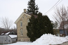 | Ferdinand Schulze House | 6.5 miles | 1996 |
| National Archives record | The nomination case file for reference 79000071 in Record Group 79. |
| Dodge County | All 36 listed properties in this county. |