 Block
From the record
One of 3 National Register listings published here for Burnett County · listed in 1980 · category: Building.
Sources: the case file at the National Archives · the National Register database, National Park Service
Listed on the National Register of Historic Places in 1980.
One of 3 National Register listings published here for Burnett County · listed in 1980 · category: Building.
Sources: the case file at the National Archives · the National Register database, National Park Service
Regional context, not property-specific evidence. The federal wildfire occurrence database lists 93 fires within 5 miles of Jacobson House and Mill Site between 1993 and 2020, burning about 138 acres in total. 7 started naturally. 8 were recorded as arson. Distance is straight-line from the map coordinates, so a fire counted here may appear on a neighbouring settlement's page as well.
| Reported cause | Fires |
|---|---|
| Debris and open burning | 33 |
| Missing data/not specified/undetermined | 22 |
| Equipment and vehicle use | 13 |
| Arson/incendiarism | 8 |
| Natural | 7 |
| Recreation and ceremony | 3 |
| Fireworks | 2 |
| Other causes | 2 |
| Power generation/transmission/distribution | 1 |
| Misuse of fire by a minor | 1 |
| Smoking | 1 |
The most recent of them, most recent first, with the day each was reported and the service that recorded it.
| Date | Cause | Size | Reported by | Name on the report |
|---|---|---|---|---|
| 8 September 2009 | Missing data/not specified/undetermined | under an acre | Wisconsin Department of Natural Resources | HAY WAGON FIRE |
| 29 September 2012 | Debris and open burning | 1.1 acres | Wisconsin Department of Natural Resources | DEER STAND FIRE |
| 24 September 2000 | Debris and open burning | under an acre | Wisconsin Department of Natural Resources | not named |
| 3 August 2008 | Natural | under an acre | Wisconsin Department of Natural Resources | not named |
| 22 August 2018 | Equipment and vehicle use | 2.0 acres | Wisconsin Department of Natural Resources | FALUN MEADOWS |
| 22 August 2013 | Equipment and vehicle use | under an acre | Wisconsin Department of Natural Resources | not named |
| 18 August 1996 | Equipment and vehicle use | under an acre | Wisconsin Department of Natural Resources | not named |
| 15 August 2007 | Natural | 2.1 acres | Wisconsin Department of Natural Resources | not named |
Regional context, not property-specific evidence. The federal mineral resources record lists 5 workings within 5 miles of Jacobson House and Mill Site: 3 occurrences, 2 past producers. None of them still produces. What was taken out: Sand and Gravel, Construction. Distance is straight-line from the map coordinates, so a quarry counted here may appear on a neighbouring settlement's page as well.
| Where | Site | Commodity | Status | Recorded |
|---|---|---|---|---|
| Mud Hen Lake Pit #3 | Sand and Gravel, Construction | Occurrence | ||
| Mud Hen Lake Pit #4 | Sand and Gravel, Construction | Occurrence | ||
| North Rice Lake Pit | Sand and Gravel, Construction | Occurrence | ||
| Peterson Gravel Pit | Sand and Gravel, Construction | Past Producer | ||
| Spirit Lake Pit | Sand and Gravel, Construction | Past Producer |
Regional context, not property-specific evidence. The National Weather Service names Grantsburg, the town this property stands in, in 53 storm reports between 1997 and 2025: 25 hail, 23 thunderstorm wind, 4 tornado, 1 lightning. The reports record 2 deaths and 16 injuries. Each account below is quoted exactly as the forecast office filed it, from the NOAA Storm Events Database, and each date opens the federal record of that event.
| When | Event | Place named | Harm | What the report says |
|---|---|---|---|---|
| June 2001 | Tornado (F3) | Grantsburg | 2 killed, 16 hurt, $10,000,000 | The tornado touched down at 806 pm local daylight time 1.5 miles east of Grantsburg and traveled east at an average speed of 40 mph through the village of Siren to the Washburn County line, then continued on to a point 3 miles west of Spooner. The path of the tornado averaged 1/8 to 1/4 mile, but reached its greatest width of ½ mile as it approached Siren around 820 pm, where it did F-3 damage. Two people were killed by the tornado, and there were 16 injuries. Four hundred homes were destroyed, 200 in Siren alone, with 280 homes damaged, and 60 businesses destroyed or damaged. Most of the damage occurred in an 8-block area of Siren. Approximately 14,000 acres of trees were leveled along the tornado path. The two people killed were in Dewey Township, about 14 miles east of Siren. An 80-year-old woman was crushed by a falling wall while trying to get to the basement, and a 77-year-old man was found dead about 100 yards from his demolished home, presumably thrown there by tornado-force winds. Many buildings in the path of the tornado through Dewey Township, including the Dewey Town Hall, were destroyed as well. Power lines, trees, and buildings were also damaged or destroyed at Alpha, Falun, and Mud Hen Lake along the path of the tornado between Grantsburg and Siren. Fifteen cows were lost when a barn collapsed near Falun. Some were killed outright. Others were injured and had to be put down. |
| September 1998 | Thunderstorm Wind | Grantsburg | $50,000 | no account filed |
| June 2010 | Tornado (EF1) | Grantsburg | $10,000 | A tornado crossed the St. Croix River into southwest Burnett County Wisconsin from Pine County Minnesota, about 1.5 miles north of Highway 70, and dissipated about 3.5 miles west-northwest of Grantsburg, WI. The tornado moved into Wisconsin around 9 pm. EF1 damage was assigned due to damage to a home near Grantsburg WI, along with significant tree damage. |
| August 2007 | Lightning | Grantsburg | $4,000 | Lightning struck a home, causing electrical damage. The lightning blew out the garage door opener, internet service, cable, telephone, router, two ethernet connections and tripped three circuits, according to the Burnett County Sentinel. The intense lightning storm also caused many small fires to break out in Burnett County, though most were under one acre in size and no property damage was reported. |
| July 2010 | Thunderstorm Wind | Grantsburg | $2,500 | Trees were blown down. In addition, 1.19 inches of rain was measured in an hour's time. |
| July 2019 | Thunderstorm Wind | Grantsburg | - | A 2-inch branch was broken from a tree in the winds. |
| June 2017 | Thunderstorm Wind | Grantsburg | - | A temporary green house off of Highway 70 on the west side of Grantsburg, Wisconsin was destroyed. |
| June 2017 | Thunderstorm Wind | Grantsburg | - | The sheriff dispatch center received numerous reports of trees and power lines down. |
| June 2017 | Thunderstorm Wind | Grantsburg | - | A 30 foot tall pine tree was blown down. |
| June 2017 | Thunderstorm Wind | Grantsburg | - | Four large pine trees were blown down. |
| July 2015 | Hail | Grantsburg | - | Nickel to quarter size hail lasted for approximately 5 minutes. There was heavy rainfall with ponding of water on the streets in low spots. |
| September 2014 | Hail | Grantsburg | - | There was dime size hail. |
| June 2013 | Hail | Grantsburg | - | Dime to nickel size hail fell for 6 minutes. |
| July 2011 | Thunderstorm Wind | Grantsburg | - | Partial roof loss to two buildings was found, along with widespread tree damage and large trees uprooted. Highway 70 and many side roads were impassable, with no power. The Red Cross opened a shelter to distribute food and water. Estimated wind speed is derived from the NWS WFO Duluth Storm Survey. |
| July 2011 | Thunderstorm Wind | Grantsburg | - | Numerous trees were blown down and power was knocked out. |
| July 2011 | Thunderstorm Wind | Grantsburg | - | A yard, 3.5 acres in area, lost nearly every tree, including large oaks over 50 years old. A fireworks tent was blown over. |
| July 2011 | Thunderstorm Wind | Grantsburg | - | Numerous trees were blown down. |
| June 2010 | Tornado (EF0) | Grantsburg | - | A second EF0 tornado briefly formed and dissipated a short time later from the same parent thunderstorm. |
| July 2008 | Thunderstorm Wind | Grantsburg | - | Trees were blown down. |
| July 2007 | Thunderstorm Wind | Grantsburg | - | Tree downed. |
| August 2007 | Thunderstorm Wind | Grantsburg | - | Estimated wind gusts up to 60 mph. |
| July 2006 | Thunderstorm Wind | Grantsburg | - | Trees blew down. |
| April 2004 | Thunderstorm Wind | Grantsburg | - | Large tree branches were blown down. |
| April 2004 | Thunderstorm Wind | Grantsburg | - | A dozen trees were blown down.There was also some light wind damage to homes. |
| May 2001 | Tornado (F0) | Grantsburg | - | A weak tornado destroyed a screen house and blew down many trees. A mobile home suffered structural damage from a falling branch. |
| June 2001 | Thunderstorm Wind | Grantsburg | - | The strong winds blew down trees. The wind speed is estimated. |
| June 2001 | Thunderstorm Wind | Grantsburg | - | Houses were destroyed. The wind speed is estimated. |
| June 1997 | Thunderstorm Wind | Grantsburg | - | Strong thunderstorm winds ripped the roof off a manufacturing building and toppled many trees. Lightning started an electrical unit on fire. No dollar estimate of the damage was available. Wind speed is estimated. |
| July 1997 | Thunderstorm Wind | Grantsburg | - | Thunderstorm winds to 56 knots (65 mph) blew down trees and power lines in and around the city. |
| April 2025 | Hail | Grantsburg | - | no account filed |
| July 2023 | Hail | Grantsburg | - | no account filed |
| May 2022 | Hail | Grantsburg | - | no account filed |
| May 2022 | Hail | Grantsburg | - | no account filed |
| May 2022 | Hail | Grantsburg | - | no account filed |
| May 2022 | Hail | Grantsburg | - | no account filed |
| May 2022 | Hail | Grantsburg | - | no account filed |
| June 2022 | Hail | Grantsburg | - | no account filed |
| June 2022 | Hail | Grantsburg | - | no account filed |
| June 2022 | Hail | Grantsburg | - | no account filed |
| July 2019 | Hail | Grantsburg | - | no account filed |
| June 2017 | Hail | Grantsburg | - | no account filed |
| June 2017 | Hail | Grantsburg | - | no account filed |
| July 2015 | Hail | Grantsburg | - | no account filed |
| August 2013 | Hail | Grantsburg | - | no account filed |
| July 2008 | Hail | Grantsburg | - | no account filed |
| April 2002 | Hail | Grantsburg | - | no account filed |
| June 2001 | Hail | Grantsburg | - | no account filed |
| August 2000 | Hail | Grantsburg | - | no account filed |
| July 1999 | Thunderstorm Wind | Grantsburg | - | no account filed |
| September 1998 | Hail | Grantsburg | - | no account filed |
| August 1997 | Hail | Grantsburg | - | no account filed |
| August 1997 | Hail | Grantsburg | - | no account filed |
| August 1997 | Thunderstorm Wind | Grantsburg | - | no account filed |
No historic map-sheet match is published for this property yet. That does not mean no map exists. This record needs a coordinate-quality review before it can be joined to a sheet boundary. Browse the county's mapped places while that work is pending.
Other National Register properties close enough to walk or drive between, ordered by distance from this one. Both positions come from the same geocoding pass that matched these properties to their map sheets.
| Photograph | Property | Distance | Listed |
|---|---|---|---|
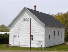 | Daniels Town Hall | 4.1 miles | 2006 |
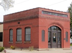 | Burnett County Abstract Company | 6.0 miles | 1980 |
| National Archives record | The nomination case file for reference 80000110 in Record Group 79. |
| Burnett County | All 3 listed properties in this county. |