 Block
From the record
One of 7 National Register listings published here for Dunn County · listed in 1986 · category: District.
Sources: the case file at the National Archives · the National Register database, National Park Service · the Wikipedia article

Listed on the National Register of Historic Places in 1986.
One of 7 National Register listings published here for Dunn County · listed in 1986 · category: District.
Sources: the case file at the National Archives · the National Register database, National Park Service · the Wikipedia article
Regional context, not property-specific evidence. The federal wildfire occurrence database lists 12 fires within 5 miles of Menomonie Downtown Historic District between 2007 and 2020, burning about 10 acres in total. None started naturally. 4 were recorded as arson. Distance is straight-line from the map coordinates, so a fire counted here may appear on a neighbouring settlement's page as well.
| Reported cause | Fires |
|---|---|
| Missing data/not specified/undetermined | 7 |
| Arson/incendiarism | 4 |
| Smoking | 1 |
The most recent of them, most recent first, with the day each was reported and the service that recorded it.
| Date | Cause | Size | Reported by | Name on the report |
|---|---|---|---|---|
| 16 August 2020 | Missing data/not specified/undetermined | under an acre | Wisconsin Department of Natural Resources | 1745 |
| 1 August 2007 | Arson/incendiarism | under an acre | Wisconsin Department of Natural Resources | not named |
| 3 June 2020 | Missing data/not specified/undetermined | 1.0 acres | Wisconsin Department of Natural Resources | 1112 |
| 7 May 2020 | Missing data/not specified/undetermined | 1.0 acres | Wisconsin Department of Natural Resources | 909 |
| 5 May 2018 | Missing data/not specified/undetermined | under an acre | Wisconsin Department of Natural Resources | 931 |
| 13 May 2019 | Arson/incendiarism | under an acre | Wisconsin Department of Natural Resources | 1151 |
| 12 May 2020 | Missing data/not specified/undetermined | under an acre | Wisconsin Department of Natural Resources | 946 |
| 11 May 2020 | Missing data/not specified/undetermined | under an acre | Wisconsin Department of Natural Resources | 939 |
Regional context, not property-specific evidence. The federal mineral resources record lists 16 workings within 5 miles of Menomonie Downtown Historic District: 8 past producers, 4 producers, 3 occurrences, 1 unknown. 4 still produce. What was taken out: Sand and Gravel, Construction, Stone, Crushed/Broken, Stone, Sand and Gravel, Industrial/Frac Sand. Distance is straight-line from the map coordinates, so a quarry counted here may appear on a neighbouring settlement's page as well.
| Where | Site | Commodity | Status | Recorded |
|---|---|---|---|---|
| Menomonie Mine | Sand and Gravel, Industrial/Frac Sand | Producer | ||
| Own Crews | Stone | Unknown | ||
| Irvington Dolomite Deposit | Stone, Crushed/Broken | Occurrence | ||
| Little Elk Creek Shale Quarry | Stone, Crushed/Broken | Past Producer | ||
| Township of Red Cedar Quarry | Stone, Crushed/Broken | Past Producer | ||
| Cedar Falls Gravel Pit | Sand and Gravel, Construction | Past Producer | ||
| Dunn Cnty Hwy Dept. Pit | Sand and Gravel, Construction | Producer | ||
| Lake Menomin Gravel Deposit | Sand and Gravel, Construction | Occurrence | ||
| Lake Menomin Gravel Pit | Sand and Gravel, Construction | Past Producer | ||
| Menomonie Gravel Deposit | Sand and Gravel, Construction | Occurrence |
Regional context, not property-specific evidence. The National Weather Service names Menomonie, the town this property stands in, in 72 storm reports between 1994 and 2025: 35 thunderstorm wind, 27 hail, 4 lightning, 2 funnel cloud. The reports record 1 death and 11 injuries. Each account below is quoted exactly as the forecast office filed it, from the NOAA Storm Events Database, and each date opens the federal record of that event.
| When | Event | Place named | Harm | What the report says |
|---|---|---|---|---|
| August 2021 | Lightning | Menomonie | 1 killed, 1 hurt | Lightning struck two construction workers. One died and the other was transported to a local hospital with serious injuries. |
| May 1998 | Tornado (F2) | Menomonie | 8 hurt, $400,000 | Two people severely injured during house collapse. Two homes destroyed. Several barns and sheds were also demolished. 6 people suffered minor injuries. One mobile home destroyed. |
| May 1998 | Thunderstorm Wind | Menomonie | 2 hurt, $300,000 | Trailer home destroyed. Damage estimate for entire county. |
| June 2002 | Thunderstorm Wind | Menomonie | $250,000 | Numerous trees down, some on homes, outbuildings and sheds. |
| May 2001 | Hail | Menomonie | $100,000 | Numerous cars damaged. |
| June 2001 | Lightning | Menomonie | $83,000 | Lightning struck a barn and set it on fire. |
| August 2009 | Lightning | Menomonie | $65,000 | Lightning struck a pine tree which fell on a home in Memomonie, Wisconsin and caused a house fire. |
| April 2002 | Thunderstorm Wind | Menomonie | $50,000 | Narrow swath of wind damage. Roof off barn. Old, abandoned wooden one-room schoolhouse collapsed. Several outbuildings down. Downburst wind per NWS damage survey. |
| May 1994 | Thunderstorm Wind | Menomonie | $50,000 | no account filed |
| July 2005 | Lightning | Menomonie | $30,000 | The chimney of a vacant home on county highway Y was struck by lightning. The resulting fire caused $30,000 damage to the structure. |
| June 2021 | Thunderstorm Wind | Menomonie | $25,000 | Scattered trees and power lines were blown down near and south of Menomonie. One of the trees damaged an apartment building near a high school. |
| June 1997 | Tornado (F1) | Menomonie | $22,000 | Shed destroyed. Corn stalks driven into the seams of house siding. |
| July 2025 | Thunderstorm Wind | Menomonie | - | Report of power lines and trees down in Menomonie. |
| July 2025 | Thunderstorm Wind | Menomonie | - | Multiple power lines and trees downed near Menomonie. Some minor roof damage was reported as well. |
| July 2023 | Thunderstorm Wind | Menomonie | - | The storm caused numerous large tree branches down around the town of Menomonie. Some branches were estimated to be at least 8 inches in diameter. In addition, the Menomonie ASOS measured a 53 mph wind gust. |
| July 2020 | Thunderstorm Wind | Menomonie | - | A downburst likely occurred in the city of Menomonie as a few power lines were blown down, and a large tree was snapped off 10 feet above the ground on the north side of Menomonie. |
| August 2018 | Thunderstorm Wind | Menomonie | - | A large tree was blown down in Menomonie. |
| April 2017 | Hail | Menomonie | - | Mainly pea sized with a few as large as pennies. |
| June 2016 | Thunderstorm Wind | Menomonie | - | Multiple trees and power lines were blown down throughout the city of Menomonie and the adjacent town of Cedar Falls. Approximately 6000 customers were affected by power outages due to downed power lines. |
| June 2013 | Flash Flood | Menomonie | - | Due to excessive rainfall, 10th Avenue (which runs through the University of Wisconsin - Stout) was closed due to flooding. |
| June 2012 | Thunderstorm Wind | Menomonie | - | An eight inch diameter tree was snapped in half. |
| July 2011 | Thunderstorm Wind | Menomonie | - | A large tree was blown over. |
| July 2011 | Thunderstorm Wind | Menomonie | - | An eight inch diameter tree was toppled across 770th Avenue, between Highway 40 and 808th Street. |
| July 2010 | Thunderstorm Wind | Menomonie | - | A wind gust of 51 knots was reported by the Menomonie Airport AWOS. |
| July 2008 | Thunderstorm Wind | North Menomonie | - | One tree reported felled. |
| July 2008 | Thunderstorm Wind | Menomonie | - | Six to 8 inch tree limbs toppled. |
| August 2007 | Thunderstorm Wind | Menomonie | - | Two twelve inch pine trees downed. |
| August 2007 | Thunderstorm Wind | Menomonie | - | Large four inch branches down at intersection of 29th and 21st St. Power lines and street lights were also downed in Menomonie. |
| August 2007 | Thunderstorm Wind | Menomonie | - | One home received partial structural damage. Light poles and power lines were also reported down. |
| July 2007 | Thunderstorm Wind | Menomonie | - | Numerous trees down from Menomonie to Tainter Lake. |
| July 2006 | Thunderstorm Wind | Menomonie | - | Eight inch tree down at high school. |
| July 2006 | Hail | Menomonie | - | Hail occurred from one mile west of Menomonie to north side of Menomonie. |
| October 2006 | Hail | Menomonie | - | Several reports of hail came from Menomonie, especially the south side of town. The hail lasted 10 minutes in some areas. |
| June 2005 | Thunderstorm Wind | Menomonie | - | Numerous trees were downed on the south side of town. A wind gust of 67 MPH was measured at the Menomonie airport. |
| July 2005 | Thunderstorm Wind | Menomonie | - | Trees and power lines were downed. |
| July 2005 | Thunderstorm Wind | Menomonie | - | Several trees, including one Oak up to 16 inches in diameter, were downed. |
| May 2004 | Thunderstorm Wind | Menomonie | - | Trees were downed in Menomonie and Otter Creek Township. The time was estimated. |
| June 2004 | Thunderstorm Wind | Menomonie | - | A tree was downed in the northeast portion of Menomonie and in rural northern Dunn County. |
| August 2004 | Thunderstorm Wind | Menomonie | - | Trees and power lines were downed. A garage was damaged by a fallen tree on Tainter Street. A dock and boat were also damaged. |
| June 2002 | Flash Flood | Menomonie | - | Nearly four inches of rain fell in less than two hours. Street flooding was the result, including water to three feet on Stokie Parkway. |
| September 2002 | Thunderstorm Wind | Menomonie | - | Few trees down. |
| May 2001 | Thunderstorm Wind | Menomonie | - | Several 18 inch diameter trees down. |
| May 1998 | Thunderstorm Wind | Menomonie | - | Home destroyed. Estimated windspeeds. |
| June 1998 | Thunderstorm Wind | Menomonie | - | Trees blown down. Estimated windspeed. |
| August 1995 | Thunderstorm Wind | Menomonie | - | Trees and power lines down. |
| August 2023 | Hail | Menomonie | - | no account filed |
| September 2022 | Hail | Menomonie | - | no account filed |
| June 2016 | Hail | Menomonie | - | no account filed |
| July 2015 | Hail | Menomonie | - | no account filed |
| August 2014 | Hail | Menomonie | - | no account filed |
| May 2013 | Hail | Menomonie | - | no account filed |
| August 2013 | Hail | Menomonie | - | no account filed |
| May 2012 | Hail | Menomonie | - | no account filed |
| May 2011 | Hail | Menomonie | - | no account filed |
| May 2011 | Hail | Menomonie | - | no account filed |
| July 2010 | Funnel Cloud | Menomonie | - | no account filed |
| July 2008 | Hail | Menomonie | - | no account filed |
| July 2007 | Hail | Menomonie | - | no account filed |
| July 2006 | Hail | Menomonie | - | no account filed |
| July 2006 | Hail | Menomonie | - | no account filed |
No historic map-sheet match is published for this property yet. That does not mean no map exists. This record needs a coordinate-quality review before it can be joined to a sheet boundary. Browse the county's mapped places while that work is pending.
Other National Register properties close enough to walk or drive between, ordered by distance from this one. Both positions come from the same geocoding pass that matched these properties to their map sheets.
| Photograph | Property | Distance | Listed |
|---|---|---|---|
 | Mabel Tainter Memorial Building | 0.3 miles | 1974 |
 | Louis Smith Tainter House | 0.4 miles | 1974 |
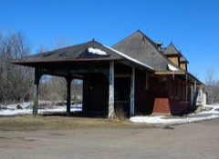 | Menomonie Omaha Depot | 0.5 miles | 2018 |
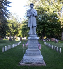 | Evergreen Cemetery | 1.1 miles | 2006 |
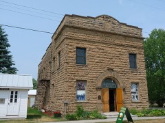 | Downsville Lodge No. 1961 I.O.O.F. | 7.0 miles | 2017 |
| National Archives record | The nomination case file for reference 86001667 in Record Group 79. |
| Wikipedia article | Community-written account of this property, licensed CC BY-SA. |
| Dunn County | All 7 listed properties in this county. |