 Block
From the record
One of 50 National Register listings published here for Walworth County · listed in 1987 · category: Building.
Sources: the case file at the National Archives · the National Register database, National Park Service
Listed on the National Register of Historic Places in 1987.
One of 50 National Register listings published here for Walworth County · listed in 1987 · category: Building.
Sources: the case file at the National Archives · the National Register database, National Park Service
The chapter on Linn Town in History of Walworth County, Wisconsin, Containing an Account of Its Settlement, Growth, Development and Resources...its War Record, Biographical Sketches, Portraits of Prominent Men and Early Settlers; the Whole Preceded by a History of Wisconsin...and an Abstract of Its Laws and Constitution.., published 1882 names Lake Geneva. This is what it says, exactly as the scans read.
The surface of the town is varied and picturesque, mostly rolling, with here and there a small reach of prairie and oak openings. It was more heavily timbered than most of the other townships, especially along the high ground that borders Lake Geneva. There is little swamp land in town, there being a small patch, however, in the northeast corner.
Passage source: History of Walworth County, Wisconsin, Containing an Account of Its Settlement, Growth, Development and Resources...its War Record, Biographical Sketches, Portraits of Prominent Men and Early Settlers; the Whole Preceded by a History of Wisconsin...and an Abstract of Its Laws and Constitution.., published 1882.
The town is drained by the west brancli of the Nippersink Creek, whicii flows through Sections 28, 29, 32, 33 and 34 in a southeasterly direction, and by the northwest branch of the same stream, which flows south and northeast through Sections 22, 27, 26, 23, 24 and 13. Thus the western, southern, and eastern portions of the town are finely drained, while the central and northern parts are abundantly watered by various small streams which flow into Lake Geneva.
Passage source: History of Walworth County, Wisconsin, Containing an Account of Its Settlement, Growth, Development and Resources...its War Record, Biographical Sketches, Portraits of Prominent Men and Early Settlers; the Whole Preceded by a History of Wisconsin...and an Abstract of Its Laws and Constitution.., published 1882.
Machine-read from a century-old scan, so expect the errors a machine makes: misspelled names, dropped words, stray characters.
Read the whole chapter on Linn Town - 14,013 words on its settlement, mills, schools and churches.
Regional context, not property-specific evidence. The federal wildfire occurrence database lists 14 fires within 5 miles of Davidson Hall between 2012 and 2020, burning about 84 acres in total. None started naturally. 2 were recorded as arson. Distance is straight-line from the map coordinates, so a fire counted here may appear on a neighbouring settlement's page as well.
| Reported cause | Fires |
|---|---|
| Debris and open burning | 4 |
| Missing data/not specified/undetermined | 4 |
| Equipment and vehicle use | 2 |
| Arson/incendiarism | 2 |
| Smoking | 1 |
| Power generation/transmission/distribution | 1 |
The most recent of them, most recent first, with the day each was reported and the service that recorded it.
| Date | Cause | Size | Reported by | Name on the report |
|---|---|---|---|---|
| 5 September 2020 | Missing data/not specified/undetermined | 1.0 acres | Wisconsin Department of Natural Resources | 20340 |
| 8 May 2019 | Arson/incendiarism | under an acre | Wisconsin Department of Natural Resources | 174 |
| 26 May 2018 | Smoking | 1.0 acres | Wisconsin Department of Natural Resources | 18-084 |
| 26 April 2018 | Missing data/not specified/undetermined | under an acre | Wisconsin Department of Natural Resources | 109 |
| 21 April 2018 | Missing data/not specified/undetermined | under an acre | Wisconsin Department of Natural Resources | 64 |
| 12 April 2018 | Debris and open burning | under an acre | Wisconsin Department of Natural Resources | 22 |
| 31 March 2019 | Debris and open burning | 5.0 acres | Wisconsin Department of Natural Resources | 125 |
| 18 March 2018 | Debris and open burning | 30 acres | Wisconsin Department of Natural Resources | 55 |
Regional context, not property-specific evidence. The federal mineral resources record lists 4 workings within 5 miles of Davidson Hall: 3 past producers, 1 producer. 1 still produces. What was taken out: Sand and Gravel, Construction. Distance is straight-line from the map coordinates, so a quarry counted here may appear on a neighbouring settlement's page as well.
| Where | Site | Commodity | Status | Recorded |
|---|---|---|---|---|
| Casey Pit | Sand and Gravel, Construction | Past Producer | ||
| Mann Brothers, Inc. | Sand and Gravel, Construction | Past Producer | ||
| Stewart Pit | Sand and Gravel, Construction | Past Producer | ||
| Williams Bay Pit | Sand and Gravel, Construction | Producer |
Regional context, not property-specific evidence. The National Weather Service names Lake Geneva, the town this property stands in, in 39 storm reports between 1995 and 2023: 21 thunderstorm wind, 10 hail, 3 lightning, 2 tornado. The reports record 6 injuries. Each account below is quoted exactly as the forecast office filed it, from the NOAA Storm Events Database, and each date opens the federal record of that event.
| When | Event | Place named | Harm | What the report says |
|---|---|---|---|---|
| June 2000 | Flash Flood | Lake Geneva | 4 hurt, $350,000 | no account filed |
| July 1998 | Thunderstorm Wind | Lake Geneva | 2 hurt, $1,500,000 | no account filed |
| August 2015 | Tornado (EF1) | Lake Geneva | $100,000 | An EF1 tornado caused a sporadic path of damage. The most severe damage was significant roof damage to 4 buildings that were warehouse buildings and metal building systems. One of those buildings sustained a collapsed wall. There was minor damage to a mobile home and a barn. A couple large retail signs were destroyed. There were many trees uprooted and snapped. |
| May 2004 | Thunderstorm Wind | Lake Geneva | $50,000 | no account filed |
| September 1997 | Lightning | Lake Geneva | $50,000 | no account filed |
| June 2010 | Thunderstorm Wind | Lake Geneva | $25,000 | Public reported trees and power lines down. A house was damaged resulting in approximatley $2,000 worth of damage. |
| October 1996 | Thunderstorm Wind | Lake Geneva | $20,000 | no account filed |
| August 2009 | Thunderstorm Wind | Lake Geneva | $15,000 | Numerous public reports were made of trees blown down and power lines down in the city of Lake Geneva. |
| May 2008 | Lightning | Lake Geneva | $10,000 | A lightning strike caused a house fire to the roof area. |
| August 2006 | Lightning | Lake Geneva | $10,000 | A home's roof antenna was struck by lightning, resulting in a minor roof fire. |
| July 2011 | Thunderstorm Wind | Lake Geneva | $8,000 | Law enforcement officials reported trees down in a 6-mile wide swath from west of Lake Geneva to east of Lake Geneva due to damaging thunderstorm wind gusts estimated at 56 knots (64 mph). A car was damaged when a tree fell on it. |
| April 2023 | Tornado (EF0) | Lake Geneva | $6,000 | EF0 tornado uprooted numerous trees and caused minor shingle and soffit damage to a home in the Cobble Creek neighborhood. A fire pit was lofted from one property to an adjacent one. |
| July 2006 | Thunderstorm Wind | Lake Geneva | $5,000 | Trees and power lines down. |
| June 1997 | Thunderstorm Wind | Lake Geneva | $4,000 | no account filed |
| June 1997 | Heavy Rain | Lake Geneva | $3,500 | A downpour of 1.41 inches of rain washed a gravel driveway out, allowing a parked van to slide down a slope into the White River. |
| May 1998 | Thunderstorm Wind | Lake Geneva | $3,000 | no account filed |
| June 1998 | Thunderstorm Wind | Lake Geneva | $3,000 | no account filed |
| June 1999 | Thunderstorm Wind | Lake Geneva | $1,000 | no account filed |
| June 1999 | Thunderstorm Wind | Lake Geneva | $1,000 | no account filed |
| May 1998 | Thunderstorm Wind | Lake Geneva | $1,000 | no account filed |
| July 1997 | Thunderstorm Wind | Lake Geneva | $1,000 | no account filed |
| July 2012 | Thunderstorm Wind | Lake Geneva | - | Law enforcement officials reported scattered trees and a power pole were blown down by severe thunderstorm wind gusts estimated at 56 knots (65 mph) in a swath from 3 miles southwest of Lake Geneva to Lake Geneva. |
| June 2011 | Thunderstorm Wind | Lake Geneva | - | Powerful thunderstorm winds pushed over several large trees. |
| June 2008 | Hail | Lake Geneva | - | Hail fell at Lake Como. |
| March 2006 | Hail | Lake Geneva | - | Two vehicle accidents occurred during hail storm due to hail accumulations creating slippery road surfaces. |
| June 2006 | Thunderstorm Wind | Lake Geneva | - | Trees down. |
| April 2023 | Hail | Lake Geneva | - | no account filed |
| September 2021 | Hail | Lake Geneva | - | no account filed |
| May 2017 | Hail | Lake Geneva | - | no account filed |
| July 2017 | Hail | Lake Geneva | - | no account filed |
| April 2015 | Hail | Lake Geneva | - | no account filed |
| June 2010 | Thunderstorm Wind | Lake Geneva | - | no account filed |
| May 2006 | Hail | Lake Geneva | - | no account filed |
| September 2005 | Hail | Lake Geneva | - | no account filed |
| March 2000 | Hail | Lake Geneva | - | no account filed |
| July 1997 | Funnel Cloud | Lake Geneva | - | no account filed |
| June 1995 | Thunderstorm Wind | Lake Geneva | - | no account filed |
| August 1995 | Thunderstorm Wind | Lake Geneva | - | no account filed |
| August 1995 | Thunderstorm Wind | Lake Geneva | - | no account filed |
No historic map-sheet match is published for this property yet. That does not mean no map exists. This record needs a coordinate-quality review before it can be joined to a sheet boundary. Browse the county's mapped places while that work is pending.
Other National Register properties close enough to walk or drive between, ordered by distance from this one. Both positions come from the same geocoding pass that matched these properties to their map sheets.
| Photograph | Property | Distance | Listed |
|---|---|---|---|
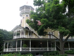 | Black Point | 1.0 miles | 1994 |
 | Bonnie Brae | 2.7 miles | 1986 |
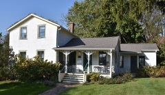 | Douglass-Stevenson House | 2.8 miles | 1986 |
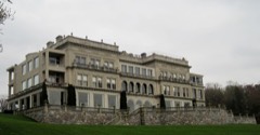 | Younglands | 5.2 miles | 1979 |
 | Fred B. Jones Estate | 5.3 miles | 1974 |
 | Riviera, The | 5.4 miles | 1986 |
| National Archives record | The nomination case file for reference 87000443 in Record Group 79. |
| Walworth County | All 50 listed properties in this county. |