BlockBefore
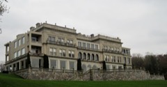
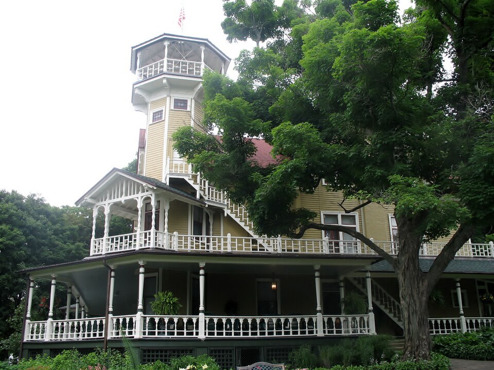
Photograph of Black Point
Photograph by The original uploader was Teemu08 at English Wikipedia, CC BY-SA 2.0. Via Wikimedia Commons.

Black Point

Listed on the National Register of Historic Places in 1994.

From the record

One of 50 National Register listings published here for Walworth County · listed in 1994 · category: Building.

Sources: the case file at the National Archives · the National Register database, National Park Service · the Wikipedia article
The listing

  • What is counted as historic. The nomination lists 1 building, 1 site as contributing to the listing.
  • Address. 580 S. Lake Shore Dr. (Pier 580), Linn, 53147
  • When was it listed? September 1994
  • Category. building
  • Town. Linn town
  • Architectural style. Queen Anne style
  • National Register reference number. 94001147 - the number the National Park Service assigned this property when it was listed, and the key its nomination file is catalogued under at the National Archives.

The ground it stands on

14,013 words

The chapter on Linn Town in History of Walworth County, Wisconsin, Containing an Account of Its Settlement, Growth, Development and Resources...its War Record, Biographical Sketches, Portraits of Prominent Men and Early Settlers; the Whole Preceded by a History of Wisconsin...and an Abstract of Its Laws and Constitution.., published 1882 names Linn. This is what it says, exactly as the scans read.

The town of Linn is designated in the Government survey as Town 1, Range 17 east. It is bounded, north by the town of Geneva ; east by Bloomfield ; south by the State line ; and west by the town of Walworth. It was formerly embraced in the town of Geneva, as established in 1838, which at that time took in the four townships making the south-east quarter of the county, viz.: Bloomfield, Hudson, Geneva and Linn. It was set off and incorporated as a town, under its present name, by act of the Territorial Legislature, January 23, 1844. It was named in honor of Senator Linn, an early patriotic statesman of Missouri.

Passage source: History of Walworth County, Wisconsin, Containing an Account of Its Settlement, Growth, Development and Resources...its War Record, Biographical Sketches, Portraits of Prominent Men and Early Settlers; the Whole Preceded by a History of Wisconsin...and an Abstract of Its Laws and Constitution.., published 1882.

The town was not thoroughly settled till later than other parts of the county, there being no village nucleus of population, except at Geneva, which being round the lake was not conveniently accessible. Further, much of the land was more heavily wooded, requiring more labor in clearing, and consequently not giving so speedy a return for the pioneers' first labors, as on the prairies and in the thin openings. Here and there, on favorable spots, the sturdy pioneers put in an early appearance, but Spring Prairie, Big Foot Prairie, and all along Sugar Creek, the government lands were well taken up by settlers before the woods of Linn were settled.

Passage source: History of Walworth County, Wisconsin, Containing an Account of Its Settlement, Growth, Development and Resources...its War Record, Biographical Sketches, Portraits of Prominent Men and Early Settlers; the Whole Preceded by a History of Wisconsin...and an Abstract of Its Laws and Constitution.., published 1882.

Machine-read from a century-old scan, so expect the errors a machine makes: misspelled names, dropped words, stray characters.

Read the whole chapter on Linn Town - 14,013 words on its settlement, mills, schools and churches.

Fires near this property

13 since 2012

Regional context, not property-specific evidence. The federal wildfire occurrence database lists 13 fires within 5 miles of Black Point between 2012 and 2020, burning about 80 acres in total. None started naturally. 1 was recorded as arson. Distance is straight-line from the map coordinates, so a fire counted here may appear on a neighbouring settlement's page as well.

Reported cause Fires
Missing data/not specified/undetermined6
Debris and open burning3
Equipment and vehicle use1
Smoking1
Arson/incendiarism1
Power generation/transmission/distribution1

The most recent of them, most recent first, with the day each was reported and the service that recorded it.

DateCause SizeReported by Name on the report
5 September 2020Missing data/not specified/undetermined1.0 acresWisconsin Department of Natural Resources20340
3 June 2018Missing data/not specified/undetermined1.0 acresWisconsin Department of Natural Resources222
8 May 2018Missing data/not specified/undeterminedunder an acreWisconsin Department of Natural Resources1800429
26 May 2018Smoking1.0 acresWisconsin Department of Natural Resources18-084
30 April 2018Missing data/not specified/undeterminedunder an acreWisconsin Department of Natural Resources1800394
21 April 2018Missing data/not specified/undeterminedunder an acreWisconsin Department of Natural Resources64
12 April 2018Debris and open burningunder an acreWisconsin Department of Natural Resources22
18 March 2018Debris and open burning30 acresWisconsin Department of Natural Resources55

Every fire recorded in Walworth County

Mines and quarries near this property

5 within 5 miles

Regional context, not property-specific evidence. The federal mineral resources record lists 5 workings within 5 miles of Black Point: 3 past producers, 2 producers. 2 still produce. What was taken out: Sand and Gravel, Construction. Distance is straight-line from the map coordinates, so a quarry counted here may appear on a neighbouring settlement's page as well.

Where SiteCommodity StatusRecorded
Casey PitSand and Gravel, ConstructionPast Producer
Devil's Hill PitSand and Gravel, ConstructionProducer
Mann Brothers, Inc.Sand and Gravel, ConstructionPast Producer
Stewart PitSand and Gravel, ConstructionPast Producer
Williams Bay PitSand and Gravel, ConstructionProducer

Every working recorded in Walworth County

Map coverage status

No historic map-sheet match is published for this property yet. That does not mean no map exists. This record needs a coordinate-quality review before it can be joined to a sheet boundary. Browse the county's mapped places while that work is pending.

Listed places nearby

6 within 8 miles

Other National Register properties close enough to walk or drive between, ordered by distance from this one. Both positions come from the same geocoding pass that matched these properties to their map sheets.

Photograph PropertyDistance Listed
Davidson Hall1.0 miles1987
Bonnie Brae1.7 miles1986
Douglass-Stevenson House3.6 miles1986
Younglands4.3 miles1979
Riviera, The4.4 miles1986
T. C. Smith House4.4 miles1982

Sources for this property

National Archives recordThe nomination case file for reference 94001147 in Record Group 79.
Wikipedia articleCommunity-written account of this property, licensed CC BY-SA.
Walworth CountyAll 50 listed properties in this county.

Provenance

  • Listing record. National Park Service National Register of Historic Places, listed-properties dataset, current to 2026-05-22.
  • Map join. Address geocoded through the United States Census geocoder, then tested against the published boundary of every sheet in the USGS Historical Topographic Map Collection.
  • How this page is made. Listing fields come from federal records; map-sheet coverage is a labelled coordinate-to-boundary calculation, not a source-field claim.
  • Wildfire. Short, Karen C. 2022. Spatial wildfire occurrence data for the United States, 1992-2020 [FPA_FOD_20221014]. 6th Edition. Fort Collins, CO: Forest Service Research Data Archive. https://doi.org/10.2737/RDS-2013-0009.6 Collected with United States Government funding and usable without additional permissions or fees.
  • Mines and quarries. USGS Mineral Resources Data System (MRDS) https://mrdata.usgs.gov/mrds/ A work of the United States government, no copyright under 17 U.S.C. 105.