 Block
From the record
16 National Register listings published here.
Sources: the county history on the Internet Archive · the National Register database, National Park Service
63 topographic sheets cover 19 settlements here, and 16 properties are on the National Register of Historic Places.
16 National Register listings published here.
Sources: the county history on the Internet Archive · the National Register database, National Park Service
Every property in this county listed on the National Register of Historic Places, with the year it was listed and the federal nomination document.
| Photograph | Property | Type | Listed | Reference |
|---|---|---|---|---|
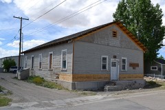 | American Legion Hall, Post 32 | building | 2014 | 14000386 |
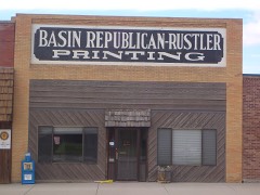 | Basin Republican-Rustler Printing Building | building | 1976 | 76001948 |
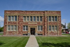 | Big Horn Academy Historic District | district | 1992 | 92000285 |
| Bridger Immigrant Road-Dry Creek Crossing | site | 1975 | 75001900 | |
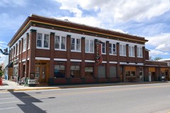 | Carey Block | building | 2009 | 09001110 |
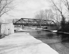 | EJE Bridge over Shell Creek | structure | 1985 | 85000415 |
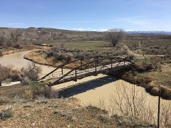 | EJP County Line Bridge | structure | 1985 | 85000412 |
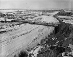 | EJZ Bridge over Shoshone River | structure | 1985 | 85000413 |
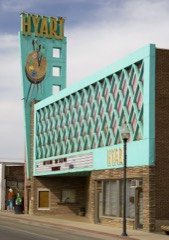 | Hyart Theater, The | building | 2009 | 08001304 |
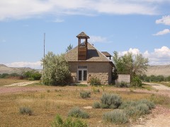 | Lower Shell School House | building | 1985 | 85000247 |
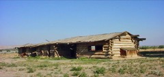 | M L Ranch | building | 1992 | 92000836 |
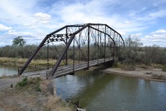 | Rairden Bridge | structure | 1985 | 85000414 |
| Schunk Lodge | district | 2018 | 100001955 | |
| Shell Community Hall | building | 2022 | 100007266 | |
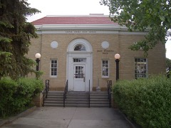 | US Post Office-Basin Main | building | 1987 | 87000779 |
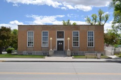 | US Post Office-Greybull Main | building | 1987 | 87000780 |
Every wildfire the federal occurrence database records inside this county: 612 of them, burning about 31,406 acres. 175 started naturally and 5 were recorded as arson. Each settlement page carries the fires within five miles of it.
| Reported cause | Fires |
|---|---|
| Missing data/not specified/undetermined | 200 |
| Natural | 175 |
| Debris and open burning | 97 |
| Recreation and ceremony | 62 |
| Equipment and vehicle use | 38 |
| Fireworks | 21 |
| Smoking | 6 |
| Arson/incendiarism | 5 |
| Power generation/transmission/distribution | 5 |
| Railroad operations and maintenance | 3 |
The five largest, by the area the report gives. None of them was recorded as arson.
| Date | Cause | Size | Reported by | Name on the report |
|---|---|---|---|---|
| 13 August 2007 | Natural | 13,450 acres | Bighorn National Forest | BONE CREEK |
| 15 August 2003 | Natural | 2,500 acres | Worland Field Office | COPPER |
| 28 August 2011 | Natural | 2,200 acres | Bighorn National Forest | RESERVIOR |
| 14 June 2018 | Natural | 1,994 acres | Worland Field Office | WEINTZ |
| 27 April 2013 | Debris and open burning | 1,509 acres | Cody Field Office | BIG FORK |
| 21 April 2016 | Missing data/not specified/undetermined | 863 acres | Cody Field Office | ML |
| 2 August 1996 | Debris and open burning | 718 acres | Worland Field Office | COLD SPR#2 |
| 19 July 2016 | Natural | 544 acres | Bighorn National Forest | ARDEN |
Every settlement page carries the fires within five miles of it - see the settlement index below.
The NOAA Storm Events Database holds 222 reports for this county, causing 1 death, 3 injuries and about $3,110,500 in recorded property damage. Each settlement page carries the reports that name it.
| Kind of event | Reports |
|---|---|
| Thunderstorm Wind | 87 |
| Hail | 62 |
| Tornado | 33 |
| Flood | 20 |
| Flash Flood | 10 |
| Funnel Cloud | 9 |
| Lightning | 1 |
The most serious of them, by death, then injury, then recorded damage. The accounts are quoted exactly as the forecast office filed them.
| When | Event | Place named | Harm | What the report says |
|---|---|---|---|---|
| June 1959 | Tornado (F2) | not stated | 1 killed, 1 hurt, $2,500 | no account filed |
| July 1978 | Tornado (F2) | not stated | 1 hurt, $250,000 | no account filed |
| August 2009 | Hail | Greybull | 1 hurt, $75,000 | Hailstones of golf ball size were numerous at a residence in Greybull. Some stones reached two inches in diameter. |
| March 2014 | Flood | Rairden | $500,000 | An ice jam caused flooding around the town of Manderson near the confluence of the Big Horn and Nowood rivers. The National Guard was called in to assist with sandbagging and other protective measures on March 9 and 10. |
| June 2011 | Flood | Hyattville | $440,000 | Medicine Lodge Creek rose rapidly during the early morning hours of Friday, June 24 as a result of snowmelt in the western Bighorn Mountains. The rising creek completely flooded the campground area and washed out portions of the main road at Medicine Lodge State Archaeological Site northeast of Hyattville. Water from the creek also ran down State Highway 31 which serves as Main Street in Hyattville. The basement of at least one home was inundated by flood waters from the creek. Officials dug a trench across the highway in Hyattville to relieve flood waters on the upstream side of the road. Flooding of agricultural land also occurred in areas between Hyattville and Manderson along the Nowood River and Medicine Lodge Creek. |
| July 2011 | Flood | Kane | $351,500 | Excessive snowmelt runoff caused flooding at Big Horn Lake. The lake elevation hovered about 15 feet above full pool at 3,655 feet. High water neared the level of the US Highway 14A causeway across the southern end of the lake. Wind gusts to 45 mph caused waves that eroded some of the embankment along the causeway and deposited debris onto the highway. On Friday night, July 22, the waves deposited enough debris to necessitate snowplows to come and clear the highway. County Road 20 along the west shore of the lake was inundated and sustained significant damage as a result of the prolonged period of high water. |
| June 2011 | Flood | Greybull | $300,000 | Shell Creek and its tributaries caused flooding in and around the community of Shell. The flooding was a result of continued snowmelt in the western Bighorn Mountains as the warmest temperatures of the season were attained. Damage was reported on the Kedesh Guest Ranch and a county road along Trappers Creek. |
| March 2014 | Flood | Greybull | $250,000 | Flooding of the Spence Oil Field and other areas north of Greybull occurred along the Big Horn River. Three homes outside the Greybull levee system had minor flooding. |
| June 2011 | Flood | Greybull | $150,000 | Flooding occurred on Shell, Horse, and Trapper creeks as snowmelt runoff increased. Lowland near the creeks and at least one guest ranch were impacted by the rising waters. No bridges were damaged by the high waters but several area roads were inundated and damaged. |
| June 2011 | Flood | Otto | $145,000 | Snowmelt waters traveled down the Greybull River and combined with heavy rain from thunderstorms to create lowland flooding along the river upstream of Greybull. Lane 40 1/2 and Road 5 southwest of Burlington were both inundated by water. The river tried to reroute itself in the vicinity of Road 5. This led county road and bridge employees to construct a new dike to protect one residence and a road. |
| June 1997 | Flash Flood | Basin | $91,000 | no account filed |
| May 2018 | Thunderstorm Wind | Manderson | $75,000 | A gust front developed ahead of a line of thunderstorms moving northward through the Bighorn Basin. Very strong winds developed along a line from Manderson northward to Greybull. At the Greybull airport, a wind gust of 78 mph was recorded before the power failed. In Basin. 15 to 20 trees were downed or uprooted, some falling on houses and power lines. In addition, a roof was blown off of a building and a power pole was snapped. In Greybull, numerous trees were uprooted. One tree fell on a house, causing some structural damage. Another tree was uprooted at a motel. |
| July 2011 | Flood | Otto | $50,000 | Flood waters along the Greybull River just upstream of Greybull were responsible for isolating at least two homes as water covered an entire field. The water also inundated low-lying areas along the west side of US Highway 16. The right-of-way fence along the highway was barely showing and nearby barrow pits were almost full. |
| June 2010 | Thunderstorm Wind | Basin | $50,000 | There was extensive thunderstorm wind damage in Basin. Most of the damage occurred south of Wyoming Avenue over the southern-quarter of the town. A large tree fell over onto the bed of a pickup, rendering it useless. Downed trees and limbs were responsible for roof damage and flying debris shattered both home and vehicle windows. |
| August 2007 | Thunderstorm Wind | Burlington | $50,000 | no account filed |
| June 2006 | Thunderstorm Wind | Lovell | $35,000 | no account filed |
| June 2021 | Thunderstorm Wind | Greybull Arpt | $25,000 | A wind gust of 79 mph was reported at the Greybull, Wyoming airport from a convective shower. The wind gust caused damage in Greybull, Wyoming, where a tree was uprooted, a roof and house under construction were damaged, and a camper was tipped over. |
| May 2013 | Flash Flood | Hyattville | $25,000 | Heavy rain from thunderstorms brought flash flooding to the Medicine Lodge State Archaeological Site. Debris covered the main road leading into the park in several spots, occasionally to a depth of one to two feet. At least six campsites in the park were damaged when normally dry arroyos to the east of the park swept water and debris across them before emptying into Medicine Lodge Creek. One camper was damaged as mud and rock flowed against its sides. Rainfall estimates ranged from 0.50 inches to 1.25 inches in about 30 minutes. |
| June 2011 | Flood | Hyattville | $25,000 | Medicine Lodge Creek overflowed its banks for the second time in a week causing damage at the Medicine Lodge State Archaeological Site. Much of the site was flooded as waters surged down the narrow creek. |
| June 2008 | Flash Flood | Greybull | $25,000 | A thunderstorm moving east along Dry Creek toward Greybull produced one to two inches of rain in Greybull in less than one hour. The town emergency manager reported a few rain gages in town measured slightly more than two inches of rain in 50 minutes. Pea sized hail of one inch in depth also occurred with the heavy rain. The Greybull storm drainage system was unable to keep up with the deluge of water and hail, flooding many prone areas around town. The heavy rain flooded portions of the Greybull River Road and several basements in town sustained damage. |
| June 1978 | Tornado (F1) | not stated | $25,000 | no account filed |
| June 1964 | Tornado | not stated | $25,000 | no account filed |
| June 1958 | Tornado (F2) | not stated | $25,000 | no account filed |
| September 1995 | Thunderstorm Wind | not stated | $15,000 | Thunderstorms moved from the Absarokas to the Big Horns. The storms produced strong winds and lightning, which knocked out power in the area for up to three and one-half hours east of Lovell. About 1,750 feet of line was downed by strong winds west of Lovell. Four inches of hail fell in Meeteetse and winds also felled a tree. |
| June 2006 | Hail | Lovell | $12,000 | no account filed |
| June 2006 | Hail | Lovell | $12,000 | no account filed |
| June 2010 | Thunderstorm Wind | Basin | $10,000 | Damage at a local ranch included a barn roof being ripped off with the remnants scattered across the property. The flying tin roof damaged a corral and injured one horse. Swathed hay that had not yet been baled was completely blown away amounting to a loss of about nine tons. |
| July 2024 | Flash Flood | Shell | $10,000 | no account filed |
| June 2015 | Flash Flood | Hyattville | $5,000 | Slow-moving showers and thunderstorms dropped heavy rain in a small drainage basin west of Medicine Lodge State Archaeological Site. Run-off in the basin fed a dry wash that brought water into the central portion of the park. The dry wash directed water into and around a newly refurbished small cabin that serves as a visitor center. There was minor damage to the park road. |
| June 2015 | Flood | Greybull | $5,000 | Minor flooding of the Greybull River occurred just south of Greybull near State Highway 789. The flooding occurred at the confluence of the Greybull River and the rain-swollen Big Horn River. Heavy rain of the previous week had filled the Big Horn River and the snowmelt run-off in the Greybull River began to back-up near the confluence. A small levee was reported to have collapsed upstream of the confluence causing further problems. Sandbags were deployed to prevent damage. Most of the flooding was confined to low-lying areas and little damage was reported. |
| July 2009 | Thunderstorm Wind | Hyattville | $5,000 | Several three-foot diameter Cottonwood trees were toppled at Medicine Lodge State Archaeological Site northeast of Hyattville. |
| June 2009 | Tornado (EF1) | Rairden | $5,000 | A tornado struck a ranch, including a home, east of Manderson. Three children were in the house at the time of the tornado. The tornado was about 100 feet wide and traveled approximately one-third mile from north-to-south, crossing State Highway 31 before dissipating. Several trees, two fences, and a wooden corral sustained considerable damage. An All-Terrain Vehicle (ATV) was lifted, spun 180 degrees, and moved about 15 feet. A bicycle was tossed onto the roof of the ranch home and several water bins were tossed about.||This landspout tornado occurred in a post-cold frontal environment. A cold front moved through Manderson around 0830MST on Monday leaving northwest wind of 30 to 40 mph in its wake. Solar heating continued to warm the surface while colder air streamed into the region aloft. This helped set the stage for an unstable atmosphere during the afternoon. A west-moving boundary from showers to the east of Manderson in the Bighorn Mountain foothills helped initiate the updraft that spawned the tornado. |
| October 2011 | Thunderstorm Wind | Byron | $3,000 | Two power poles were felled by a wind gust associated with outflow from a thunderstorm. |
| June 2010 | Thunderstorm Wind | Basin | $3,000 | A severe wind gust was measured on equipment located at a landfill about three miles north-northwest of Basin. Power lines and trees were also reported down in the area. |
| June 2009 | Thunderstorm Wind | Shell | $3,000 | Trees were downed across U.S. Highway 14 between mile markers 20 and 21 in Shell Canyon. |
| June 2009 | Thunderstorm Wind | Shell | $2,500 | Trees and power lines were reported down near Beaver Creek west of Shell. |
| May 1984 | Tornado (F0) | not stated | $2,500 | no account filed |
| July 1974 | Tornado (F1) | not stated | $2,500 | no account filed |
| June 1974 | Tornado (F1) | not stated | $2,500 | no account filed |
| June 1974 | Tornado (F1) | not stated | $2,500 | no account filed |
| July 1967 | Tornado (F2) | not stated | $2,500 | no account filed |
| June 1962 | Tornado (F2) | not stated | $2,500 | no account filed |
| July 1962 | Tornado (F2) | not stated | $2,500 | no account filed |
| July 1959 | Tornado | not stated | $2,500 | no account filed |
| May 2015 | Flash Flood | Hyattville | $2,000 | Heavy rain of one-half to one inch inundated dry washes and arroyos in and around Medicine Lodge State Archaeological Site. Water and mud flowing out of one small canyon caused damage to at least six campsites in the middle portion of the site. |
| August 2009 | Hail | Greybull | $2,000 | Hail estimated at two inches in diameter dented the hood of a traveling vehicle. Most of the stones were the size of a half dollar coin. |
| June 2009 | Thunderstorm Wind | Greybull | $1,500 | Thunderstorm wind gusts downed one large tree which blocked a road near the Greybull library. Also, newspaper stands were blown over in Greybull. |
| July 2016 | Thunderstorm Wind | Cowley Arpt | $1,000 | The AWOS at the Cowley Airport registered a peak wind gust of 67 mph just after 1500MST. Shortly thereafter, these winds struck Lovell where the local police reported downed power lines at 1515MST. |
| May 2014 | Thunderstorm Wind | Hyattville | $1,000 | Thunderstorm outflow toppled two large trees at Medicine Lodge State Archaeological Site. The falling trees damaged a fence and narrowly missed a small cabin on the property. |
| July 2009 | Thunderstorm Wind | Rairden | $1,000 | Estimated wind gusts of 60 to 70 mph partially uprooted a spruce tree and large tree limbs were brought down at a ranch east of Manderson. The wind also blew a swing 30-feet through the air and along the ground. |
| June 2009 | Thunderstorm Wind | Shell | $1,000 | A trained spotter along U.S. Highway 14 reported estimated winds around 70 mph and numerous branches blown off trees. |
| June 2009 | Thunderstorm Wind | Shell | $500 | Large branches were blown off trees west of Shell. |
| July 2025 | Thunderstorm Wind | Greybull Arpt | - | A 67 mph wind gust was reported at the Southern Big Horn County airport near Greybull. |
| June 2024 | Thunderstorm Wind | Greybull Arpt | - | The South Big Horn County airport reported a wind gust of 71 mph. |
| July 2024 | Thunderstorm Wind | Greybull Arpt | - | The South Big Horn airport had a wind gust of 59 mph. |
| July 2024 | Thunderstorm Wind | Greybull Arpt | - | The South Big Horn County airport near Greybull reported a wind gust of 59 mph. |
| July 2023 | Thunderstorm Wind | Greybull Arpt | - | A 59 mph wind gust was reported at the Greybull Airport. |
| July 2023 | Thunderstorm Wind | Greybull Arpt | - | The South Big Horn County airport had a 61 mph wind gust. |
| May 2023 | Hail | Greybull Arpt | - | A trained spotter reported quarter size hail to the northwest of Greybull. |
| May 2023 | Hail | Byron | - | A trained spotter reported half dollar size hail the southwest of Byron, WY. |
The Survey's mineral resources record lists 253 workings inside this county. 30 still produce and 223 are closed or unrecorded. Each settlement page carries the workings within five miles of it.
| Commodity | Workings |
|---|---|
| Uranium | 113 |
| Gypsum-Anhydrite | 63 |
| Bentonite | 36 |
| Sand and Gravel, Construction | 10 |
| Clay | 7 |
| Stone, Crushed/Broken | 6 |
| Pumice | 3 |
| Magnesite | 3 |
| Silica | 3 |
| Gold | 2 |
| Titanium-Heavy Minerals | 1 |
| Thorium, Zirconium, Iron | 1 |
| Zirconium, Titanium-Heavy Minerals, Thorium | 1 |
| Iron | 1 |
The least common of them first, because a county's hundredth gravel pit says nothing its first ten did not.
| Where | Site | Commodity | Status | Recorded |
|---|---|---|---|---|
| Cowley | Titanium-Heavy Minerals, Thorium, Zirconium, Iron | Occurrence | 1955 | |
| Lovell | Zirconium, Titanium-Heavy Minerals, Thorium, Iron | Occurrence | ||
| Porcupine Group | REE, Beryllium | Prospect | Monazite | |
| Soldier Creek Prospect | Potassium, Potash | Occurrence | ||
| Spanish Point Agate Mine | Semiprecious Gemstone | Prospect | ||
| Unknown | Fire Clay (Refractory) | Past Producer | ||
| Unknown | Lead | Occurrence | ||
| Bald Mountain Placer Claims | Gold | Prospect | ||
| Unknown | Gold | Prospect | ||
| Unknown | Pumice | Occurrence | ||
| Unknown | Magnesite | Occurrence | ||
| Unknown | Pumice | Occurrence | ||
| Unknown | Silica | Prospect | ||
| Unknown | Magnesite | Occurrence | ||
| Unknown | Silica | Prospect | ||
| Unknown | Pumice | Occurrence | ||
| Unknown | Silica | Past Producer | 1927 | |
| Unknown | Magnesite | Occurrence | ||
| Big Coulee | Stone, Crushed/Broken | Unknown | ||
| Five Springs Area | Stone, Crushed/Broken | Unknown | ||
| Little Sheep Mountain | Stone, Crushed/Broken | Prospect | ||
| North Emblem | Stone, Crushed/Broken | Unknown | ||
| Shell Creek Canyon | Stone, Crushed/Broken | Unknown | ||
| Sykes Mountain | Stone, Crushed/Broken | Unknown | ||
| American Colloid Co Mine | Clay | Producer | ||
| Dresser Industry Inc Mill | Clay | Producer | ||
| Lovell | Clay | Producer | ||
| Sage Creek Mill | Clay | Producer | ||
| Snake Mine | Clay | Past Producer | ||
| Stucco Mill | Clay | Producer | ||
| Unknown | Clay | Occurrence | ||
| Asay Pit Number One | Sand and Gravel, Construction | Unknown | ||
| Asay Pit Number Three | Sand and Gravel, Construction | Unknown | ||
| Big Horn Redi-Mix, Inc. | Sand and Gravel, Construction | Past Producer | ||
| Blm Pit | Sand and Gravel, Construction | Unknown | ||
| City Pit | Sand and Gravel, Construction | Unknown | ||
| Clark Pit | Sand and Gravel, Construction | Producer | ||
| Government Pit Number One | Sand and Gravel, Construction | Unknown | ||
| Sand and Gravel Nichols | Sand and Gravel, Construction | Past Producer | ||
| Shirran Pit | Sand and Gravel, Construction | Unknown | ||
| Valley Ranch | Sand and Gravel, Construction | Unknown | ||
| Bear Creek #1 | Bentonite | Unknown | ||
| Bear Creek #2 | Bentonite | Unknown | ||
| Beaver Hill Mines | Bentonite | Producer | ||
| Beaver Hill Mines | Bentonite | Producer | ||
| Big Horn River | Bentonite | Unknown | ||
| Big Horn River Area | Bentonite | Unknown | ||
| Bighorn Bentonite Co. Claims | Bentonite | Occurrence | ||
| Colony Plant Bentonite | Bentonite | Producer | ||
| Crystal | Bentonite | Unknown | ||
| Dresser Bentonite Mine | Bentonite | Producer | ||
| Dry Creek #2 | Bentonite | Occurrence | ||
| Dry Gulch | Bentonite | Unknown | ||
| Greybull | Bentonite | Unknown | ||
| Greybull Area #1 | Bentonite | Producer | ||
| Greybull Area #2 | Bentonite | Producer | ||
| Greybull Area #3 | Bentonite | Producer | ||
| Greybull Area #4 | Bentonite | Producer | ||
| Gypsum Creek Area | Bentonite | Past Producer | ||
| L.E.Collingwood Bent.Mine & Mill | Bentonite | Producer | ||
| Lovell Deposit #1 | Bentonite | Producer | ||
| Lovell Deposit #2 | Bentonite | Producer | ||
| Lovell Mines | Bentonite | Producer | ||
| North of Cowley | Bentonite | Past Producer | ||
| North-East of Greybull | Bentonite | Producer | ||
| Northwest of Greybull | Bentonite | Producer | ||
| Porter Gulch Area | Bentonite | Producer | ||
| Shell Canal | Bentonite | Unknown | ||
| Stucco Mines | Bentonite | Producer | ||
| Unknown | Bentonite | Occurrence | ||
| Unknown | Bentonite | Unknown | ||
| Unknown | Bentonite | Unknown | ||
| Unknown | Bentonite | Prospect | ||
| Unknown | Bentonite | Occurrence | ||
| Unknown | Bentonite | Occurrence | ||
| Unknown | Bentonite | Unknown | ||
| Wyo-Ben Products | Bentonite | Past Producer | ||
| Beaver Creek #1 | Gypsum-Anhydrite | Occurrence | ||
| Beaver Creek #2 | Gypsum-Anhydrite | Occurrence | ||
| Dry Creek #1 | Gypsum-Anhydrite | Occurrence | ||
| East Fork Mcdermotts Creek | Gypsum-Anhydrite | Occurrence | ||
| Greybull Stucco | Gypsum-Anhydrite | Past Producer | ||
| Gypsum Quarry #3 | Gypsum-Anhydrite | Past Producer | ||
| Gypsum Quarry #6 | Gypsum-Anhydrite | Producer | ||
| Gypsum Quarry No. 7 | Gypsum-Anhydrite | Past Producer | ||
| Himes Mill | Gypsum-Anhydrite | Producer | ||
| Horse Creek Canyon | Gypsum-Anhydrite | Unknown | ||
| Hyattville Area | Gypsum-Anhydrite | Occurrence | ||
| Little Sheep | Gypsum-Anhydrite | Occurrence | ||
| Little Sheep Mountain Anticline #1 | Gypsum-Anhydrite | Occurrence | ||
| Little Sheep Mountain Anticline #10 | Gypsum-Anhydrite | Producer | ||
| Little Sheep Mountain Anticline #11 | Gypsum-Anhydrite | Occurrence | ||
| Little Sheep Mountain Anticline #12 | Gypsum-Anhydrite | Occurrence | ||
| Little Sheep Mountain Anticline #13 | Gypsum-Anhydrite | Occurrence | ||
| Little Sheep Mountain Anticline #14 | Gypsum-Anhydrite | Occurrence | ||
| Little Sheep Mountain Anticline #15 | Gypsum-Anhydrite | Occurrence | ||
| Little Sheep Mountain Anticline #18 | Gypsum-Anhydrite | Occurrence | ||
| Little Sheep Mountain Anticline #19 | Gypsum-Anhydrite | Occurrence | ||
| Little Sheep Mountain Anticline #2 | Gypsum-Anhydrite | Occurrence | ||
| Little Sheep Mountain Anticline #20 | Gypsum-Anhydrite | Occurrence | ||
| Little Sheep Mountain Anticline #3 | Gypsum-Anhydrite | Occurrence | ||
| Little Sheep Mountain Anticline #4 | Gypsum-Anhydrite | Occurrence | ||
| Little Sheep Mountain Anticline #5 | Gypsum-Anhydrite | Occurrence | ||
| Little Sheep Mountain Anticline #6 | Gypsum-Anhydrite | Occurrence | ||
| Little Sheep Mountain Anticline #8 | Gypsum-Anhydrite | Occurrence | ||
| Little Sheep Mountain Anticline #9 | Gypsum-Anhydrite | Occurrence | ||
| Little Sheep Mountain Antilline No7 | Gypsum-Anhydrite | Occurrence | ||
| Lovell Mine | Gypsum-Anhydrite | Producer | ||
| Paintrock Area | Gypsum-Anhydrite | Unknown | ||
| Potato Ridge | Gypsum-Anhydrite | Occurrence | ||
| Sheep Mountain Anticline #1 | Gypsum-Anhydrite | Occurrence | ||
| Sheep Mountain Anticline #2 | Gypsum-Anhydrite | Occurrence | ||
| Tenseep Canyon | Gypsum-Anhydrite | Occurrence | ||
| Three Fork Canyon Area #1 | Gypsum-Anhydrite | Occurrence | ||
| Three Fork Canyon Area #2 | Gypsum-Anhydrite | Occurrence | ||
| Three Fork Canyon Area #4 | Gypsum-Anhydrite | Occurrence | ||
| Three Forks Canyon Area #3 | Gypsum-Anhydrite | Occurrence | ||
| Unknown | Gypsum-Anhydrite | Unknown | ||
| Unknown | Gypsum-Anhydrite | Past Producer | ||
| Unknown | Gypsum-Anhydrite | Occurrence | ||
| Unknown | Gypsum-Anhydrite | Occurrence | ||
| Unknown | Gypsum-Anhydrite | Prospect | ||
| Unknown | Gypsum-Anhydrite | Unknown | ||
| Unknown | Gypsum-Anhydrite | Past Producer | ||
| Unknown | Gypsum-Anhydrite | Occurrence | ||
| Unknown | Gypsum-Anhydrite | Unknown | ||
| Unknown | Gypsum-Anhydrite | Unknown | ||
| Unknown | Gypsum-Anhydrite | Prospect | ||
| Unknown | Gypsum-Anhydrite | Unknown | ||
| Unknown | Gypsum-Anhydrite | Unknown | ||
| Unknown | Gypsum-Anhydrite | Unknown | ||
| Unknown | Gypsum-Anhydrite | Unknown | ||
| Unknown | Gypsum-Anhydrite | Prospect | ||
| Unknown | Gypsum-Anhydrite | Unknown | ||
| Unknown | Gypsum-Anhydrite | Unknown | ||
| Unknown | Gypsum-Anhydrite | Occurrence | ||
| Unknown | Gypsum-Anhydrite | Unknown | ||
| Unknown | Gypsum-Anhydrite | Producer | ||
| Unknown | Gypsum-Anhydrite | Occurrence | ||
| Zeisman Ranch | Gypsum-Anhydrite | Unknown | ||
| Al Egbert | Uranium | Unknown | ||
| Amsden Property | Uranium | Prospect | ||
| Anomaly #1 | Uranium | Occurrence | ||
| Anomaly #4 | Uranium | Occurrence | ||
| Anomaly #4 | Uranium | Occurrence | ||
| Anomaly #6 | Uranium | Occurrence | ||
| Anomaly No 1 | Uranium | Unknown | ||
| Anomaly No. 3 | Uranium | Occurrence | ||
| Asay-Egbert Prospects | Uranium | Occurrence | ||
| Asay-Egbert Prospects | Uranium | Occurrence | ||
| Avery Claims | Uranium | Unknown | ||
| Beaver Creek | Uranium | Unknown | ||
| Big Hill Group | Uranium | Occurrence | ||
| Big Hill Group | Uranium | Occurrence | ||
| Big Hill Group | Uranium | Occurrence | ||
| Big Hill Group | Uranium | Occurrence | ||
| Big Hill Group | Uranium | Occurrence | ||
| Big Hill Group | Uranium | Unknown | ||
| Big Hill Group | Uranium | Occurrence | ||
| Burgess Claim | Uranium | Unknown | ||
| Burgess Claim | Uranium | Unknown | ||
| Cave Group | Uranium | Unknown | ||
| Claim Area | Uranium | Unknown | ||
| Crooked Creek Group | Uranium | Occurrence | ||
| Crooked Creek Group | Uranium | Prospect | ||
| Dirty Beast | Uranium | Prospect | ||
| Dry Creek Group No.1 | Uranium | Occurrence | ||
| Dry Creek Group No.2 | Uranium | Occurrence | ||
| Dry Creek Group No.3 | Uranium | Occurrence | ||
| Egbert | Uranium | Occurrence | ||
| End of Day & Sun Up Claims No.1 | Uranium | Prospect | ||
| End of Day & Sun Up Claims No.2 | Uranium | Prospect | ||
| End of Day & Sun Up Claims No.3 | Uranium | Prospect | ||
| End of Day & Sun Up Claims No.4 | Uranium | Prospect | ||
| Fuesner & Sons | Uranium | Past Producer | ||
| High Noon | Uranium | Past Producer | ||
| High Noon Claims | Uranium | Unknown | ||
| Horseshoe 9-10 | Uranium | Occurrence | ||
| Horseshoe Claims #9&10 | Uranium | Past Producer | ||
| Horseshoe Group | Uranium | Unknown | ||
| Jet 8 | Uranium | Past Producer | ||
| Jet Claims, Modern Claims | Uranium | Past Producer | Vein | |
| John Claim | Uranium | Unknown | ||
| Lisbon Mines | Uranium | Unknown | ||
| Little Mountain | Uranium | Past Producer | ||
| Little Mountain | Uranium | Past Producer | ||
| Lucky Strike | Uranium | Occurrence | ||
| Marvel Mine | Uranium | Occurrence | ||
| Marvel Mine | Uranium | Unknown | ||
| Mickey 2-10 | Uranium | Past Producer | ||
| Midnight | Uranium | Past Producer | ||
| Midnight | Uranium | Past Producer | ||
| Midnight | Uranium | Past Producer | ||
| Mike #10 | Uranium | Occurrence | Vein | |
| Mike #10 & Mickey #2-10 | Uranium | Past Producer | ||
| Mike 1-10 | Uranium | Past Producer | ||
| Mike 1-10 | Uranium | Past Producer | ||
| Mike Claims | Uranium | Occurrence | ||
| Morris Avery | Uranium | Occurrence | Sedimentary | |
| Mudstone Claims | Uranium | Unknown | ||
| Mudstone Claims | Uranium | Unknown | ||
| Mudstone Claims | Uranium | Unknown | ||
| Old Glory Hole | Uranium | Unknown | ||
| Reeves Ranch | Uranium | Occurrence | ||
| Reeves Ranch | Uranium | Unknown | ||
| Robertson Claim-No.1 | Uranium | Prospect | ||
| Robertson Claim-No.1 | Uranium | Prospect | ||
| Ryan Consolidated Claims | Uranium | Producer | Vein | |
| Sanguine #12 | Uranium | Unknown | ||
| Saunders Mine | Uranium | Unknown | ||
| Shell Creek Prospect | Uranium | Past Producer | ||
| Smith Property & Lucky Strike Claim | Uranium | Prospect | ||
| Smith-Pauleson | Uranium | Occurrence | Sedimentary | |
| Smith-Powleson Claim | Uranium | Occurrence | ||
| Sunup Group | Uranium | Occurrence | ||
| Super Cub Mine | Uranium | Past Producer | ||
| Titan Mine | Uranium | Unknown | ||
| Tri Pacer #4 | Uranium | Occurrence | ||
| Tri-Pacer #4 | Uranium | Past Producer | ||
| Tri-Pacer #5 | Uranium | Past Producer | ||
| Unknown | Uranium | Occurrence | ||
| Unknown | Uranium | Occurrence | ||
| Unknown | Uranium | Occurrence | Vein | |
| Unknown | Uranium | Occurrence | ||
| Unknown | Uranium | Occurrence | Tyuyamunite | |
| Unknown | Uranium | Occurrence | ||
| Unknown | Uranium | Occurrence | ||
| Unknown | Uranium | Occurrence | ||
| Unknown | Uranium | Past Producer | ||
| Unknown | Uranium | Unknown | ||
| Unknown | Uranium | Occurrence | ||
| Unknown | Uranium | Occurrence | ||
| Unknown | Uranium | Past Producer | ||
| Unknown | Uranium | Prospect | ||
| Unknown | Uranium | Unknown | ||
| Unknown | Uranium | Unknown | ||
| Unknown | Uranium | Occurrence | ||
| Unknown | Uranium | Unknown | ||
| Unknown | Uranium | Unknown | ||
| Unknown | Uranium | Unknown | ||
| Unknown | Uranium | Occurrence | ||
| Unknown | Uranium | Unknown | ||
| Unknown | Uranium | Unknown | ||
| Unknown | Uranium | Past Producer | ||
| Unknown | Uranium | Occurrence | ||
| Unknown | Uranium | Unknown | ||
| Unknown | Uranium | Occurrence | ||
| Unknown | Uranium | Producer | ||
| Western Bighorn Group | Uranium | Unknown | ||
| Whitehead Claims | Uranium | Occurrence | ||
| Wildcat Group | Uranium | Occurrence | ||
| Wildcat Group 9 Claims Staked | Uranium | Occurrence | ||
| Yellowtail Mine | Uranium | Producer |
The part of each published history that is about one town: 1 chapter, each reproduced complete.
| Town | Chapter | From | Length |
|---|---|---|---|
| Basin | Big Horn County, Wyoming : the Gem of the Rockies | Big Horn County, Wyoming : the Gem of the Rockies (1906) | 1,150 words |
Named settlements recorded in the Geographic Names Information System, each with the topographic sheets covering it. Villages, hamlets and abandoned places alike. Each is shown with the nearest named watercourse or landform and the survey quadrangle it falls on.
South Big Horn census division · 82410 · On Antelope Creek · Greybull South quadrangle
7 sheets, 1955 to 1982
North Big Horn census division · 82412 · On Coon Creek · Byron quadrangle
7 sheets, 1955 to 1980
North Big Horn census division · 82420 · On Big Wash · Cowley quadrangle
8 sheets, 1955 to 1980
Central Big Horn census division · 82422 · On Horse Creek · Emblem quadrangle
7 sheets, 1955 to 1980
Central Big Horn census division · 82426 · On Beaver Creek · Shell quadrangle
16 sheets, 1898 to 1993
Central Big Horn census division · 82426 · Near Tin Can Alley · Greybull South quadrangle
7 sheets, 1955 to 1982
South Big Horn census division · 82428 · On Medicine Lodge Creek · Hyattville quadrangle
9 sheets, 1955 to 1979
North Big Horn census division · 82431 · Near Katys Nipple · Kane quadrangle
8 sheets, 1955 to 1980
North Big Horn census division · 82431 · On Peterson Creek · Lovell quadrangle
9 sheets, 1955 to 1980
South Big Horn census division · 82432 · Near Schoolhouse Gulch · Manderson quadrangle
9 sheets, 1955 to 1979
South Big Horn census division · On Willow Creek · Brokenback Narrows quadrangle
18 sheets, 1899 to 1993
South Big Horn census division · Near Dead Indian Hill · Dead Indian Hill quadrangle
7 sheets, 1951 to 1982
South Big Horn census division · 82441 · On Horse Creek · Shell quadrangle
16 sheets, 1898 to 1993