 Block
Grand Bay, Alabama
22 topographic sheets cover this place, the earliest surveyed in 1921 and the latest in 1984. It stands in the Grand Bay census division. It lies in ZIP code area 36541. The Survey maps it on the Grand Bay quadrangle. 3,460 people lived here at the 2020 count. It stands 82 feet above sea level.
On record in Grand Bay
Buildings and businesses the archive holds for this place. Each opens its own page, with the source record it came from.
On the National Register 1 record
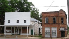 Grand Bay Historic Districtlisted 1990
Population over time
2 figuresGrand Bay fell from 3,672 to 3,460 between 2010 and 2020. These are the recorded population figures Wikidata holds for this place, reached through the Geographic Names Information System number this page is keyed on rather than by name, so they belong to this place and not to another of the same name. Most are census counts, but not all are: an early figure may be a founding or settlement estimate, and an estimate published within five years of a census is left out. The change column is computed, and is left blank where more than 20 years separate a figure from the one before it, because a gap that long is not a change between two counts.
| Year | People | Change |
|---|---|---|
| 2010 | 3,672 | |
| 2020 | 3,460 | -212 (-6%) |
Topographic sheets covering this place
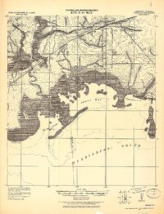
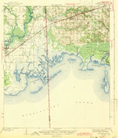
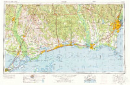
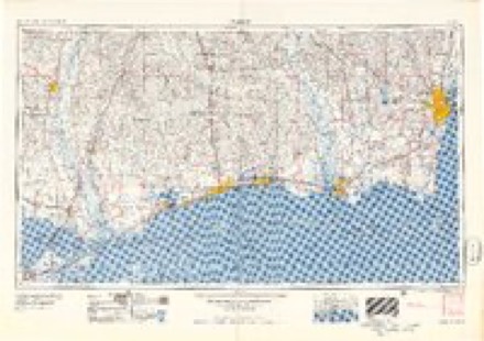
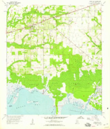
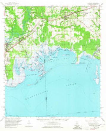
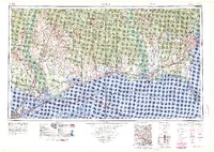
11 surveys from 22 printed sheetsMatched by testing this settlement's coordinate against the published boundary of every sheet in the United States Geological Survey's historical collection. Each opens the scanned sheet at the Survey.
- 1921 USGS Grand Bay quadrangle1:62500
- 1943 USGS Grand Bay quadrangle1:62500, 2 printings
- 1953 USGS Mobile quadrangle1:250000, 3 printings
- 1957 USGS Mobile quadrangle1:250000, 3 printings
- 1958 USGS Grand Bay quadrangle1:24000, 3 printings
- 1958 USGS Grand Bay quadrangle1:62500, 2 printings
- 1960 USGS Mobile quadrangle1:250000
- 1963 USGS Mobile quadrangle1:250000
- 1965 USGS Mobile quadrangle1:250000
- 1982 USGS Biloxi quadrangle1:100000, 2 printings
- 1984 USGS Mobile quadrangle1:250000, 3 printings
Fires near this place
648 since 1992Regional context, not property-specific evidence. The federal wildfire occurrence database lists 648 fires within 5 miles of Grand Bay between 1992 and 2019, burning about 10,157 acres in total. 4 started naturally. 306 were recorded as arson. Distance is straight-line from the map coordinates, so a fire counted here may appear on a neighbouring settlement's page as well.
| Reported cause | Fires |
|---|---|
| Arson/incendiarism | 306 |
| Debris and open burning | 185 |
| Missing data/not specified/undetermined | 106 |
| Recreation and ceremony | 30 |
| Equipment and vehicle use | 12 |
| Natural | 4 |
| Railroad operations and maintenance | 3 |
| Smoking | 2 |
The most recent of them, most recent first, with the day each was reported and the service that recorded it.
| Date | Cause | Size | Reported by | Name on the report |
|---|---|---|---|---|
| 9 September 2016 | Arson/incendiarism | 20 acres | Alabama Forestry Commission | 20160909-16 |
| 8 September 2004 | Debris and open burning | 20 acres | Alabama Forestry Commission | not named |
| 6 September 2005 | Arson/incendiarism | 3.0 acres | Alabama Forestry Commission | not named |
| 30 September 2008 | Arson/incendiarism | 3.0 acres | Alabama Forestry Commission | not named |
| 30 September 2001 | Arson/incendiarism | 40 acres | Alabama Forestry Commission | not named |
| 30 September 1997 | Arson/incendiarism | 2.0 acres | Alabama Forestry Commission | not named |
| 30 September 1995 | Missing data/not specified/undetermined | under an acre | Alabama Forestry Commission | not named |
| 24 September 1994 | Debris and open burning | 5.0 acres | Alabama Forestry Commission | not named |
Settlements close enough to share some of these fires:
Mines and quarries near this place
10 of 11 shownRegional context, not property-specific evidence. The federal mineral resources record lists 11 workings within 5 miles of Grand Bay: 7 producers, 4 past producers. 7 still produce. What was taken out: Sand and Gravel, Construction, Silica, Clay, Sand and Gravel, Construction, Clay. Distance is straight-line from the map coordinates, so a quarry counted here may appear on a neighbouring settlement's page as well.
| Where | Site | Commodity | Status | Recorded |
|---|---|---|---|---|
| Mcconnell Quarry | Sand and Gravel, Construction, Clay | Producer | Unconsolidated Sediments | |
| Whitehead Pit | Clay | Past Producer | ||
| Grand Bay Quarry | Silica | Producer | Unconsolidated Sediments | |
| Mallette Brothers Number 1 Pit | Silica | Producer | Unconsolidated Sediments | |
| Grand Bay Quarry | Sand and Gravel, Construction | Producer | Quartz | |
| H & J Sand Co. Pit | Sand and Gravel, Construction | Producer | ||
| Joe Moore Pit | Sand and Gravel, Construction | Past Producer | ||
| Mcconnell and Moore Pit | Sand and Gravel, Construction | Past Producer | ||
| Mobile Sand Pit | Sand and Gravel, Construction | Producer | ||
| Nicholson Pit | Sand and Gravel, Construction | Past Producer |
Storms near this place
39 since 1995Regional context, not property-specific evidence. The National Weather Service names Grand Bay in 39 storm reports between 1995 and 2026: 13 thunderstorm wind, 11 flash flood, 8 hail, 4 tornado. No death or injury is recorded in these reports. Each account below is quoted exactly as the forecast office filed it, from the NOAA Storm Events Database, and each date opens the federal record of that event.
| When | Event | Place named | Harm | What the report says |
|---|---|---|---|---|
| August 2006 | Thunderstorm Wind | Grand Bay | $45,000 | High winds from a thunderstorm blew the roofs off of two portable buildings at a school in Grand Bay. Trees were also blown down and nickel size hail was also reported in the area. No students were in the portables when their roofs were blown off. |
| October 2017 | Flash Flood | Grand Bay | $30,000 | Heavy rain caused multiple roads and businesses to flood around southern Mobile county. |
| December 2015 | Flash Flood | Grand Bay | $30,000 | Four to six inches of rain fell in a short time over central and southern Mobile County. This resulted in flooding across numerous areas and numerous road closures. Grand Bay Fire Department conducted a water rescue at Highway 188 and Ferland Road. Another water rescue was conducted on Golf Way Drive in Prichard. Water was reported in a home on Kent Street in Mobile. |
| March 2011 | Thunderstorm Wind | Grand Bay | $20,000 | Winds estimated at 80 mph destroyed a barn and downed multiple trees and power lines. A double wide mobile home was also blown off its foundation along Fred Freedland Road. |
| April 2008 | Flash Flood | Grand Bay | $15,000 | no account filed |
| June 2001 | Thunderstorm Wind | Grand Bay | $8,000 | High winds from a thunderstorm blew trees and power lines down near Grand Bay. |
| May 2016 | Thunderstorm Wind | Grand Bay | $5,000 | A severe thundestorm wind gusts downed a power pole on Fort Lake Road. |
| December 2015 | Thunderstorm Wind | Grand Bay | $5,000 | Thunderstorm wind gusts around 60 mph downed trees across the road at Fort Lake Rd and Gaston Loop Rd. |
| February 2012 | Thunderstorm Wind | Grand Bay | $3,000 | Winds estimated at 60 mph downed a few trees. |
| April 2015 | Thunderstorm Wind | Grand Bay | $1,000 | Severe thunderstorm winds blew down a large tree at the intersection of Grandy Bay-Wilmer Rd and Interstate 10. |
| March 2026 | Tornado (EF0) | Grand Bay | - | Available high resolution satellite imagery was able to reveal an|EF0 tornado tracked north of Interstate 10 near Grand Bay. The|tornado began north of Pascagoula Road solely in forest causing|minor tree damage. While there is a gap in visible damage on|satellite imagery, radar tornado debris signature persists east|connecting with another small corridor of tree damage near Ramsey|Road and Boe Road. This is where the end point of the tornado is|estimated as any visible damage associated with the radar|signature disappears after reaching I-10. |
| July 2025 | Thunderstorm Wind | Grand Bay | - | High winds downed powerlines at Grand Bay Wilmer Road and Warren Creek Road. |
| December 2024 | Tornado (EF1) | Grand Bay | - | An EF1 tornado began south of Dees in Mobile County west of Grand|Bay Wilmer Road. A radar indicated tornado debris signature began|in the adjacent forest, tracking northeast across Grand Bay Wilmer|Road. As it crossed the road, multiple pine trees were snapped|midway up the trunk along with a couple smaller pine tree snaps|near the base of the trunk. One tree had fallen across power|lines and brought them down. The smaller snaps to the south were|likely thanks to the supercells RFD with the primary damage being|near the bridge here. The tornado weakened somewhat as it|continued northeast across Balford and Ballard Roads. Here some|metal roofing material was tossed to the west with multiple large|tree limbs broken. The tornado then continued northeast across Ben|Hamilton Road impacting a pond north of the road. This pond had|multiple trees that were uprooted with a tree snapped low. The|tornado went through a majority of forest and open fields between|Ben Hamilton Road and Dawes Road, additionally impacting a|neighborhood with most notable damage being along the intersection|of Southern Oaks Trail and Dawes Road. Damage was mostly|comprised of large tree limbs broken off and minor roofing damage|to homes. There were additional reports of sheds flipped|over/moved and a piece of metal breaking a window of one of the|homes. |
| June 2023 | Flash Flood | Grand Bay | - | Water was covering the road on Henderson Camp Road at Oakdale Avenue. |
| June 2023 | Flash Flood | Grand Bay | - | A portion of AL 188 at Oakdale was impassable due to water overflowing the roadway. |
| June 2023 | Heavy Rain | Grand Bay | - | A total of 3.22 inches of rain was recorded over a 6 hour period at Mesonet Station USA3 in Grand Bay, AL. |
| May 2022 | Thunderstorm Wind | Grand Bay | - | High winds knocked over semi-trucks and rolled an RV at an RV park. |
| August 2022 | Flash Flood | Grand Bay | - | Multiple flooded roads reported in Grand Bay. |
| March 2022 | Thunderstorm Wind | Grand Bay | - | An NWS damage survey found a couple of snapped large branches with a few snapped or uprooted softwood trees. A couple out buildings with most of their roofs removed and a manufactured home with minor roof damage. Winds were estimated to be 75 mph and time was estimated by radar. |
| May 2019 | Thunderstorm Wind | Grand Bay | - | High winds downed power lines on Ramsey Road near the railroad crossing. |
| July 2019 | Heavy Rain | Grand Bay | - | Total rainfall of 4.65 inches. |
| June 2017 | Flash Flood | Grand Bay | - | A vehicle stalled in high water on Argyle Road just south of Tom Waller Road. |
| October 2017 | Flash Flood | Grand Bay | - | Heavy rains caused fast flowing water over Potter Tract Road just south of Saeger Road. |
| March 2016 | Heavy Rain | Grand Bay | - | Storm Total of 2.98 inches through 11 am. |
| April 2014 | Flash Flood | Grand Bay | - | Shell belt Road remains closed due to flooding. |
| March 2011 | Tornado (EF1) | Grand Bay | - | The tornado touched down just south of County Road 33 along Fred Freeland Road. The tornado widened to about 80 yards wide, destroying a horse barn, moving a double wide mobile home off its foundation, snapping several pine trees and bringing down power lines. |
| March 2009 | Flash Flood | Grand Bay | - | Heavy Rains produced flooding along I-10 in Grand Bay. |
| February 2007 | Hail | Grand Bay | - | A severe thunderstorm produced penny sized hail in Grand Bay. |
| September 2000 | Hail | Grand Bay | - | A thunderstorm produced nickel sized hail in the community. |
| May 1999 | Hail | Grand Bay | - | Nickel size hail was reported just to the west of St. Elmo Airport near Grand Bay. |
| May 1995 | Tornado (F0) | Grand Bay | - | A tornado was reported near the eleven mile marker two miles north of Grand Bay. No damage was reported from the tornado. |
| July 2025 | Hail | Grand Bay | - | no account filed |
| June 2023 | Hail | Grand Bay | - | no account filed |
| June 2011 | Hail | Grand Bay | - | no account filed |
| August 2011 | Thunderstorm Wind | Grand Bay | - | no account filed |
| May 2008 | Flash Flood | Grand Bay | - | no account filed |
| July 2008 | Thunderstorm Wind | Grand Bay | - | no account filed |
| May 2003 | Hail | Grand Bay | - | no account filed |
| January 1997 | Hail | Grand Bay | - | no account filed |
Nearest settlements
The eight closest, with where each one stands in the county. Distances are straight-line, computed from the Geographic Names Information System coordinates.
| Map | Place | Distance | Sheets |
|---|---|---|---|
| Pinecrest | 0.9 miles | 22 | |
| Fernland | 2.6 miles | 22 | |
| Cloverdale | 3.0 miles | 21 | |
| Saint Elmo | 5.0 miles | 23 | |
| Dixon Corner | 5.6 miles | 24 | |
| Dees | 6.1 miles | 23 | |
| Irvington | 6.1 miles | 33 | |
| Union Church | 6.2 miles | 23 |
Elsewhere
Matched on this settlement's Geographic Names Information System number rather than its name, so it cannot be a different place of the same name in another state.
| Wikipedia article on Grand Bay | An encyclopaedic summary. Its text is share-alike, so it is linked here rather than copied. |
| Wikidata item Q1274917 | The structured record the population and elevation above come from. Public domain (CC0). |
Provenance
This settlement is recorded in the Geographic Names Information System as feature 155081. The sheet list is computed by point-in-boundary test against the United States Geological Survey's historical topographic inventory. Both are works of the United States government and carry no copyright under 17 U.S.C. 105.
Wildfire. Short, Karen C. 2022. Spatial wildfire occurrence data for the United States, 1992-2020 [FPA_FOD_20221014]. 6th Edition. Fort Collins, CO: Forest Service Research Data Archive. https://doi.org/10.2737/RDS-2013-0009.6 Collected with United States Government funding and usable without additional permissions or fees.
Mines and quarries. USGS Mineral Resources Data System (MRDS) https://mrdata.usgs.gov/mrds/ A work of the United States government, no copyright under 17 U.S.C. 105.
Storms. NOAA National Centers for Environmental Information, Storm Events Database https://www.ncei.noaa.gov/stormevents/ A work of the United States government, no copyright under 17 U.S.C. 105. Narratives are quoted verbatim from the National Weather Service report and are not edited or summarised.