 Block
Shottsville, Alabama
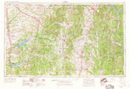
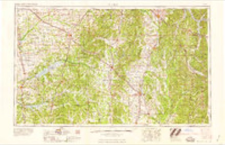
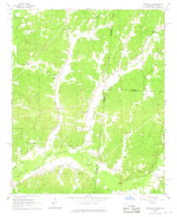
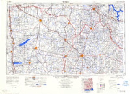
8 topographic sheets cover this place, the earliest surveyed in 1956 and the latest in 1984. It stands in the Bexar census division. It lies in ZIP code area 35593. It stands on Little Creek. The Survey maps it on the Shottsville quadrangle. It stands 489 feet above sea level.
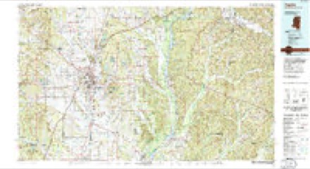
Topographic sheets covering this place
5 surveys from 8 printed sheetsMatched by testing this settlement's coordinate against the published boundary of every sheet in the United States Geological Survey's historical collection. Each opens the scanned sheet at the Survey.
- 1956 USGS Tupelo quadrangle1:250000, 2 printings
- 1958 USGS Tupelo quadrangle1:250000
- 1967 USGS Shottsville quadrangle1:24000
- 1984 USGS Tupelo quadrangle1:250000, 3 printings
- 1984 USGS Tupelo quadrangle1:100000
Fires near this place
195 since 1992Regional context, not property-specific evidence. The federal wildfire occurrence database lists 195 fires within 5 miles of Shottsville between 1992 and 2020, burning about 3,373 acres in total. None started naturally. 134 were recorded as arson. Distance is straight-line from the map coordinates, so a fire counted here may appear on a neighbouring settlement's page as well.
| Reported cause | Fires |
|---|---|
| Arson/incendiarism | 134 |
| Debris and open burning | 34 |
| Missing data/not specified/undetermined | 21 |
| Smoking | 3 |
| Power generation/transmission/distribution | 1 |
| Misuse of fire by a minor | 1 |
| Recreation and ceremony | 1 |
The most recent of them, most recent first, with the day each was reported and the service that recorded it.
| Date | Cause | Size | Reported by | Name on the report |
|---|---|---|---|---|
| 8 September 1999 | Arson/incendiarism | under an acre | Alabama Forestry Commission | not named |
| 8 September 1999 | Arson/incendiarism | 2.0 acres | Alabama Forestry Commission | not named |
| 7 September 1998 | Debris and open burning | 3.3 acres | Alabama Forestry Commission | not named |
| 6 September 2014 | Arson/incendiarism | 2.0 acres | Alabama Forestry Commission | NOR-20140906-001 |
| 6 September 1999 | Arson/incendiarism | 8.0 acres | Alabama Forestry Commission | not named |
| 6 September 1999 | Arson/incendiarism | 5.0 acres | Alabama Forestry Commission | not named |
| 4 September 2010 | Arson/incendiarism | under an acre | Alabama Forestry Commission | not named |
| 30 September 1998 | Arson/incendiarism | 10 acres | Alabama Forestry Commission | not named |
Settlements close enough to share some of these fires:
Mines and quarries near this place
7 within 5 milesRegional context, not property-specific evidence. The federal mineral resources record lists 7 workings within 5 miles of Shottsville: 6 producers, 1 past producer. 6 still produce. What was taken out: Sand and Gravel, Construction. Distance is straight-line from the map coordinates, so a quarry counted here may appear on a neighbouring settlement's page as well.
| Where | Site | Commodity | Status | Recorded |
|---|---|---|---|---|
| Gann Pit | Sand and Gravel, Construction | Past Producer | ||
| Hargett Pit | Sand and Gravel, Construction | Producer | ||
| Plant #109 | Sand and Gravel, Construction | Producer | ||
| Robinson Mine & Mill | Sand and Gravel, Construction | Producer | ||
| Terrell Pit | Sand and Gravel, Construction | Producer | ||
| Thornton Pit | Sand and Gravel, Construction | Producer | ||
| Tremont Pit | Sand and Gravel, Construction | Producer |
Storms near this place
28 since 2003Regional context, not property-specific evidence. The National Weather Service names Shottsville in 28 storm reports between 2003 and 2025: 17 thunderstorm wind, 5 hail, 3 tornado, 2 flash flood. No death or injury is recorded in these reports. Each account below is quoted exactly as the forecast office filed it, from the NOAA Storm Events Database, and each date opens the federal record of that event.
| When | Event | Place named | Harm | What the report says |
|---|---|---|---|---|
| May 2008 | Tornado (EF1) | Shottsville | $100,000 | The tornado spun up very quickly about 2.5 miles southwest of the Shottsville Community along County Road 13, between Reedy Branch Road and CR-154. The tornado then tracked just south of due east for almost the entire length of Marion County, with a slight left turn noted near the middle of the path. The tornado crossed CR-11, SR-19, SR-187, US-43, and SR-253, before lifting along CR-34. The tornado remained mostly in a heavily forested area, and thousands of trees were either snapped off or uprooted. Several mobile homes and one carport sustained varying degrees of damage along the path. |
| February 2011 | Thunderstorm Wind | Shottsville | $15,000 | Two homes near County Road 19 suffered roof damage. |
| April 2011 | Thunderstorm Wind | Shottsville | $15,000 | Trees were knocked down across the county as a squall line moved through the area. |
| April 2009 | Thunderstorm Wind | Shottsville | $5,000 | Several trees were blown down on CR-13, near AL-19. An old store had its walls blown down. |
| April 2011 | Thunderstorm Wind | Shottsville | $2,000 | A few trees were blown down along Highway 19 near the Franklin County line. |
| May 2003 | Thunderstorm Wind | Shottsville | $2,000 | Trees were blown down near SR 19 in northern Marion County. |
| May 2025 | Thunderstorm Wind | Shottsville | - | Trees were downed along County Road 157 and Highway 19. |
| July 2024 | Flash Flood | Shottsville | - | A few roads were flooded and temporarily impassable in Hamilton and parts of northwestern Marion County, including Academy Dr. |
| March 2023 | Tornado (EF1) | Shottsville | - | National Weather Service meteorologists surveyed damage in northwest Marion County and determined that it was consistent with an EF1 tornado, with maximum winds near 90 mph. The tornado began near the Shottsville Community Church along County Road 56, where it produced minor damage to the exterior of the church building. The tornado tracked east northeast before reaching Reid Road where a higher degree of damage was first noted. There were multiple uprooted softwood trees in a broad area stretching from Reid Road to Highway 19. There was also a home on Reid Road which sustained damage to its metal roof, and a large tree fell on top of a barn in the backyard. While the degree of surrounding tree damage was noteworthy, several homes within the path on Highway 19 were undamaged. The tornado continued east-northeast uprooting several softwood trees along Triplett Road and producing a more concentrated area of uprooted and snapped softwood trees along County Road 317.|The tornado reached Nichols Cemetery Road where it appeared to be weakening as the damage mostly consisted of broken large branches. However, upon reaching County Road 178, the tornado uprooted several softwood trees before lifting shortly thereafter in a wooded area east of County Road 178. |
| June 2022 | Thunderstorm Wind | Shottsville | - | Several trees uprooted along Highway 19. |
| June 2022 | Thunderstorm Wind | Shottsville | - | Numerous trees uprooted in Shottsville. |
| February 2020 | Flash Flood | Shottsville | - | Several roads flooded and impassable in the city of Hamilton. |
| April 2020 | Thunderstorm Wind | Shottsville | - | Several trees uprooted near County Roads 19 and across the entire county. |
| February 2019 | Flood | Shottsville | - | Heavy rainfall over a several day period led to many creeks to overflow their banks, including Bull Mountain Creek. |
| April 2019 | Tornado (EF1) | Shottsville | - | National Weather Service meteorologists surveyed damage in Marion County and determined that it was consistent with an EF1 tornado, with maximum sustained winds near 90 mph. The tornado touched down just southeast of the intersection of County Road 13 and Grant Road. It rapidly intensified as it tracked northward and crossed County Road 13, where it uprooted dozens of pine trees and a few hardwoods. The tin was partially torn off a small barn and was deposited to the west of the path. Just as quickly as the tornado intensified, it dissipated just north of County Road 13 before reaching County Road 56. |
| April 2018 | Thunderstorm Wind | Shottsville | - | Several trees uprooted in the Shottsville Community near the intersection of County Road 126 and Colburn Road. |
| March 2017 | Hail | Shottsville | - | Golf ball size hail near County Road 87. |
| April 2015 | Thunderstorm Wind | Shottsville | - | Several trees uprooted in the town of Shottsville. |
| April 2015 | Thunderstorm Wind | Shottsville | - | A few trees uprooted and a shed was damaged in northwest Marion County. |
| April 2015 | Thunderstorm Wind | Shottsville | - | Numerous trees uprooted on Single Springs Church Road. |
| October 2014 | Thunderstorm Wind | Shottsville | - | Several trees uprooted along Highway 11 south of the town of Shottsville. |
| June 2014 | Thunderstorm Wind | Shottsville | - | A mobile home was overturned off County Road 150. |
| February 2014 | Thunderstorm Wind | Shottsville | - | Several trees were blown down along Alabama Highway 19 near the Franklin county line. |
| February 2014 | Thunderstorm Wind | Shottsville | - | A large pine was blown down across Highway 19 near the intersection of County Road 13. |
| June 2022 | Hail | Shottsville | - | no account filed |
| June 2014 | Hail | Shottsville | - | no account filed |
| March 2011 | Hail | Shottsville | - | no account filed |
| April 2011 | Hail | Shottsville | - | no account filed |
Nearest settlements
The eight closest, with where each one stands in the county. Distances are straight-line, computed from the Geographic Names Information System coordinates.
| Map | Place | Distance | Sheets |
|---|---|---|---|
| Bexar | 4.9 miles | 8 | |
| Weston | 8.6 miles | 9 | |
| Barnesville | 8.8 miles | 9 | |
| Pleasant Ridge | 9.5 miles | 10 | |
| Hamilton | 11.0 miles | 10 | |
| Pigeye | 11.1 miles | 12 | |
| Byrd | 12.5 miles | 10 | |
| Fulton Bridge | 13.4 miles | 8 |
Elsewhere
Matched on this settlement's Geographic Names Information System number rather than its name, so it cannot be a different place of the same name in another state.
| Wikipedia article on Shottsville | An encyclopaedic summary. Its text is share-alike, so it is linked here rather than copied. |
| Wikidata item Q22058555 | The structured record the population and elevation above come from. Public domain (CC0). |
Provenance
This settlement is recorded in the Geographic Names Information System as feature 126823. The sheet list is computed by point-in-boundary test against the United States Geological Survey's historical topographic inventory. Both are works of the United States government and carry no copyright under 17 U.S.C. 105.
Wildfire. Short, Karen C. 2022. Spatial wildfire occurrence data for the United States, 1992-2020 [FPA_FOD_20221014]. 6th Edition. Fort Collins, CO: Forest Service Research Data Archive. https://doi.org/10.2737/RDS-2013-0009.6 Collected with United States Government funding and usable without additional permissions or fees.
Mines and quarries. USGS Mineral Resources Data System (MRDS) https://mrdata.usgs.gov/mrds/ A work of the United States government, no copyright under 17 U.S.C. 105.
Storms. NOAA National Centers for Environmental Information, Storm Events Database https://www.ncei.noaa.gov/stormevents/ A work of the United States government, no copyright under 17 U.S.C. 105. Narratives are quoted verbatim from the National Weather Service report and are not edited or summarised.