 Block
From the record
21 National Register listings published here.
Sources: the National Register database, National Park Service
36 topographic sheets cover 51 settlements here, and 21 properties are on the National Register of Historic Places.
21 National Register listings published here.
Sources: the National Register database, National Park Service
Every property in this county listed on the National Register of Historic Places, with the year it was listed and the federal nomination document.
| Photograph | Property | Type | Listed | Reference |
|---|---|---|---|---|
 | Elliott and Anna Barham House | building | 2004 | 03001453 |
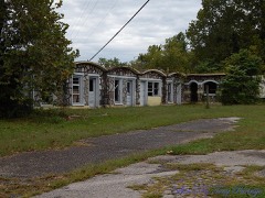 | Bear Creek Motel | building | 2001 | 01000175 |
| Bergman High School | building | 1992 | 92001203 | |
 | Boone County Courthouse | building | 1976 | 76000387 |
| Boone County Jail | building | 1976 | 76000388 | |
| Carrollton Road-Carrollton Segment | structure | 2008 | 08000432 | |
| Cottonwood School #45 | building | 2002 | 02001078 | |
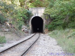 | Cricket and Crest Tunnels Historic District | district | 2007 | 07000954 |
 | Duncan House | building | 2005 | 05001065 |
 | Evans-Kirby House | building | 2005 | 04001505 |
 | Everton School | building | 1992 | 92001205 |
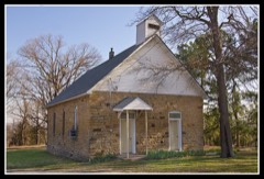 | Grubb Springs School | building | 1996 | 96000329 |
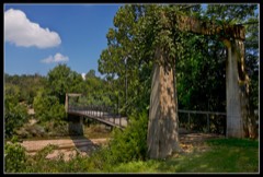 | Haggard Ford Swinging Bridge | structure | 1995 | 95000790 |
 | Harrison Courthouse Square Historic District | district | 1999 | 99000523 |
 | Harrison High School | building | 2007 | 06001284 |
 | Hotel Seville | building | 1994 | 94000443 |
| Missouri and North Arkansas Depot-Bellefonte | building | 1992 | 92000601 | |
| Rose Hill Cemetery | site | 2025 | 100011832 | |
| Twelve Oaks | building | 2010 | 09001237 | |
| Valley Springs School | building | 1992 | 92001204 | |
| Zinc Swinging Bridge-BO0162 | structure | 2007 | 06001286 |
Every wildfire the federal occurrence database records inside this county: 272 of them, burning about 5,360 acres. 3 started naturally and 68 were recorded as arson. Each settlement page carries the fires within five miles of it.
| Reported cause | Fires |
|---|---|
| Debris and open burning | 90 |
| Missing data/not specified/undetermined | 81 |
| Arson/incendiarism | 68 |
| Equipment and vehicle use | 13 |
| Smoking | 11 |
| Recreation and ceremony | 3 |
| Natural | 3 |
| Railroad operations and maintenance | 3 |
The five largest, by the area the report gives. Three of them were set deliberately.
| Date | Cause | Size | Reported by | Name on the report |
|---|---|---|---|---|
| 8 March 2017 | Missing data/not specified/undetermined | 512 acres | Arkansas Forestry Commission | not named |
| 13 November 2001 | Arson/incendiarism | 373 acres | Arkansas Forestry Commission | HILL TOP |
| 26 February 2006 | Arson/incendiarism | 205 acres | Arkansas Forestry Commission | RED BANK |
| 27 March 2001 | Debris and open burning | 182 acres | Arkansas Forestry Commission | not named |
| 23 May 1997 | Arson/incendiarism | 157 acres | Arkansas Forestry Commission | not named |
| 7 March 2012 | Missing data/not specified/undetermined | 110 acres | Arkansas Forestry Commission | RIDGEVIEW |
| 3 February 2017 | Missing data/not specified/undetermined | 95 acres | Arkansas Forestry Commission | not named |
| 15 January 2000 | Debris and open burning | 90 acres | Arkansas Forestry Commission | not named |
Every settlement page carries the fires within five miles of it - see the settlement index below.
The NOAA Storm Events Database holds 467 reports for this county, causing 2 deaths, 71 injuries and about $18,705,250 in recorded property damage. Each settlement page carries the reports that name it.
| Kind of event | Reports |
|---|---|
| Hail | 198 |
| Thunderstorm Wind | 191 |
| Flash Flood | 40 |
| Tornado | 18 |
| Heavy Rain | 10 |
| Lightning | 5 |
| Funnel Cloud | 2 |
| Flood | 2 |
| Waterspout | 1 |
The most serious of them, by death, then injury, then recorded damage. The accounts are quoted exactly as the forecast office filed them.
| When | Event | Place named | Harm | What the report says |
|---|---|---|---|---|
| April 1973 | Tornado (F3) | not stated | 1 killed, 19 hurt, $2,500,000 | no account filed |
| May 2024 | Tornado (EF3) | Bellefonte | 1 killed, 1 hurt | The Boone-Marion County tornado began just to the west of Bellefonte Road, near|the intersection of Maxie Camp Road in Boone County, damaging|trees and a few power poles as it crossed the road. A few homes|sustained some damage, mainly to their roofs and the southern and|southeastern exterior walls. A hay barn was also completely|destroyed. The tornado then kept moving east into an open field,|snapping trees in its path and along Maxie Camp Road. The tornado|crossed US Highway 65, moving over the Boone County Sheriff's|Department Building and an Arkansas State Police Troop Center.|The two buildings sustained very minor damage, mainly consisting|of missing shingles and bent light poles. A loaded trailer of the|Boone County Sheriff's Department was lofted onto a gate, and|then further tossed onto an Arkansas State Patrol car, both|sustaining major damage. Just east of the highway, a storage unit|complex sustained damage to all three of its storage buildings,|and an RV was flipped on its side. Another business building|behind the storage units only sustained damage to glass windows|and a broken garage door. Just to the south of the storage|complex, another large metal building with multiple bay doors|facing the prevailing tornado forward speed winds was badly|damaged, with most walls collapsed. The tornado kept moving east,|expanding in width, and snapping trees and power poles along|Maxie Camp Road. As the tornado approached the intersection of|Maxie Camp and Starkey Road, a mobile home was completely lofted|and destroyed. Extensive tree damage was observed all along the|north-south portion of Maxie Camp Road. A couple homes, one with|a CMU footprint and the other with a partial concrete pad and|open crawlspace concrete footing were completely lifted off of|their bases and destroyed, with below code anchoring methods|found on both of these homes. Trees in the immediate vicinity of|the destroyed homes were snapped, and a large pickup truck was|rolled onto its roof. This was the location of the worst observed|structural damage, consistent with EF3 wind speeds of up to|145 mph. A resident of one of the destroyed homes sustained non-|life-threatening injuries. The tornado then started to move due|northeast, paralleling US Highway 62, moving just southeast of|Olvey, and causing mainly tree damage and damaging small|outbuildings. Boone County Sheriff's Department reported one|fatality in Boone County inside a destroyed mobile home, near the|Olvey area. This tornado then exited Boone County and entered Marion County. |
| July 1999 | Tornado (F1) | Lead Hill | 26 hurt | no account filed |
| March 1991 | Tornado (F2) | not stated | 12 hurt, $2,500,000 | no account filed |
| April 1982 | Tornado (F3) | not stated | 5 hurt, $2,500,000 | no account filed |
| March 1961 | Tornado (F2) | not stated | 4 hurt, $250,000 | no account filed |
| April 2017 | Tornado (EF1) | Bellefonte | 1 hurt, $400,000 | A tornado moved near/through the town of Bellefonte. A couple homes sustained significant damage. A chandelier fell on a woman in the first house impacted by the tornado, resulting in a head injury and a hospital visit. She is expected to have a full recovery. Subsequent damage included damage to outbuildings and several trees uprooted. |
| March 2020 | Tornado (EF2) | Everton | 1 hurt, $275,000 | The tornado began along Highway 206 East near Marshall Creek Road, where power poles were broken and there was some damage to a residence. Through southeast Boone County, the tornado uprooted and snapped trees, then moved across the southeast portion of Everton. There, the roof of a house was torn off and several trees were snapped at mid-trunk level. ||The tornado then tracked into Marion County where it uprooted trees. Near the intersection of County Roads 4019 and 4023, it destroyed a hay barn. Several large trees were uprooted and the porch was ripped off of a home. Several trees and power poles were downed and snapped. Before crossing Meadowcrest Lane and County Road 4019, it uprooted and snapped power poles and trees, caused extensive damage to a house, and destroyed an outbuilding. The tornado crossed Arkansas Highway 125 south near Eros and damaged the Bruno-Pyatt School. East of Eros, the tornado caused severe damage to a residence and destroyed its garage. Near the intersection of County Roads 4018 and 4010, several houses had severe damage. One person had a minor injury but was reportedly in good condition. The final damage points were WSW of Yellville, where several large trees were uprooted, power poles were broken, and a residence sustained roof damage. |
| June 2002 | Flash Flood | Harrison | 1 hurt | Heavy rainfall occurred over parts of Boone County and resulted in flash flooding in and around the Harrison area. Up to 3 inches of rain fell in Harrison in about 2 hours, with reports of as much as 5 to 6 inches of rain in the Batavia area. Highway 392 was covered by high water near Batavia. Bear Creek went out if it's banks, about 6 miles northwest of Harrison, and covered two lanes of U.S. Highway 65 at the Bear Creek Springs community. Also at Bear Creek Springs, five people had to be rescued from flooded businesses near the creek. One person who was rescued was taken to the hospital for treatment of a laceration. A nearby campground was also flooded. |
| August 2000 | Lightning | Harrison | 1 hurt | no account filed |
| May 2011 | Flood | Omaha | $4,000,000 | Some of the campsites around Bull Shoals Lake were closed due to flooding. |
| April 2011 | Flash Flood | (Hro)Harrison Arpt | $1,000,000 | Flash flooding occurred in Harrison. Numerous houses were flooded. The intersection of U.S. Highway 62 and 65 flooded, as did Arkansas Highway 7 south of Harrison. |
| March 2008 | Flash Flood | Crest | $1,000,000 | Numerous roads and low water bridges were flooded across the county. Crooked Creek overflowed onto Arkansas Highway 7. There were several bridges under water. The soccer field and parking lot at Harrison Junior High were flooded. At Everton, Marshall Creek flooded the town. Several residents were evacuated. |
| April 2019 | Tornado (EF1) | Bergman | $700,000 | This tornado touched down just south of Zinc Road just southeast of Bergman in Boone County, where several trees were uprooted. After crossing Zinc Road, more trees were either uprooted or snapped, with some damage to site-built homes. Several mobile homes were either damaged or destroyed further northeast along Choctaw Lane and Daniels Road, especially those that were not strapped down. Several homes were damaged from large trees falling into the structures. Many outbuildings were damaged or destroyed along this path. Most of the damage was confined to areas along Daniels and Sugar Roads. This tornado lifted just north of Arkansas Hwy 7 in the Dixon Hollow area. |
| August 2013 | Flash Flood | Cricket | $600,000 | Flash flooding occurred on many roads in Boone County, and many low-water crossings were under water. In the Harrison area, U.S. 65 was blocked off due to water over the road, and Arkansas 7 had 4 feet of water over it. Water from Bear Creek flowed over the bridge on Arkansas 14 and deposited debris on the roadway. Water surrounded a mobile home in Omaha, but the fire department got the 83 year-old occupant out. |
| April 2015 | Tornado (EF1) | Burlington | $500,000 | The tornado started 2.5 miles southwest of Burlington and tracked generally east to just past the new US Hwy 65. The tornado then dropped southeast before lifting 3 miles southwest of Myrtle. Homes were damaged off of old Hwy 65, and several buildings at the Arkansas Baptist Boys Ranch were damaged. Some chicken houses were damaged, along with several trees snapped or uprooted along the path. |
| April 2011 | Flood | Omaha | $500,000 | Widespread areal flooding occurred. |
| April 1994 | Thunderstorm Wind | Zinc | $500,000 | Thunderstorm winds destroyed a house and moved another off its foundation. |
| June 2008 | Thunderstorm Wind | Harrison | $250,000 | Many trees were down, with some falling on houses and vehicles. A number of power lines were blown down, as well. |
| October 2009 | Flash Flood | Crest | $175,000 | Flash flooding damaged many county roads. |
| August 2012 | Thunderstorm Wind | Harrison | $100,000 | Part of the metal roof was blown off a business, the roof was taken off a pawn shop, power poles were snapped, and power lines and business signs were blown down. |
| October 2009 | Flash Flood | Alpena | $100,000 | Long Creek flooded. Several houses had to be evacuated by a swift water rescue team. |
| April 2017 | Tornado (EF1) | Bergman | $80,000 | Boone County Emergency Management performed an aerial damage survey near the communities of Bergman and Lead Hill in Boone County. A path of damage 3.4 miles in length was found beginning 2.8 miles north-northeast of Bergman, ending 1.7 miles southwest of South Lead Hill. Much of the damage path was characterized by uprooted trees and snapped large tree limbs which converged on the center of the damage path. Damage to several homes was noted along the damage path. The worst of the damage removed part of the roof of a single family residence and destroyed a few outbuildings and several fences. |
| July 2011 | Thunderstorm Wind | Harrison | $80,000 | Trees and power lines were blown down on Pine St. and Union Rd., damaging several vehicles. Part of a metal roof was blown off. |
| September 2014 | Flash Flood | Omaha | $75,000 | Streets flooded in Harrison and low-water crossings were flooded in Boone County. The Harrison airport measured 1.41 inches of rain between 2:59 PM and 3:11 PM CDT. |
| June 2009 | Thunderstorm Wind | Harrison | $75,000 | Shingles were blown off some roofs, a few barns were blown down, and trees and power lines were blown down. |
| June 2009 | Thunderstorm Wind | Lead Hill | $75,000 | Trees and large limbs were down. Shingles were off of houses and a few barns were damaged. |
| August 1998 | Thunderstorm Wind | Harrison | $60,000 | no account filed |
| October 2009 | Flash Flood | Crest | $50,000 | A couple of slabs were washed out at low water crossings near Omaha, and a couple of roads had to be closed near Alpena. |
| April 1994 | Thunderstorm Wind | Lead Hill | $50,000 | Thunderstorm winds blew the roof off a house. |
| October 2009 | Flash Flood | Harrison | $40,000 | Low water crossings in Harrison off of U.S. Highway 65 were flooded. Seven water rescues occurred. |
| March 2008 | Flash Flood | (Hro)Harrison Arpt | $25,000 | Low water bridges were covered. |
| March 2020 | Thunderstorm Wind | Everton | $20,000 | A house was damaged and power lines were downed east of Valley Springs. |
| April 2017 | Thunderstorm Wind | Bellefonte | $20,000 | Trees and power lines were blown down, blocking parts of Highway 65. One house sustained structural damage. |
| January 2013 | Thunderstorm Wind | Sugarloaf | $15,000 | Trees and power lines were blown down. |
| January 2013 | Thunderstorm Wind | Diamond City | $15,000 | Trees and power lines were blown down. |
| July 2009 | Thunderstorm Wind | Omaha | $15,000 | A roof was blown off of a mobile home. Several trees were down. |
| July 2009 | Thunderstorm Wind | Omaha | $15,000 | A large oak tree was down. Telephone poles and power lines were down. |
| March 2020 | Thunderstorm Wind | Everton | $10,000 | A home was damaged in Everton. |
| August 2013 | Thunderstorm Wind | Valley Spgs | $10,000 | Trees and power lines were blown down along U.S. 65. |
| July 2012 | Thunderstorm Wind | Harrison | $10,000 | A very large tree fell, damaging the front of a house. |
| February 2012 | Lightning | Harrison | $10,000 | Lightning struck a tree, blowing the tree apart. Pieces of the tree went across the street, breaking out the window of a house and damaging a pickup truck. |
| July 2010 | Flash Flood | Harrison | $10,000 | Streets flooded and low water crossings had to be barricaded in Harrison. |
| December 2010 | Thunderstorm Wind | Lowry | $10,000 | Several power lines were blown down. |
| July 2009 | Lightning | Bergman | $10,000 | Lightning killed 12 cows, three calves, and a bull belonging to the Bergman High School FFA chapter. The cattle had huddled under a large oak tree when the lightning struck. |
| July 2009 | Flash Flood | Harrison | $10,000 | Trees and brush were washed down Crooked Creek and piled up against the Hudson Road bridge. The county road department had to use a grappling truck to clear out the brush pile-up. |
| January 2013 | Thunderstorm Wind | Omaha | $5,000 | Trees were blown down. |
| January 2013 | Thunderstorm Wind | Lead Hill | $5,000 | The roof was blown off of a barn. |
| June 2012 | Thunderstorm Wind | Omaha | $5,000 | Power lines were blown down on Old Highway 65. |
| September 2010 | Flash Flood | (Hro)Harrison Arpt | $5,000 | Some streets, low water bridges, and low water crossings were flooded around Harrison. |
| July 2009 | Thunderstorm Wind | Valley Spgs | $5,000 | A horse shed was overturned. |
| June 1994 | Thunderstorm Wind | Batavia | $5,000 | Some trees were knocked down. |
| April 1994 | Hail | Harrison | $5,000 | Several vehicles were damaged by golf ball-size hail. |
| April 1994 | Hail | Harrison | $5,000 | Several vehicles were damaged by golf ball-size hail. |
| June 1994 | Thunderstorm Wind | Harrison | $5,000 | Thunderstorm winds downed some trees onto Highway 65. |
| July 2016 | Thunderstorm Wind | Lowry | $3,000 | Widespread large trees down. There was damage to the roof of a home and there were power outages. |
| May 1982 | Tornado (F1) | not stated | $2,500 | no account filed |
| May 1982 | Tornado (F1) | not stated | $2,500 | no account filed |
| March 2015 | Thunderstorm Wind | Alpena | $2,000 | A shed was blown over in Alpena. |
| September 2012 | Thunderstorm Wind | Zinc | $2,000 | A tree fell on a power line. |
The Survey's mineral resources record lists 86 workings inside this county. 4 still produce and 82 are closed or unrecorded. Each settlement page carries the workings within five miles of it.
| Commodity | Workings |
|---|---|
| Zinc | 36 |
| Lead | 31 |
| Stone, Crushed/Broken | 10 |
| Sand and Gravel, Construction | 10 |
| Lead, Zinc | 2 |
| Manganese | 1 |
| Silica | 1 |
The least common of them first, because a county's hundredth gravel pit says nothing its first ten did not.
| Where | Site | Commodity | Status | Recorded |
|---|---|---|---|---|
| Alfred E. Granger Property | Manganese | Occurrence | ||
| Everton Prospect | Silica | Prospect | ||
| Low Gap Mine | Lead, Zinc | Past Producer | Galena, Smithsonite | |
| Saturn Placer | Lead, Zinc | Occurrence | Galena | |
| Boone County 5-0 Quarry & Crushing | Stone, Crushed/Broken | Past Producer | ||
| Duffield Quarry & Mill | Stone, Crushed/Broken | Producer | ||
| Gravel Pit | Sand and Gravel, Construction | Unknown | ||
| Mc Clinton Pit & Plant | Sand and Gravel, Construction | Producer | ||
| Mcclinton Quarry | Stone, Crushed/Broken | Producer | ||
| Mcentire Pit | Sand and Gravel, Construction | Producer | ||
| Unk Gravel Pit | Sand and Gravel, Construction | Unknown | ||
| Unknown Gravel Piat | Sand and Gravel, Construction | Unknown | ||
| Unknown Gravel Pit | Sand and Gravel, Construction | Unknown | ||
| Unknown Gravel Pit | Sand and Gravel, Construction | Unknown | ||
| Unknown Gravel Pit | Sand and Gravel, Construction | Unknown | ||
| Unknown Gravel Pit | Sand and Gravel, Construction | Unknown | ||
| Unknown Gravel Pit | Sand and Gravel, Construction | Unknown | ||
| Unknown Quarry | Stone, Crushed/Broken | Unknown | ||
| Unknown Quarry | Stone, Crushed/Broken | Unknown | ||
| Unknown Quarry | Stone, Crushed/Broken | Unknown | ||
| Unknown Quarry | Stone, Crushed/Broken | Unknown | ||
| Unknown Quarry | Stone, Crushed/Broken | Unknown | ||
| Unknown Quarry | Stone, Crushed/Broken | Unknown | ||
| Unknown Quarry | Stone, Crushed/Broken | Unknown | ||
| Ayers Cut | Lead | Occurrence | Galena | |
| Bailey Mine | Lead | Past Producer | ||
| Bessie | Lead, Zinc | Past Producer | 1900 | |
| Boggs Mine | Lead | Past Producer | ||
| Bonanza Mine | Zinc, Lead | Past Producer | Smithsonite, Sphalerite | |
| Bryan & Snyder Mine | Lead | Past Producer | ||
| Cave Mine | Zinc, Lead | Past Producer | Galena, Smithsonite, Sphalerite | |
| Coker Hollow Mine | Lead | Past Producer | ||
| Denison Mine | Lead | Past Producer | ||
| Elixir Mine | Lead | Past Producer | ||
| Empire Mine | Lead | Past Producer | ||
| Frisco Mine | Lead | Past Producer | ||
| Halliday Mine | Lead | Past Producer | ||
| Harrison Smeltin & Refining Co. | Lead | Past Producer | ||
| Jackson Mine | Lead | Past Producer | ||
| Jones Prospects | Zinc, Lead | Occurrence | 1900 | |
| Low Gap Prospect | Lead | Prospect | ||
| Madison Mine | Lead | Unknown | ||
| Mason Mine | Lead | Past Producer | ||
| Minnie Lee Mine | Lead | Past Producer | ||
| More Lock Mine | Lead | Past Producer | ||
| Oswego Mine | Lead | Past Producer | ||
| Red Fox Mine | Lead | Past Producer | ||
| Rhodes-Manchester Mine | Lead | Past Producer | ||
| Rock & Ore Prospect | Lead | Prospect | ||
| Silver Fox Mine | Lead | Past Producer | ||
| Starkey Mine | Lead | Past Producer | ||
| Unknown Mine | Lead | Unknown | ||
| Van Vorhees Mine | Lead | Past Producer | ||
| Virginia J Prospect | Lead | Prospect | ||
| Willis Mine | Lead, Zinc | Prospect | ||
| Almy Mine | Zinc | Past Producer | ||
| Bailey Outcrops | Zinc | Occurrence | Smithsonite | |
| Big Mineral Placer Claim | Zinc | Occurrence | Unknown | |
| Briscoe Prospect | Zinc | Occurrence | ||
| Buck Hollow Prospects | Zinc | Occurrence | Smithsonite | |
| Carrier Prospect | Zinc | Prospect | ||
| Carrollton Lode Claim | Zinc | Occurrence | Smithsonite, Sphalerite | |
| Charles B. Wier | Zinc | Occurrence | ||
| Combination Lode | Zinc | Past Producer | Smithsonite, Sphalerite | |
| Coon Hollow Mine | Zinc | Past Producer | ||
| Empire Lode | Zinc | Occurrence | Surface | |
| Found Indian Claim | Zinc | Occurrence | Hemimorphite, Sphalerite | |
| Frisco Placer | Zinc | Past Producer | Hemimorphite, Smithsonite, Sphalerite | |
| Gloria Mine | Zinc | Past Producer | ||
| Hook Farm Prospect | Zinc | Occurrence | ||
| Idlewilde Claim | Zinc | Occurrence | ||
| Jackpot Mine | Zinc | Unknown | ||
| Josie B. Mine | Zinc | Past Producer | ||
| Kansas Claim | Zinc | Occurrence | ||
| Last Chance Claim | Zinc | Occurrence | Unknown | |
| Little Rock Placer Claim | Zinc | Occurrence | Smithsonite, Sphalerite | |
| Max Black Mine | Zinc | Past Producer | ||
| Moark Mining Corp. | Zinc | Past Producer | ||
| New Era Claim | Zinc | Occurrence | Smithsonite | |
| Oklahoma Claim | Zinc | Past Producer | Smithsonite | |
| Onwata 1 & 2 7ines | Zinc | Past Producer | ||
| Rhodes Property | Zinc | Occurrence | Sphalerite | |
| Rosin Jack | Zinc | Occurrence | Sphalerite | |
| Unk | Zinc | Unknown | ||
| Unk | Zinc | Unknown | ||
| Walter Mine | Zinc | Past Producer |
Named settlements recorded in the Geographic Names Information System, each with the topographic sheets covering it. Villages, hamlets and abandoned places alike. Each is shown with the nearest named watercourse or landform and the survey quadrangle it falls on.
Carrollton township · 72611 · Near Sycamore Hollow · Alpena quadrangle
12 sheets, 1904 to 1985
Batavia township · 72601 · Near Kennedy Mountain · Batavia quadrangle
12 sheets, 1904 to 1985
Jackson township · 72601 · On Denning Creek · Batavia quadrangle
12 sheets, 1904 to 1985
Bellefonte township · 72601 · On Brush Creek · Harrison quadrangle
13 sheets, 1904 to 1985
Sugar Loaf township · 72644 · Near Tucker Hollow · Omaha NE quadrangle
13 sheets, 1904 to 1985
South Harrison township · 72601 · On Dry Jordan Creek · Harrison quadrangle
13 sheets, 1904 to 1985
Prairie township · 72633 · On Crawford Mountain · Everton quadrangle
16 sheets, 1893 to 1985
Sugar Loaf township · 72644 · On West Sugarloaf Creek · Diamond City quadrangle
15 sheets, 1893 to 1985
South Harrison township · 72601 · On Dry Branch · Harrison quadrangle
13 sheets, 1904 to 1985
Sugar Loaf township · 72644 · Near Terrapin Hollow · Diamond City quadrangle
15 sheets, 1893 to 1985
Bellefonte township · 72601 · On Dry Branch · Harrison quadrangle
13 sheets, 1904 to 1985
No longer a settlement
Blythe township · 72601 · Near Cowvat Hollow · Everton quadrangle
16 sheets, 1893 to 1985
Jefferson township · 72633 · On Snowball Branch · Everton quadrangle
16 sheets, 1893 to 1985
Summit township · 72601 · Near Piney Mountain · Osage NE quadrangle
13 sheets, 1904 to 1985
Long Creek township · 72611 · On Lick Branch · Alpena quadrangle
12 sheets, 1904 to 1985
No longer a settlement
Sugar Loaf township · 72644 · On Deshield Fork · Diamond City quadrangle
15 sheets, 1893 to 1985
Sugar Loaf township · 72644 · On Trotter Branch · Diamond City quadrangle
15 sheets, 1893 to 1985
Jefferson township · 72601 · On Elm Branch · Everton quadrangle
16 sheets, 1893 to 1985
Ewing township · 72601 · Near Pilot Mountain · Harrison quadrangle
13 sheets, 1904 to 1985
No longer a settlement
The vanished settlements of Boone County: the places named above that are no longer on the map.