Block
From the record
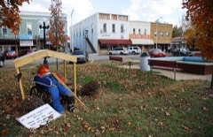
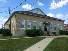
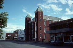
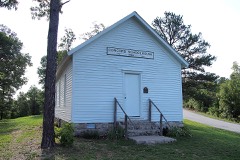
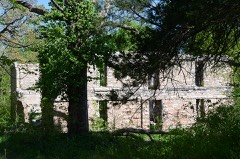
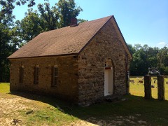
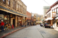
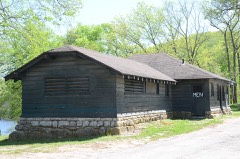
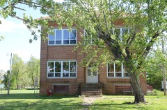
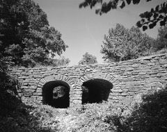
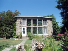
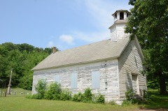
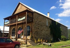
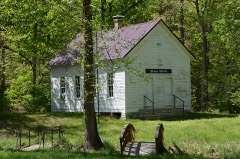
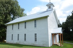
34 National Register listings published here.
Sources: the National Register database, National Park Service
39 topographic sheets cover 50 settlements here, and 34 properties are on the National Register of Historic Places.
34 National Register listings published here.
Sources: the National Register database, National Park Service
Every property in this county listed on the National Register of Historic Places, with the year it was listed and the federal nomination document.
Every wildfire the federal occurrence database records inside this county: 357 of them, burning about 6,942 acres. 12 started naturally and 105 were recorded as arson. Each settlement page carries the fires within five miles of it.
| Reported cause | Fires |
|---|---|
| Missing data/not specified/undetermined | 134 |
| Arson/incendiarism | 105 |
| Debris and open burning | 92 |
| Natural | 12 |
| Smoking | 6 |
| Equipment and vehicle use | 5 |
| Misuse of fire by a minor | 2 |
| Recreation and ceremony | 1 |
The five largest, by the area the report gives. Two of them were set deliberately.
| Date | Cause | Size | Reported by | Name on the report |
|---|---|---|---|---|
| 4 July 2012 | Debris and open burning | 250 acres | Arkansas Forestry Commission | ALPENA |
| 1 December 2007 | Arson/incendiarism | 227 acres | Arkansas Forestry Commission | PENSION MT. |
| 24 March 2007 | Arson/incendiarism | 200 acres | Arkansas Forestry Commission | BUTTERFLY |
| 14 January 2003 | Missing data/not specified/undetermined | 200 acres | Arkansas Forestry Commission | not named |
| 18 March 2017 | Missing data/not specified/undetermined | 189 acres | Arkansas Forestry Commission | not named |
| 15 March 2018 | Missing data/not specified/undetermined | 168 acres | Arkansas Forestry Commission | not named |
| 2 March 1999 | Missing data/not specified/undetermined | 140 acres | Arkansas Forestry Commission | not named |
| 15 April 2003 | Missing data/not specified/undetermined | 95 acres | Arkansas Forestry Commission | not named |
Every settlement page carries the fires within five miles of it - see the settlement index below.
The NOAA Storm Events Database holds 412 reports for this county, causing 4 deaths, 67 injuries and about $2,805,100 in recorded property damage. Each settlement page carries the reports that name it.
| Kind of event | Reports |
|---|---|
| Thunderstorm Wind | 192 |
| Hail | 155 |
| Flash Flood | 38 |
| Tornado | 18 |
| Flood | 7 |
| Lightning | 2 |
The most serious of them, by death, then injury, then recorded damage. The accounts are quoted exactly as the forecast office filed them.
| When | Event | Place named | Harm | What the report says |
|---|---|---|---|---|
| April 2022 | Flood | Cabanal | 1 killed | A vehicle driven into a flooded low water crossing near the intersection of county roads 705 and 741 was swept away, with the driver drowning in the flood water. Heavy rainfall had ended by early afternoon, but some low water crossings remained flooded well after the rain had stopped. |
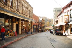
| April 2017 | Flash Flood | Eureka Spgs | 1 killed | Leatherwood Creek flooded several roads north and northeast of town. People were playing in and near the creek. One of them was swept downstream and drowned. |
| March 2015 | Flash Flood | Beaver | 1 killed | Leatherwood Creek flooded portions of Highway 187 near Elk Ranch. A vehicle was swept off the road by these flood waters. The vehicle was quickly found by first responders but the victim's body wasn't found until April 6th. |
| May 2002 | Flash Flood | North Central Portion | 1 killed | An estimated 3 inches of rain fell over the hilly part of Carroll county to the north of Berryville. This rain caused small streams and low water crossings to flood. A 25 year old man died as his truck was swept away by flood waters while trying to drive over a low water crossing over Clabber Creek on County Road 403 about 3 miles north of Berryville. |
| July 1984 | Hail | not stated | 18 hurt | no account filed |
| July 1984 | Hail | not stated | 18 hurt | no account filed |
| March 1961 | Tornado (F2) | not stated | 14 hurt, $25,000 | no account filed |
| May 1995 | Hail | Eureka Springs | 10 hurt | Severe thunderstorms moved across northwest Arkansas during the evening of May 24th. Thunderstorm winds gusted to 60 miles an hour in Bloomer, and hail ranging from nickel to golf ball-size fell at Eureka Springs. The hail injured approximately ten persons attending an outdoor passion play in Eureka Springs. Dime-size hail fell two miles southeast of Fort Smith, at Jenny Lind, and at Strickler. |
| April 1987 | Thunderstorm Wind | not stated | 5 hurt | no account filed |
| May 1973 | Tornado (F2) | not stated | 2 hurt, $250,000 | no account filed |
| November 2022 | Tornado (EF1) | Green Forest | $200,000 | This tornado developed southwest of Green Forest and moved into town, damaging trees and power poles. Several poultry barns were damaged or destroyed, three grain bins were toppled, and multiple homes were damaged. It continued northeast of town where trees were uprooted, several homes were damaged, and several poultry barns were damaged. Based on this damage, maximum estimated wind in the tornado was 90 to 100 mph. |
| October 2009 | Flash Flood | Metalton | $200,000 | Numerous roads were flooded and closed in and around Metalton, Oak Grove, and Carrollton. Some of these were washed out by flood water. Five houses were evacuated due to flood waters. |
| April 2008 | Flash Flood | Berryville | $200,000 | Heavy rain caused numerous county roads to be washed out. The ends of several bridges were also washed out. |
| April 2011 | Flash Flood | Oak Grove | $125,000 | A water rescue was necessary at a home near the intersection of County Road 625 and State Highway 103 due to rising flood water. Portions of County Roads 625 and 621 were washed out by flood water. |
| April 2017 | Tornado (EF1) | Busch | $100,000 | This is the first segment of the three segment tornado. In Carroll County, this tornado snapped and uprooted numerous trees, damaged a number of homes, destroyed outbuildings, and blew down power poles. Based on this damage, maximum estimated wind in this segment of the tornado was 100 to 110 mph. The tornado moved into Barry County, Missouri, and eventually Stone County, Missouri, where it dissipated. |
| August 2013 | Flood | Beaver | $100,000 | State Line Drive bridge in Holiday Island was under water and nearly washed out. |
| August 2013 | Flash Flood | Beaver | $100,000 | Butler Creek flooded portions of Highway 187 between Beaver and Highway 62. A person was swept away from a vehicle while trying to cross a low water bridge near Beaver resulting in a swift water rescue. The flooding washed away portions of roads. |
| April 2011 | Flash Flood | Beaver | $100,000 | Some homes in the Holiday Island area were damaged from rising flood water. |
| March 2007 | Hail | Urbanette | $100,000 | A broad swath of hail up to golfball size occurred across the northeastern portion of the county. The largest hail reportedly damaged homes and automobiles. |
| April 2011 | Flash Flood | Eureka Spgs | $75,000 | Several roads were closed in town due to high water and some businesses had flood damage due to rising water. |
| April 2024 | Thunderstorm Wind | Oak Grove | $50,000 | Strong thunderstorm wind destroyed a metal building, and damaged the siding of a home. |
| April 2023 | Thunderstorm Wind | Berryville | $50,000 | Strong thunderstorm wind estimated from 70 to 80 mph blew most of the metal roof covering from a school building, snapped numerous large tree limbs, and uprooted a few trees in a broad swath across the northwestern portion of Berryville. |
| October 2019 | Thunderstorm Wind | Elk Ranch | $50,000 | Strong thunderstorm wind uprooted numerous trees, damaged homes, damaged outbuildings, and blew down power lines in and around the Rock Springs Community. |
| April 2008 | Tornado (EF1) | Metalton | $50,000 | The tornado that began about 1 mile west-southwest of Alabam in Madison County Arkansas continued into Carroll County about 9.4 miles south-southwest of Berryville. The tornado damaged a home, destroyed barns, and caused extensive tree damage before it dissipated south of Berryville. |
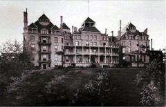
| June 2005 | Lightning | Eureka Spgs | $50,000 | Lightning struck the Crescent Hotel causing a fire. The fire was contained to the penthouse. Sixty people were evacuated from the hotel due to the fire. |
| June 1994 | Thunderstorm Wind | Berryville | $50,000 | Thunderstorm winds downed several trees and power lines. |
| June 1994 | Thunderstorm Wind | Green Forest | $50,000 | Some trees and power lines were blown down. |
| June 2009 | Lightning | Farwell | $40,000 | Lightning struck a house and caused a fire that resulted in considerable damage. |
| March 2006 | Tornado (F1) | Urbanette | $40,000 | The supercell cycled again and produced a fourth tornado that affected mainly rural areas. The tornado produced minor damage to homes and snapped or uprooted numerous trees. Several outbuildings were damaged by the tornado. The tornado, which was rated F1 in Carroll County, moved into Stone County, Missouri at 2256 CST where it continued to produce F1 damage. See Storm Data for Missouri, Southwest for details concerning the Stone County segment of this tornado. |
| May 2025 | Tornado (EF1) | Osage | $30,000 | This tornado developed along and just west of Highway 103, south of Osage. It moved northeast across Highway 412, and dissipated after crossing County Road 905. The tornado snapped and uprooted numerous trees, and damaged outbuildings. Based on this damage, maximum estimated wind in the tornado was 95 to 105 mph. |
| July 2001 | Thunderstorm Wind | Green Forest | $30,000 | Thunderstorm winds estimated at 70 miles an hour blew down numerous trees and power lines. A few of the trees landed on roofs of houses. |
| May 2024 | Hail | Denver | $25,000 | Golf ball size hail damaged homes and vehicles. |
| August 2024 | Thunderstorm Wind | Busch | $25,000 | Strong thunderstorm wind overturned recreational vehicles near Beaver Lake Dam. |
| April 2021 | Thunderstorm Wind | Oak Grove | $25,000 | Strong thunderstorm wind damaged a barn and a couple chicken houses. |
| October 2019 | Thunderstorm Wind | Oak Grove | $25,000 | Strong thunderstorm wind uprooted trees and damaged homes. |
| April 2015 | Thunderstorm Wind | Carrollton | $25,000 | Strong thunderstorm wind snapped several trees. A tree was blown down onto a house. |
| March 2007 | Thunderstorm Wind | Urbanette | $25,000 | Strong thunderstorm wind blew down a tree onto a home in Maple. |
| March 2006 | Hail | Busch | $25,000 | Hail up to golfball size covered the ground. |
| July 2006 | Thunderstorm Wind | Eureka Spgs | $25,000 | Thunderstorm winds estimated at 80 miles an hour carved a path approximately a mile and a half in length through town causing numerous trees and power lines to be blown down. Glass windows were blown out of several buildings. |
| November 2004 | Flash Flood | Countywide | $25,000 | Heavy thunderstorm rains caused a few county roads to be washed out across Carroll County. |
| April 2011 | Hail | Grandview | $25,000 | no account filed |
| June 2009 | Hail | Eureka Spgs | $25,000 | no account filed |
| July 1972 | Tornado (F1) | not stated | $25,000 | no account filed |
| April 1955 | Tornado (F2) | not stated | $25,000 | no account filed |
| July 2009 | Thunderstorm Wind | Oak Grove | $20,000 | Thunderstorm winds estimated at 80 miles an hour damaged roofs and blew down several large tree limbs. |
| May 2024 | Hail | Elk Ranch | $15,000 | Ping pong ball size hail damaged homes and vehicles. |
| February 2023 | Hail | Beaver | $15,000 | Half dollar size hail damaged homes and vehicles. |
| February 2023 | Hail | Beaver | $15,000 | Ping pong ball size hail damaged homes and vehicles. |
| February 2023 | Hail | Eureka Spgs | $15,000 | Half dollar size hail damaged homes and vehicles. |
| April 2015 | Thunderstorm Wind | Green Forest | $15,000 | Strong thunderstorm wind damaged a home. |
| March 2015 | Hail | Urbanette | $15,000 | no account filed |
| April 2011 | Hail | Eureka Spgs | $15,000 | no account filed |
| April 2011 | Hail | Eureka Spgs | $15,000 | no account filed |
| May 1997 | Thunderstorm Wind | Berryville | $15,000 | no account filed |
| October 2019 | Thunderstorm Wind | Eureka Spgs | $10,000 | Strong thunderstorm wind uprooted trees and damaged outbuildings. |
| December 2018 | Thunderstorm Wind | Berryville Arpt | $10,000 | Strong thunderstorm wind damaged hangars at the Carroll County Airport and uprooted trees. |
| January 2013 | Thunderstorm Wind | Green Forest | $10,000 | Strong thunderstorm wind blew down large tree limbs and power lines and damaged the roofs of three chicken houses. |
| May 2013 | Thunderstorm Wind | Oak Grove | $10,000 | Large trees limbs and power lines were blown down by strong thunderstorm wind in and around Blue Eye. Numerous power outages resulted from the damage. |
| April 2011 | Flash Flood | Berryville Arpt | $10,000 | A vehicle driven into flood water was submerged under a bridge on Highway 62 between Eureka Springs and Berryville. |
| August 2011 | Thunderstorm Wind | Cabanal | $10,000 | Strong thunderstorm wind blew down large tree limbs and power lines. |
The Survey's mineral resources record lists 19 workings inside this county. 12 still produce and 7 are closed or unrecorded. Each settlement page carries the workings within five miles of it.
| Commodity | Workings |
|---|---|
| Sand and Gravel, Construction | 11 |
| Stone, Crushed/Broken | 3 |
| Manganese | 2 |
| Limestone, General | 1 |
| Strontium | 1 |
| Iron | 1 |
The least common of them first, because a county's hundredth gravel pit says nothing its first ten did not.
| Where | Site | Commodity | Status | Recorded |
|---|---|---|---|---|
| Newman Pyrite Prospect | Iron | Occurrence | ||
| Orval K Hawkin Property | Strontium | Prospect | ||
| Unk Quarry | Limestone, General | Producer | ||
| Fancher Tract | Manganese | Prospect | ||
| Hittson Prospect | Manganese | Occurrence | ||
| Kirk Mountain Quarry | Stone, Crushed/Broken | Past Producer | ||
| R & R Gravel Quarry | Stone, Crushed/Broken | Producer | ||
| R&R Gravel Plant | Stone, Crushed/Broken | Producer | ||
| Battler Creek Pit & Plant | Sand and Gravel, Construction | Producer | ||
| Carroll County Pit | Sand and Gravel, Construction | Producer | ||
| Garrett Sand & Gravel Co | Sand and Gravel, Construction | Past Producer | ||
| Kings River Pit & Plant | Sand and Gravel, Construction | Producer | ||
| Osage Pit | Sand and Gravel, Construction | Past Producer | ||
| R & R Quarry No 2 | Sand and Gravel, Construction | Producer | ||
| Unk Gravel Pit | Sand and Gravel, Construction | Producer | ||
| Unk Gravel Pit | Sand and Gravel, Construction | Producer | ||
| Unk Gravel Pit | Sand and Gravel, Construction | Producer | ||
| Unk Gravel Pit | Sand and Gravel, Construction | Producer | ||
| Unk Gravel Pit | Sand and Gravel, Construction | Producer |
Named settlements recorded in the Geographic Names Information System, each with the topographic sheets covering it. Villages, hamlets and abandoned places alike. Each is shown with the nearest named watercourse or landform and the survey quadrangle it falls on.
Central township · 72616 · On Mill Branch · Berryville quadrangle
12 sheets, 1900 to 1985
Central township · 72638 · On Braswell Branch · Green Forest quadrangle
12 sheets, 1904 to 1985
No longer a settlement
Southeast township · 72616 · Near Gage Mountain · Berryville quadrangle
12 sheets, 1900 to 1985
Southeast township · 72740 · Marble quadrangle
13 sheets, 1900 to 1985
No longer a settlement
Southeast township · 72616 · Near Chinkapin Mountain · Marble quadrangle
13 sheets, 1900 to 1985
Southeast township · 72611 · Near Winding Staircase Hollow · Osage NE quadrangle
13 sheets, 1904 to 1985
Northeast township · 72638 · On Yocum Creek · Denver quadrangle
12 sheets, 1904 to 1985
No longer a settlement
Western township · 72632 · Near Mount Oberammergau · Eureka Springs quadrangle
12 sheets, 1900 to 1985
Central township · 72616 · Grandview quadrangle
12 sheets, 1900 to 1985
No longer a settlement
Western township · 72631 · On West Leatherwood Creek · Eureka Springs quadrangle
12 sheets, 1900 to 1985
No longer a settlement
Central township · 72616 · On Clabber Creek · Grandview quadrangle
12 sheets, 1900 to 1985
Western township · 72631 · On Haddock Creek · Eureka Springs quadrangle
12 sheets, 1900 to 1985
Northeast township · 72638 · On South Fork Dry Creek · Alpena quadrangle
12 sheets, 1904 to 1985
Northeast township · 72616 · Near Ant Mountain · Grandview quadrangle
12 sheets, 1900 to 1985
No longer a settlement
Central township · 72632 · Near Livingston Hollow · Eureka Springs quadrangle
12 sheets, 1900 to 1985
No longer a settlement
Western township · 72632 · Near Pond Mountain · Sandstone Mountain quadrangle
14 sheets, 1900 to 1985
Western township · 72632 · Sandstone Mountain quadrangle
14 sheets, 1900 to 1985
No longer a settlement
Southeast township · 72638 · Near Pinnacle · Green Forest quadrangle
12 sheets, 1904 to 1985
No longer a settlement
Northeast township · 72638 · Near Miller Mountain · Green Forest quadrangle
12 sheets, 1904 to 1985
No longer a settlement
Northeast township · 72638 · By Chaney Bluff · Alpena quadrangle
12 sheets, 1904 to 1985
No longer a settlement
Central township · 72631 · Near Huckleberry Point · Eureka Springs quadrangle
12 sheets, 1900 to 1985
Central township · 72616 · Near Boat Mountain · Eureka Springs quadrangle
12 sheets, 1900 to 1985
Central township · 72616 · On Osage Creek · Grandview quadrangle
12 sheets, 1900 to 1985
Central township · 72616 · Near Brushy Mountain · Grandview quadrangle
12 sheets, 1900 to 1985
No longer a settlement
Northeast township · 72638 · On Spring Creek · Denver quadrangle
12 sheets, 1904 to 1985
No longer a settlement
Southeast township · 72638 · Near Brawley Hollow · Green Forest quadrangle
12 sheets, 1904 to 1985
Central township · 72632 · Near Huckleberry Point · Eureka Springs quadrangle
12 sheets, 1900 to 1985
No longer a settlement
Western township · 72631 · By Salts Bluff · Beaver quadrangle
15 sheets, 1900 to 1985
No longer a settlement
Central township · 72632 · Near Big Mill Hollow · Rockhouse quadrangle
14 sheets, 1900 to 1985
No longer a settlement
Southeast township · 72740 · Marble quadrangle
13 sheets, 1900 to 1985
No longer a settlement
Northeast township · 72638 · Near Buzzard Roost Hollow · Blue Eye quadrangle
13 sheets, 1904 to 1985
The vanished settlements of Carroll County: the places named above that are no longer on the map.