Block
From the record
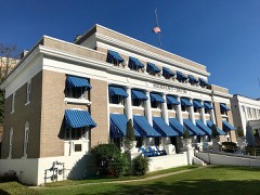
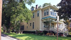
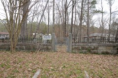
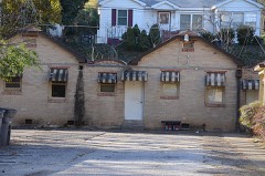
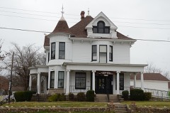
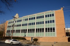
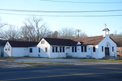
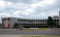
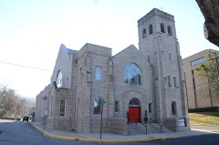
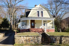
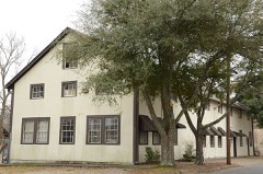
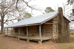
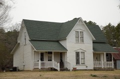
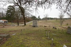
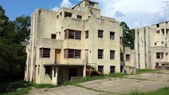
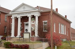
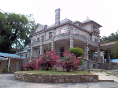
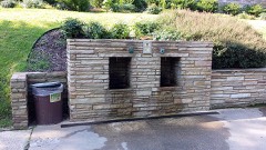
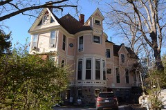
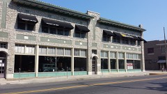
95 National Register listings published here, 1 of them a National Historic Landmark.
Sources: the National Register database, National Park Service
68 topographic sheets cover 50 settlements here, and 95 properties are on the National Register of Historic Places.
95 National Register listings published here, 1 of them a National Historic Landmark.
Sources: the National Register database, National Park Service
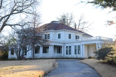
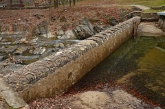
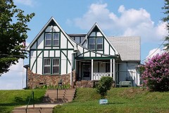
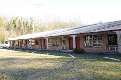
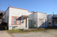
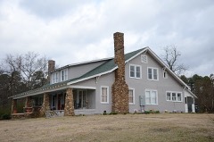
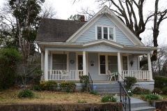
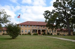
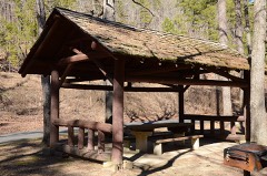
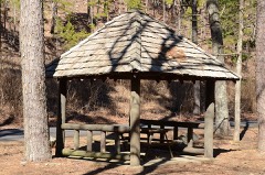
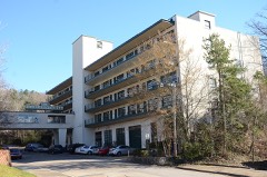
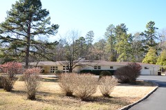
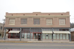
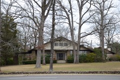
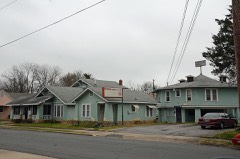
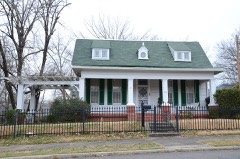
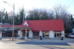
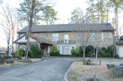
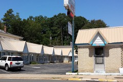
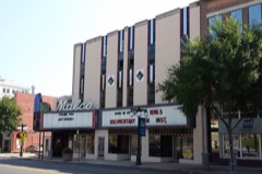
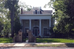
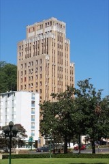
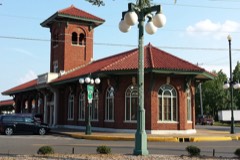
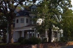
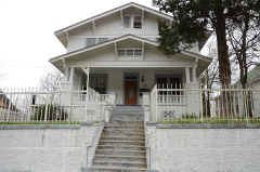
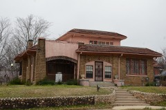
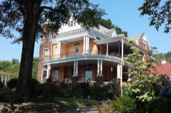
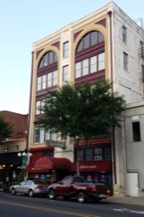
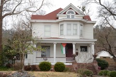
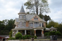
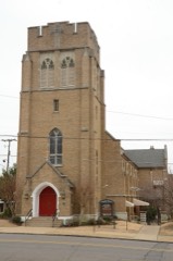
Every property in this county listed on the National Register of Historic Places, with the year it was listed and the federal nomination document.
Every wildfire the federal occurrence database records inside this county: 1,243 of them, burning about 11,727 acres. 97 started naturally and 374 were recorded as arson. Each settlement page carries the fires within five miles of it.
| Reported cause | Fires |
|---|---|
| Arson/incendiarism | 374 |
| Debris and open burning | 337 |
| Missing data/not specified/undetermined | 243 |
| Natural | 97 |
| Equipment and vehicle use | 78 |
| Recreation and ceremony | 39 |
| Misuse of fire by a minor | 31 |
| Smoking | 25 |
| Fireworks | 10 |
| Power generation/transmission/distribution | 7 |
| Railroad operations and maintenance | 2 |
The five largest, by the area the report gives. Two of them were set deliberately.
| Date | Cause | Size | Reported by | Name on the report |
|---|---|---|---|---|
| 23 January 2014 | Arson/incendiarism | 2,067 acres | Ouachita National Forest | FROST BITE |
| 20 July 2006 | Natural | 475 acres | Ouachita National Forest | SOUTH POWELL #1 |
| 29 July 2012 | Natural | 355 acres | Arkansas Forestry Commission | MT. RIANTE |
| 19 September 2013 | Natural | 350 acres | Ouachita National Forest | PIPELINE |
| 5 March 2009 | Arson/incendiarism | 326 acres | Ouachita National Forest | BLAKELY # 1 |
| 7 March 2020 | Missing data/not specified/undetermined | 267 acres | Arkansas Forestry Commission | not named |
| 16 February 2016 | Natural | 223 acres | Ouachita National Forest | BEAR MTN |
| 20 February 1995 | Debris and open burning | 193 acres | Ouachita National Forest | not named |
Every settlement page carries the fires within five miles of it - see the settlement index below.
The NOAA Storm Events Database holds 820 reports for this county, causing 5 deaths, 69 injuries and about $53,969,880 in recorded property damage. Each settlement page carries the reports that name it.
| Kind of event | Reports |
|---|---|
| Thunderstorm Wind | 345 |
| Hail | 304 |
| Flash Flood | 71 |
| Tornado | 41 |
| Lightning | 28 |
| Heavy Rain | 15 |
| Funnel Cloud | 9 |
| Flood | 7 |
The most serious of them, by death, then injury, then recorded damage. The accounts are quoted exactly as the forecast office filed them.
| When | Event | Place named | Harm | What the report says |
|---|---|---|---|---|
| April 2011 | Thunderstorm Wind | Hawes | 2 killed, $15,000 | A 24 year-old man and his 18-month old daughter were killed when a tree fell into their mobile home. They were in a bedroom at the time, and that is the end of the mobile home that the tree crashed into. |
| April 2011 | Tornado (EF3) | Ozark Lithia | 1 killed, 20 hurt, $21,000,000 | Homes were destroyed in the Walnut Valley, Ozark Lithia, Ranch Estates, and Mountain Valley areas. Church buildings and the Teen Challenge building on Arkansas Highway 7 were badly damaged. Vehicles were piled up in the parking lot of the church. An 8-month old baby was killed in the Walnut Valley area. A Red Cross survey indicated approximately 25 houses and 21 mobile homes were destroyed, 22 houses and 5 mobile homes suffered severe damage, 18 houses and 4 mobile homes had minor damage, and 5 houses and 2 mobile homes were affected. A two-story house had its top floor removed. Several outbuildings and a well-constructed barn were destroyed. A portion of the tornado's track was determined during an aerial survey by the Arkansas Forestry Commission. This tornado exited Garland County northwest of the incorporated portion of Fountain Lake and entered Saline County in Hot Springs Village. |
| June 2011 | Thunderstorm Wind | Fountain Lake (Unincorporated) | 1 killed, $25,000 | Thunderstorm winds knocked down a few trees and power lines around the 2400 block of Park Ave. (Arkansas Highway 7) in Hot Springs. Traffic came to a halt on the highway due to the fallen trees. A 25 year-old woman, who was stopped in traffic, was killed when another tree fell, crushing the cab of the pickup truck she was driving. No one else was in the vehicle. |
| August 2006 | Lightning | Hot Spgs | 1 killed | A 19 year old male was struck and killed by lightning while jogging around the track at Hot Springs Middle School. |
| April 2011 | Tornado (EF2) | Maddox | 10 hurt, $5,000,000 | This tornado affected areas around the Bear community, Brady Mountain Rd., the eastern end of Lake Ouachita, and Lake Ouachita State Park. A Red Cross survey indicated approximately 1 house destroyed, 4 houses and 3 mobile homes with major damage, 16 houses and 9 mobile homes with minor damage, and 3 houses and 1 mobile home affected. A large metal building that once housed a golf academy sustained severe damage, with the roof torn off and metal girders twisted. A camping trailer was blown into a field and destroyed. Several outbuildings were destroyed. Hundreds of trees were knocked down or snapped off. Numerous power lines were blown down. Considerable damage occurred at Lake Ouachita State Park. A portion of the tornado's track was determined during an aerial survey by the Arkansas Forestry Commission. |
| April 2011 | Tornado (EF2) | Maddox | 9 hurt, $3,000,000 | A tornado affected the area around Old Dallas Rd. and the Sunshine community. A Red Cross survey indicated 1 house and 8 mobile homes were destroyed, 4 houses and 4 mobile homes suffered major damage, and 19 houses and 9 mobile homes had minor damage. Numerous outbuildings were destroyed. A travel trailer was pushed onto a car. Hundreds of trees were blown down or snapped off, and numerous power lines were blown down. |
| March 1967 | Tornado (F3) | not stated | 6 hurt, $250,000 | no account filed |
| May 1961 | Tornado (F2) | not stated | 6 hurt, $250,000 | no account filed |
| May 1955 | Tornado (F3) | not stated | 3 hurt, $250,000 | no account filed |
| January 2023 | Tornado (EF1) | Blakely | 2 hurt, $5,000,000 | This tornado began just to the southwest of Jessieville, causing tree damage around an Arkansas Forestry Commission building. The tornado then quickly moved northeast into Jessieville, and caused damage to a few homes in town. Most notably, damage was noted to several buildings on the campus of Jessieville High School, and three out of four fixed light poles for the football field were bent over. The tornado continued to move northeast, doing damage to a pole barn just north of town, before finally dissipating. |
| July 1990 | Thunderstorm Wind | not stated | 2 hurt | no account filed |
| November 1988 | Thunderstorm Wind | not stated | 2 hurt | no account filed |
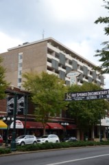
| August 2012 | Thunderstorm Wind | Hot Spgs | 1 hurt, $2,500,000 | A microburst struck downtown Hot Springs, doing considerable damage. A hotel had a large hole, approximately 30 feet by 20 feet, punched in its facade. A bank had windows blown out. A skywalk between two buildings was badly damaged with a lot of material hanging out of the bottom (over the street) and windows blown out. A motorcyclist suffered minor injuries after he took shelter under the skywalk and was hit by flying debris. A used car dealership in a 65 year-old building had one wall caved in and numerous windows blown out. Most of the cars that were for sale were damaged. A nearby tire shop had all of its front windows blown out. A theater had damage to its marquee and a large ceramic planter was blown through a wall. The cornice of one building was blown off, scattering bricks across an adjacent parking lot. A radio tower was bent over the roof of the central fire station. Another radio tower, belonging to an ambulance service, was also bent over. At least two dozen businesses and residences suffered roof damage. A number of very large trees were blown down. One of these fell against a house and was so large that a mobile crane was brought in to remove it. Numerous power lines were blown down, leaving thousands of people without power. |
| January 1982 | Tornado (F2) | not stated | 1 hurt, $250,000 | no account filed |
| February 2011 | Thunderstorm Wind | Lake Catherine | 1 hurt, $150,000 | A couple of very large trees were blown down. One of the trees sliced through a house on Elmwood Dr., injuring a woman inside. Nearby, part of a metal roof was peeled off a building at a lumber mill. |
| November 2019 | Lightning | Bear | 1 hurt, $75,000 | A woman, 61 years old, in Royal, was burned by a lightning strike and airlifted to a Memphis hospital due to bad weather in the Little Rock area. Her trailer caught fire from the lightning strike and she suffered burns to her hands and feet. |
| July 2013 | Thunderstorm Wind | Hot Spgs | 1 hurt, $10,000 | A large tree limb fell onto a car in Gulpha Gorge. There was one minor injury. |
| July 2009 | Lightning | Lonsdale | 1 hurt | An electric utility worker was injured by lightning while putting equipment in his truck. |
| July 2008 | Lightning | Lake Catherine | 1 hurt | A man was injured by lightning while cutting a limb off a tree. He was clearing brush on his hunting property at the time. |
| November 2005 | Tornado (F2) | Pearcy | 1 hurt | A strong tornado tracked into southwestern Garland County from Hot Spring County. The tornado rolled a mobile home into a tree, with a man injured near Pearcy. In the same area, several homes had mainly roof damage. The tornado then hit areas on the west side of Lake Hamilton, with structural damage to several homes and docks destroyed. Along the way, numerous trees were uprooted or snapped with power lines downed. The tornado dissipated roughly 3 miles southeast of Mountain Pine. |
| August 2000 | Thunderstorm Wind | Pearcy | 1 hurt | no account filed |
| May 2011 | Flood | Jessieville | $3,000,000 | Some of the campsites around Lake Catherine were closed due to flooding. |
| November 1988 | Tornado (F2) | not stated | $2,500,000 | no account filed |
| December 2009 | Flood | Gladstone | $1,250,000 | Flash flooding, which developed on the evening of the 23rd, became widespread areal flooding on the morning on the 24th and continued into Christmas morning. A minor landslide occurred on West Mountain in Hot Springs. Part of Arkansas Highway 227 (Mountain Pine Rd.) had to be closed for awhile. Bridges that were washed out, damaged, or flooded including those on Deerpark Rd., Kelly Hollow at Wildcat Rd., Caddo Gap near Norman Dr., South Harris Rd., Holy Spirit Ln., Hughes Rd., Owl Creek Rd., Brady Mountain Rd., and Brady Mountain Cutoff. Lake Hamilton and Lake Catherine rose rapidly out of their winter pools, approaching summertime lake levels. Docks broke loose in the Big Mazarn area, sending pieces of the docks, boats, personal watercraft, and other debris floating in Lake Hamilton. Boats and boat docks floated off on Lake Balboa and Lake Cortez in Hot Springs Village. |
| April 2011 | Flood | Jessieville | $1,000,000 | Widespread areal flooding occurred. |
| May 2013 | Tornado (EF1) | Maddox | $500,000 | An EF1 tornado damaged several houses, mostly on their roofs, but one house lost a room that had been added on. A mobile home and two travel trailers were destroyed, and another mobile home had one end torn off. A few barns and outbuildings were destroyed. A falling tree crushed a van and another went through the roof of a mobile home. Numerous large trees were snapped off or blown down. |
| April 2011 | Tornado (EF1) | Hamilton | $500,000 | Thousands of trees were blown down on land belonging to private timber companies. An old house suffered severe damage, another house had its garage destroyed, and several outbuildings were damaged. The track of this tornado was close to Main Haul Rd. The tornado exited Garland County north-northeast of Beaudry and entered Saline County west-northwest of Electric. |
| May 1998 | Tornado (F1) | Hot Spgs | $500,000 | The tornado touched down along Highway 70 near the entrance to the Hot Springs Airport. A number of trees were knocked down in the yard of a residence at this location. The storm continued to move east southeast onto the airport property where a couple of trees and signs were blown down at the airport entrance. A few storage buildings, as well as a large hangar, were also damaged at the airport. Several planes parked near the hangar were blown several hundred yards off the tarmac. The next damage noted was about one half mile east southeast of the airport where a number of trees and power lines were knocked down. Several homes in the area also suffered roof damage. More significant damage was found along Central Avenue in Hot Springs where a number of businesses in several shopping malls sustained structural damage. Numerous trees, power lines and signs were also knocked down in the area. More trees and power lines were blown down about a half mile farther southeast. Several homes, storage buildings and fences were also damaged. The tornado finally lifted 3 miles south southeast of Hot Springs. Damage noted along the path of the tornado was consistent with an F1 rating. |
| July 2013 | Thunderstorm Wind | Pleasant Hill | $400,000 | Just west of Hot Springs, thunderstorm winds damaged two businesses in a strip mall. At a dollar store, winds blew in through a roll-up garage door in the back, traveled through the store and rearranged some of the merchandise, then blew out the front doors. Part of the ceiling and ceiling tiles were left sagging in the front of the store. A consignment shop next door also had ceiling tiles fall. At the same intersection, a second dollar store had a window blown out, part of the roof damaged, and sagging ceiling tiles. Also at the same intersection, a portable storage building was blown off its concrete blocks and destroyed. In nearby areas, numerous trees and power lines were blown down, and a number of power poles were snapped off. Several of the trees fell on houses. A billboard was partially destroyed. A small barn was destroyed. On Rock Creek Bay, part of the western end of Lake Hamilton, a boat dock and party barge were overturned. |
| April 2011 | Flash Flood | Pleasant Hill | $400,000 | People camping had to be rescued. Two camping trailers and three trucks floated away. The fire department rescuers became surrounded by high water. No injuries were reported. Severe flash flooding also occurred on Big Mazarn Creek and Meyers Creek. |
| September 2008 | Flash Flood | Mt Tabor | $330,000 | Arkansas Highways 5 and 7 were closed due to flooding. |
| September 2008 | Flash Flood | Pettyview | $330,000 | Flooding occurred on Lawler Road off of Amity Road. Small creeks were flooded. |
| September 2008 | Flash Flood | Pearcy | $330,000 | A foot of water was over Amity Road. |
| May 2013 | Flash Flood | Avant | $275,000 | Arkansas 7 flooded near Hot Springs Village and 6 to 8 inches of water covered Central Ave. at the U.S. 70/270 Bypass. Water eventually rose to a depth of 2 feet on some roads in Hot Springs Village. For the 24-hour period ending at 7 AM on the 31st, Jessieville measured 3.80 inches of rain. |
| December 1982 | Tornado (F2) | not stated | $250,000 | no account filed |
| March 1959 | Tornado (F2) | not stated | $250,000 | no account filed |
| March 1996 | Tornado (F1) | Pearcy | $200,000 | no account filed |
| July 2014 | Thunderstorm Wind | Hawes | $150,000 | Trees and power lines were blown down on Arkansas 227 and numerous other places in Garland County. |
| December 2012 | Lightning | Pettyview | $130,000 | Lightning struck a large pine tree and then jumped to an adjacent house, setting it on fire. The house was a total loss, as was a motorcycle parked in front of the house. |
| June 2010 | Thunderstorm Wind | Mountain Pine | $125,000 | A downburst from a severe thunderstorms blew down numerous trees and large limbs in Mountain Pine. One tree fell on a mobile home, one fell on the roof of a house, another knocked the front porch off a house, and yet another tree fell on a car. Several other homes and outbuildings were damaged by falling trees. Power lines were blown down as well. |
| March 2007 | Thunderstorm Wind | Pearcy | $125,000 | A mobile home was destroyed when it was blown off its block and split in half. Much of the roof of a house was torn off, as was part of the roof of another house. A number of trees were blown down or snapped off. |
| December 2012 | Lightning | Ozark Lithia | $120,000 | Lightning struck a pine tree, then traveled to the ground, where the electrical charge forked. One fork went to a workshop, knocking out the power and melting the breakers in the breaker box. The other fork traveled to a downspout on a house and then up along the gutter on the front of the house. Beams holding up the porch roof were splintered but remained enough intact to support the roof. The lightning then traveled to the flashing on the roof, subsequently setting fire to the roof vents and the roof. Water ran into the house, ruining expensive wood flooring and damaging some furnishings. |
| April 2014 | Thunderstorm Wind | Hot Spgs | $100,000 | Trees and power lines were blown down. A few of the trees landed on houses. |
| May 2013 | Tornado (EF1) | Lake Ouachita East | $100,000 | A waterspout developed in Lake Ouachita, north of the Brady Mountain area. Its starting point was determined based on videos and interviews with witnesses. The waterspout moved onshore, becoming a tornado, about 1.5 miles east of Lena Landing. Huge trees were blown down or snapped off on Air National Guard Cove. The falling trees damaged a house and a number of cabins, with some of the cabins having holes poked in their roofs. Farther away from the lake, a lessening number of trees were blown down. |
| August 2011 | Thunderstorm Wind | Hot Spgs | $100,000 | The roof was blown off a store on Central Ave. in downtown Hot Springs, allowing water to pour into the building. |
| April 2009 | Thunderstorm Wind | Hot Springs Village | $100,000 | A communication tower was snapped in half in Hot Springs Village. |
| May 2009 | Flash Flood | May | $100,000 | A car was washed away at a low water bridge on Arkansas Highway 298. A tributary washed over the road on Shady Grove Road. Traffic lanes on Highway 70 west of Hot Springs had to be closed due to water. Malvern Avenue had to be closed when a creek overflowed. Fresno Road and Lago Drive were washed away. Flooding occurred on Park Avenue, Central Avenue, and Bathhouse Row in Hot Springs. The Gulpha Creek Bridge in Hot Springs flooded, as well. |
| July 2009 | Lightning | Hempwallace | $100,000 | Lightning knocked out power to about 10,000 customers in the Hot Springs area. |
| April 2008 | Tornado (EF1) | Diamondhead | $100,000 | A tornado blew down hundreds of trees. The tornado moved out of Garland County and into Hot Spring County in the Diamondhead area. |
| February 2008 | Thunderstorm Wind | Hot Springs Village | $100,000 | Three large pine trees fell on a home in Hot Springs Village. A pine tree fell on a golf course. Also, an 80-foot tree fell on a home. |
| June 2008 | Thunderstorm Wind | Bear | $100,000 | Trees were down. At least one tree fell on a house. Power lines blocked some roads. |
| July 1997 | Thunderstorm Wind | Mountain Pine | $100,000 | Thunderstorm winds caused significant damage to parts of a marina at the Brady Mountain Resort area on Lake Ouachita. A new section of the marina was destroyed, and an older section sustained minor damage. Some trees were also blown down. |
| April 2001 | Lightning | Hot Spgs | $90,000 | Lightning struck a storage building at a business in Hot Springs, resulting in a fire. The fire destroyed the storage building, along with it's contents. |
| February 2013 | Lightning | Pleasant Hill | $80,000 | A house was struck by lightning, causing a fire. Due to the amount of lightning in the area, firefighters delayed climbing onto the roof of the house. Four people lived in the house, but no one was injured. |
| September 2014 | Thunderstorm Wind | Hot Spgs | $75,000 | A high-rise motel that was undergoing extensive reconstruction was damaged as thunderstorm winds tore building materials off the side of the motel. Motorcycles and cars were damaged when the building materials fell on them. |
| June 2013 | Flood | Mt Tabor | $75,000 | Large amounts of rain over the Ouachita River and its tributaries from May 30th through June 1st contributed to a large rise on Lake Ouachita. The lake rose 9 feet by June 3rd, followed by a slow fall. The lake did not return to its normal level until June 21st. Roads and campgrounds near the lake were submerged. Some gangways to boat docks also went under water, causing people to have to travel in boats to reach their boat docks. |
| July 2011 | Thunderstorm Wind | (Hot)Hot Spgs Arpt | $75,000 | The roof was blown off a metal industrial building. |
| July 2011 | Lightning | Sunshine | $75,000 | Lightning struck a workshop, and the resulting fire caused heavy damage to the structure and its contents. Among the items destroyed were pieces of furniture that were being refinished and a motorcycle. |
| May 2017 | Thunderstorm Wind | Gardner | $60,000 | There was roof damage to a dozen storage units and a home had a utility pole fall onto it. |
| May 2020 | Thunderstorm Wind | Crystal Spgs | $50,000 | Thunderstorm winds blew most of the tin roofing off of one of the primary docks at Crystal Springs Resort and set a few boats loose in the lake. A few pine trees were also uprooted or snapped. While the most extensive damage occurred at one dock, a few other docks were pushed together resulting in some minor damage to the docks and boats in between. |
The Survey's mineral resources record lists 80 workings inside this county. 22 still produce and 58 are closed or unrecorded. Each settlement page carries the workings within five miles of it.
| Commodity | Workings |
|---|---|
| Sand and Gravel, Construction | 21 |
| Silica | 21 |
| Clay | 6 |
| Vanadium | 5 |
| Slate, Dimension | 5 |
| Stone, Crushed/Broken | 4 |
| Quartz | 4 |
| Niobium (Columbium) | 3 |
| Flagstone | 3 |
| Stone | 3 |
| Calcium | 1 |
| Silica, Tripoli | 1 |
| Limestone, General | 1 |
| Gemstone | 1 |
The least common of them first, because a county's hundredth gravel pit says nothing its first ten did not.
| Where | Site | Commodity | Status | Recorded |
|---|---|---|---|---|
| Arkansas Power and Light Company Property | Fluorine-Fluorite, Pyrite | Past Producer | ||
| Caldwell Quarry | Limestone, General | Past Producer | ||
| Delinde Wavellite Mine | Gemstone | Prospect | 1965, 1967 | |
| Hot Springs Pit | Silica, Tripoli | Producer | ||
| No Name | Calcium | Past Producer | ||
| Old Spanish Diggings | Gold | Prospect | ||
| Lecroy Farm | Niobium (Columbium) | Unknown | ||
| No Name | Flagstone | Past Producer | ||
| No Name | Flagstone | Past Producer | ||
| No Name | Flagstone | Past Producer | ||
| Potash Sulfur Springs | Niobium (Columbium) | Occurrence | ||
| Unk | Stone | Past Producer | ||
| Unk | Stone | Past Producer | ||
| Unk Hot Springs | Stone | Past Producer | ||
| Wilson Springs Vanadium Deposit | Vanadium, Niobium (Columbium) | Past Producer | 1950, 1967 | |
| Blocker Lead Quartz | Quartz | Producer | 1940 | |
| Job No Joo-235 | Stone, Crushed/Broken | Producer | ||
| John Mcearl Tract | Quartz | Producer | 1940 | |
| Miller Mountain Tract | Quartz | Producer | ||
| Mountain Pine Pit | Stone, Crushed/Broken | Producer | ||
| No Name | Stone, Crushed/Broken | Past Producer | ||
| Quartz Processing Corp. Quarry | Quartz | Producer | ||
| Terry Quarries | Stone, Crushed/Broken | Past Producer | ||
| No Name | Slate, Dimension | Past Producer | ||
| No Name | Slate, Dimension | Past Producer | ||
| No Name | Slate, Dimension | Past Producer | ||
| No Name | Slate, Dimension | Past Producer | ||
| Potash Sulfur Springs | Vanadium | Producer | 1960, 1966, 1983 | |
| Potash Sulphur Springs | Vanadium | Past Producer | ||
| Union Carbide Pit | Vanadium | Producer | ||
| Union Carbide Plant | Vanadium | Producer | ||
| Unk | Slate, Dimension | Past Producer | ||
| No Name | Clay | Past Producer | ||
| No Name | Clay | Past Producer | ||
| No Name | Clay | Past Producer | ||
| No Name | Clay | Past Producer | ||
| No Name | Clay | Past Producer | ||
| Unk | Clay | Past Producer | ||
| A C Avant Area | Silica | Past Producer | ||
| Beard Area | Silica | Producer | ||
| Colemans Mill | Silica | Producer | ||
| Cruse Anderson Area | Silica | Past Producer | ||
| Dierks Crystal Area No 6 | Silica | Past Producer | ||
| Dierks Quartz Area No 5 | Silica | Past Producer | ||
| Dierks Quartz Area No.4 | Silica | Past Producer | ||
| Dierks Tract No 3 | Silica | Past Producer | ||
| Hamilton Hill | Silica | Past Producer | ||
| Hot Spring City Gravel Pit | Sand and Gravel, Construction | Producer | ||
| Hot Springs Mill | Silica | Producer | ||
| Hot Springs Village Pit & Plant | Sand and Gravel, Construction | Past Producer | ||
| J W Ellison Tract | Silica | Past Producer | ||
| James Pit & Plant | Sand and Gravel, Construction | Producer | ||
| Mc Earl Mine | Silica | Producer | ||
| Miller Mountain Quarry | Silica | Producer | ||
| Natural Hones Mill | Silica | Producer | ||
| No Name | Silica | Past Producer | ||
| No Name | Silica | Past Producer | ||
| No Name | Silica | Past Producer | ||
| No Name | Silica | Past Producer | ||
| O J Blackman | Silica | Past Producer | ||
| Phillips Claim | Silica | Unknown | ||
| Smith Pit & Plant | Sand and Gravel, Construction | Producer | ||
| T & T Pit | Sand and Gravel, Construction | Past Producer | ||
| Unk | Sand and Gravel, Construction | Past Producer | ||
| Unk | Sand and Gravel, Construction | Past Producer | ||
| Unk | Sand and Gravel, Construction | Past Producer | ||
| Unk | Sand and Gravel, Construction | Past Producer | ||
| Unk | Sand and Gravel, Construction | Past Producer | ||
| Unk | Sand and Gravel, Construction | Past Producer | ||
| Unk | Sand and Gravel, Construction | Past Producer | ||
| Unk | Sand and Gravel, Construction | Past Producer | ||
| Unk | Sand and Gravel, Construction | Past Producer | ||
| Unk | Sand and Gravel, Construction | Past Producer | ||
| Unk | Sand and Gravel, Construction | Producer | ||
| Unk | Sand and Gravel, Construction | Producer | ||
| Unk | Sand and Gravel, Construction | Past Producer | ||
| Unk | Sand and Gravel, Construction | Past Producer | ||
| Unk | Sand and Gravel, Construction | Past Producer | ||
| W T Coleman Tract | Silica | Past Producer | ||
| Weyerhauser Pit No 1 | Sand and Gravel, Construction | Producer |
Named settlements recorded in the Geographic Names Information System, each with the topographic sheets covering it. Villages, hamlets and abandoned places alike. Each is shown with the nearest named watercourse or landform and the survey quadrangle it falls on.
Hale township · 71949 · On Angling Creek · Goosepond Mountain quadrangle
14 sheets, 1890 to 1985
No longer a settlement
Hale township · 71949 · On Still Branch · Jessieville quadrangle
13 sheets, 1890 to 1982
Whittington township · 71913 · Hot Springs North quadrangle
15 sheets, 1890 to 1982
No longer a settlement
Hale township · 71949 · Near Gobblers Knob · Crystal Springs quadrangle
15 sheets, 1890 to 1982
No longer a settlement
Hale township · 71949 · On Cedar Fourche Creek · Crystal Springs quadrangle
15 sheets, 1890 to 1982
No longer a settlement
Hale township · 71968 · On Little Bear Creek · Crystal Springs quadrangle
15 sheets, 1890 to 1982
Whittington township · 71901 · Near Indian Mountain · Fountain Lake quadrangle
14 sheets, 1890 to 1985
No longer a settlement
Hot Springs township · 71901 · On Middle Branch Gulpha Creek · Hot Springs North quadrangle
15 sheets, 1890 to 1982
Hale township · On Little Creek · Avant quadrangle
14 sheets, 1890 to 1982
No longer a settlement
Whittington township · 71901 · Near Bald Mountain · Fountain Lake quadrangle
14 sheets, 1890 to 1985
No longer a settlement
Whittington township · 71913 · On Rabbit Creek · Mountain Pine quadrangle
13 sheets, 1890 to 1982
Lake Hamilton township · 71964 · On Lost Creek · Hempwallace quadrangle
8 sheets, 1955 to 1986
Whittington township · 71901 · Fountain Lake quadrangle
14 sheets, 1890 to 1985
No longer a settlement
Hot Springs township · 71901 · On Hot Springs Mountain · Hot Springs North quadrangle
15 sheets, 1890 to 1982
Hale township · 71949 · On Baily Branch · Jessieville quadrangle
13 sheets, 1890 to 1982
Lake Hamilton township · 71901 · On Gulpha Creek · Lake Catherine quadrangle
12 sheets, 1948 to 1985
Lake Hamilton township · 71913 · On Fourche a Loupe Creek · Hot Springs South quadrangle
11 sheets, 1955 to 1986
Hale township · 71949 · On Ritter Creek · Jessieville quadrangle
13 sheets, 1890 to 1982
No longer a settlement
Whittington township · 72087 · On Pleasant Run Creek · Lonsdale quadrangle
15 sheets, 1890 to 1985
Whittington township · 72087 · Lonsdale quadrangle
15 sheets, 1890 to 1985
No longer a settlement
Hale township · 71956 · Near Blakely Mountain · Mountain Pine quadrangle
13 sheets, 1890 to 1982
Whittington township · 71909 · Near Glazypeau Mountain · Jessieville quadrangle
13 sheets, 1890 to 1982
Hale township · 71949 · On Redbank Creek · Fannie quadrangle
14 sheets, 1890 to 1982
No longer a settlement
Lake Hamilton township · 71913 · On Rush Fork · Hempwallace quadrangle
8 sheets, 1955 to 1986
Whittington township · 71913 · On Bull Bayou · Mountain Pine quadrangle
13 sheets, 1890 to 1982
Lake Hamilton township · 71913 · On Mazarn Creek · Hempwallace quadrangle
8 sheets, 1955 to 1986
Lake Hamilton township · 71901 · On East Branch Gulpha Creek · Lake Catherine quadrangle
12 sheets, 1948 to 1985
No longer a settlement
Lake Hamilton township · 71913 · On White Oak Creek · Hot Springs South quadrangle
11 sheets, 1955 to 1986
Lake Hamilton township · 71913 · On Mazarn Creek · Hempwallace quadrangle
8 sheets, 1955 to 1986
Whittington township · 71968 · On Bear Creek · Mountain Pine quadrangle
13 sheets, 1890 to 1982
Hot Springs township · 71901 · On East Branch Gulpha Creek · Lake Catherine quadrangle
12 sheets, 1948 to 1985
No longer a settlement
The vanished settlements of Garland County: the places named above that are no longer on the map.