 Block
From the record
33 National Register listings published here.
Sources: the National Register database, National Park Service
89 topographic sheets cover 46 settlements here, and 33 properties are on the National Register of Historic Places.
33 National Register listings published here.
Sources: the National Register database, National Park Service
Every property in this county listed on the National Register of Historic Places, with the year it was listed and the federal nomination document.
| Photograph | Property | Type | Listed | Reference |
|---|---|---|---|---|
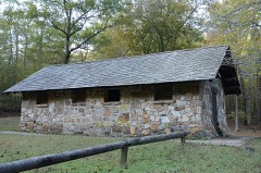 | Bard Springs Bathhouse | building | 1993 | 93001073 |
 | Bard Springs Dam No. 1 | structure | 1993 | 93001074 |
 | Bard Springs Dam No. 2 | structure | 1993 | 93001075 |
| Bard Springs Picnic Shelter | building | 1993 | 93001076 | |
| Bogg Springs Hotel | building | 1993 | 93001023 | |
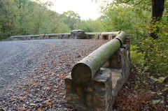 | Buckeye Vista Overlook | structure | 2007 | 07000204 |
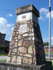 | Ebenezer Monument | object | 1992 | 91000689 |
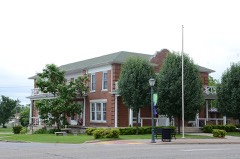 | Elks Lodge | building | 1998 | 98000616 |
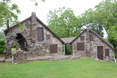 | C. E. Foster House | building | 1993 | 93000084 |
| Heathcliff Cabin | building | 2021 | 100006926 | |
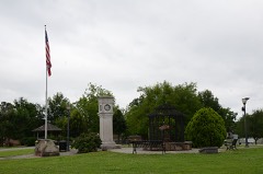 | Janssen Park | district | 1979 | 79000448 |
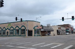 | Mena Commercial Historic District | district | 2009 | 09000321 |
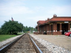 | Mena Kansas City-Southern Depot | building | 1991 | 91000685 |
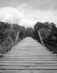 | Mountain Fork Bridge | structure | 1990 | 90000540 |
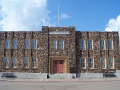 | National Guard Armory | building | 1991 | 91000682 |
 | Old Post Office | building | 1991 | 91000686 |
| Old U.S. 71 Ouachita River Bridges | district | 2025 | 100011300 | |
 | Polk County Courthouse | building | 1992 | 92001618 |
| Shady Lake Bathhouse | building | 1993 | 93001097 | |
| Shady Lake CCC Bridge #1 | structure | 2010 | 10000841 | |
| Shady Lake CCC Bridge #2 | structure | 2010 | 10000842 | |
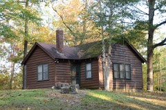 | Shady Lake Caretaker's House | building | 1993 | 93001098 |
| Shady Lake Dam | structure | 1993 | 93001099 | |
| Shady Lake Picnic Pavilion | building | 1993 | 93001100 | |
| Shady Lake Recreation Area Historic District | district | 2015 | 15000480 | |
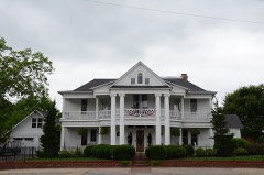 | Judge Benjamin Shaver House | building | 1979 | 79003431 |
 | St. Agnes Catholic Church | building | 1991 | 91000696 |
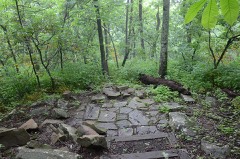 | State Line Marker | object | 1976 | 76000448 |
 | Studebaker Showroom | building | 2000 | 00000636 |
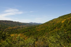 | Sugar Creek Vista Overlook | structure | 2007 | 07000205 |
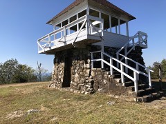 | Tall Peak Fire Tower | building | 1993 | 93001077 |
| Wickes School | building | 2024 | 100010843 |
Every wildfire the federal occurrence database records inside this county: 633 of them, burning about 9,952 acres. 104 started naturally and 198 were recorded as arson. Each settlement page carries the fires within five miles of it.
| Reported cause | Fires |
|---|---|
| Arson/incendiarism | 198 |
| Debris and open burning | 127 |
| Missing data/not specified/undetermined | 116 |
| Natural | 104 |
| Equipment and vehicle use | 31 |
| Railroad operations and maintenance | 25 |
| Recreation and ceremony | 15 |
| Smoking | 7 |
| Misuse of fire by a minor | 4 |
| Fireworks | 4 |
| Power generation/transmission/distribution | 2 |
The five largest, by the area the report gives. None of them was recorded as arson.
| Date | Cause | Size | Reported by | Name on the report |
|---|---|---|---|---|
| 27 November 2012 | Natural | 873 acres | Ouachita National Forest | RASPBERRY MOUNTAIN |
| 16 March 2018 | Missing data/not specified/undetermined | 560 acres | Oklahoma Division of Forestry | RIDGETOP RD FIRE |
| 1 April 2003 | Equipment and vehicle use | 545 acres | Ouachita National Forest | WEST HANNA FIRE |
| 14 March 2006 | Natural | 540 acres | Ouachita National Forest | ICE CREAM |
| 15 June 2011 | Natural | 377 acres | Ouachita National Forest | FORK MOUNTAIN |
| 12 August 2010 | Natural | 352 acres | Ouachita National Forest | HANNA 2 |
| 26 September 2017 | Missing data/not specified/undetermined | 210 acres | Arkansas Forestry Commission | not named |
| 27 August 2005 | Natural | 185 acres | Ouachita National Forest | SHORT CREEK FIRE |
Every settlement page carries the fires within five miles of it - see the settlement index below.
The NOAA Storm Events Database holds 535 reports for this county, causing 4 deaths, 73 injuries and about $190,371,530 in recorded property damage. Each settlement page carries the reports that name it.
| Kind of event | Reports |
|---|---|
| Hail | 211 |
| Thunderstorm Wind | 195 |
| Flash Flood | 64 |
| Tornado | 37 |
| Heavy Rain | 13 |
| Lightning | 8 |
| Funnel Cloud | 5 |
| Flood | 2 |
The most serious of them, by death, then injury, then recorded damage. The accounts are quoted exactly as the forecast office filed them.
| When | Event | Place named | Harm | What the report says |
|---|---|---|---|---|
| April 2009 | Tornado (EF3) | Potter | 3 killed, 30 hurt, $130,000,000 | A tornado began to the west-southwest of Mena, then tracked through the northwest side of Mena. According to the Polk County Judge, 165 houses were destroyed, 701 houses had major damage, and more than 11,000 trees were blown down. The Polk County Courthouse, county jail, Mena City Hall, and the police and fire departments were damaged in downtown Mena, as were several businesses. Mena Middle School, also located downtown, was structurally damaged beyond repair. A nursing home was also damaged. Most of the city lost electricity. The tornado then tracked to the northeast, badly damaging several industrial buildings. There was considerable roof damage at Rich Mountain Community College, and lesser damage to the hospital. As the tornado continued to the northeast, a tractor dealership was destroyed. A number of rural residences and farms were damaged as the tornado moved out into rural Polk County. North of Ink, damage was noted along Polk 74 and Polk 71; these same areas had been damaged by a tornado on October 6, 2008. Three fatalities occurred on the northwest side of Mena. One was a woman at a Masonic Lodge, and the others were a man and woman at separate residences. |
| January 1950 | Tornado (F3) | not stated | 1 killed, 1 hurt, $2,500 | no account filed |
| April 1979 | Tornado (F2) | not stated | 17 hurt, $2,500,000 | no account filed |
| November 1993 | Tornado (F2) | not stated | 11 hurt, $50,000,000 | An F2 tornado touched down in Polk County and traveled approximately 20 miles before it lifted. Even though the tornado was not on the ground continuously, it still managed to cause extensive damage to several towns along its path. The tornado initially touched down approximately 2.50 miles west of Cove, along Highway 4. The storm passed through Cove where it damaged and destroyed several homes and businesses. The tornado then struck the Hatfield area where it destroyed or damaged a number of homes. The tornado continued moving northeastward and struck the southwest part of Mena. In Mena, a large number of homes and businesses sustained damage. Most of the buildings that were struck were either destroyed or received major damage. Eleven people in Mena were treated for minor injuries. A local park in Mena lost a number of large trees. Some of these trees were over 100 years old. A number of buildings in Mena were damaged as a result of trees falling on the structures. The tornado finally lifted about three miles northeast of Mena, in the community of Hillcrest, where it destroyed a few mobile homes and damaged several others. Initial estimates placed the damage at over $6 million. |
| May 2013 | Tornado (EF2) | Cove | 5 hurt, $285,000 | This tornado exited McCurtain County, Oklahoma, 1.4 miles southeast of Plunkettville and entered Polk County, Arkansas, 3 miles southwest of Cove. In Arkansas, several mobile homes were damaged, including one that was crushed by a large tree and another that rolled over onto two vehicles. Trees were blown down onto a house, and a barn was destroyed. Several houses suffered roof damage. Numerous large trees, power lines, and power poles were blown down. Two cars were crushed by falling trees. Five people were injured. |
| August 2011 | Lightning | Mena Muni Arpt | 2 hurt | Two people were injured by lightning at the Mena airport. They were on a Tug towing an airplane at the time. They were conscious and talking after the lightning strike, but were taken to the hospital to be checked out. Lightning detection data indicated that the thunderstorm produced only two cloud-to-ground lightning strikes. |
| March 1991 | Thunderstorm Wind | not stated | 2 hurt | no account filed |
| October 1984 | Thunderstorm Wind | not stated | 2 hurt | no account filed |
| December 1975 | Tornado (F1) | not stated | 1 hurt, $250,000 | no account filed |
| July 2016 | Thunderstorm Wind | Mena | 1 hurt, $5,000 | A tree fell on a truck and injured 1 person. |
| April 2007 | Thunderstorm Wind | Big Fork | 1 hurt | The Local Coordinator reported several trees and power lines were down in the Big Fork community. One fell on a pickup truck resulting in minor injury. Power was out in Big Fork for a short time. |
| May 2013 | Flash Flood | Rich Mtn | $1,750,000 | Widespread flash flooding occurred in Polk County. U.S. 71 was closed from Mena to the Scott County line. Arkansas 8 and Arkansas 370 were flooded in the eastern part of the county. A landslide closed Arkansas 88 a few miles west of Mena. A number of county roads were impassable; 30 bridges were damaged and 3 were washed out. For the 24-hour period ending at 7 AM on the 31st, Big Fork measured 7.55 inches of rain and Mena collected 7.07 inches. At the Mena airport, rainfall on the 30th measured 4.07 inches, followed by another 1.69 inches on the 31st. A fiber optic cable was knocked out of service. As a result, there was no landline phone service, cell phone service, or Internet service to most of the county for about 24 hours from the 30th into the 31st. |
| May 2011 | Flood | Rich Mtn | $500,000 | no account filed |
| May 2014 | Flash Flood | Rich Mtn | $425,000 | Excessive rainfall caused severe flash flooding in Polk County. During the afternoon and early evening hours, the Mena airport recorded 6.98 inches of rain in 7 hours. Of that amount, 3.89 inches fell in only two hours during the early evening. The storm total rainfall at the airport was 7.30 inches. More than 40 swift-water rescues became necessary. U.S. 71 was flooded south of Mena, and numerous other roads were barricaded. Some homes and businesses were sandbagged as a precaution, but water did enter a few structures. Numerous county roads and bridges were damaged, including pavement washed off roads, gravel washed away, and bridge approaches washed out. Other large rainfall totals in Polk County were 5.84 inches at Hatfield, 4.50 inches at Bogg Springs, and 3.88 inches at Cove. |
| July 2014 | Flash Flood | Rich Mtn | $400,000 | Rainfall amounts included 6.72 inches at Bogg Springs and 6.48 inches at Mena. Numerous county roads flooded. A 70 foot-long bridge was washed out on Polk 7, a bridge was damaged on Polk 6, a 6-foot diameter culvert was washed away on Bunch Rd. in Wickes, and a section of Polk 257 was washed out. Water entered three businesses in Wickes and the Baptist camp flooded in Bogg Springs. |
| April 2011 | Tornado (EF1) | Mena | $350,000 | The tornado destroyed a warehouse used by a snack food company. Numerous trees were blown down, with one of the trees falling on a house. A barn was damaged. |
| November 2011 | Flash Flood | Cove | $300,000 | Evacuations of some residences were necessary in Acorn. Water entered some businesses in Mena. Numerous county roads were flooded. |
| September 2001 | Flash Flood | Southeast Portion | $300,000 | Heavy rains resulted in flash flooding across a large part of southeast Polk County. Several roads were flooded, with county roads 61, 67, 69, and 664 washed out. At least a dozen bridges were washed out as well. People were stranded in campgrounds due to the bridge and road washouts. Also, a pontoon boat was washed out of a lake, over a small dam, and ended up in a county road. |
| April 2009 | Tornado (EF1) | Mountain Fork | $250,000 | A tornado moved out of Le Flore County, Oklahoma, and entered Polk County, Arkansas, just north of where Oklahoma Highway 63 becomes Arkansas Highway 8 at the state line. A vacation home was destroyed and a 5th-wheel camping trailer was overturned. Hundreds of trees were knocked down in the Ouachita National Forest. Much of the track of the tornado through the forest was inaccessible by road, so aerial imagery from a flyover by the USDA Forest Service was used to determine this portion of the track. |
| April 1981 | Tornado (F1) | not stated | $250,000 | no account filed |
| May 1971 | Tornado (F2) | not stated | $250,000 | no account filed |
| April 2011 | Tornado (EF1) | Big Fork | $200,000 | A tornado blew down numerous trees and power lines. The tornado exited Polk County east-northeast of Opal and entered Montgomery County southwest of Pine Ridge. |
| July 2009 | Flash Flood | Mena | $200,000 | A business was flooded and water entered approximately 10 houses. Flooding occurred on Arkansas Highway 375 west of Mena and Arkansas Highway 8. Also, several county roads were flooded. Minor street flooding occurred in Mena. |
| April 2011 | Flood | Rich Mtn | $150,000 | Widespread areal flooding occurred. |
| October 2014 | Thunderstorm Wind | Hatfield | $125,000 | Roofs were partially torn off two chicken houses and there was minor damage to a couple of other chicken house roofs; two old, unused chicken houses were badly damaged; and many trees and some power lines were blown down. |
| May 2015 | Flash Flood | Potter | $100,000 | Several roads were washed out, and bridges along Polk County Road 40 and 95 were washed out completely. |
| July 2014 | Lightning | Mena | $100,000 | Lightning caused extensive damage to the communications system at the sheriff's office in Mena. |
| June 1998 | Tornado (F1) | Cove | $100,000 | no account filed |
| May 2013 | Tornado (EF1) | Wickes | $75,000 | An EF1 tornado caused a mobile home and a horse trailer to be crushed by falling trees. Shingles were blown off a house. The metal roof was blown off a shed. Numerous trees were uprooted or snapped off. |
| April 2011 | Thunderstorm Wind | Mena | $75,000 | Power lines and poles were blown down in Mena, leaving much of the city without power. |
| March 2008 | Flash Flood | Howard | $75,000 | Many low water crossings were flooded across the county. County Road 47, County Road 95 and Arkansas Highway 8 were blocked due to flooding. |
| October 2008 | Tornado (EF1) | Ink | $75,000 | Numerous trees were blown down, as were a few power lines. A couple of the falling trees landed on the edge of houses' roofs. Several old chicken houses being used as hay barns were damaged. An old barn and a few outbuildings were destroyed, the tin was taken off a couple of barn roofs, an old garage was blown off its foundation, and much of the tin roof was taken off another garage. Shingles were blown off a couple of houses. |
| April 2011 | Thunderstorm Wind | Wickes | $60,000 | A tree was blown down onto a house. Numerous county roads were blocked by fallen trees. |
| July 2009 | Lightning | Potter | $60,000 | A lightning strike set a house on fire on Polk County Road 93. |
| May 2015 | Thunderstorm Wind | Big Fork | $50,000 | Numerous trees and power lines were blown down across the town of Big Fork. Some structures also received damage. |
| May 2015 | Thunderstorm Wind | Big Fork | $50,000 | Numerous trees and power lines were blown down all over the town of Big Fork. Some structures also received some damage. |
| July 2014 | Thunderstorm Wind | Hatfield | $50,000 | Roofs of houses were damaged. |
| October 2014 | Tornado (EF1) | Rocky | $50,000 | A pole barn was blown down, hundreds of trees were uprooted, and power lines and power poles were blown down. |
| January 2013 | Flash Flood | Ink | $50,000 | Some bridges were washed out around Ink. |
| June 2011 | Thunderstorm Wind | Rocky | $50,000 | Polk 93 and Polk 164 were blocked by downed trees and power lines. Trees fell on a house and a vehicle. |
| April 1993 | Thunderstorm Wind | Cove | $50,000 | Thunderstorm winds blew down a number of trees. |
| June 2012 | Thunderstorm Wind | Board Camp | $40,000 | A hay barn was blown down, another barn was damaged, and trees were blown down. |
| April 2011 | Thunderstorm Wind | Bogg Spgs | $40,000 | Chicken houses were damaged and a large tree was blown down. |
| April 2011 | Thunderstorm Wind | Mena | $40,000 | Trees were blown down on a house and vehicle on the south side of Mena. |
| May 2013 | Tornado (EF1) | Mountain Fork | $35,000 | An EF1 tornado blew the roof off a metal barn, destroyed a shed, damaged the roof of a house, and blew down many large trees. |
| April 2014 | Lightning | Mena | $30,000 | Lightning struck a tree and a house in Mena. A small fire started in the house but was quickly extinguished. Power was knocked out for about 45 minutes at the hospital, nursing home, elementary school, and high school. |
| July 2011 | Flash Flood | Nunley | $30,000 | Culverts were washed out after heavy rain - up to 4 inches - fell in the Board Camp area. |
| October 2014 | Thunderstorm Wind | Rocky | $25,000 | Large trees, power lines, and a power pole were blown down. |
| June 2014 | Thunderstorm Wind | Cove | $25,000 | Multiple trees were blown down, blocking roads in the Cove area. |
| July 2014 | Thunderstorm Wind | Wickes | $25,000 | U.S. 278 was blocked by numerous fallen trees. |
| May 2011 | Thunderstorm Wind | Rocky | $25,000 | The roofs of several buildings were damaged. |
| April 2008 | Flash Flood | Cherry Hill | $25,000 | Sandbagging was needed at the emergency room at the hospital in Mena. Up to a foot of water was over places on U.S. Highway 71. Arkansas Highway 375 had up to 6 inches of standing water. Standing water was also reported on many streets and roadways across the county. |
| November 1977 | Tornado (F2) | not stated | $25,000 | no account filed |
| March 1961 | Tornado (F2) | not stated | $25,000 | no account filed |
| November 1952 | Tornado (F2) | not stated | $25,000 | no account filed |
| October 2017 | Thunderstorm Wind | Hatfield | $20,000 | Several county roads in the area were temporarily blocked from overturned trees and power lines. One home was unlivable due to severe roof damage. |
| June 2014 | Thunderstorm Wind | Vandervoort | $20,000 | Trees were blown down, blocking county roads in the area around Vandervoort. |
| April 2011 | Tornado (EF1) | Wickes | $20,000 | A house had its porch and part of its roof blown off. Much of the roof was blown off a mobile home. Trees were blown down. |
| July 2014 | Thunderstorm Wind | Mena | $15,000 | A tree fell on a house. |
| October 2014 | Thunderstorm Wind | Hatfield | $15,000 | Trees were blown down. |
The Survey's mineral resources record lists 55 workings inside this county. 1 still produces and 54 are closed or unrecorded. Each settlement page carries the workings within five miles of it.
| Commodity | Workings |
|---|---|
| Manganese | 25 |
| Sand and Gravel, Construction | 13 |
| Barium-Barite | 7 |
| Clay | 3 |
| Stone, Crushed/Broken | 3 |
| Stone | 2 |
| Slate, Dimension | 1 |
| Silica | 1 |
The least common of them first, because a county's hundredth gravel pit says nothing its first ten did not.
| Where | Site | Commodity | Status | Recorded |
|---|---|---|---|---|
| Avant & Heath | Slate, Dimension | Past Producer | ||
| Little Missouri | Silica | Past Producer | ||
| Dickey Clay Mfg. Co. Deposit | Stone | Past Producer | ||
| Rogers Pit | Stone | Past Producer | Surface | |
| Lehrack Quarry | Stone, Crushed/Broken | Past Producer | ||
| National Slate Co Quarry | Stone, Crushed/Broken | Past Producer | ||
| Tom Heath Quarry | Stone, Crushed/Broken | Past Producer | ||
| Unk | Clay | Past Producer | ||
| Unk | Clay | Past Producer | ||
| Unk | Clay | Past Producer | ||
| Bee Mountain | Barium-Barite | Prospect | ||
| Boar Tusk Mountain Prospect | Barium-Barite | Prospect | ||
| Cossatot River Mine | Barium-Barite | Past Producer | ||
| Don H Williams | Barium-Barite | Prospect | ||
| He Mountain Coon Creek | Barium-Barite | Past Producer | ||
| Two Mile Creek Prospects | Barium-Barite | Prospect | ||
| Viles Creek | Barium-Barite | Past Producer | ||
| Berg Pit & Plant | Sand and Gravel, Construction | Producer | ||
| Unk | Sand and Gravel, Construction | Past Producer | ||
| Unk | Sand and Gravel, Construction | Past Producer | ||
| Unk | Sand and Gravel, Construction | Past Producer | ||
| Unk | Sand and Gravel, Construction | Past Producer | ||
| Unk | Sand and Gravel, Construction | Past Producer | ||
| Unk | Sand and Gravel, Construction | Past Producer | ||
| Unk | Sand and Gravel, Construction | Past Producer | ||
| Unk | Sand and Gravel, Construction | Past Producer | ||
| Unk | Sand and Gravel, Construction | Past Producer | ||
| Unk | Sand and Gravel, Construction | Past Producer | ||
| Unk | Sand and Gravel, Construction | Past Producer | ||
| Unk | Sand and Gravel, Construction | Past Producer | ||
| American Prospect | Manganese | Prospect | ||
| Arkansas Manganese Co | Manganese | Past Producer | ||
| Boar Tusk | Manganese | Prospect | ||
| Bowen Claim | Manganese | Prospect | ||
| Coon Creek | Manganese | Past Producer | ||
| Cubage & Newtonmn Mining Claims | Manganese | Prospect | ||
| Doty Claim | Manganese | Past Producer | ||
| Dr Scott Claim & Prospect | Manganese | Prospect | ||
| Duncan,Dieckman & Duncan | Manganese | Past Producer | ||
| E S White Prospect | Manganese | Prospect | ||
| Eagle Lode Claims Numbers 1 to 5 | Manganese | Occurrence | ||
| Eagle Mountain Mine | Manganese | Past Producer | ||
| Grady Lawrence Mine | Manganese | Past Producer | ||
| Hablitzel | Manganese | Prospect | ||
| Harold Bullard Prospects | Manganese | Prospect | ||
| Harris Creek Group | Manganese | Past Producer | ||
| Hazlett Estate | Manganese | Prospect | ||
| Lavine | Manganese | Prospect | ||
| Lost Hatchet Mine | Manganese | Past Producer | ||
| Parson | Manganese | Past Producer | ||
| Pickell Mn Prospect | Manganese | Occurrence | ||
| Prospect | Manganese | Prospect | ||
| Shady Lake Mill | Manganese | Past Producer | ||
| W.Allen Claim | Manganese | Prospect | ||
| Ward Mine | Manganese | Past Producer |
Named settlements recorded in the Geographic Names Information System, each with the topographic sheets covering it. Villages, hamlets and abandoned places alike. Each is shown with the nearest named watercourse or landform and the survey quadrangle it falls on.
Fulton township · 71953 · On Butcherknife Creek · Big Fork quadrangle
15 sheets, 1906 to 1986
White township · 71973 · Near Whiskey Peak · Bog Springs quadrangle
16 sheets, 1913 to 1986
Cedar township · 71953 · Near Pine Mountain · Rich Mountain quadrangle
22 sheets, 1890 to 1989
Mountain township · 71953 · On Turbin Creek · Pine Ridge quadrangle
15 sheets, 1890 to 1985
Cove township · 71945 · On Mike Creek · Cove quadrangle
16 sheets, 1913 to 1986
No longer a settlement
Acorn township · 71953 · Near Rich Mountain · Rich Mountain quadrangle
22 sheets, 1890 to 1989
Eagle township · 71953 · On Thompson Creek · Potter quadrangle
22 sheets, 1890 to 1989
No longer a settlement
Gap Springs township · 71972 · On Faulkner Branch · Baker Springs quadrangle
17 sheets, 1913 to 1986
White township · 71944 · On Little Coon Creek · Gillham quadrangle
15 sheets, 1913 to 1986
Cedar township · 71953 · On Nichols Branch · Mountain Fork quadrangle
22 sheets, 1890 to 1989
Potter township · 71953 · On Sweetwater Creek · Potter quadrangle
22 sheets, 1890 to 1989
Potter township · 71953 · On McKinney Creek · Potter quadrangle
22 sheets, 1890 to 1989
Acorn township · 71953 · On Rich Mountain · Rich Mountain quadrangle
22 sheets, 1890 to 1989
White township · 71937 · Near Cross Mountains · Bog Springs quadrangle
16 sheets, 1913 to 1986
No longer a settlement
Gap Springs township · 71953 · On Sulphur Creek · Nichols Mountain quadrangle
18 sheets, 1913 to 1986
The vanished settlements of Polk County: the places named above that are no longer on the map.