Block
From the record
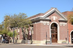
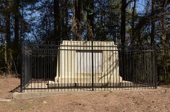
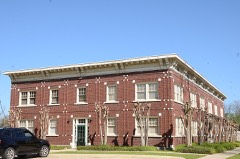
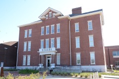
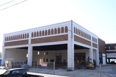
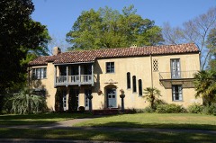
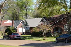
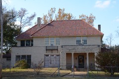
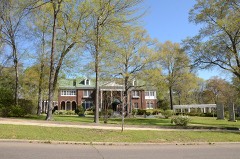
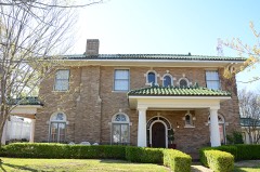
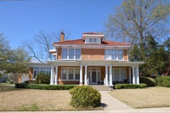
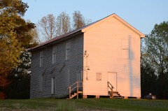
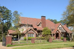
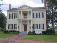
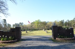
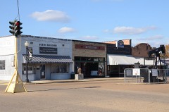
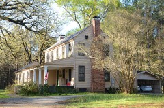
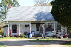
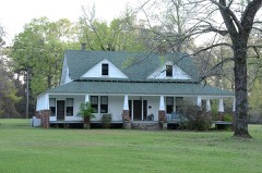
40 National Register listings published here.
Sources: the National Register database, National Park Service
69 topographic sheets cover 68 settlements here, and 40 properties are on the National Register of Historic Places.
40 National Register listings published here.
Sources: the National Register database, National Park Service
Every property in this county listed on the National Register of Historic Places, with the year it was listed and the federal nomination document.
Every wildfire the federal occurrence database records inside this county: 1,088 of them, burning about 8,359 acres. 81 started naturally and 137 were recorded as arson. Each settlement page carries the fires within five miles of it.
| Reported cause | Fires |
|---|---|
| Missing data/not specified/undetermined | 427 |
| Debris and open burning | 293 |
| Arson/incendiarism | 137 |
| Equipment and vehicle use | 86 |
| Natural | 81 |
| Misuse of fire by a minor | 19 |
| Smoking | 17 |
| Railroad operations and maintenance | 17 |
| Recreation and ceremony | 9 |
| Other causes | 1 |
| Firearms and explosives use | 1 |
The five largest, by the area the report gives. One of them was set deliberately.
| Date | Cause | Size | Reported by | Name on the report |
|---|---|---|---|---|
| 23 February 2007 | Debris and open burning | 450 acres | Arkansas Forestry Commission | CAMDEN |
| 10 September 2013 | Missing data/not specified/undetermined | 203 acres | Arkansas Forestry Commission | MARYSVILLE |
| 4 October 2006 | Misuse of fire by a minor | 115 acres | Arkansas Forestry Commission | not named |
| 7 March 2007 | Debris and open burning | 103 acres | Arkansas Forestry Commission | CORNIE CREEK |
| 6 February 2009 | Arson/incendiarism | 101 acres | Arkansas Forestry Commission | STRONG |
| 21 May 2018 | Missing data/not specified/undetermined | 96 acres | Arkansas Forestry Commission | not named |
| 9 February 2016 | Debris and open burning | 95 acres | Arkansas Forestry Commission | not named |
| 28 July 1998 | Debris and open burning | 90 acres | Arkansas Forestry Commission | not named |
Every settlement page carries the fires within five miles of it - see the settlement index below.
The NOAA Storm Events Database holds 519 reports for this county, causing 3 deaths, 35 injuries and about $42,217,000 in recorded property damage. Each settlement page carries the reports that name it.
| Kind of event | Reports |
|---|---|
| Thunderstorm Wind | 228 |
| Hail | 172 |
| Flash Flood | 62 |
| Tornado | 45 |
| Flood | 5 |
| Lightning | 3 |
| Heavy Rain | 3 |
| Funnel Cloud | 1 |
The most serious of them, by death, then injury, then recorded damage. The accounts are quoted exactly as the forecast office filed them.
| When | Event | Place named | Harm | What the report says |
|---|---|---|---|---|
| January 2005 | Tornado (F3) | Junction City | 2 killed, 13 hurt, $3,000,000 | The tornado that moved through Claiborne Parish Louisiana moved northeast into Union County Arkansas. The tornado first struck the community of Junction City, Arkansas just north of the Arkansas, Louisiana state line. From the area surveyed, the tornado was on the ground continuously from touchdown to end. For the early part of the track, the damage was confined to minor damage to homes with numerous trees downed from Junction City to near Tatum Rd approximately 8 miles south of El Dorado. In Junction City, two people were injured when a tree fell on their home as they were in bed. As the tornado approached Tatum Rd, it appears to have intensified significantly while growing wider in its destruction. It was through the area from Tatum Rd, across Hwy 7 and into the vicinity of Rushwood Rd that the storm did its greatest damage. Numerous homes, both mobile and well constructed frame homes were either destroyed or heavily damaged. A number of vehicles were rolled and tossed through the air, landing several yards from their initial location. It was in the area of Tatum Rd through Rushwood Rd that two fatalities occurred, both of them elderly residents. The majority of the injuries also occurred in this area. After leaving the Rushwood Rd area, the storm began to weaken and decreasing in path width. Except for minor structural damage to buildings in Lawson, trees downed or broken was the main damage for the latter part of the track. |
| December 1978 | Tornado (F2) | not stated | 1 killed, 7 hurt, $250,000 | no account filed |
| February 2007 | Tornado (EF3) | Junction City | 5 hurt | A strong tornado developed under a supercell thunderstorm which moved northeast across the county. Damage was largely confined to heavily wooded areas with less than 20 structures sustaining damage. Six of these structures received heavy damage near the community of Strong, Arkansas. Numerous snapped and fallen large trees were also observed.|The extent of the damage ranged from shingles off some homes to others completely demolished. Of the 6 homes that were severly damaged...two were mobile homes. The tornado began in extreme southwest Union County near Junction City where a metal roof was blown off a pharmacy on Route 167. The tornado produced sporadic tree damage along Welloo and Welch roads. Moving northeast...the tornado downed additional trees across Caledonia and Iron Mountain roads. The tornado continued in a northeast direction...crossing Hwy 82 and intensified as it crossed Old Strong highway. Here a well build brick home was mostly demolished. The tornado traveled a half mile east and demolished a double wide trailer blowing the debris 150 to 200 yards downstream. Several other homes were affected from this storm before the storm lifted near the community of New London. Five injuries were reported from this tornado with no fatalities. At the most damaging point of the storm after it crossed Hwy 82...the storm was rated an EF3 on the new enhanced Fujita scale. A monetary damage amount was not available for this publication. |The Damage Indicator for the event was (DI): FR 12 while the Degree of Damage for the event was (DOD): 8. |
| March 1972 | Tornado (F2) | not stated | 3 hurt, $2,500,000 | no account filed |
| March 1992 | Tornado (F1) | not stated | 1 hurt, $25,000,000 | no account filed |
| February 1998 | Thunderstorm Wind | El Dorado | 1 hurt, $1,000,000 | Trees were toppled throughout the area with damage to many homes and businesses and powerlines. The Noalmark Broadcasting tower was blown down and a tree fell across a home totally demolishing it. Residents were evacuated after a nitric acid tank was blown down near the El Dorado Chemical Plant. The spill residue was contained and neutralized on-site. There was one injury reported when a man was trapped inside his car after a tree fell on it. |
| May 1981 | Tornado (F1) | not stated | 1 hurt, $250,000 | no account filed |
| May 2011 | Thunderstorm Wind | El Dorado | 1 hurt, $40,000 | A large tree was downed in town that fell on a home. There was a report of one minor injury. |
| June 2009 | Thunderstorm Wind | Strong | 1 hurt, $30,000 | A tree was downed on a home in Strong, Arkansas with one minor injury reported. |
| April 1997 | Thunderstorm Wind | El Dorado | 1 hurt | High winds downed trees west of town including one that fell across an automobile. A person was trapped inside the car and sustained minor injuries. |
| April 1997 | Thunderstorm Wind | El Dorado | 1 hurt | A woman was injured when trees fell across her mobile home in the Newell Community. She was trapped for several hours until rescued but suffered only minor injuries. |
| March 1972 | Tornado (F3) | not stated | $2,500,000 | no account filed |
| June 2023 | Tornado (EF2) | Wilmington Lndg | $2,000,000 | During the evening hours on Sunday, June 18th, a strong thunderstorm developed about 12 miles to the northeast of El Dorado, Arkansas in Union County. Shortly after forming, the storm became severe and started to rotate. The storm went on to produce an EF-2 tornado, touching down near the Cypress Creek Oil Field to the north of Moro Bay Highway near Stowe Ditch Road. At this location, there were numerous trees either snapped or uprooted from winds around 80 to 85 mph. As the tornado tracked to the southeast towards Moro Bay Highway, it strengthened some which was evident from the more widespread tree damage. As it crossed Moro Bay Highway, it did not cause any major damage to structures despite there being some along the path. From there,|the road network became sparse, but some additional tree damage was observed along Feldmann Road to the southeast of Moro Bay Highway. ||From there, the tornado continued to track southeast, causing significant damage along Pigeon Hill Road. The tornado continued to strengthen as it moved toward New London Road. This is where the greatest destruction was observed as the tornado moved over|a chicken farm and five chicken coops. Three of the five chicken coops were completely destroyed with additional damage to a few other barns and outbuildings. With the amount of tree damage surrounding the chicken coops, along with the total destruction of three of them, the tornado was rated EF-2 with maximum winds at 115 mph. This damage was short-lived and confined to this farm on the west and east side of New London Road. Additionally, there was a tree that fell on a manufactured home just to the north of the farm. The owners of the farm who lived in a brick home were able to call the family in the manufactured home after getting the tornado warning and had them rush to their house. So no one was in the the manufactured home when it took on damage. From there, the tornado continued to track to the southeast with more significant tree damage off Christian Road and North Road to the north of Phelps Road before lifting. |
| October 2009 | Flood | Champagnolle | $2,000,000 | Excessive heavy rainfall that fell during the middle and latter half of October resulted in very high river levels on the Ouachita River at Felsenthal, Arkansas. The river did not crest until the first part of November so the crest information will be included in the November publication of Storm Data. At the end of October, the river level at the Felsenthal Lock and Dam was near 83 feet which was some 13 feet above flood stage. Most of the communities residents had to move to higher ground as water was reported in as many as 15 homes with many city streets flooded and closed. Upwards of 14 homes in the Calion area were inundated by flood waters. Shelters were being setup to house the evacuated residents. Meals were provided by local chapters of the Red Cross. Most of the towns streets were inundated as well with water 5 foot deep across some roads. Travel by boat became necessary by the end of the month, especially in the Moro Bay areas. Union County, Arkansas was declared a Federal Disaster Area because of the extensive flooding and storm damage that occurred during the month of October. |
| April 2016 | Lightning | El Dorado | $250,000 | Lightning struck the Murmill Baptist Church on Beacon Hill Road in Southeast El Dorado. This resulted in a fire which completely burned the church down to the ground. |
| October 2009 | Thunderstorm Wind | Junction City | $250,000 | Trees were downed in the community of Junction City, Arkansas blocking four city streets. Damage was also reported in town where trees were downed at the intersection of North Newton and Oakhurst Boulevard. Nearly 20 trees were downed within a quarter mile stretch at Ebenezer Road were several structures also received damage. Two mobile homes were destroyed. Also, a home was damaged on Smith Street in El Dorado, Arkansas. Trees also fell on two vehicles across the county and a canopy was damaged at the Yocum Elementary School. |
| August 2008 | Flash Flood | El Dorado | $250,000 | Police Department reported that several roads across the city had nearly one foot of water on them. Water was beginning to enter some parked cars in some areas. Between 1100 am and noon, the local police department was busy blocking badly flooded streets and helping people who had become stranded inside stalled cars. Water reached the windows of some stalled vehicles and covered the hoods of others. Flooding was particularly bad on 19th Street just east of College Avenue and at the Mellor Park Mall. Other streets that reported flooding were Timerlane, Grove, West Block, Junction City Road, Hillsboro, North West Avenue and Mount Holly Road. Water was high enough to go into a business located on North West Street. |
| April 1991 | Tornado (F2) | not stated | $250,000 | no account filed |
| February 2008 | Tornado (EF0) | Junction City | $200,000 | The tornado snapped off many trees along a seven mile path starting 2 miles west of Junction City, Arkansas to 5 miles north northeast of Junction City, Arkansas. Several porches and awnings were destroyed in the town and there was roof damage throughout the north side of the city. Severe roof damage was reported to the Juncition City First United Methodist Church. |
| April 2004 | Tornado (F1) | Three Creeks | $200,000 | Along the path of the tornado, 6 homes received minor to moderate damage from falling trees and roof damage. A roof was also peeled off a church. Numerous trees were snapped off and blown down as well. |
| October 2009 | Flash Flood | New Hope | $175,000 | At least 30 roads are flooded and closed throughout the county. DOTD does not have enough signs to close the roads that are currently flooded across the county. Union County, Arkansas was deemed a Federal Disaster Area because of the flash flooding, river flooding, and storm damage that the county ensued during the month of October. |
| June 2001 | Flash Flood | El Dorado | $175,000 | Unofficial reports of 10 inches of rain were received which was responsible for washing out a number of roads, bridges and culverts throughout the area from El Dorado to Smackover. Murphy road was washed out completely and Hayes City Loop suffered extensive culvert damage while Silver Hill Loop was "cut in two." Silver Hill Loop arches northward from Arkansas 160 west of Smackover and was described as a scene that resembled the aftermath of a small bombing attack. The road simply vanished into a jagged crater than sank well past the original road bed, some six feet beneath the existing cap, into a pool of muddy water. |
| April 2011 | Tornado (EF1) | Norphlet | $150,000 | The National Weather Service conducted a storm survey in Union County Arkansas and concluded that storm damage was the result of an EF1 tornado. The tornado touched down at around 10:12 AM, in the town of Norphlet. An old gas station cover was blown down and several trees were snapped along Black street eastward across Hayes St. Some minor roof damage occurred to homes along Hayes street. The tornado continued eastward crossing N Tate Road where a carport collapsed on a vehicle and several trees were snapped or uprooted. The tornado continued along the south side of Tate Road snapping trees and peeling shingles from several homes. The tornado lifted east of a pasture where several hardwood and softwood trees were snapped or uprooted. A small metal outbuilding suffered structural damage as well. Maximum winds are estimated at 90-100 mph. |
| January 2023 | Tornado (EF1) | Griffin | $130,000 | An EF-1 tornado with estimated maximum winds near 107 mph touched down along Pleasant Hill Road east of Highway 15 (Haynesville Highway) and tracked generally in a northeasterly direction across Spot Attaway Road and Wesson Road, snapping and uprooting numerous hardwood and softwood trees. The most significant structural damage was observed as the tornado crossed Emma Drive west of Parkers Chapel Road. Here, two double-wide manufactured homes were partially shifted off their cinder blocks but remained intact with no other damage. Two outbuildings were also destroyed. One outbuilding was small and entirely made out of wood, but its 2x4 vertical support boards were driven 3 feet into the ground during construction and mostly remained in place. The other outbuilding was much larger and consisted of a metal roof and frame, which was twisted to a great degree. The expected wind speeds for these two outbuildings and their degree of damage were in the low EF-2 range. However, given the all-wood construction of the first building and its support beams remaining partially buried, and a distinct lack of widespread tree damage in the immediate vicinity, the estimated wind speeds were lowered, resulting in an EF-1 rating, which was also more consistent with the vast majority of the damage observed. ||The tornado continued northeast across Parkers Chapel Road and through a couple of neighborhoods south and east of Parkers Chapel School. Widespread snapping and uprooting of large softwood pine trees occurred in this area. Structural damage in this area was caused by the falling trees rather than the tornado itself. One uprooted tree fell through a single-wide manufactured home occupied by three people when the tornado struck. Fortunately, no injuries occurred in this home. ||More snapped and uprooted softwood trees were observed as the tornado crossed Lynn Drive, Evans Drive, Ables Drive, Rilla Street, Oleta Avenue, Wotapi Street, and Highway 15. The tornado began to weaken as it continued northeast out of the Parkers Chapel community but snapped another softwood tree north of Buchanan Road east of Highway 15 before finally lifting near the intersection of Highway 15/Highway 82 on the southwest side of El Dorado. |
| April 2018 | Tornado (EF1) | Catesville | $125,000 | An EF-1 tornado, with estimated maximum winds around 110 mph, touched down along Highway 167 just north of Wingfield Lake Road and quickly intensified over the Faircrest community. The tornado reached its maximum intensity and width along Peace and Mount Union Roads. It uprooted and snapped numerous trees in this location and damaged the roofs of several homes. It also rolled and destroyed a travel trailer and did roof damage to a number of mobile homes as well. The tornado moved northeast and did sporadic tree damage along Iron Mountain Road before it crossed Bayou de Loutre. The tornado continued northeast and uprooted a few trees along Patterson Loop Road and Hibanks Road. The tornado then re-strengthened as it crossed Highway 82 and uprooted and snapped several trees near the Hope Landing organization just west of Spencer Lane. Minor tree damage was noted just north of this location before the tornado finally lifted. |
| August 2010 | Thunderstorm Wind | El Dorado | $100,000 | Thunderstorm winds downed several trees...some of which struck homes in the El Dorado area. There were no reports of injuries. Damage was reported to the El Dorado High School building on Timberlane and Parnell Road. The winds blew down a wall to one of the buildings along with large trees that fell on the school property. Half the roof was also taken off a home in the Mount Moriah community. |
| June 2009 | Flash Flood | El Dorado | $100,000 | Excessive heavy rainfall resulted in several flooded cars inside the city. |
| October 2009 | Flash Flood | New Hope | $100,000 | Many roadways across the county were closed and impassable from excessive heavy rainfall. These include Hwy. 167, Hwy. 7, Hwy. 82, Hwy. 172 and Hwy. 160 around El Dorado as well as State Line Road near Junction City. Numerous cars were stalled out in knee deep water throughout the city of El Dorado as well. |
| October 2009 | Flash Flood | Wesson | $100,000 | Some county roads were closed due to high water. Union County was one of 20 counties across the state that were declared disaster areas from rainfall up to the 13th, 14th and 15th of October. |
| April 2015 | Thunderstorm Wind | El Dorado | $75,000 | Trees were downed on two different homes in El Dorado causing minor to moderate damage. |
| March 2007 | Thunderstorm Wind | El Dorado | $75,000 | A supercell thunderstorm produced downed trees and powerlines along Hwy 167 south of town. Two stores were also damaged along Iron Mountain Road in the Faircrest Community. The roof was blown off one store. |
| April 2018 | Tornado (EF1) | Kinard | $70,000 | An EF-1 tornado, with estimated maximum winds around 110 mph, touched down along Nick Springs Road just east of Spencer Lane. It uprooted and snapped trees here along with breaking several large branches. The tornado continued northeast and intersected Lawson Road, where it rapidly intensified to its strongest and widest point. It did considerable tree damage here and damaged the roofs of a number of homes, mobile homes, and barns in this location. Widespread tree damage was found here that included numerous uprooted and snapped trees. The tornado continued northeast where it uprooted several trees along Frisby Road, with a number of trees landing on homes. The tornado then continued northeast where it uprooted a number of trees along Rhodes Chapel Road before lifting. |
| May 2023 | Lightning | El Dorado | $50,000 | Lightning struck an oil tank at the Delek Refinery in El Dorado, setting it on fire. |
| May 2013 | Thunderstorm Wind | El Dorado | $50,000 | Numerous trees were downed along with power poles. Some structural damage was also reported. |
| October 2009 | Flash Flood | Cairo | $50,000 | Highway 82 between Cairo and El Dorado, Arkansas has water covering the highway with cars stalled in the high water. |
| October 2009 | Tornado (EF1) | Smackover | $50,000 | An EF1 tornado touched down 3 miles west southwest of Smackover, Arkansas and downed large trees while snapping several others. The path width was 75 yards wide with a path length of 1.5 miles. At least 4 homes received damage from downed trees. |
| June 2004 | Thunderstorm Wind | Smackover | $50,000 | Tree downed on a home and truck in town. No injuries reported. |
| November 1994 | Thunderstorm Wind | Smackover | $50,000 | Thunderstorm winds downed some trees and power lines. Several homes were also damaged by fallen trees. |
| May 2015 | Lightning | El Dorado | $40,000 | A lightning strike resulted in a house fire in El Dorado, Arkansas. |
| May 2013 | Thunderstorm Wind | El Dorado | $35,000 | A large tree fell onto a home causing severe structural damage. No injuries were reported. |
| December 2012 | Thunderstorm Wind | El Dorado | $30,000 | Trees were downed around El Dorado including one tree on a home just north of town. There were no reports of injuries. |
| January 2023 | Tornado (EF1) | Norphlet | $25,000 | An EF-1 tornado with estimated maximum winds near 105 mph touched down about 3 miles southwest of Norphlet, just southwest of the intersection of Murphy Loop and Shady Grove Road. The tornado tracked northeast over the span of approximately one minute, snapping and uprooting several hardwood and softwood trees and causing minor damage to structures resulting mainly from the impacts of the fallen trees. The damage path ended just to the southeast of the intersection of Shady Grove Road, Murphy Loop, and Burchfield Road. |
| January 2017 | Tornado (EF0) | Lawson | $25,000 | An EF-0 tornado with maximum estimated winds between 75 and 80 mph touched down just south of Lawson Road in the Lawson community where peeled back a portion of a roof of a single wide mobile home with one portion of the wall detached. The tornado continued north across Lawson Road and over a heavily wooded area to Mount Zion Road where it snapped a few small trees. The tornado lifted shortly after crossing Mount Zion Road. |
| September 2013 | Thunderstorm Wind | El Dorado | $25,000 | Numerous trees and powerlines were downed along Campbell Road and Hinson Road in the Parkers Chapel Community. One tree fell through a mobile home causing significant damage. There were no reports of injuries. |
| January 2013 | Thunderstorm Wind | El Dorado | $25,000 | Numerous trees were downed including one that fell on a house near Parkers Chapel, Arkansas. |
| June 2004 | Thunderstorm Wind | El Dorado | $25,000 | Tree down on a trailer in Lisbon. No injuries reported. |
| March 1975 | Tornado (F1) | not stated | $25,000 | no account filed |
| September 1961 | Tornado (F2) | not stated | $25,000 | no account filed |
| February 1950 | Tornado (F2) | not stated | $25,000 | no account filed |
| May 2015 | Thunderstorm Wind | Strong | $20,000 | Several trees were downed in the Strong community. A tree was down on the Community Center in town. |
| April 2013 | Thunderstorm Wind | Strong | $20,000 | Numerous trees were downed in Strong, Arkansas. One of these trees fell on a home and another tree fell on a local library. There were no report of injuries. |
| April 2011 | Tornado (EF1) | Blanchard Spgs | $20,000 | This tornado is a continuation of the tornado that moved out of northwest Union Parish, Louisiana and into Union County, Arkansas. The EF1 tornado damaged was confined mainly to trees in rural areas of Union County. Several trees were snapped and uprooted along the path. The tornado damaged the roofs of 5 to 6 homes in the community of Lawson, Arkansas. Only minor damage was noted. Over most of its path the tornado managed to avoid hitting homes and other buildings. |
| October 2009 | Flash Flood | Smackover | $20,000 | A high water rescue was reported for an elderly man who was trapped in his home on Canova Road near the Smackover Creek. No injuries were reported. |
| October 2009 | Thunderstorm Wind | (Eld)El Dorado Goodw | $20,000 | Thunderstorms winds damaged several chicken houses west of El Dorado, Arkansas. |
| September 2008 | Tornado (EF0) | Huttig | $20,000 | An EF0 tornado touched down in Union County, Arkansas in the town of Huttig, Arkansas. The tornado tracked for approximately 0.50 miles. Several trees and large branches were snapped and a house in Huttig sustained roof damage. |
| August 2005 | Thunderstorm Wind | El Dorado | $20,000 | Two roofs were taken off buildings with damage to a third in the south part of town. |
| January 2017 | Tornado (EF1) | Trull | $10,000 | An EF-1 tornado with maximum estimated winds near 90 mph touched down along Shuler Road between Dry Creek Lane and Wolfie Road where several small pine trees were snapped. The tornado continued north northeast across a heavily wooded area before snapping large branches along Parnell Road, and later intensified as it reached Highway 82 and Guinn Road. Here, several large pine trees were uprooted and a tree fell against a portion of a home, damaging a small antenna tower. The tornado lifted shortly thereafter on Guinn Road. |
| July 2016 | Thunderstorm Wind | Smackover | $10,000 | Trees were downed in Smackover, including one tree that fell across a vehicle. |
| April 2015 | Thunderstorm Wind | Newell | $10,000 | A tree was downed on a house in the Parkers Chapel community. |
| May 2015 | Thunderstorm Wind | Hillsboro | $10,000 | A tree fell on a vehicle southeast of El Dorado, Arkansas. |
The Survey's mineral resources record lists 20 workings inside this county. 3 still produce and 17 are closed or unrecorded. Each settlement page carries the workings within five miles of it.
| Commodity | Workings |
|---|---|
| Bromine | 9 |
| Sand and Gravel, Construction | 6 |
| Clay | 2 |
| Stone, Crushed/Broken | 1 |
| Sulfur | 1 |
| Brick Clay | 1 |
The least common of them first, because a county's hundredth gravel pit says nothing its first ten did not.
| Where | Site | Commodity | Status | Recorded |
|---|---|---|---|---|
| El Dorado Brick Works Pit and Plant | Brick Clay | Past Producer | ||
| El Dorado Monument Works | Stone, Crushed/Broken | Past Producer | ||
| El Dorado Sulphur Plant | Sulfur | Producer | ||
| Unk | Clay | Past Producer | ||
| Unk | Clay | Past Producer | ||
| Bounds Pit | Sand and Gravel, Construction | Past Producer | ||
| Jet Asphalt & Rock Co | Sand and Gravel, Construction | Past Producer | ||
| Ouchita Aggregate Co,Inc | Sand and Gravel, Construction | Past Producer | ||
| Unk | Sand and Gravel, Construction | Past Producer | ||
| Unk | Sand and Gravel, Construction | Past Producer | ||
| Unk | Sand and Gravel, Construction | Past Producer | ||
| Arkansas Chemicals,Inc | Bromine | Past Producer | ||
| Great Lakes Bromine Plant & Mine | Bromine | Producer | ||
| Great Lakes Chemical Marysville | Bromine | Past Producer | ||
| Michigan Bromine Plant & Mine | Bromine | Producer | ||
| Unk | Bromine | Past Producer | ||
| Unk | Bromine | Past Producer | ||
| Unk | Bromine | Past Producer | ||
| Unk | Bromine | Past Producer | ||
| Veliscol Corp | Bromine | Past Producer |
Named settlements recorded in the Geographic Names Information System, each with the topographic sheets covering it. Villages, hamlets and abandoned places alike. Each is shown with the nearest named watercourse or landform and the survey quadrangle it falls on.
Jackson township · 71749 · On Polly Branch · Junction City quadrangle
18 sheets, 1927 to 1989
Jackson township · 71730 · On Polly Branch · Junction City quadrangle
18 sheets, 1927 to 1989
Harrison township · 71765 · On Lick Creek · Moro Bay quadrangle
17 sheets, 1934 to 1989
Garner township · 71749 · Wesson SW quadrangle
12 sheets, 1953 to 1989
No longer a settlement
Henderson township · 71749 · On Turkey Creek · Junction City quadrangle
18 sheets, 1927 to 1989
Lapile township · 71747 · On Kelly Spring Creek · Huttig quadrangle
18 sheets, 1934 to 1989
El Dorado township · 71730 · On Dry Creek · Junction City quadrangle
18 sheets, 1927 to 1989
Jackson township · 71749 · On Polly Branch · Junction City quadrangle
18 sheets, 1927 to 1989
Harrison township · 71765 · On Horsehead Creek · New Union quadrangle
19 sheets, 1934 to 1989
Wilmington township · 71730 · Near Pigeon Hills · Moro Bay quadrangle
17 sheets, 1934 to 1989
Henderson township · 71749 · On Lick Creek · Junction City quadrangle
18 sheets, 1927 to 1989
Cornie township · 71749 · On Sheppard Branch · Wesson quadrangle
13 sheets, 1953 to 1989
The vanished settlements of Union County: the places named above that are no longer on the map.