 Block
Augusta, Arkansas
12 topographic sheets cover this place, the earliest surveyed in 1935 and the latest in 1986. It stands in Augusta Township. It lies in ZIP code area 72006. It stands on Goose Pond Slough. The Survey maps it on the Augusta quadrangle. 1,998 people lived here at the 2020 count. It stands 217 feet above sea level.
Research this city
On record in Augusta
Buildings and businesses the archive holds for this place. Each opens its own page, with the source record it came from.
On the National Register 10 records
 Augusta Commercial Historic Districtlisted 2008
 Augusta Electrical Generating Plantlisted 2010
 Augusta Memorial Park Historic Sectionlisted 2003
 Augusta Presbyterian Churchlisted 1986
 Ferguson Houselisted 1975
 Gregory Houselisted 2012
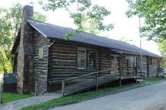 Jess Norman Post 166 American Legion Hutlisted 2001
 Mathis-Hyde Houselisted 2011
 Woodruff County Courthouselisted 1982
- George Washington Carver High School Home Economics Buildinglisted 2004
Population over time
3 figuresAugusta fell from 2,693 to 1,998 between 2000 and 2020. These are the recorded population figures Wikidata holds for this place, reached through the Geographic Names Information System number this page is keyed on rather than by name, so they belong to this place and not to another of the same name. Most are census counts, but not all are: an early figure may be a founding or settlement estimate, and an estimate published within five years of a census is left out. The change column is computed, and is left blank where more than 20 years separate a figure from the one before it, because a gap that long is not a change between two counts.
| Year | People | Change |
|---|---|---|
| 2000 | 2,693 | |
| 2010 | 2,199 | -494 (-18%) |
| 2020 | 1,998 | -201 (-9%) |
Topographic sheets covering this place
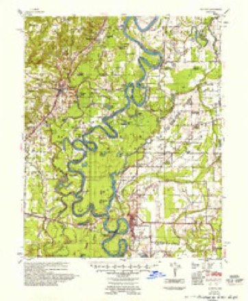
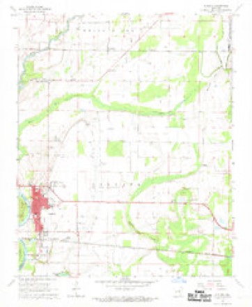
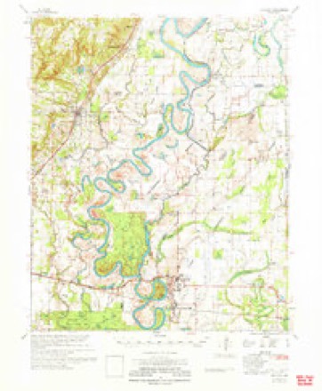
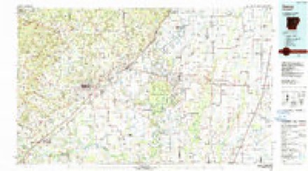
7 surveys from 12 printed sheetsMatched by testing this settlement's coordinate against the published boundary of every sheet in the United States Geological Survey's historical collection. Each opens the scanned sheet at the Survey.
- 1935 USGS Augusta quadrangle1:62500, 2 printings
- 1953 USGS Memphis quadrangle1:250000, 3 printings
- 1956 USGS Memphis quadrangle1:250000
- 1957 USGS Augusta quadrangle1:62500
- 1968 USGS Augusta quadrangle1:24000, 2 printings
- 1971 USGS Augusta quadrangle1:62500
- 1986 USGS Searcy quadrangle1:100000, 2 printings
Fires near this place
4 since 1998Regional context, not property-specific evidence. The federal wildfire occurrence database lists 4 fires within 5 miles of Augusta between 1998 and 2010, burning about 19 acres in total. None started naturally. None was recorded as arson. Distance is straight-line from the map coordinates, so a fire counted here may appear on a neighbouring settlement's page as well.
| Reported cause | Fires |
|---|---|
| Smoking | 2 |
| Debris and open burning | 2 |
The most recent of them, most recent first, with the day each was reported and the service that recorded it.
| Date | Cause | Size | Reported by | Name on the report |
|---|---|---|---|---|
| 1 July 2010 | Debris and open burning | 5.0 acres | Arkansas Forestry Commission | not named |
| 8 June 1998 | Debris and open burning | 2.0 acres | Arkansas Forestry Commission | not named |
| 3 February 2001 | Smoking | 8.8 acres | Central Arkansas Refuges Complex | MORRIS 201 |
| 1 October 2000 | Smoking | 3.0 acres | Arkansas Forestry Commission | not named |
Settlements close enough to share some of these fires:
Mines and quarries near this place
4 within 5 milesRegional context, not property-specific evidence. The federal mineral resources record lists 4 workings within 5 miles of Augusta: 3 past producers, 1 producer. 1 still produces. What was taken out: Sand and Gravel, Construction. Distance is straight-line from the map coordinates, so a quarry counted here may appear on a neighbouring settlement's page as well.
| Where | Site | Commodity | Status | Recorded |
|---|---|---|---|---|
| River Sand and Gravel Dredge | Sand and Gravel, Construction | Producer | ||
| Unk | Sand and Gravel, Construction | Past Producer | ||
| Unk | Sand and Gravel, Construction | Past Producer | ||
| Unk Sandpits 2 | Sand and Gravel, Construction | Past Producer |
Storms near this place
60 of 183 shownRegional context, not property-specific evidence. The National Weather Service names Augusta in 183 storm reports between 1994 and 2025: 134 flood, 31 thunderstorm wind, 8 hail, 3 flash flood. The reports record 3 injuries. Each account below is quoted exactly as the forecast office filed it, from the NOAA Storm Events Database, and each date opens the federal record of that event.
| When | Event | Place named | Harm | What the report says |
|---|---|---|---|---|
| December 2021 | Tornado (EF2) | Augusta | 3 hurt, $500,000 | This tornado developed just north of Augusta, west of Arkansas Highway 33, moving northeast, severely damaging homes and uprooting or snapping trees in the neighborhood along Sinclair Street and power lines were downed. As the tornado moved northeast it severely damaged farm buildings along Raspberry Lane/Woodruff County Road 260. The tornado continued over rural farm land, eventually crossing Arkansas Hwy. 17 between Tupelo and Overcup, lifting just east of Arkansas Hwy. 17 south of Overcup. The 3 injuries were just north of Augusta. Two farm shops and several grain bins were destroyed. Extensive damage was noted on the north side of Augusta. |
| May 2013 | Thunderstorm Wind | Augusta | $75,000 | A metal building at a truck supply store was destroyed, part of the canopy at a gas station was damaged, and a number of trees were blown down. A couple of the trees landed on structures, including a house and garage. |
| June 2009 | Thunderstorm Wind | Augusta | $75,000 | A boat dock on the White River was blown onto the shore in the Taylor Bay area. One power pole and three trees were down. |
| December 2009 | Flood | New Augusta | $50,000 | Heavy rainfall in early December, combined with planned reservoir releases, caused the White River at Augusta to rise above flood stage on the 3rd. This river remained above flood stage through the rest of December and into January, aided by additional very heavy rainfall on the 23rd and 24th. Thousands of acres of cropland and several rural roads became inundated due to the high water. |
| June 2009 | Thunderstorm Wind | Augusta | $50,000 | Trees were uprooted and limbs were down across the area. One tree fell on a house. |
| July 1994 | Thunderstorm Wind | Augusta | $50,000 | Thunderstorm winds downed some power lines and a utility pole. |
| September 1994 | Thunderstorm Wind | Augusta | $50,000 | Thunderstorm winds downed two large trees and some power lines. |
| June 2013 | Flood | Augusta | $20,000 | Heavy rainfall from late May into early June caused the White River at Augusta to rise above flood stage during the evening hours on May 31st. The river remained above flood stage through the first half of June, then fell below flood stage during the early morning hours on the 15th. |
| December 2011 | Flood | Augusta | $20,000 | Additional heavy rainfall as well as routed water from upstream dams kept the White River at Augusta above flood stage throughout December. |
| June 2009 | Thunderstorm Wind | Augusta | $20,000 | Trees were blown down. |
| July 2014 | Thunderstorm Wind | Augusta | $15,000 | Trees were blown down in Augusta. |
| November 2011 | Flood | Augusta | $15,000 | Heavy rainfall caused the White River near Augusta to rise above flood stage during the early morning hours on the 23rd. This river reached over 30 feet during the month of November and minor flooding continued through the end of the month. |
| January 2014 | Flood | Augusta | $10,000 | Heavy rainfall in December and early January kept the White River at Augusta above flood stage through much of January. The river fell below flood stage during the afternoon hours of the 24th. |
| May 2014 | Flood | Augusta | $10,000 | The White River at Augusta remained above flood stage from heavy rainfall back in April. This river remained above flood stage for much of May before finally dropping back below flood stage during the early morning hours of the 26th. |
| April 2014 | Flood | Augusta | $10,000 | Heavy spring rains caused the White River at Augusta to rise above flood stage during the morning hours on the 9th. The river then remained above flood stage until the morning hours on the 27th. |
| May 2013 | Flood | Augusta | $10,000 | Heavy springtime rainfall kept the White River at Augusta above flood stage from April into much of May before finally dropping below flood stage during the morning of the 23rd. |
| April 2012 | Flood | Augusta | $10,000 | Heavy rainfall at the end of March pushed the White River at Augusta above flood stage through the 20th of April. |
| May 2011 | Flood | New Augusta | $10,000 | Very heavy rainfall in late April into early May caused the White River at Augusta to rise above flood stage, remaining there through the entire month of May. |
| March 2010 | Flood | New Augusta | $10,000 | This flooding was a continuation of flooding from February and previous months. Heavy rainfall from previous months kept the White River at Augusta above flood stage for several months. The river finally dropped below flood stage during the morning hours of the 6th. |
| March 2010 | Flood | Augusta | $10,000 | After finally dropping below flood stage in early March following several months above flood stage, additional rainfall during the middle and end of the month caused the White River at Augusta to rise back above flood stage during the early evening hours of the 24th. This river remained above flood stage into April. |
| April 2011 | Flood | Augusta | $10,000 | no account filed |
| March 1997 | Thunderstorm Wind | Augusta | $7,000 | no account filed |
| April 2017 | Tornado (EF1) | New Augusta | $5,000 | An EF1 tornado moved through western Woodruff County, Arkansas. Several trees were uprooted and/or snapped. A metal shed sustained damage as well. |
| August 2015 | Thunderstorm Wind | Augusta | $5,000 | Some structural damage to some buildings occurred, along with some trees and power lines blown down. |
| June 2014 | Flood | Augusta | $5,000 | Heavy rainfall late in June caused the White River at Augusta to rise above flood stage during the early morning hours of the 30th. This river remained above flood stage into July. |
| March 2014 | Flood | Augusta | $5,000 | Heavy rainfall caused the White River at Augusta to rise above flood stage during the morning hours of the 18th. The river fell back below flood stage during the afternoon of the 30th. |
| April 2014 | Flood | Augusta | $5,000 | Heavy rainfall during the early morning hours of the 27th caused the White River at Augusta to rise above flood stage during the late morning hours that day. Additional heavy rainfall through the evening hours on the 27th kept the river above flood stage into May. |
| April 2013 | Flood | Augusta | $5,000 | Heavy springtime rainfall caused the White River at Augusta to rise above flood stage again during the morning of the 29th. This river remained above flood stage into May. |
| January 2012 | Flood | Augusta | $5,000 | A series of heavy rain events in late January pushed the White River at Augusta above flood stage in late January. |
| February 2012 | Flash Flood | Augusta | $5,000 | The White River at Augusta crested just over 30 feet as a series of heavy rain events during the winter months caused minor flooding through most of February. |
| January 2012 | Flood | Augusta | $5,000 | Heavy rain fell through November and December, causing the White River at Augusta to rise above flood stage from late November through early January. |
| March 2012 | Flood | Augusta | $5,000 | Heavy rainfall in early March pushed the White River at Augusta above flood stage through the end of march. Dam releases from upstream aided in keeping the river above flood stage. |
| August 2011 | Thunderstorm Wind | Augusta | $5,000 | Several large trees were blown down. |
| April 2010 | Flood | Augusta | $5,000 | Heavy rainfall during late March, and additional rainfall in April allowed the White River at Augusta to remain above flood stage through April, and even into May. |
| May 2010 | Flood | Augusta | $5,000 | The White River near Augusta remained above flood stage through April and into the first part of May before falling below flood stage during the morning hours of the 9th. |
| May 2010 | Flood | Augusta | $5,000 | Heavy rains across portions of Arkansas caused the White River near Augusta to rise back above flood stage on the evening of the 16th. This river remained above flood stage into June. |
| September 2009 | Flash Flood | Augusta | $5,000 | Water was deep in places around Augusta and McCrory. |
| June 1994 | Thunderstorm Wind | Augusta | $5,000 | Thunderstorm winds downed some trees. |
| June 2011 | Flood | New Augusta | $5,000 | no account filed |
| February 2013 | Flood | Augusta | $2,000 | Heavy rain in the month of February fell on the White River, which was already high due to above-average winter precipitation. The river rose above flood stage on the 27th of February. |
| January 2013 | Flood | Augusta | $2,000 | Heavy rain fell from January 9th through January 13th and caused minor flooding along the White River at Augusta. The co-operative observer at Augusta reported a total of 3.51 inches of rain through the period. The river crested at 28.77 feet on January 16th. |
| April 2013 | Flood | Augusta | $2,000 | Heavy springtime rainfall caused the White River at Augusta to rise above flood stage during the morning of the 26th. This river then fell below flood stage the following afternoon. |
| July 2014 | Flood | New Augusta | $1,000 | The White River at Augusta remained above flood stage from late June into early July. This river fell below flood stage during the early afternoon hours on the 2nd. |
| March 2013 | Flood | Augusta | $1,000 | A series of heavy rain events towards the end of February caused the White River at Augusta to rise above flood stage during the beginning of March. The river crested at 27.99 feet on March 2nd. |
| May 2013 | Flood | Augusta | $1,000 | Heavy rainfall in late May caused the White River at Augusta to rise back above flood stage during the evening hours on the 31st. This river remained above flood stage into June. |
| July 2010 | Flood | Augusta | $1,000 | Rainfall upstream caused the White River at Augusta to rise above flood stage during the afternoon hours of the 14th, before falling below flood stage during the afternoon of the 16th. |
| July 2009 | Thunderstorm Wind | Augusta | $1,000 | A tree was down. |
| April 2025 | Flood | Augusta | - | Major river flooding was observed at Augusta along the White River. |
| January 2025 | Flood | Augusta | - | River flooding took place on the White River at Augusta from the beginning of January through the middle of the month. A crest would take place at this site on 1/2/2025 at 0100 LST of 31.63 feet in minor flood stage. |
| May 2025 | Flood | Augusta | - | Major river flooding was observed at Augusta along the White River. This forecast point remained above at least minor flood stage the entire month of May. |
| February 2025 | Flood | Augusta | - | Minor flooding was observed over the entire month of February at Augusta along the White River. |
| January 2025 | Flood | Augusta | - | The White River at Augusta would enter minor flood stage in late January and continue to remain in minor flood stage entering February. No crest at this site would take place as the river flooding at this site continued into February. |
| June 2025 | Flood | Augusta | - | Major river flooding was observed at Augusta along the White River. |
| July 2025 | Flood | Augusta | - | Major river flooding was observed at Augusta along the White River. |
| January 2024 | Flood | Augusta | - | Heavy rain brought flooding to the White River at Augusta January 16-20, 2024. |
| January 2024 | Flood | Augusta | - | Heavy rain brought flooding to the White River at Augusta January 24-31, 2024. |
| March 2024 | Flood | Augusta | - | Heavy rain led to the White River at Augusta going into minor flood stage from March 28 until March 30. |
| February 2024 | Flood | Augusta | - | Heavy rain in January brought continued flooding into early February 2024 on the White River at Augusta. |
| May 2024 | Flood | Augusta | - | Minor flooding along the White River at Augusta was noted. |
| July 2024 | Flood | Augusta | - | Heavy rain caused the White River to enter minor flood stage at Augusta. The White River at Augusta crested on July 19th at 1715 LST with a stage of 29.20 feet. |
Nearest settlements
The eight closest, with where each one stands in the county. Distances are straight-line, computed from the Geographic Names Information System coordinates.
| Map | Place | Distance | Sheets |
|---|---|---|---|
| New Augusta | 0.8 miles | 12 | |
| New Salem | 4.1 miles | 12 | |
| Negro Head Corner (historical) | 4.3 miles | 12 | |
| Union | 5.3 miles | 12 | |
| Fitzhugh | 5.7 miles | 12 | |
| Revel | 5.7 miles | 13 | |
| Cavell | 5.7 miles | 12 | |
| Riverside | 6.6 miles | 10 |
Elsewhere
Matched on this settlement's Geographic Names Information System number rather than its name, so it cannot be a different place of the same name in another state.
| Wikipedia article on Augusta | An encyclopaedic summary. Its text is share-alike, so it is linked here rather than copied. |
| Wikidata item Q79483 | The structured record the population and elevation above come from. Public domain (CC0). |
Provenance
This settlement is recorded in the Geographic Names Information System as feature 76211. The sheet list is computed by point-in-boundary test against the United States Geological Survey's historical topographic inventory. Both are works of the United States government and carry no copyright under 17 U.S.C. 105.
Wildfire. Short, Karen C. 2022. Spatial wildfire occurrence data for the United States, 1992-2020 [FPA_FOD_20221014]. 6th Edition. Fort Collins, CO: Forest Service Research Data Archive. https://doi.org/10.2737/RDS-2013-0009.6 Collected with United States Government funding and usable without additional permissions or fees.
Mines and quarries. USGS Mineral Resources Data System (MRDS) https://mrdata.usgs.gov/mrds/ A work of the United States government, no copyright under 17 U.S.C. 105.
Storms. NOAA National Centers for Environmental Information, Storm Events Database https://www.ncei.noaa.gov/stormevents/ A work of the United States government, no copyright under 17 U.S.C. 105. Narratives are quoted verbatim from the National Weather Service report and are not edited or summarised.