 Block
Cutter, Arizona
12 topographic sheets cover this place, the earliest surveyed in 1954 and the latest in 2004. It stands in the San Carlos census division. It lies in ZIP code area 85550. It stands on Ramboz Wash. The Survey maps it on the Cutter quadrangle. 84 people lived here at the 2020 count. It stands 3,163 feet above sea level.
Population over time
2 figuresCutter grew from 74 to 84 between 2010 and 2020. These are the recorded population figures Wikidata holds for this place, reached through the Geographic Names Information System number this page is keyed on rather than by name, so they belong to this place and not to another of the same name. Most are census counts, but not all are: an early figure may be a founding or settlement estimate, and an estimate published within five years of a census is left out. The change column is computed, and is left blank where more than 20 years separate a figure from the one before it, because a gap that long is not a change between two counts.
| Year | People | Change |
|---|---|---|
| 2010 | 74 | |
| 2020 | 84 | +10 (+14%) |
Topographic sheets covering this place
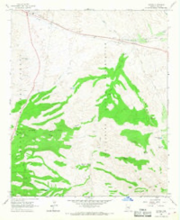
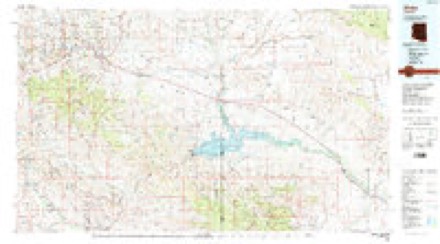
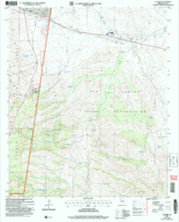
8 surveys from 12 printed sheetsMatched by testing this settlement's coordinate against the published boundary of every sheet in the United States Geological Survey's historical collection. Each opens the scanned sheet at the Survey.
- 1954 USGS Mesa quadrangle1:250000, 4 printings
- 1957 USGS Mesa quadrangle1:250000
- 1958 USGS Mesa quadrangle1:250000
- 1960 USGS Mesa quadrangle1:250000
- 1964 USGS Mesa quadrangle1:250000
- 1966 USGS Cutter quadrangle1:24000
- 1986 USGS Globe quadrangle1:100000, 2 printings
- 2004 USGS Cutter quadrangle1:24000





Fires near this place
314 since 1992Regional context, not property-specific evidence. The federal wildfire occurrence database lists 314 fires within 5 miles of Cutter between 1992 and 2020, burning about 830 acres in total. 23 started naturally. 106 were recorded as arson. Distance is straight-line from the map coordinates, so a fire counted here may appear on a neighbouring settlement's page as well.
| Reported cause | Fires |
|---|---|
| Arson/incendiarism | 106 |
| Missing data/not specified/undetermined | 97 |
| Debris and open burning | 27 |
| Misuse of fire by a minor | 26 |
| Natural | 23 |
| Smoking | 12 |
| Equipment and vehicle use | 8 |
| Railroad operations and maintenance | 7 |
| Recreation and ceremony | 3 |
| Fireworks | 3 |
| Other causes | 1 |
| Power generation/transmission/distribution | 1 |
The most recent of them, most recent first, with the day each was reported and the service that recorded it.
| Date | Cause | Size | Reported by | Name on the report |
|---|---|---|---|---|
| 7 September 2008 | Misuse of fire by a minor | under an acre | San Carlos Agency | SKILL |
| 4 September 2019 | Arson/incendiarism | under an acre | San Carlos Agency | BEVERLY HILLS |
| 4 September 2019 | Missing data/not specified/undetermined | under an acre | San Carlos Agency | ISA |
| 29 September 2019 | Arson/incendiarism | 8.8 acres | San Carlos Agency | RANCH |
| 26 September 2020 | Missing data/not specified/undetermined | under an acre | San Carlos Agency | TEN |
| 2 September 2019 | Natural | 47 acres | San Carlos Agency | SOTO |
| 2 September 1993 | Debris and open burning | 1.5 acres | San Carlos Agency | DINKY |
| 18 September 2020 | Arson/incendiarism | 2.0 acres | San Carlos Agency | SALLY |
Settlements close enough to share some of these fires:
Mines and quarries near this place
4 within 5 milesRegional context, not property-specific evidence. The federal mineral resources record lists 4 workings within 5 miles of Cutter: 4 past producers. None of them still produces. What was taken out: Asbestos, Copper, Sand and Gravel, Construction. Distance is straight-line from the map coordinates, so a quarry counted here may appear on a neighbouring settlement's page as well.
| Where | Site | Commodity | Status | Recorded |
|---|---|---|---|---|
| Cutter Pit | Sand and Gravel, Construction | Past Producer | ||
| Silver Bell Group M S 3698 | Copper | Past Producer | ||
| Apache Claims | Asbestos | Past Producer | Vein | |
| Metate Asbestos Corp Claims | Asbestos | Past Producer |
Storms near this place
8 since 2008Regional context, not property-specific evidence. The National Weather Service names Cutter in 8 storm reports between 2008 and 2025: 5 flash flood, 3 heavy rain. No death or injury is recorded in these reports. Each account below is quoted exactly as the forecast office filed it, from the NOAA Storm Events Database, and each date opens the federal record of that event.
| When | Event | Place named | Harm | What the report says |
|---|---|---|---|---|
| January 2008 | Flash Flood | Cutter | $50,000 | A railroad bridge over the Gilson Wash collapsed which resulted in a train derailment. Considerable damage resulted, but no injuries were reported. |
| August 2012 | Flash Flood | Cutter | $20,000 | Scattered thunderstorms developed across southern Gila county during the afternoon hours on August 19th, and they produced locally heavy rain with rain rates in excess of 2 inches per hour. Some of the heaviest rain occurred southeast of Globe, along Indian Highway 6 between Apache Gold Casino and San Carlos. At 540 pm, San Carlos Tribal Police reported flooding along the Gilson wash as well as nearby areas on Indian Highway 6. At 6 pm, the San Carlos Tribal Police reported a motorist vehicle stranded in the wash along Highway 6, or the old San Carlos Road. The flooding led to the issuance of a Flash Flood Warning at 452 pm. |
| October 2025 | Flash Flood | Cutter | - | Route 6 closed from the San Carlos Detention Center to US-70 due to flooding. No damages or injuries reported. |
| September 2025 | Flash Flood | Cutter | - | Video from San Carlos Apache Police Department showed a water rescue of 5 kids and their dog who were trapped out on an island in the middle of Gilson Wash near Waco Rd. The police department received the calls for help around 2040MST. The water moving through the wash was up to the waists of the kids at the time of the rescue. A gauge several miles upstream on Gilson Wash began rising just after 1900MST and reached a peak stage of 4.2 ft at 2036MST. The floodwaters originated from a storm that produced around 2 inches of rain near Cutter. No injuries were reported. |
| July 2024 | Flash Flood | Cutter | - | Mesonet stream gauge along Gilson Wash recorded an approximate 2.38 ft jump, impacting downstream low water crossings. No damages nor injuries were reported. |
| August 2018 | Heavy Rain | Cutter | - | Thunderstorms with locally heavy rainfall developed across southern Gila County during the evening hours on August 7th; peak rainfall rates with the stronger storms ranged between one and two inches per hours. The rains led to some minor flooding of roads in the areas around Globe; according to the Arizona Department of Highways there was minor flooding on Highway 70 about 1 mile east of Cutter or 9 miles east of Globe. The flooding occurred around 1840MST. A Flash Flood Warning had been issued for the area earlier at 1808MST but flash flooding was not observed along Highway 70. |
| July 2012 | Heavy Rain | Cutter | - | Scattered thunderstorms developed across southern Gila county during the morning hours on July 13th, and they persisted into the afternoon. The storms produced locally heavy rainfall which led to running washes, flooding of area streets and overflowing creeks. At 1128 am, a trained spotter in Globe reported street flooding. At 1240 pm, law enforcement personnel indicated that a creek was overflowing approximately 3 miles southeast of Cutter. No reports of injuries or property damage were received in response to the heavy rains. |
| July 2010 | Heavy Rain | Cutter | - | Large thunderstorm complex resulted in heavy rain and 1/4 inch hail just east of Globe. |
Nearest settlements
The eight closest, with where each one stands in the county. Distances are straight-line, computed from the Geographic Names Information System coordinates.
| Map | Place | Distance | Sheets |
|---|---|---|---|
| Pinal | 5.6 miles | 20 | |
| Globe | 7.6 miles | 20 | |
| Copper Hill | 8.0 miles | 20 | |
| Dimario Place | 8.9 miles | 20 | |
| Little Acres | 9.4 miles | 20 | |
| Central Heights | 9.5 miles | 20 | |
| Midland City | 10.0 miles | 20 | |
| Miami Gardens | 10.1 miles | 20 |
Elsewhere
Matched on this settlement's Geographic Names Information System number rather than its name, so it cannot be a different place of the same name in another state.
| Wikipedia article on Cutter | An encyclopaedic summary. Its text is share-alike, so it is linked here rather than copied. |
| Wikidata item Q5795116 | The structured record the population and elevation above come from. Public domain (CC0). |
Provenance
This settlement is recorded in the Geographic Names Information System as feature 28221. The sheet list is computed by point-in-boundary test against the United States Geological Survey's historical topographic inventory. Both are works of the United States government and carry no copyright under 17 U.S.C. 105.
Wildfire. Short, Karen C. 2022. Spatial wildfire occurrence data for the United States, 1992-2020 [FPA_FOD_20221014]. 6th Edition. Fort Collins, CO: Forest Service Research Data Archive. https://doi.org/10.2737/RDS-2013-0009.6 Collected with United States Government funding and usable without additional permissions or fees.
Mines and quarries. USGS Mineral Resources Data System (MRDS) https://mrdata.usgs.gov/mrds/ A work of the United States government, no copyright under 17 U.S.C. 105.
Storms. NOAA National Centers for Environmental Information, Storm Events Database https://www.ncei.noaa.gov/stormevents/ A work of the United States government, no copyright under 17 U.S.C. 105. Narratives are quoted verbatim from the National Weather Service report and are not edited or summarised.