 Block
Helena, Arizona
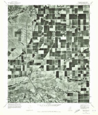
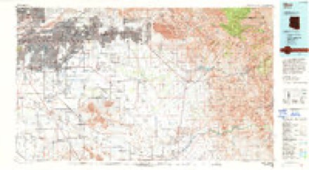
21 topographic sheets cover this place, the earliest surveyed in 1913 and the latest in 1994. It stands in the Phoenix census division. It lies in ZIP code area 85283. The Survey maps it on the Guadalupe quadrangle.
Topographic sheets covering this place
11 surveys from 21 printed sheetsMatched by testing this settlement's coordinate against the published boundary of every sheet in the United States Geological Survey's historical collection. Each opens the scanned sheet at the Survey.
- 1913 USGS Mesa quadrangle1:62500
- 1915 USGS Mesa quadrangle1:62500, 2 printings
- 1952 USGS Guadalupe quadrangle1:24000, 6 printings
- 1952 USGS Mesa quadrangle1:62500
- 1954 USGS Mesa quadrangle1:250000, 4 printings
- 1957 USGS Mesa quadrangle1:250000
- 1958 USGS Mesa quadrangle1:250000
- 1960 USGS Mesa quadrangle1:250000
- 1964 USGS Mesa quadrangle1:250000
- 1971 USGS Guadalupe quadrangle1:24000
- 1994 USGS Mesa quadrangle1:100000, 2 printings





Fires near this place
1,072 since 1995Regional context, not property-specific evidence. The federal wildfire occurrence database lists 1,072 fires within 5 miles of Helena between 1995 and 2020, burning about 221 acres in total. 7 started naturally. 12 were recorded as arson. Distance is straight-line from the map coordinates, so a fire counted here may appear on a neighbouring settlement's page as well.
| Reported cause | Fires |
|---|---|
| Missing data/not specified/undetermined | 1045 |
| Arson/incendiarism | 12 |
| Natural | 7 |
| Misuse of fire by a minor | 3 |
| Equipment and vehicle use | 3 |
| Smoking | 1 |
| Power generation/transmission/distribution | 1 |
The most recent of them, most recent first, with the day each was reported and the service that recorded it.
| Date | Cause | Size | Reported by | Name on the report |
|---|---|---|---|---|
| 9 September 2018 | Missing data/not specified/undetermined | under an acre | Phoenix Fire Department | 334642 |
| 9 September 2015 | Missing data/not specified/undetermined | under an acre | Arizona Department of Forestry and Fire Management - State Office | 155223 |
| 7 September 2018 | Missing data/not specified/undetermined | under an acre | Phoenix Fire Department | 332703 |
| 7 September 2018 | Missing data/not specified/undetermined | under an acre | Tempe Fire Department | 1820604 |
| 5 September 2011 | Missing data/not specified/undetermined | under an acre | Arizona Department of Forestry and Fire Management - State Office | AZ-112019 |
| 5 September 2010 | Missing data/not specified/undetermined | under an acre | Arizona Department of Forestry and Fire Management - State Office | AZ-101071 |
| 30 September 2020 | Missing data/not specified/undetermined | under an acre | Arizona Department of Forestry and Fire Management - State Office | not named |
| 30 September 2020 | Missing data/not specified/undetermined | under an acre | Arizona Department of Forestry and Fire Management - State Office | not named |
Settlements close enough to share some of these fires:
Mines and quarries near this place
3 within 5 milesRegional context, not property-specific evidence. The federal mineral resources record lists 3 workings within 5 miles of Helena: 1 past producer, 1 unknown, 1 prospect. None of them still produces. What was taken out: Sand and Gravel, Construction, Tungsten, Copper. Distance is straight-line from the map coordinates, so a quarry counted here may appear on a neighbouring settlement's page as well.
| Where | Site | Commodity | Status | Recorded |
|---|---|---|---|---|
| Gabitzsch-Owens | Tungsten, Copper | Prospect | ||
| ADOT Gravel Pit | Sand and Gravel, Construction | Unknown | ||
| Sand and Gravel Quarry | Sand and Gravel, Construction | Past Producer | Sand and Gravel |
Storms near this place
17 since 2013Regional context, not property-specific evidence. The National Weather Service names Helena in 17 storm reports between 2013 and 2025: 11 thunderstorm wind, 3 heavy rain, 1 flash flood, 1 funnel cloud. No death or injury is recorded in these reports. Each account below is quoted exactly as the forecast office filed it, from the NOAA Storm Events Database, and each date opens the federal record of that event.
| When | Event | Place named | Harm | What the report says |
|---|---|---|---|---|
| September 2014 | Heavy Rain | Helena | $50,000 | Widespread showers and embedded thunderstorms developed across the central and southeast portion of the greater Phoenix metropolitan area during the early morning hours on September 8th, and they persisted into the middle of the morning. The showers produced intense rainfall; gages indicated rain rates from 2 to nearly 6 inches per hour at times. Many locations across Tempe and Chandler received 2.5 to 5 inches of rain during the morning. According to an on-line article posted by the East Valley Tribune, at about 0800MST heavy rain caused the collapse of a roof at the Fry's grocery store located at the intersection of Baseline Road and McClintock Road. The Tempe Fire Department indicated that there were no injuries, and that the store would be closed until further notice. |
| August 2018 | Thunderstorm Wind | Helena | $15,000 | Thunderstorms with strong gusty outflow winds developed over the central portion of the greater Phoenix metropolitan area during the evening hours on August 8th. Some of the stronger storms affected portions of the community of Tempe and at about 2000MST multiple reports were received of large tree damage just south of the Superstition Freeway or Highway 60. According to a trained spotter located 3 miles southeast of Tempe, just south of Highway 60, gusty winds estimated as high as 75 mph downed a number of trees on the Loop 101 freeway near Highway 60 and the Guadalupe Road on-ramp. The damage occurred at about 2001MST. The trees and tree debris resulted in a significant driving hazard to motorists on the Loop 101. At the same time, a public report was received indicating many tree branches as well as whole trees were snapped and downed near the intersection of Rural road and Guadalupe Road. No injuries were reported due to the strong gusty winds. |
| August 2020 | Thunderstorm Wind | Helena | $10,000 | Public reported three 15-20 foot tall trees were uprooted near the 101 Freeway and Warner Road in south Tempe. Another twenty to thirty trees saw larger limbs snapped off as well. A severe warned storm was moving through the area with 50-55 mph winds. Winds were estimated from radar and nearby weather stations. No injuries were reported. |
| August 2018 | Flash Flood | Helena | $10,000 | Thunderstorms with locally heavy rain developed across the southeast portion of the greater Phoenix metropolitan area during the late evening hours on August 9th, and the storms continued into the early morning hours on August 10th. The stronger storms produced intense rain with peak rain rates in excess of 4 inches per hour. Some of the heaviest rain fell in the community of Tempe, north of the Superstition Freeway, and led to episodes of early morning flash flooding. As an example of the intense rain that fell, at 0103MST an NWS employee near Baseline Road and the Loop 101 freeway measured 2.56 inches of rain within one hour and 40 minutes; most of the rain fell within one hour. Additionally, at Arizona State University, Flood Control District rain gage reports indicated that 2 inches of rain fell within 34 minutes ending at 0022MST. |At 0030MST, Arizona Department of Highways reported extensive flooding on Highway 60 under McClintock Road. This report came via Twitter. At 0038MST, Tempe police reported that McClintock Drive was closed between Broadway Road and Apache Boulevard due to flash flooding. This was about 1 mile southeast of Arizona State University. A bit later at 0130MST, Tempe police reported that Southern Avenue was closed between Rural Road and McClintock Drive due to flooding. At the same time, Tempe police indicated that Mill Avenue was closed between Broadway Road and 13th Street due to flooding. Finally, at 0138MST, Arizona Department of Highways reported that Highway 60 was closed at the Mill Avenue underpass due to flash flooding. A Flash Flood Warning was in effect at the time of the flooding and remained in effect through 0300MST. |
| August 2014 | Thunderstorm Wind | Helena | $10,000 | Thunderstorms developed across portions of the greater Phoenix area during the evening hours on August 3rd, and some of the storms produced strong and gusty outflow winds. According to a National Weather Service employee, gusty winds estimated to be nearly 60 mph blew down a tree at an intersection about 2 miles west of Fiesta Mall. Debris from the fallen tree was blown onto a car causing damage. The location of the damage was near the intersection of the Superstition Freeway and the Loop 101. |
| July 2014 | Thunderstorm Wind | Helena | $10,000 | Scattered thunderstorms affected much of the greater Phoenix area, including southeast valley communities such as Tempe and Chandler, during the late afternoon hours on July 13th. The stronger thunderstorms generated gusty and damaging microburst winds, estimated to be in excess of 60 mph. At about 1710MST, a report was received from an amateur radio operator in south Tempe who reported that multiple trees were blown down near the intersection of Warner and McClintock roads. At nearly the same time, a trained weather spotter about 1 mile north of the Chandler Fashion Center mall reported a number of trees blown down with diameters of up to 13 inches. |
| August 2015 | Thunderstorm Wind | Helena | $5,000 | Thunderstorms developed across portions of the greater Phoenix metropolitan area during the afternoon hours on August 25th, and some of them affected the communities of Tempe and Ahwatukee. The stronger storms produced gusty and damaging outflow winds estimated to be in excess of 50 mph. At 1800MST, a trained spotter 2 miles southeast of Tempe reported that trees were snapped and blown over, blocking the road at the intersection of Redmon Drive and Newberry road. About 10 minutes earlier, an amateur radio operator reported that a 10 inch diameter tree snapped due to high winds and was blown over about 1 mile south of Ahwatukee. The downed tree also blocked the street where it fell. Fortunately there were no reports of injuries due to the falling trees. |
| February 2023 | Thunderstorm Wind | Helena | $3,000 | A large dead tree fell through a brick wall in a apartment complex in the area of Rural and Baseline Roads in Tempe as line of strong showers and storms associated with a cold front moved through. Timing estimated from radar. No injuries were reported. |
| June 2024 | Thunderstorm Wind | Helena | $500 | Twelve inch tree branch from a large tree broke off near the intersection of Price and Baseline Roads in Tempe. Wind gusts were estimated at between 40-50 mph based on nearby observing sites. No injuries were reported. |
| November 2025 | Hail | Helena | - | A photo shows a few hail stones, with the largest measuring up to 1.00 inch in diameter in the area of Loop 101 and U.S. 60 in Tempe. There was also a lot of 0.5 inch diameter hail reported. No damages or injuries reported. |
| October 2022 | Thunderstorm Wind | Helena | - | A trained spotter recorded a 64mph wind gust with a handheld anemometer in the area of East Baseline Road and South Rural Road in Tempe. No damages or injuries were reported. |
| July 2022 | Thunderstorm Wind | Helena | - | Spotter measured a 62 mph wind gust with handheld anemometer from his home located near the intersection of Baseline and Rural Roads. |
| August 2021 | Thunderstorm Wind | Helena | - | A 68 mph gust was recorded by a trained weather spotter using a handheld anemometer near Baseline Road and Rural Road. |
| September 2021 | Thunderstorm Wind | Helena | - | A tree was reported down on McClintock Drive between Elliot Road and Warner Road blocking southbound traffic. No injuries were reported. |
| December 2019 | Funnel Cloud | Helena | - | Multiple public and trained spotter reports, with photos and videos, confirmed a brief funnel cloud developed over Chandler and south Tempe near Loop-101. The funnel extended at most a quarter of the way down from the cloud base to the ground. |
| September 2014 | Heavy Rain | Helena | - | A line of powerful thunderstorms moved east across the greater Phoenix area during the early afternoon hours, followed by additional thunderstorm development which continued into the evening on September 27th. The stronger thunderstorms produced heavy rain with peak rain rates in excess of 2 inches per hour. The rain led to significant and widespread urban street flooding across the greater Phoenix metropolitan area, resulting in the issuance of both Urban and Small Stream Flood Advisories and Flash Flood Warnings. According to a trained weather spotter in Tempe, a storm total rainfall amount of 2.14 inches was measured as of 1720MST. Another trained spotter 2 miles west of Fountain Hills measured the exact same amount in a 3 hour period ending at 1728MST. At 1440MST, a trained spotter 2 miles southeast of Glendale reported flooded roadways with water covering the wheel wells of vehicles. At 1517MST, a trained spotter 4 miles south of Goldfield Ranch reported flooded roads, with some roads impassable. At 1625MST a trained spotter 3 miles northwest of Phoenix Sky Harbor Airport reported that the intersection of 24th Street and Thomas Road was flooded and impassable. |
| July 2013 | Heavy Rain | Helena | - | Scattered thunderstorms developed across portions of the greater Phoenix metropolitan area during the afternoon hours on July 15th, and they produced locally heavy rainfall across portions of the east valley communities such as Mesa, Tempe and Chandler. The heavy rain led to the issuance of an Urban and Small Stream Flood Advisory which began at 527 pm and continued until 730 pm. At 525 pm a trained weather spotter 3 miles southwest of Fiesta Mall reported 0.72 inches of rain within 25 minutes. Another trained spotter 5 miles northeast of Phoenix Mesa Gateway reported 0.40 inches within 15 minutes. The heavy rain led to urban flooding and significant disruption to the rush hour traffic across the east valley communities. |
Nearest settlements
The eight closest, with where each one stands in the county. Distances are straight-line, computed from the Geographic Names Information System coordinates.
| Map | Place | Distance | Sheets |
|---|---|---|---|
| Renaissance | 1.1 miles | 21 | |
| Camelot Luxury Homes | 1.1 miles | 21 | |
| Dusk File | 1.4 miles | 21 | |
| Guadalupe | 1.4 miles | 21 | |
| Kyrene | 1.5 miles | 21 | |
| Peterson | 1.5 miles | 23 | |
| The Lakes | 1.6 miles | 21 | |
| Peterson (historical) | 1.6 miles | 23 |
Provenance
This settlement is recorded in the Geographic Names Information System as feature 24457. The sheet list is computed by point-in-boundary test against the United States Geological Survey's historical topographic inventory. Both are works of the United States government and carry no copyright under 17 U.S.C. 105.
Wildfire. Short, Karen C. 2022. Spatial wildfire occurrence data for the United States, 1992-2020 [FPA_FOD_20221014]. 6th Edition. Fort Collins, CO: Forest Service Research Data Archive. https://doi.org/10.2737/RDS-2013-0009.6 Collected with United States Government funding and usable without additional permissions or fees.
Mines and quarries. USGS Mineral Resources Data System (MRDS) https://mrdata.usgs.gov/mrds/ A work of the United States government, no copyright under 17 U.S.C. 105.
Storms. NOAA National Centers for Environmental Information, Storm Events Database https://www.ncei.noaa.gov/stormevents/ A work of the United States government, no copyright under 17 U.S.C. 105. Narratives are quoted verbatim from the National Weather Service report and are not edited or summarised.