Block
From the record
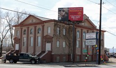
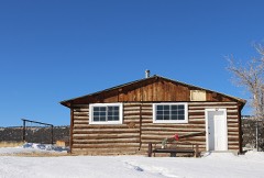
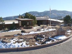
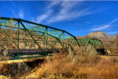
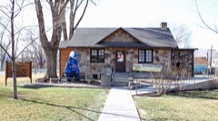
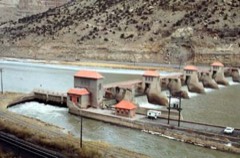
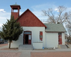
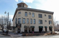
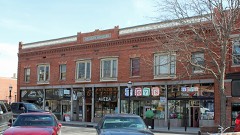
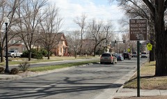
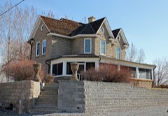
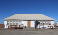
33 National Register listings published here.
Sources: the National Register database, National Park Service
134 topographic sheets cover 36 settlements here, and 33 properties are on the National Register of Historic Places.
33 National Register listings published here.
Sources: the National Register database, National Park Service
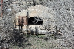
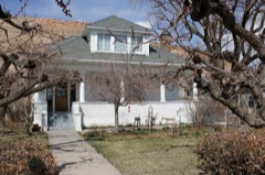
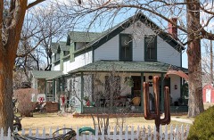
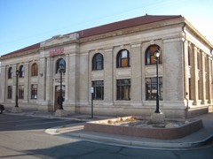
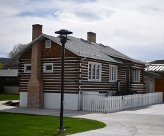
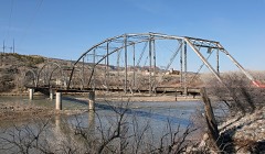
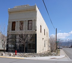
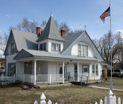
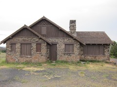
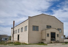
Every property in this county listed on the National Register of Historic Places, with the year it was listed and the federal nomination document.
Every wildfire the federal occurrence database records inside this county: 4,308 of them, burning about 222,119 acres. 1,608 started naturally and 41 were recorded as arson. Each settlement page carries the fires within five miles of it.
| Reported cause | Fires |
|---|---|
| Missing data/not specified/undetermined | 1968 |
| Natural | 1608 |
| Smoking | 187 |
| Recreation and ceremony | 173 |
| Equipment and vehicle use | 128 |
| Debris and open burning | 90 |
| Fireworks | 46 |
| Arson/incendiarism | 41 |
| Railroad operations and maintenance | 31 |
| Firearms and explosives use | 15 |
| Misuse of fire by a minor | 9 |
| Power generation/transmission/distribution | 9 |
| Other causes | 3 |
The five largest, by the area the report gives. None of them was recorded as arson.
| Date | Cause | Size | Reported by | Name on the report |
|---|---|---|---|---|
| 31 July 2020 | Natural | 139,007 acres | Grand Junction Field Office | PINE GULCH |
| 27 June 2012 | Natural | 13,920 acres | Northwest District, Grand Junction | PINE RIDGE |
| 12 August 2017 | Natural | 13,000 acres | Grand Junction Fire Department | UNKNOWN |
| 30 July 1995 | Natural | 5,343 acres | Moab Field Office | TRIANGLE |
| 3 July 2000 | Natural | 4,580 acres | Northwest District, Grand Junction | CONE MTN |
| 12 July 1994 | Natural | 3,625 acres | Northwest District, Grand Junction | TWO ROAD |
| 11 July 2009 | Natural | 2,599 acres | Grand Mesa, Uncompahgre and Gunnison National Forests | DOMINGUEZ |
| 9 June 2002 | Missing data/not specified/undetermined | 2,533 acres | Northwest District, Grand Junction | DIERICH CR |
Every settlement page carries the fires within five miles of it - see the settlement index below.
The NOAA Storm Events Database holds 472 reports for this county, causing 5 deaths, 6 injuries and about $3,287,470 in recorded property damage. Each settlement page carries the reports that name it.
| Kind of event | Reports |
|---|---|
| Thunderstorm Wind | 160 |
| Flash Flood | 70 |
| Heavy Rain | 69 |
| Hail | 62 |
| Flood | 33 |
| Funnel Cloud | 23 |
| Debris Flow | 19 |
| Lightning | 11 |
| Tornado | 10 |
| Wildfire | 10 |
| Dust Devil | 5 |
The most serious of them, by death, then injury, then recorded damage. The accounts are quoted exactly as the forecast office filed them.
| When | Event | Place named | Harm | What the report says |
|---|---|---|---|---|
| May 2014 | Debris Flow | Plateau City | 3 killed, $25,000 | A landslide consisting of about 30 million cubic meters of rock and soil broke loose from the side of the Grand Mesa near the 10,000 foot level and traveled nearly 3 miles down the West Salt Creek drainage. Three ranchers were apparently buried by the landslide which deposited debris over 100 feet deep along the slide path. This was one of the largest landslides ever documented in the United States. This landslide occurred during the period of peak snowmelt and just after heavy rainfall occurred in the area. Radar estimates and nearby rain gauge measurements for the 36 hour period prior to the landslide were around one inch. |
| May 2023 | Flood | Gateway | 1 killed | West Creek in Mesa County ran high and fast as a result of accelerated snowmelt resulting in the creek with flooding observed by local law enforcement. West Creek drains south into the Dolores River. A 94-year old man drowned after accidentally backing his ATV into West Creek and was swept downstream. |
| August 2006 | Heavy Rain | Clifton | 1 killed | no account filed |
| August 2016 | Heavy Rain | Whitewater | 4 hurt | Heavy rainfall resulted in reduced visibilities along Highway 50 near Whitewater where a fatal car accident occurred. |
| July 2016 | Lightning | Glade Park | 1 hurt | Lightning struck a girl riding an ATV near Glade Park. The girl was injured but survived. |
| September 1998 | Lightning | Clifton | 1 hurt | no account filed |
| October 2015 | Hail | Grand Jct | $500,000 | Large hail up to the size of ping pong balls damaged the roofs of many houses. |
| May 2009 | Hail | Durham | $400,000 | NWS employees and trained spotters reported large hail across a significant swath of the Grand Valley, from the Redlands area to the downtown Grand Junction area. At least 800 vehicles were damaged, including vehicles parked outside at six vehicle dealerships. |
| July 1998 | Heavy Rain | Grand Jct | $400,000 | no account filed |
| August 1999 | Hail | Redlands | $300,000 | no account filed |
| August 1997 | Flash Flood | Grand Jct | $250,000 | no account filed |
| June 2011 | Flood | De Beque | $125,000 | Many area waterways in Western Colorado, including the Colorado River, were running at or near bank full conditions to begin June as runoff was enhanced by warming temperatures over a record snow pack. Flood advisories for the Colorado River were in place all of June across Mesa County from near De Beque to the Utah state line. Flood warnings were first issued near Cameo on June 5th, and except for a brief lowering below the flood stagt from the 19th to the 23rd, the warning stayed in place through the end of the month. Minor flooding and bank erosion were experienced from De Beque to the confluence with the Gunnison River in Grand Junction. Some city recreational trails along the river washed away. Within River Bend State Park near Palisade a service road eroded away and part of the disk golf course was washed away. In some areas up to 20 feet of bank was lost to the river and a few homes in Grand Junction and Palisade reported water in the basement from the high water table. ||The Colorado River, from the confluence with the Gunnison River in Grand Junction to the Utah State line was in flood stage from June 7th to June 11th, peaking on the 8th. In numerous places the river flooded low lying areas and approached Interstate 70. The water came within a few inches of closing the I-70 bridge near Skippers Island. A few sections of the river between Fruita and Loma lost between 20 to 30 feet of bank and some utilities were washed out. Multiple agencies and businesses worked to mitigate the flooding problems. |
| July 2021 | Debris Flow | Gateway | $100,000 | A normally dry arroyo erupted into a raging waterfall along Colorado Highway 141. Additionally, mud and debris flowed onto the highway. |
| July 2011 | Flash Flood | (Gjt)Walker Arpt | $100,000 | A combination of heavy rainfall and a canal breach resulted in areas of flash flooding in some northern sections of Grand Junction. The flooded areas were bounded from east to west between 27 Road and 24 Road, and from south to north between F Road and the barren hills to the north of Grand Junction Regional Airport. The flash flooding in the eastern part of the affected area was unrelated to the canal breach. A road just northwest of the airport was impassable with fast moving water 2 feet deep where several cars were stopped. A woman got out of one of the cars and slipped into the fast moving water. She was carried about a quarter mile downstream where she was rescued. Significant erosion occurred along many sections of paved roads and at some residences. Some outbuildings were flooded and landscaping was heavily damaged. Several roads were closed for up to two days as repairs were made. Natural drainages that normally only contained water flows about a foot deep were running over 12 feet deep. |
| July 2005 | Thunderstorm Wind | De Beque | $100,000 | no account filed |
| June 2025 | Flash Flood | Gateway | $80,000 | Flash flooding was observed along Salt Creek down to the confluence with the Dolores River, near the intersection of Salt Creek Road and Colorado Highway 141. A COOP observer nearby reported a pickup truck caught in the flood and floated upright downstream. Additionally, a Colorado Department of Transportation grader was noted leaving the CDOT facility in nearby Gateway and headed toward the area of this flash flooding. No reports of additional damage, or any injuries or fatalities were received. |
| August 2014 | Flash Flood | Pagosa Spgs Arpt | $70,000 | Several residences around Bass Lake experienced flash flooding due to heavy rainfall. One house was washed off it's foundation and a shed was destroyed. |
| July 2013 | Lightning | Grand Jct | $60,000 | The We Kare-A-Lot childcare facility was struck by lightning in the wee hours, igniting a fire in the building which resulted in extensive damage. |
| July 2021 | Debris Flow | Cascade | $50,000 | Colorado Highway 141 was closed in both directions for several hours due to a mudslide that occurred between 4.40 Road near Gateway and Desert Road in Unaweep Canyon. |
| September 2005 | Thunderstorm Wind | Fruita | $40,000 | no account filed |
| July 2014 | Flash Flood | Mesa | $30,000 | Flash flooding was observed at the intersection of Highway 65 and the DeBeque cutoff as well as other areas to the south of DeBeque where farmland was inundated. Irrigation ditches overflowed and were filled with debris. Many roads in the area were inundated and isolated some residents by cutting off escape routes. Some flood damage occurred to outbuildings near one of the houses. |
| August 2003 | Flash Flood | Fruita | $30,000 | no account filed |
| August 2003 | Heavy Rain | Fruita | $30,000 | no account filed |
| August 1999 | Hail | Molina | $30,000 | no account filed |
| August 2023 | Debris Flow | Cameo | $25,000 | A strong thunderstorm developed over the Grand Mesa before moving northward over I-70. This led to a significant rockslide occurring on the interstate near the Highway 65 junction, or near mile marker 49. The eastbound lanes were closed for a period of time with some of the rocks making it to the westbound lanes. Radar estimated 0.60 to 0.90 inches of rain fell. |
| August 2001 | Flash Flood | Redlands | $25,000 | no account filed |
| September 1999 | Flash Flood | Grand Jct | $25,000 | no account filed |
| September 2025 | Flash Flood | Orchard Mesa | $20,000 | Thunderstorms developed over the Redlands area of Grand Junction late in the afternoon of September 4th, and remained there for 2-3 hours. Impacts began to be noticed around 6:45 PM MDT, with an LSR in the area of 1 ESE Redlands indicating Water out of the banks of nearby wash and running over Redlands Parkway in several areas. Approximately half an hour later, another LSR indicated that water running over the roadway in many areas along South Camp Road in the Redlands (Redlands 1SSE). Debris was also reported as having to be removed from Monument Road (Redlands 3SSE). In addition to the LSR'd events, properties were flooded, normally dry washes were overfilled, and water and debris inundated several roadways in the area. Additionally, social media reports indicated flooding along No Thoroughfare Canyon, Monument Road, and in the Devil's Kitchen area of Colorado National Monument. Once the rain stopped and the storms dissipated, a local spotter provided the total precipitation from this storm, which was a 2.33 inches. |
| May 2016 | Flash Flood | Plateau City | $20,000 | During the period of snowmelt on the Grand Mesa, an estimated 30,000 cubic meters of dirt and rock material slid off the head scarp and into the sag pond at the head of the West Salt Creek Landslide area. This caused a large volume of water in the sag pond to overflow the debris dam and cut a channel up to 100 feet deep and 50 feet wide down the 2.8 mile long face of the landslide. The flood waters continued down below the landslide along West Salt Creek at depths over 12 feet and then down to the larger Plateau Creek where the flood waters came up to within about a foot of Rodeo Road in Collbran. The flash flood caused damage to some roads, fences, a barn and horse riding area. |
| August 2000 | Flash Flood | Gateway | $20,000 | no account filed |
| September 1997 | Lightning | Grand Jct | $20,000 | no account filed |
| September 1997 | Flash Flood | Palisade | $20,000 | no account filed |
| May 2008 | Flood | Mack | $15,000 | Rivers, small streams, and creeks across much of Mesa County exceeded bankfull and caused minor flooding. Emergency Manager and weather spotter reports indicated low land flooding along portions of the Colorado River from DeBeque Canyon to the Utah State Line. The Interstate 70 median east of the Loma exit was flooded. Water lapped at the side of the westbound Interstate 70 bridge near the Loma Exit causing officials to close one lane in each direction for a period. Water covered a section of the westbound interstate lanes in DeBeque Canyon and near the Highway 65 cutoff. The Colorado River was out of its banks on both sides of the river in the Highway 340 Bridge area and encroached into an adjacent State Park campground. Portions of the Colorado Riverfront Trail in Grand Junction were closed due to high water. The Gunnison River was out of its banks and covered an access road to a construction company in the vicinity of the Department of Energy. |
| September 2005 | Thunderstorm Wind | De Beque | $15,000 | no account filed |
| September 2005 | Thunderstorm Wind | Fruita | $15,000 | no account filed |
| July 1998 | Heavy Rain | Whitewater | $15,000 | no account filed |
| July 2021 | Debris Flow | Palisade | $10,000 | A debris flow occurred along Interstate 70 between mile markers 42 and 47 as a result of heavy rains. The road was closed for a couple of hours due to cleanup operations. |
| July 2021 | Flash Flood | Loma | $10,000 | A flash flood occurred 10 miles north-northeast of Loma as a ten foot wall of water flowed outside of a normally dry wash. Evacuations took place for homes along 16 Road. Though not within the Pine Gulch Fire burn scar, the heavy rain originated from the scar and flowed downstream. |
| July 2021 | Flash Flood | Fruita | $10,000 | A flash flood occurred in Hunter Canyon on 21 Road northeast of Fruita with an estimated 8 feet of water flowing down the wash. Though not within the Pine Gulch Fire burn scar, the heavy rain originated from the scar and flowed downstream. |
| July 2021 | Flash Flood | Pagosa Spgs Arpt | $10,000 | Mesa County Sheriff's Office responded to a report of two hikers trapped by flash flood waters in Rough Canyon. When deputies arrived at the trailhead, it was discovered several other people were also unable to reach the parking lot due to rising floodwaters. Storms in the area quickly turned what typically is a dried creek bed at the start of the trail into an unpassable rushing river. Rescue crews estimate it was about 15 feet wide and 3-5 feet deep. It took about 6 hours for the water to recede enough for rescuers to reach everyone. Four families, who started the day on a hike or UTV trail, were safely rescued. |
| September 2017 | Thunderstorm Wind | (Gjt)Walker Arpt | $10,000 | A strong microburst snapped several power poles in the desert north of Grand Junction where the outflow winds were most intense. Over 5200 homes were without power for almost two hours. A pickup truck received minor damage from the downed power lines. The ASOS weather station at the Grand Junction Regional Airport measured wind gusts to 60 mph from the winds that flowed out beyond the main microburst impact area where the winds were likely stronger. |
| July 2012 | Heavy Rain | Fruita | $10,000 | Heavy rainfall resulted in street flooding and some damage to businesses in the downtown area of Fruita. Exactly an inch of rain fell within 45 minutes at one location. Radar estimated up to 1.5 inches of rainfall at other locations in Fruita. |
| June 2009 | Heavy Rain | Grand Jct | $10,000 | Heavy rainfall resulted in minor flooding in many areas within the Grand Junction metropolitan area. Street flooding occurred along North Avenue between 4th and 7th Streets where a manhole cover was blown out, along 7th Street between North Avenue and Orchard Avenue, and on Patterson Road between 12th and 15th Streets. Flood waters also seeped into the Doubletree Hotel where some water damage occurred. |
| August 2005 | Flash Flood | Gateway | $10,000 | no account filed |
| July 2005 | Thunderstorm Wind | Gateway | $10,000 | no account filed |
| June 2004 | Flash Flood | Gateway | $10,000 | no account filed |
| June 2004 | Thunderstorm Wind | Grand Jct | $10,000 | no account filed |
| September 2003 | Hail | Mack | $10,000 | no account filed |
| September 2003 | Hail | Fruita | $10,000 | no account filed |
| August 2002 | Flood | Whitewater | $10,000 | no account filed |
| July 2001 | Flash Flood | Redlands | $10,000 | no account filed |
| September 2000 | Thunderstorm Wind | Palisade | $8,000 | no account filed |
| September 1997 | Flash Flood | Gateway | $8,000 | no account filed |
| August 2008 | Thunderstorm Wind | Grand Jct | $6,000 | Strong outflow winds from thunderstorms blew limbs off trees and also blew the roof off of a business on South 8th Street. |
| August 2000 | Lightning | Palisade | $6,000 | no account filed |
| October 2022 | Flash Flood | Durham | $5,000 | Flash flooding occurred as a result of heavy rain from thunderstorms on the lower end of the No Thoroughfare Trail between D Road and Monument Road in Grand Junction. |
| September 2022 | Flash Flood | Cameo | $5,000 | Flash flooding occurred on the lower portion of the Palisade Plunge trail in Mesa County as a result of heavy rain from thunderstorms. |
| July 2021 | Debris Flow | Collbran | $5,000 | Rocks, mud and water were found along Main Street in Collbran as a result of heavy rains. Sandbags were placed in front of certain businesses. Additionally, two trees were uprooted due to flash flooding along Highway 330. |
| August 2017 | Flash Flood | Whitewater | $5,000 | After receiving 0.98 inches of heavy rain on August 4 and receiving another 1.20 inches throughout the whole day on August 5, flash flooding occurred. Rocks and other debris were washed across the pasture, into some trees, and also across the driveway due to the culverts running high. The debris and water flowing across the gravel driveway washed out a portion of the driveway. The siding on one of the outbuildings came off. Additionally, both the power and phone lines were out for a couple of hours. The Colorado Department of Transportation was out until 0200 on August 6 clearing the roads. |
| September 2014 | Flash Flood | Mack | $5,000 | Heavy rainfall filled a reservoir and resulted in the overtopping of a privately owned dam which resulted in flash flood waters up to 5 feet deep below the dam. The top two to three feet of the dam was eroded by the water flow. |
The Survey's mineral resources record lists 541 workings inside this county. 79 still produce and 462 are closed or unrecorded. Each settlement page carries the workings within five miles of it.
| Commodity | Workings |
|---|---|
| Uranium, Vanadium | 203 |
| Uranium | 144 |
| Sand and Gravel, Construction | 84 |
| Vanadium | 60 |
| Vanadium, Uranium | 27 |
| Clay | 21 |
| Fluorine-Fluorite | 8 |
| Fire Clay (Refractory) | 7 |
| Copper | 6 |
| Mica | 6 |
| Gypsum-Anhydrite | 5 |
| Molybdenum | 4 |
| Stone | 4 |
| Stone, Dimension | 3 |
The least common of them first, because a county's hundredth gravel pit says nothing its first ten did not.
| Where | Site | Commodity | Status | Recorded |
|---|---|---|---|---|
| Clover Gulch Placers | Gold, Uranium | Past Producer | 1925 | |
| Copper Rivet Mine | Copper, Silver, Chromium | Past Producer | 1925, 1942 | |
| Ladder Canyon | Feldspar | Unknown | ||
| Molina Deposit | Quartz, Feldspar, Mica, Tin | Unknown | ||
| Queen No 2 | Silica | Unknown | ||
| Unknown | Sulfur | Occurrence | ||
| Amethyst | Gemstone | Unknown | ||
| Beryl Gem | Beryllium, Gemstone | Unknown | ||
| Blue Gem No.1 Claim | Beryllium | Unknown | ||
| Fireside Enterprises | Limestone, Dimension | Occurrence | ||
| Himes Drilling | Limestone, Dimension | Unknown | ||
| Pyramid Group | Copper, Chromium | Past Producer | 1906, 1908 | |
| Unknown | Barium-Barite | Occurrence | Hydrothermal Vein | |
| Unnamed Mine | Barium-Barite | Unknown | ||
| Loma Rock Quarry | Stone, Dimension | Producer | ||
| Unknown | Stone, Dimension | Occurrence | Metamorphic | |
| Unknown | Stone, Dimension | Occurrence | ||
| Gavette Claim | Molybdenum | Occurrence | Molybdenite | |
| Golden Stone | Stone | Unknown | ||
| Kruckenburg Quarry | Stone | Unknown | ||
| Ladder Canyon | Mica, Molybdenum | Unknown | ||
| Lode Queen Group | Molybdenum | Unknown | ||
| Unnamed | Stone | Unknown | ||
| Unnamed Mine | Molybdenum | Unknown | ||
| Unnamed Mine | Stone | Unknown | ||
| Gateway | Gypsum-Anhydrite | Unknown | ||
| Unknown | Gypsum-Anhydrite | Occurrence | Sedimentary | |
| Unknown | Gypsum-Anhydrite | Occurrence | Sedimentary | |
| Unnamed Mine | Gypsum-Anhydrite | Unknown | ||
| Unnamed Mine | Gypsum-Anhydrite | Unknown | ||
| Colo Copper Properties | Copper | Producer | ||
| Colorado No. 3 Claim | Copper | Occurrence | Vein | |
| Crystal Queen # 2 | Copper | Unknown | ||
| King | Mica | Producer | Muscovite | |
| King | Mica | Unknown | ||
| King Ladder Canyon | Mica | Unknown | ||
| King Property | Mica | Unknown | ||
| Mica View | Mica | Unknown | ||
| Sinbad Valley | Copper | Unknown | ||
| Unaweep | Copper | Unknown | ||
| Unknown | Fire Clay (Refractory) | Occurrence | ||
| Unknown | Fire Clay (Refractory) | Occurrence | ||
| Unknown | Fire Clay (Refractory) | Occurrence | ||
| Unknown | Fire Clay (Refractory) | Occurrence | ||
| Unknown | Fire Clay (Refractory) | Occurrence | ||
| Unknown | Fire Clay (Refractory) | Occurrence | ||
| Unknown | Fire Clay (Refractory) | Occurrence | ||
| East Creek | Fluorine-Fluorite | Unknown | ||
| Queen Beth | Fluorine-Fluorite | Unknown | ||
| Unknown | Fluorine-Fluorite | Occurrence | ||
| Unknown | Fluorine-Fluorite | Occurrence | ||
| Unknown | Fluorine-Fluorite | Occurrence | ||
| Unnamed Mine | Fluorine-Fluorite | Unknown | ||
| Unnamed Mine | Fluorine-Fluorite | Occurrence | ||
| Unnamed Mine | Fluorine-Fluorite | Unknown | ||
| Clay Pit | Clay | Unknown | ||
| Clay Pit | Clay | Unknown | ||
| Clay Pit | Clay | Unknown | ||
| Clay Pit | Clay | Unknown | ||
| Clay Pit | Clay | Unknown | ||
| Clay Pit | Clay | Unknown | ||
| Clay Pit | Clay | Unknown | ||
| Clay Pit | Clay | Unknown | ||
| Unk | Clay | Unknown | ||
| Unknown | Clay | Occurrence | ||
| Unknown | Clay | Occurrence | ||
| Unknown | Clay | Producer | ||
| Unnamed Mine | Clay | Unknown | ||
| Unnamed Mine | Clay | Unknown | ||
| Unnamed Mine | Clay | Unknown | ||
| Unnamed Mine | Clay | Unknown | ||
| Unnamed Mine | Clay | Unknown | ||
| Unnamed Mine | Clay | Unknown | ||
| Unnamed Mine | Clay | Unknown | ||
| Unnamed Mine | Clay | Unknown | ||
| Unnamed Mine | Clay | Unknown | ||
| Arrowhead Incl #25 & #34 | Vanadium, Uranium | Producer | ||
| Black Rock No 2 | Vanadium, Uranium | Past Producer | ||
| Blue Canyon | Vanadium, Uranium | Occurrence | ||
| Durango No 2 | Vanadium, Uranium | Past Producer | ||
| Flat Top | Vanadium, Uranium | Past Producer | ||
| Gilmore Lode | Vanadium, Uranium | Past Producer | ||
| Harvey-Pick and Shovel | Vanadium, Uranium | Past Producer | ||
| Joe | Vanadium, Uranium | Past Producer | ||
| John Brown Claims | Vanadium, Uranium | Occurrence | Coffinite, Uraninite | |
| Kanarado 3 | Vanadium, Uranium | Past Producer | ||
| La Plaza 1 | Vanadium, Uranium | Past Producer | ||
| Larry and Leslie Claim Group | Vanadium, Uranium | Past Producer | ||
| Legal and Lucky Day | Vanadium, Uranium | Past Producer | ||
| Little Maverick 1 | Vanadium, Uranium | Past Producer | ||
| Locus 1,2 and 3 | Vanadium, Uranium | Past Producer | ||
| Lumsden 1 | Vanadium, Uranium | Past Producer | ||
| Mesa 8 | Vanadium, Uranium | Past Producer | ||
| Mesa No. 5 C-G-27 | Vanadium, Uranium | Producer | ||
| Montezuma | Vanadium, Uranium | Past Producer | ||
| Negus | Vanadium, Uranium | Occurrence | ||
| Peach 10 Inc. 1 and 2 | Vanadium, Uranium | Past Producer | ||
| Queen of the Hills | Vanadium, Uranium | Past Producer | ||
| Rae Marie Group | Vanadium, Uranium | Past Producer | ||
| Ronnie 2 | Vanadium, Uranium | Unknown | ||
| Unknown | Vanadium, Uranium | Occurrence | ||
| Yellow Cat | Vanadium, Uranium | Unknown | ||
| Zee Lse Rajah 49 | Vanadium, Uranium | Unknown | ||
| Ajax and Canyon Portals | Uranium, Vanadium | Unknown | ||
| Atlas-Bonanza | Uranium, Vanadium | Producer | ||
| Beth B & Kelly Rock Claims | Uranium, Vanadium | Producer | ||
| Black Mama | Uranium, Vanadium | Producer | Underground | |
| Bujan | Uranium, Vanadium | Unknown | ||
| Calamity # 10,11,13,17,18,19,20,21 | Uranium, Vanadium | Producer | ||
| Calamity Group | Uranium, Vanadium | Producer | ||
| Calamity Mines | Uranium, Vanadium | Unknown | ||
| Calamity-Mesa Creek Vanadium Dis | Vanadium | Unknown | ||
| Cambell # 2 | Uranium, Vanadium | Producer | ||
| Cedar Cliff Muscrat Et Al Claim | Uranium, Vanadium | Producer | ||
| Cottonwood | Vanadium | Unknown | ||
| Crescent # 1 | Uranium, Vanadium | Unknown | ||
| Economy | Uranium, Vanadium | Unknown | ||
| Flagstone Mine | Uranium, Vanadium | Unknown | ||
| Great Hesper | Uranium, Vanadium | Unknown | ||
| Half Acre | Uranium, Vanadium | Unknown | ||
| Homestead & Pack'Rat Group | Uranium, Vanadium | Unknown | ||
| Incline 2 G 2 | Uranium, Vanadium | Past Producer | ||
| Karns Incline | Uranium, Vanadium | Unknown | ||
| Lavada Mine | Vanadium | Unknown | ||
| Lucius Pitkin Inc | Uranium, Vanadium | Past Producer | ||
| Lumsden Point | Vanadium | Unknown | ||
| Maw Mine | Uranium, Vanadium | Producer | ||
| Midwest | Uranium, Vanadium | Unknown | ||
| Mining Lease 31 | Uranium, Vanadium | Past Producer | ||
| Ml-31 | Uranium, Vanadium | Unknown | ||
| Moore Mine | Vanadium | Unknown | ||
| Mount Lincoln | Uranium, Vanadium | Unknown | ||
| Negus | Uranium, Vanadium | Unknown | ||
| North Beaver Mesa | Vanadium | Unknown | ||
| October 7,9,10,11 | Uranium, Vanadium | Past Producer | ||
| Outlaw | Uranium, Vanadium | Unknown | ||
| Outlaw 23 | Uranium, Vanadium | Unknown | ||
| Outlaw Group Mine | Uranium, Vanadium | Producer | ||
| Outlaw Vanadium Group | Vanadium | Past Producer | ||
| Phoenix Uran. Mines | Uranium, Vanadium | Unknown | ||
| Property Mesa Co Mine | Uranium, Vanadium | Unknown | ||
| Queen Bee T Bar F Et Al Claims | Uranium, Vanadium | Occurrence | ||
| Rainbow | Uranium, Vanadium | Past Producer | ||
| Rajah 72 | Uranium, Vanadium | Past Producer | ||
| Rajah Group Mines | Uranium, Vanadium | Producer | ||
| Rock Pit Mine | Uranium, Vanadium | Unknown | ||
| Simpson Mining Co | Uranium, Vanadium | Unknown | ||
| Smith | Uranium, Vanadium | Unknown | ||
| Triangle | Uranium, Vanadium | Unknown | ||
| Unnamed | Uranium, Vanadium | Unknown | ||
| Unnamed | Uranium, Vanadium | Unknown | ||
| Unnamed | Uranium, Vanadium | Unknown | ||
| Unnamed | Uranium, Vanadium | Unknown | ||
| Unnamed | Uranium, Vanadium | Unknown | ||
| Unnamed Mine | Uranium, Vanadium | Unknown | ||
| Unnamed Mine | Uranium, Vanadium | Unknown | ||
| Unnamed Mine | Uranium, Vanadium | Unknown | ||
| Unnamed Mine | Vanadium, Uranium | Unknown | ||
| Unnamed Mine | Uranium, Vanadium | Unknown | ||
| Unnamed Mine | Uranium, Vanadium | Unknown | ||
| Unnamed Tunnels | Uranium, Vanadium | Unknown | ||
| Upper John Brow | Vanadium | Unknown | ||
| Yellowbird Mines | Uranium, Vanadium | Unknown | ||
| Abbot Pit | Sand and Gravel, Construction | Producer | ||
| Allen Pit | Sand and Gravel, Construction | Unknown | ||
| Bradbury Pit | Sand and Gravel, Construction | Producer | ||
| Burk Pit | Sand and Gravel, Construction | Unknown | ||
| Cole Pit | Sand and Gravel, Construction | Unknown | ||
| Corn Const Co 30 1/2 Road Pit | Sand and Gravel, Construction | Producer | ||
| Corn Construction Co 30 Road Pit | Sand and Gravel, Construction | Unknown | ||
| Egger Pit 501 | Sand and Gravel, Construction | Producer | ||
| Elam Gravel Pit | Sand and Gravel, Construction | Unknown | ||
| Fruita Ready Mix | Sand and Gravel, Construction | Producer | ||
| Gearhart Mt Garfield | Sand and Gravel, Construction | Unknown | ||
| Golden Pit | Sand and Gravel, Construction | Unknown | ||
| Gravel Pit | Sand and Gravel, Construction | Unknown | ||
| Gravel Pit | Sand and Gravel, Construction | Unknown | ||
| Gravel Pit | Sand and Gravel, Construction | Unknown | ||
| Gravel Pit | Sand and Gravel, Construction | Unknown | ||
| Gravel Pit | Sand and Gravel, Construction | Unknown | ||
| Gravel Pit | Sand and Gravel, Construction | Unknown | ||
| Gravel Pit | Sand and Gravel, Construction | Unknown | ||
| Gravel Pit | Sand and Gravel, Construction | Unknown | ||
| Gravel Pit | Sand and Gravel, Construction | Unknown | ||
| Gravel Pit | Sand and Gravel, Construction | Unknown | ||
| Gravel Pit | Sand and Gravel, Construction | Unknown | ||
| Gravel Pit | Sand and Gravel, Construction | Unknown | ||
| Gravel Pit | Sand and Gravel, Construction | Unknown | ||
| Gravel Pit | Sand and Gravel, Construction | Unknown | ||
| Gravel Pit | Sand and Gravel, Construction | Unknown | ||
| Gravel Pit | Sand and Gravel, Construction | Unknown | ||
| Gravel Pit | Sand and Gravel, Construction | Unknown | ||
| Gravel Pit | Sand and Gravel, Construction | Unknown | ||
| Gravel Pit | Sand and Gravel, Construction | Unknown | ||
| Gravel Pit | Sand and Gravel, Construction | Unknown | ||
| Gravel Pit | Sand and Gravel, Construction | Unknown | ||
| Gravel Pit | Sand and Gravel, Construction | Unknown | ||
| Gravel Pit | Sand and Gravel, Construction | Unknown | ||
| Gravel Pit | Sand and Gravel, Construction | Unknown | ||
| Gravel Pit | Sand and Gravel, Construction | Unknown | ||
| Herron & Strong | Sand and Gravel, Construction | Unknown | ||
| Huffer Pit | Sand and Gravel, Construction | Producer | ||
| Loma Rock Quarry | Sand and Gravel, Construction | Unknown | ||
| Nichols Pit | Sand and Gravel, Construction | Producer | ||
| Pit 500 | Sand and Gravel, Construction | Producer | ||
| Pit 512 | Sand and Gravel, Construction | Past Producer | ||
| Riverside Sand & Gravel | Sand and Gravel, Construction | Unknown | ||
| Smith Aggregate | Sand and Gravel, Construction | Unknown | ||
| United Sand & Gravel | Sand and Gravel, Construction | Producer | ||
| Unknown | Sand and Gravel, Construction | Occurrence | Gravel | |
| Unknown | Sand and Gravel, Construction | Occurrence | ||
| Unknown | Sand and Gravel, Construction | Occurrence | Gravel | |
| Unknown | Sand and Gravel, Construction | Producer | ||
| Unknown | Sand and Gravel, Construction | Producer | Gravel | |
| Unknown | Sand and Gravel, Construction | Producer | Gravel | |
| Unknown | Sand and Gravel, Construction | Producer | Gravel | |
| Unknown | Sand and Gravel, Construction | Occurrence | Sedimentary | |
| Unknown | Sand and Gravel, Construction | Occurrence | ||
| Unknown | Sand and Gravel, Construction | Occurrence | ||
| Unknown | Sand and Gravel, Construction | Producer | Gravel | |
| Unknown | Sand and Gravel, Construction | Producer | Gravel | |
| Unknown | Sand and Gravel, Construction | Producer | Gravel | |
| Unnamed | Sand and Gravel, Construction | Unknown | ||
| Unnamed | Sand and Gravel, Construction | Unknown | ||
| Unnamed | Sand and Gravel, Construction | Unknown | ||
| Unnamed | Sand and Gravel, Construction | Unknown | ||
| Unnamed Gravel Pit | Sand and Gravel, Construction | Unknown | ||
| Unnamed Gravel Pit | Sand and Gravel, Construction | Unknown | ||
| Unnamed Gravel Pit | Sand and Gravel, Construction | Unknown | ||
| Unnamed Gravel Pit | Sand and Gravel, Construction | Unknown | ||
| Unnamed Gravel Pit | Sand and Gravel, Construction | Unknown | ||
| Unnamed Gravel Pit | Sand and Gravel, Construction | Unknown | ||
| Unnamed Gravel Pit | Sand and Gravel, Construction | Unknown | ||
| Unnamed Gravel Pit | Sand and Gravel, Construction | Unknown | ||
| Unnamed Gravel Pit | Sand and Gravel, Construction | Unknown | ||
| Unnamed Gravel Pit | Sand and Gravel, Construction | Unknown | ||
| Unnamed Gravel Pit | Sand and Gravel, Construction | Unknown | ||
| Unnamed Mine | Sand and Gravel, Construction | Unknown | ||
| Unnamed Mine | Sand and Gravel, Construction | Unknown | ||
| Unnamed Mine | Sand and Gravel, Construction | Unknown | ||
| Unnamed Mine | Sand and Gravel, Construction | Unknown | ||
| Unnamed Mine | Sand and Gravel, Construction | Unknown | ||
| Unnamed Mine | Sand and Gravel, Construction | Unknown | ||
| Unnamed Mine | Sand and Gravel, Construction | Unknown | ||
| Unnamed Mine | Sand and Gravel, Construction | Unknown | ||
| Unnamed Mine | Sand and Gravel, Construction | Unknown | ||
| Unnamed Mine | Sand and Gravel, Construction | Unknown | ||
| A E C Uranium Mill | Uranium | Past Producer | ||
| Ajax | Uranium | Occurrence | ||
| Ajax | Uranium | Unknown | ||
| Amax Uranium | Uranium | Prospect | ||
| Anchor Mine | Uranium | Unknown | ||
| Arrowhead #26 | Uranium | Prospect | ||
| Beaver Mesa | Uranium | Producer | ||
| Blue Flame | Uranium | Unknown | ||
| C G 26 | Uranium | Unknown | ||
| C-G-26 | Uranium | Occurrence | ||
| Calamity Creek Group | Uranium | Unknown | ||
| Captin Jinks | Uranium | Occurrence | ||
| Captin Jinks | Uranium | Unknown | ||
| Climax Uranium | Uranium | Occurrence | ||
| Climax Uranium | Uranium | Unknown | ||
| Copper Rivet Mine 1 + 2 | Uranium | Unknown | ||
| Depression Rainbow Wasp | Uranium | Occurrence | Carnotite | |
| Dixie | Uranium | Unknown | ||
| Elizabeth Gp. | Uranium | Producer | ||
| Farmers Mine | Uranium | Unknown | ||
| Ford and Fordo Claims | Uranium | Occurrence | Carnotite | |
| Ford, Fondo | Uranium | Occurrence | ||
| Forest Service | Uranium | Unknown | ||
| G-1,G 2 ,G-3,G 4 | Uranium | Unknown | ||
| Garfield | Uranium | Unknown | ||
| Go Boy Mine | Uranium | Unknown | ||
| Hi-Grade | Uranium | Unknown | ||
| Hicks Mine | Uranium | Unknown | ||
| Holland Mine | Uranium | Unknown | ||
| Humdinger | Uranium | Producer | ||
| Hygrade Mine | Uranium | Unknown | ||
| Jessie Lesile Claims | Uranium | Occurrence | Carnotite | |
| John Brown | Uranium | Occurrence | ||
| John Brown | Uranium | Occurrence | ||
| John Brown | Uranium | Occurrence | ||
| La Sal Claims | Uranium | Producer | Carnotite | |
| Little Girl Pretty Boy | Uranium | Unknown | ||
| Little Girl, Pretty Boy, Cottonwood | Uranium | Occurrence | ||
| Lode Mine | Uranium | Producer | ||
| Lode Mine | Uranium | Unknown | ||
| Lost Indian # 1 Austin # 8 | Uranium | Unknown | ||
| Lost Indian #1, Austin #8 | Uranium | Occurrence | ||
| Lumsden La Salle J W L | Uranium | Unknown | ||
| Lumsden, La Salle, J.W.L. Fraction | Uranium | Producer | ||
| Mcginley Mine | Uranium | Unknown | ||
| Midwest Red Arrow | Uranium | Unknown | ||
| Mike Group | Uranium | Unknown | ||
| Mike Roger and Engebretson | Uranium | Unknown | ||
| Mike, Roger and Engebretson | Uranium | Occurrence | ||
| Mine Mesa 5 | Uranium | Unknown | ||
| Mother Dee Mine | Uranium | Unknown | ||
| Mt Lincoln | Uranium | Unknown | ||
| Okan | Uranium | Unknown | ||
| Old Black Diamond | Uranium | Unknown | ||
| Outlaw 23 | Uranium | Producer | ||
| Payrock | Uranium | Producer | ||
| Payrock Claims | Uranium | Producer | ||
| Rajah | Uranium | Occurrence | ||
| Rajah | Uranium | Unknown | ||
| Rodger Group | Uranium | Producer | ||
| Scotty Claims | Uranium | Occurrence | Carnotite | |
| Stormy | Uranium | Unknown | ||
| Sunflower Group | Uranium | Unknown | ||
| Tarzan Claims 1 - 20 | Uranium | Occurrence | Carnotite | |
| Unknown | Uranium | Occurrence | ||
| Unknown | Uranium | Occurrence | ||
| Unknown | Uranium | Occurrence | ||
| Unknown | Uranium | Producer | ||
| Unknown | Uranium | Producer | Carnotite | |
| Unnamed | Uranium | Unknown | ||
| Unnamed | Uranium | Unknown | ||
| Unnamed Mine | Uranium | Unknown | ||
| Unnamed Mine | Uranium | Unknown | ||
| Unnamed Mine | Uranium | Unknown | ||
| Unnamed Mine | Uranium | Unknown | ||
| Unnamed Mine | Uranium | Unknown | ||
| Unnamed Mine | Uranium | Unknown | ||
| Unnamed Mine | Uranium | Unknown | ||
| Unnamed Mine | Uranium | Unknown | ||
| Unnamed Mine | Uranium | Unknown | ||
| Unnamed Mine | Uranium | Unknown | ||
| Unnamed Mine | Uranium | Unknown | ||
| Unnamed Mine | Uranium | Unknown | ||
| Unnamed Mine | Uranium | Unknown | ||
| Unnamed Mine | Uranium | Unknown | ||
| Unnamed Mine | Uranium | Unknown | ||
| Urantah | Uranium | Prospect | ||
| Wards | Uranium | Unknown | ||
| Whitewater Crushing and Sampling P | Uranium | Producer | ||
| William | Uranium | Unknown | ||
| Winger Mine | Uranium | Unknown | ||
| AEC Lease Tract C-G-27 | Uranium, Vanadium | Past Producer | ||
| AEC Lease Tract C-G-27a | Uranium, Vanadium | Past Producer | ||
| Aec Lease Tract Unit C-G-26 | Uranium, Vanadium | Past Producer | ||
| Aec Lease Tract Unit C-G-26a | Uranium, Vanadium | Past Producer | ||
| Ajax 1 Mine | Uranium, Vanadium | Past Producer | ||
| Arrowhead 8 | Uranium, Vanadium | Producer | ||
| Arrowhead Group | Uranium, Vanadium | Past Producer | ||
| Arrowhead N.E. 22, 23, 30 | Uranium, Vanadium | Unknown | ||
| Arrowhead No. 28 | Uranium, Vanadium | Past Producer | 1949 | |
| Arrowhead No. 29 | Uranium, Vanadium | Past Producer | ||
| At-05-1-36 | Uranium, Vanadium | Past Producer | ||
| Atlas-Lone Mesa No 7 | Uranium, Vanadium | Past Producer | ||
| Austin Mine | Uranium, Vanadium | Producer | ||
| B-Chitty-U | Uranium, Vanadium | Producer | ||
| Banco No 7 | Uranium, Vanadium | Past Producer | ||
| Beaver Mesa Claims | Uranium, Vanadium | Producer | Coffinite, Uraninite | |
| Belmont 1 and 2 | Uranium, Vanadium | Past Producer | ||
| Bessie Group | Uranium, Vanadium | Past Producer | ||
| Big Indian Lease | Uranium, Vanadium | Past Producer | ||
| Big Maverick | Uranium, Vanadium | Past Producer | ||
| Big Seven | Uranium, Vanadium | Past Producer | ||
| Black Jack Mine | Uranium, Vanadium | Producer | ||
| Black Streak | Uranium, Vanadium | Past Producer | ||
| Blue Creek | Uranium, Vanadium | Past Producer | ||
| Blue Mesa View | Uranium, Vanadium | Past Producer | ||
| Blue Ribbon Group | Uranium, Vanadium | Past Producer | ||
| Blue Ribbon No 1 | Uranium, Vanadium | Past Producer | ||
| Blue Ribbon No 17 | Uranium, Vanadium | Past Producer | ||
| Blue Ribbon No 3 | Uranium, Vanadium | Past Producer | ||
| Blue Ribbon No 32 | Uranium, Vanadium | Past Producer | ||
| Bluebird | Uranium, Vanadium | Past Producer | ||
| Bluebird Dump | Uranium, Vanadium | Past Producer | ||
| Bonanza | Uranium, Vanadium | Past Producer | ||
| Bonanza 3 | Uranium, Vanadium | Past Producer | ||
| Bonanza Shaft | Uranium, Vanadium | Past Producer | 1947 | |
| Bud 1 | Uranium, Vanadium | Past Producer | ||
| Buena Vista | Uranium, Vanadium | Unknown | ||
| Buick | Uranium, Vanadium | Past Producer | ||
| Calamity 1 | Uranium, Vanadium | Past Producer | ||
| Calamity 14 | Uranium, Vanadium | Past Producer | ||
| Calamity 15 | Uranium, Vanadium | Past Producer | ||
| Calamity 2 | Uranium, Vanadium | Past Producer | ||
| Calco | Uranium, Vanadium | Past Producer | ||
| Cave Canyon | Uranium, Vanadium | Past Producer | ||
| Cedar Cliff Claims | Uranium, Vanadium | Occurrence | Coffinite, Uraninite | |
| Cedar Pt. No 3 | Uranium, Vanadium | Past Producer | ||
| Cherokee Shaft | Uranium, Vanadium | Past Producer | ||
| Chico and C Fraction | Uranium, Vanadium | Past Producer | ||
| Cliff Dweller | Uranium, Vanadium | Past Producer | ||
| Cottonwood Claims | Uranium, Vanadium | Occurrence | Coffinite, Uraninite | |
| Cub | Uranium, Vanadium | Past Producer | ||
| Dalilu-Yellowbird | Uranium, Vanadium | Past Producer | ||
| Deal Group | Uranium, Vanadium | Past Producer | ||
| Depresion No. 6 | Uranium, Vanadium | Past Producer | ||
| Depression Group | Uranium, Vanadium | Past Producer | ||
| Depression No 2 and 3 | Uranium, Vanadium | Past Producer | ||
| Depression No 4 and 5 | Uranium, Vanadium | Past Producer | ||
| Economy | Uranium, Vanadium | Producer | ||
| Elizabeth | Uranium, Vanadium | Occurrence | ||
| Elizabeth 17 and 18 | Uranium, Vanadium | Past Producer | ||
| Elizabeth 7-10 | Uranium, Vanadium | Prospect | ||
| Emerson | Uranium, Vanadium | Past Producer | ||
| Ford and Fordo Claim Group | Uranium, Vanadium | Past Producer | 1952 | |
| Fountain of Youth | Uranium, Vanadium | Past Producer | ||
| Fraction | Uranium, Vanadium | Past Producer | ||
| G-1 | Uranium, Vanadium | Past Producer | 1948, 1950 | |
| G-2 | Uranium, Vanadium | Past Producer | ||
| G-3 | Uranium, Vanadium | Past Producer | ||
| G-4 | Uranium, Vanadium | Past Producer | ||
| Gateway Tailings | Uranium, Vanadium | Past Producer | ||
| Gladys 1 | Uranium, Vanadium | Past Producer | ||
| Hansen 3 | Uranium, Vanadium | Past Producer | ||
| Hanson-Negus | Uranium, Vanadium | Past Producer | ||
| Harvey Pick and Shovel | Uranium, Vanadium | Producer | Coffinite, Uraninite | |
| Hidden Treasure Shaft | Uranium, Vanadium | Past Producer | ||
| Hope 1 To 4 | Uranium, Vanadium | Past Producer | ||
| Hubbard Homestead | Uranium, Vanadium | Producer | Coffinite, Uraninite | |
| Hubbard Homestead & Packrat Group | Uranium, Vanadium | Past Producer | ||
| Hubbard Mine | Uranium, Vanadium | Producer | ||
| Humbinger | Uranium, Vanadium | Occurrence | Carnotite | |
| Humdinger | Uranium, Vanadium | Past Producer | ||
| Hummer | Uranium, Vanadium | Past Producer | ||
| Incline 1 G 1 | Uranium, Vanadium | Past Producer | ||
| Incline 3 G 3 | Uranium, Vanadium | Past Producer | ||
| Incline 4 G 4 | Uranium, Vanadium | Past Producer | ||
| J. W. L. Fraction | Uranium, Vanadium | Past Producer | ||
| Jody Group | Uranium, Vanadium | Past Producer | ||
| John Brown | Uranium, Vanadium | Past Producer | ||
| Johnnie Mae | Uranium, Vanadium | Producer | Uraninite | |
| Johnnie Mae 2 | Uranium, Vanadium | Past Producer | ||
| Johnnie Mae Claim | Uranium, Vanadium | Past Producer | ||
| Johnny Mae 3 | Uranium, Vanadium | Past Producer | ||
| July | Uranium, Vanadium | Past Producer | ||
| Jumbo 1 | Uranium, Vanadium | Past Producer | ||
| Jwl-Fraction 2 | Uranium, Vanadium | Past Producer | ||
| Kanardo and Little Maverick | Uranium, Vanadium | Occurrence | Carnotite | |
| King Solomon | Uranium, Vanadium | Past Producer | ||
| Klondike | Uranium, Vanadium | Past Producer | ||
| La Sal | Uranium, Vanadium | Producer | 1951 | |
| La Sal 4 | Uranium, Vanadium | Producer | ||
| La Sal 5 and 7 | Uranium, Vanadium | Past Producer | ||
| La Sal Group | Uranium, Vanadium | Past Producer | ||
| La Sal No. 1 | Uranium, Vanadium | Unknown | ||
| La Salle Group | Uranium, Vanadium | Past Producer | ||
| Lasal Claim Group | Uranium, Vanadium | Producer | Carnotite | |
| Lee 1-6 | Uranium, Vanadium | Past Producer | 1943 | |
| Levada | Uranium, Vanadium | Past Producer | ||
| Liberty Bell | Uranium, Vanadium | Producer | ||
| Liberty Bell 2 | Uranium, Vanadium | Past Producer | ||
| Lincoln | Uranium, Vanadium | Unknown | ||
| Little Johnny | Uranium, Vanadium | Past Producer | ||
| Log Cabin | Uranium, Vanadium | Past Producer | ||
| Lone Peak | Uranium, Vanadium | Past Producer | ||
| Look Out | Uranium, Vanadium | Past Producer | ||
| Lost Dutchman | Uranium, Vanadium | Producer | 1955 | |
| Lucky Day | Uranium, Vanadium | Past Producer | ||
| Lucky K | Uranium, Vanadium | Past Producer | ||
| Lucky K Claims | Uranium, Vanadium | Occurrence | Carnotite | |
| Lucky Pine 2 | Uranium, Vanadium | Past Producer | ||
| Lucky Strike | Uranium, Vanadium | Past Producer | ||
| Lumsden No. 6 and No.2 | Uranium, Vanadium | Past Producer | 1939, 1951 | |
| Mammoth-Lincoln | Uranium, Vanadium | Past Producer | ||
| Mark 2 | Uranium, Vanadium | Past Producer | ||
| Mary 3 | Uranium, Vanadium | Past Producer | ||
| Matchless | Uranium, Vanadium | Producer | ||
| Maverick | Uranium, Vanadium | Past Producer | ||
| Mesa No. 5 | Uranium, Vanadium | Producer | ||
| Mill Site Lode | Uranium, Vanadium | Past Producer | ||
| Mineral Channel 5 | Uranium, Vanadium | Past Producer | ||
| Mineral Channel No. 12 | Uranium, Vanadium | Producer | ||
| Mining Lease 34 | Uranium, Vanadium | Past Producer | ||
| Monroe 18 | Uranium, Vanadium | Past Producer | ||
| Neglegted | Uranium, Vanadium | Past Producer | ||
| Neilson | Uranium, Vanadium | Past Producer | ||
| Neilson Mother D | Uranium, Vanadium | Past Producer | ||
| New Verde | Uranium, Vanadium | Producer | 1955 | |
| Newheisel | Uranium, Vanadium | Past Producer | ||
| Oakn | Uranium, Vanadium | Producer | ||
| October Adit | Uranium, Vanadium | Producer | ||
| Okan Mine | Uranium, Vanadium | Producer | Carnotite | |
| Outlaw Economy | Uranium, Vanadium | Past Producer | ||
| Outlaw Mesa Claims | Uranium, Vanadium | Producer | Coffinite, Uraninite | |
| Pack Rat | Uranium, Vanadium | Past Producer | 1951 | |
| Pack Rat and Johnie Mae | Uranium, Vanadium | Producer | ||
| Pay Lode | Uranium, Vanadium | Past Producer | ||
| Payday 1-7 | Uranium, Vanadium | Past Producer | ||
| Payrock Group | Uranium, Vanadium | Past Producer | ||
| Payrock Mines | Uranium, Vanadium | Past Producer | ||
| Phoenix Uran. Mines | Uranium, Vanadium | Producer | ||
| Pie Face 1 | Uranium, Vanadium | Past Producer | ||
| Powder Horn Incline | Uranium, Vanadium | Past Producer | ||
| Ppt. Concentrate | Uranium, Vanadium | Past Producer | ||
| Protector | Uranium, Vanadium | Past Producer | ||
| Queen Bee Virginia W | Uranium, Vanadium | Occurrence | Coffinite, Uraninite | |
| Radium 7 | Uranium, Vanadium | Past Producer | ||
| Rae Marie | Uranium, Vanadium | Unknown | ||
| Rainy Day | Uranium, Vanadium | Past Producer | ||
| Rajah | Uranium, Vanadium | Producer | Coffinite, Uraninite | |
| Rajah 30 | Uranium, Vanadium | Past Producer | ||
| Rajah 1 | Uranium, Vanadium | Unknown | ||
| Rajah 11+63 | Uranium, Vanadium | Past Producer | ||
| Rajah 49 | Uranium, Vanadium | Producer | 1954 | |
| Rajah 67+68, 61, 62, and 63 | Uranium, Vanadium | Prospect | ||
| Ranch View | Uranium, Vanadium | Past Producer | ||
| Raven 3 | Uranium, Vanadium | Past Producer | ||
| Raven Claims | Uranium, Vanadium | Occurrence | Carnotite | |
| Rena | Uranium, Vanadium | Unknown | ||
| Roger Mike Et Al Claims | Uranium, Vanadium | Occurrence | Carnotite | |
| Roger, Mike, Et Al Claims | Uranium, Vanadium | Prospect | ||
| Ronnie #1, 2 | Uranium, Vanadium | Occurrence | ||
| Ronnie 1 | Uranium, Vanadium | Unknown | ||
| Rosebud | Uranium, Vanadium | Producer | ||
| Rudot | Uranium, Vanadium | Unknown | ||
| Salute 3 | Uranium, Vanadium | Unknown | ||
| San Jova Mine | Uranium, Vanadium | Producer | ||
| Scott 2 | Uranium, Vanadium | Unknown | ||
| Shakin Quakie | Uranium, Vanadium | Unknown | ||
| Shelby Dean 2 | Uranium, Vanadium | Unknown | ||
| Small Spot | Uranium, Vanadium | Unknown | ||
| Snow Shoe | Uranium, Vanadium | Unknown | ||
| Soldier Boy | Uranium, Vanadium | Unknown | ||
| Spring | Uranium, Vanadium | Past Producer | ||
| Stafford No. 5 | Uranium, Vanadium | Producer | ||
| Stormy Treasure | Uranium, Vanadium | Unknown | ||
| Sun | Uranium, Vanadium | Unknown | ||
| Sunspot | Uranium, Vanadium | Unknown | ||
| Supply 11 | Uranium, Vanadium | Unknown | ||
| Supply 14 | Uranium, Vanadium | Unknown | ||
| Tenderfoot Group | Uranium, Vanadium | Occurrence | ||
| The Cave | Uranium, Vanadium | Unknown | ||
| The Duke | Uranium, Vanadium | Unknown | ||
| Thorton Tunnel | Uranium, Vanadium | Producer | 1949 | |
| Thunder Cloud No.1 Mine | Uranium, Vanadium | Past Producer | 1940, 1956 | |
| Trojan 18+20 | Uranium, Vanadium | Unknown | ||
| Unknown | Uranium, Vanadium | Occurrence | ||
| Vanadium King 1 | Uranium, Vanadium | Unknown | ||
| Wasp | Uranium, Vanadium | Unknown | ||
| Wedge | Uranium, Vanadium | Producer | ||
| Winfield-Mccormick | Uranium, Vanadium | Producer | ||
| Wray Mesa | Uranium, Vanadium | Unknown | ||
| Yellow Jacket #1 | Uranium, Vanadium | Producer | ||
| Yellow Jacket 15 | Uranium, Vanadium | Unknown | ||
| Yellow Jacket 9 | Uranium, Vanadium | Unknown |
Named settlements recorded in the Geographic Names Information System, each with the topographic sheets covering it. Villages, hamlets and abandoned places alike. Each is shown with the nearest named watercourse or landform and the survey quadrangle it falls on.
De Beque census division · 81630 · Near Horseshoe Canyon · Wagon Track Ridge quadrangle
15 sheets, 1929 to 1981
Whitewater-Kannah Creek census division · 81527 · Near Dominguez Canyon · Triangle Mesa quadrangle
17 sheets, 1956 to 1980
De Beque census division · 81630 · Near Coal Canyon · Cameo quadrangle
16 sheets, 1955 to 1981
Clifton census division · 81520 · Near Moulton Valley · Clifton quadrangle
12 sheets, 1956 to 1981
Collbran census division · 81624 · On Buzzard Creek · Collbran quadrangle
13 sheets, 1955 to 1982
De Beque census division · 81630 · On Horsethief Creek · De Beque quadrangle
17 sheets, 1929 to 1981
Grand Junction census division · 81505 · On Leach Creek · Grand Junction quadrangle
14 sheets, 1956 to 1981
Fruita census division · 81521 · On Little Salt Wash · Fruita quadrangle
14 sheets, 1956 to 1981
Glade Park-Gateway census division · 81522 · On West Creek · Gateway quadrangle
25 sheets, 1949 to 1980
Fruita census division · 81521 · On Bulkley Wash · Mack quadrangle
13 sheets, 1956 to 1981
Glade Park-Gateway census division · 81523 · On Cruse Wash · Glade Park quadrangle
16 sheets, 1956 to 1980
Grand Junction census division · 81501 · On Indian Wash · Grand Junction quadrangle
14 sheets, 1956 to 1981
Collbran census division · 81624 · Near Standup Gulch · South Mamm Peak quadrangle
12 sheets, 1957 to 1982
Whitewater-Kannah Creek census division · 81527 · On Kannah Creek · Whitewater quadrangle
16 sheets, 1956 to 1980
Fruita census division · 81524 · On East Branch Reed Wash · Mack quadrangle
13 sheets, 1956 to 1981
Collbran census division · 81643 · By Spruce Point · Mesa Lakes quadrangle
16 sheets, 1955 to 1981
Collbran census division · 81643 · By Spruce Point · Mesa Lakes quadrangle
16 sheets, 1955 to 1981
Collbran census division · 81646 · On Cottonwood Creek · Molina quadrangle
15 sheets, 1955 to 1981
Grand Junction census division · 81503 · On Indian Wash · Grand Junction quadrangle
14 sheets, 1956 to 1981
Clifton census division · 81526 · On Watson Creek · Palisade quadrangle
15 sheets, 1956 to 1981
Clifton census division · 81504 · On Lewis Wash · Clifton quadrangle
12 sheets, 1956 to 1981
Collbran census division · 81624 · Near Clover Gulch · Collbran quadrangle
13 sheets, 1955 to 1982
Grand Junction census division · 81507 · Near Riggs Hill · Colorado National Monument quadrangle
17 sheets, 1934 to 1981
Grand Junction census division · 81507 · On Gunnison River · Grand Junction quadrangle
14 sheets, 1956 to 1981
Fruita census division · 81525 · Near Knowles Canyon · Bitter Creek Well quadrangle
21 sheets, 1885 to 1980
Whitewater-Kannah Creek census division · 81527 · On Callow Creek · Whitewater quadrangle
16 sheets, 1956 to 1980