 Block
Peconic, Colorado
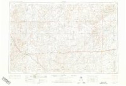
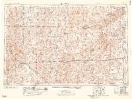
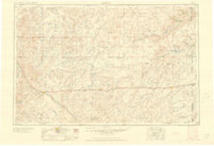
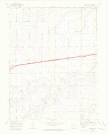
10 topographic sheets cover this place, the earliest surveyed in 1954 and the latest in 1981. It stands in the Burlington census division. It lies in ZIP code area 80807. The Survey maps it on the Peconic quadrangle.
Topographic sheets covering this place
5 surveys from 10 printed sheetsMatched by testing this settlement's coordinate against the published boundary of every sheet in the United States Geological Survey's historical collection. Each opens the scanned sheet at the Survey.
- 1954 USGS Limon quadrangle1:250000, 4 printings
- 1957 USGS Limon quadrangle1:250000
- 1958 USGS Limon quadrangle1:250000
- 1969 USGS Peconic quadrangle1:24000, 3 printings
- 1981 USGS Burlington quadrangle1:100000
Fires near this place
11 since 2014Regional context, not property-specific evidence. The federal wildfire occurrence database lists 11 fires within 5 miles of Peconic between 2014 and 2016, burning about 171 acres in total. 1 started naturally. None was recorded as arson. Distance is straight-line from the map coordinates, so a fire counted here may appear on a neighbouring settlement's page as well.
| Reported cause | Fires |
|---|---|
| Missing data/not specified/undetermined | 7 |
| Equipment and vehicle use | 3 |
| Natural | 1 |
The most recent of them, most recent first, with the day each was reported and the service that recorded it.
| Date | Cause | Size | Reported by | Name on the report |
|---|---|---|---|---|
| 8 August 2014 | Missing data/not specified/undetermined | under an acre | Burlington Fire Protection District | UNKNOWN |
| 2 August 2016 | Equipment and vehicle use | 120 acres | Burlington Fire Protection District | UNKNOWN |
| 19 August 2014 | Equipment and vehicle use | under an acre | Burlington Fire Protection District | UNKNOWN |
| 6 July 2016 | Missing data/not specified/undetermined | 30 acres | Burlington Fire Protection District | UNKNOWN |
| 5 July 2016 | Missing data/not specified/undetermined | under an acre | Burlington Fire Protection District | UNKNOWN |
| 5 July 2016 | Natural | under an acre | Burlington Fire Protection District | UNKNOWN |
| 1 July 2016 | Missing data/not specified/undetermined | under an acre | Burlington Fire Protection District | UNKNOWN |
| 3 April 2016 | Missing data/not specified/undetermined | 1.0 acres | Burlington Fire Protection District | UNKNOWN |
Settlements close enough to share some of these fires:
Mines and quarries near this place
9 within 5 milesRegional context, not property-specific evidence. The federal mineral resources record lists 9 workings within 5 miles of Peconic: 9 unknowns. None of them still produces. What was taken out: Sand and Gravel, Construction. Distance is straight-line from the map coordinates, so a quarry counted here may appear on a neighbouring settlement's page as well.
| Where | Site | Commodity | Status | Recorded |
|---|---|---|---|---|
| Unk | Sand and Gravel, Construction | Unknown | ||
| Unk | Sand and Gravel, Construction | Unknown | ||
| Unk | Sand and Gravel, Construction | Unknown | ||
| Unk | Sand and Gravel, Construction | Unknown | ||
| Unk | Sand and Gravel, Construction | Unknown | ||
| Unk | Sand and Gravel, Construction | Unknown | ||
| Unk | Sand and Gravel, Construction | Unknown | ||
| Unk | Sand and Gravel, Construction | Unknown | ||
| Unk | Sand and Gravel, Construction | Unknown |
Storms near this place
44 since 1998Regional context, not property-specific evidence. The National Weather Service names Peconic in 44 storm reports between 1998 and 2025: 25 hail, 12 thunderstorm wind, 6 tornado, 1 flash flood. No death or injury is recorded in these reports. Each account below is quoted exactly as the forecast office filed it, from the NOAA Storm Events Database, and each date opens the federal record of that event.
| When | Event | Place named | Harm | What the report says |
|---|---|---|---|---|
| July 2009 | Hail | Peconic | $50,000 | Large hail of unknown size (estimated at 1.75 in diameter based on nearby reports), and driven by strong winds, broke through windows of numerous vehicles on Interstate 70. |
| June 2022 | Thunderstorm Wind | Peconic | $40,000 | Winds from an isolated thunderstorm overturned four irrigation pivots in fields surrounding the location. |
| June 2022 | Hail | Peconic | $3,000 | Wind-driven egg sized hail broke several windows of a mobile home and destroyed the siding and under pining on the west facing side of the mobile home. Siding was stripped down to the plywood underneath. |
| August 2023 | Thunderstorm Wind | Peconic | $1,000 | A few healthy 2 inch tree limbs were reported down. |
| July 2020 | Flash Flood | Peconic | $10 | Via Twitter video, water was found over the road. Depth of water is unknown. |
| May 2025 | Hail | Peconic | - | Mping report of half dollar size hail near Peconic. |
| August 2025 | Thunderstorm Wind | Peconic | - | An off duty NWS employee reported dust storm conditions with visibilities around one quarter mile along Interstate 70 near the Colorado/Kansas state line just ahead of a line of thunderstorms. The nearest observation was at the Goodland Airport (KGLD) which reported a 60 mph wind gust with the thunderstorms at 16:36. |
| May 2024 | Tornado (EFU) | Peconic | - | Public report, with photo, of landspout south of CR N and west of CR 59. |
| June 2024 | Thunderstorm Wind | Peconic | - | Trained spotter reports estimated 100 MPH which was later reduced to 85 MPH due to NWS storm survey team's interview. Lawn furniture blown more than 100 feet. Pea sized hail was also reported. |
| August 2024 | Thunderstorm Wind | Peconic | - | Weatherlink site Ocean Front reported 42 mph sustained wind along with 59 mph gust. |
| August 2024 | Hail | Peconic | - | Pea to quarter sized hail observed. |
| August 2024 | Hail | Peconic | - | Cocorahs observer reported a hole ripped in window screen from hail ranging from dime to quarter in size. |
| August 2024 | Tornado (EFU) | Peconic | - | Photo and report of tornado south of I-70. No damage was reported. Unknown wind speed. |
| August 2024 | Thunderstorm Wind | Peconic | - | Five broken wooden power poles, four overturned irrigation pivots, a shed's roof was completely destroyed, and three grain silos were damaged. Maximum wind gust estimated at 110 MPH. |
| August 2024 | Tornado (EFU) | Peconic | - | Photo and reports of a tornado crossing Highway 24 and I-70. No damage was observed. Unknown wind speed. |
| June 2023 | Hail | Peconic | - | Pea to dime sized hail observed. Corn was flattened with plants and tall weeds severely stripped of leaves. |
| August 2023 | Hail | Peconic | - | Hail was observed at MM 447 on I-70. |
| May 2021 | Thunderstorm Wind | Peconic | - | Blowing dust associated with thunderstorm outflow occurred in eastern Kit Carson County with visibility reduced between half to one-quarter mile at times. A mesonet station near Burlington recorded a peak wind gust of 38 mph at the time of the observation. |
| June 2018 | Hail | Peconic | - | The hail ranged from pea to half dollar in size and covered the ground. |
| May 2018 | Tornado (EF0) | Peconic | - | No damage was reported with this tornado. This tornado was reported by two separate chasers. |
| June 2018 | Hail | Peconic | - | The hail ranged from pea to nickel in size. |
| September 2017 | Hail | Peconic | - | Mostly pea to dime size hail fell. There were a few quarter size hail stones that fell. |
| June 2015 | Thunderstorm Wind | Peconic | - | Eight large trees were laid over and a 30 ft. radio tower was bent in half. Estimated time of report from radar. |
| May 2014 | Hail | Peconic | - | Time of the report was estimated from Doppler radar. |
| May 2014 | Hail | Peconic | - | Time of report estimated from radar. Hail was mostly pea size with the largest stones up to golf ball size. |
| June 2014 | Hail | Peconic | - | Received the storm report through Twitter. |
| April 2013 | Tornado (EF0) | Peconic | - | A brief landspout tornado was reported by storm chasers. |
| June 2012 | Tornado (EF0) | Peconic | - | Storm chaser reported funnel cloud and swirling dirt beneath, correlating good with a brief circulation on Doppler radar. There was no apparent damage. |
| August 2009 | Thunderstorm Wind | Peconic | - | Peak winds were estimated to be near 60 mph. |
| June 1999 | Hail | Peconic | - | Windows broken out by large hail at farmstead. |
| June 1998 | Thunderstorm Wind | Peconic | - | Wind accompanied by dime size hail. |
| May 2019 | Hail | Peconic | - | no account filed |
| June 2018 | Hail | Peconic | - | no account filed |
| May 2017 | Hail | Peconic | - | no account filed |
| September 2016 | Hail | Peconic | - | no account filed |
| July 2015 | Thunderstorm Wind | Peconic | - | no account filed |
| May 2014 | Hail | Peconic | - | no account filed |
| May 2014 | Hail | Peconic | - | no account filed |
| June 2013 | Thunderstorm Wind | Peconic | - | no account filed |
| June 2013 | Hail | Peconic | - | no account filed |
| June 2010 | Hail | Peconic | - | no account filed |
| June 2009 | Hail | Peconic | - | no account filed |
| July 2009 | Hail | Peconic | - | no account filed |
| July 2009 | Hail | Peconic | - | no account filed |
Nearest settlements
The eight closest, with where each one stands in the county. Distances are straight-line, computed from the Geographic Names Information System coordinates.
| Map | Place | Distance | Sheets |
|---|---|---|---|
| Burlington | 6.5 miles | 10 | |
| West Burlington | 8.6 miles | 10 | |
| Bethune | 14.7 miles | 11 | |
| Tuttle (historical) | 22.7 miles | 11 | |
| Stratton | 24.2 miles | 8 | |
| Vona | 31.5 miles | 8 | |
| Seibert | 38.2 miles | 8 | |
| Flagler | 48.7 miles | 8 |
Provenance
This settlement is recorded in the Geographic Names Information System as feature 195127. The sheet list is computed by point-in-boundary test against the United States Geological Survey's historical topographic inventory. Both are works of the United States government and carry no copyright under 17 U.S.C. 105.
Wildfire. Short, Karen C. 2022. Spatial wildfire occurrence data for the United States, 1992-2020 [FPA_FOD_20221014]. 6th Edition. Fort Collins, CO: Forest Service Research Data Archive. https://doi.org/10.2737/RDS-2013-0009.6 Collected with United States Government funding and usable without additional permissions or fees.
Mines and quarries. USGS Mineral Resources Data System (MRDS) https://mrdata.usgs.gov/mrds/ A work of the United States government, no copyright under 17 U.S.C. 105.
Storms. NOAA National Centers for Environmental Information, Storm Events Database https://www.ncei.noaa.gov/stormevents/ A work of the United States government, no copyright under 17 U.S.C. 105. Narratives are quoted verbatim from the National Weather Service report and are not edited or summarised.