 Block
Stratton, Colorado
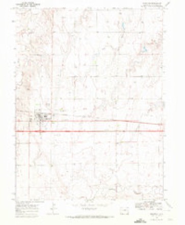
8 topographic sheets cover this place, the earliest surveyed in 1954 and the latest in 1981. It stands in the Stratton census division. It lies in ZIP code area 80836. The Survey maps it on the Stratton quadrangle. 656 people lived here at the 2020 count. It stands 4,413 feet above sea level.
Population over time
2 figuresStratton fell from 658 to 656 between 2010 and 2020. These are the recorded population figures Wikidata holds for this place, reached through the Geographic Names Information System number this page is keyed on rather than by name, so they belong to this place and not to another of the same name. Most are census counts, but not all are: an early figure may be a founding or settlement estimate, and an estimate published within five years of a census is left out. The change column is computed, and is left blank where more than 20 years separate a figure from the one before it, because a gap that long is not a change between two counts.
| Year | People | Change |
|---|---|---|
| 2010 | 658 | |
| 2020 | 656 | -2 (-0%) |
Topographic sheets covering this place
5 surveys from 8 printed sheetsMatched by testing this settlement's coordinate against the published boundary of every sheet in the United States Geological Survey's historical collection. Each opens the scanned sheet at the Survey.
- 1954 USGS Limon quadrangle1:250000, 4 printings
- 1957 USGS Limon quadrangle1:250000
- 1958 USGS Limon quadrangle1:250000
- 1969 USGS Stratton quadrangle1:24000
- 1981 USGS Burlington quadrangle1:100000
Fires near this place
8 since 2013Regional context, not property-specific evidence. The federal wildfire occurrence database lists 8 fires within 5 miles of Stratton between 2013 and 2016, burning about 17 acres in total. None started naturally. None was recorded as arson. Distance is straight-line from the map coordinates, so a fire counted here may appear on a neighbouring settlement's page as well.
| Reported cause | Fires |
|---|---|
| Equipment and vehicle use | 3 |
| Debris and open burning | 2 |
| Missing data/not specified/undetermined | 2 |
| Power generation/transmission/distribution | 1 |
The most recent of them, most recent first, with the day each was reported and the service that recorded it.
| Date | Cause | Size | Reported by | Name on the report |
|---|---|---|---|---|
| 27 September 2013 | Equipment and vehicle use | under an acre | Stratton Fire Department | UNKNOWN |
| 8 August 2016 | Power generation/transmission/distribution | under an acre | Stratton Fire Department | UNKNOWN |
| 13 August 2014 | Debris and open burning | under an acre | Stratton Fire Department | UNKNOWN |
| 27 July 2014 | Debris and open burning | under an acre | Stratton Fire Department | UNKNOWN |
| 21 June 2013 | Equipment and vehicle use | under an acre | Stratton Fire Department | UNKNOWN |
| 17 June 2016 | Equipment and vehicle use | under an acre | Stratton Fire Department | UNKNOWN |
| 11 June 2013 | Missing data/not specified/undetermined | 15 acres | Stratton Fire Department | UNKNOWN |
| 28 May 2013 | Missing data/not specified/undetermined | under an acre | Stratton Fire Department | UNKNOWN |
Settlements close enough to share some of these fires:
Mines and quarries near this place
2 within 5 milesRegional context, not property-specific evidence. The federal mineral resources record lists 2 workings within 5 miles of Stratton: 2 unknowns. None of them still produces. What was taken out: Sand and Gravel, Construction. Distance is straight-line from the map coordinates, so a quarry counted here may appear on a neighbouring settlement's page as well.
Storms near this place
60 of 187 shownRegional context, not property-specific evidence. The National Weather Service names Stratton in 187 storm reports between 1995 and 2026: 135 hail, 35 thunderstorm wind, 12 tornado, 4 flash flood. No death or injury is recorded in these reports. Each account below is quoted exactly as the forecast office filed it, from the NOAA Storm Events Database, and each date opens the federal record of that event.
| When | Event | Place named | Harm | What the report says |
|---|---|---|---|---|
| July 1997 | Hail | Stratton | $500,000 | Up to golfball size hail with 20 mph winds damaged roofs, windows, siding, and autos. |
| June 2011 | Thunderstorm Wind | Stratton | $300,000 | A farmstead received severe wind damage as an intense Rear Flank Downdraft swept across Kit Carson county about 8 miles north of Stratton. An unoccupied trailer home, barn and grain bin were destroyed, and damage occurred to several vehicles and numerous light poles. Cattle feeders were also damaged, and a total of three irrigation pivots in the area were toppled. |
| August 2008 | Flood | Stratton | $150,000 | Observer reported 5.35 inches of rain in 90 minutes which resulted in low land flooding, numerous flooded basements and county roads becoming impassible in northern Kit Carson and southern Yuma counties. This precipitation fell on already saturated soils after a week of heavy rain episodes. |
| June 2014 | Thunderstorm Wind | Stratton | $100,000 | Large tree blown down, damage done to irrigation pivots, and a grain bin was destroyed. |
| August 2009 | Thunderstorm Wind | Stratton | $15,000 | Thunderstorm wind broke 4 inch limbs off trees, blew the top off a grain bin and blew down a shop door. |
| July 1997 | Hail | Stratton | $10,000 | Hail and wind damaged mobile homes in Stratton at 1854 MST. |
| October 1997 | Tornado (F1) | Stratton | $10,000 | Brief tornado damaged a large barn and a pole barn. |
| August 2010 | Thunderstorm Wind | Stratton | $5,000 | Calving shed blown down towards the west at Road 30.5 and Road W which is one half mile north of Stratton. Power lines were also down just north of this location. |
| July 2019 | Hail | Stratton | $2,000 | Ping pong to golf ball hail reported. The wind blown hail broke two windows. |
| August 2019 | Hail | Stratton | $2,000 | A member of the public reported tennis ball size hail as well as window damage. |
| October 2025 | Hail | Stratton | $500 | Hail ranged from penny to quarter in size. Hail and wind broke glass in exterior door. |
| June 2011 | Thunderstorm Wind | Stratton | $500 | The front porch door was damaged and several trees uprooted. |
| May 2013 | Hail | Stratton | $400 | Hail was reported to have broken a window. |
| April 2026 | Thunderstorm Wind | Stratton | - | Measured by a personal weather station. |
| April 2026 | Thunderstorm Wind | Stratton | - | Measured by a personal weather station. |
| May 2025 | Hail | Stratton | - | Hail report from Stratton. Hail ranging from 1-1.5 inches occurring in Stratton measured with tape measure. |
| May 2025 | Hail | Stratton | - | MPing report of 1.5 inch hail. |
| May 2025 | Hail | Stratton | - | Report of 2 inch hail in Stratton with no rain or wind. |
| August 2025 | Hail | Stratton | - | Trained spotter reported dime to penny sized hail, 40 MPH winds, and heavy rain in Stratton. No flooding or damage reported. |
| May 2024 | Thunderstorm Wind | Stratton | - | Mesonet site kcostrat21 reported a gust of 61 MPH. |
| May 2024 | Hail | Stratton | - | Report of a 2 mile swath of up to half dollar sized hail that was 6 inches deep and that flattened the wheat. |
| May 2024 | Hail | Stratton | - | Picture was submitted via Facebook of four hail stones compared to a quarter; each one was bigger than a quarter with the biggest being estimated around a golf ball size. |
| July 2024 | Hail | Stratton | - | Accumulating hail was covering the ground to an unknown depth and estimated to be golf ball sized. |
| June 2024 | Thunderstorm Wind | Stratton | - | Ambient weather station; SevenFarms. |
| June 2024 | Thunderstorm Wind | Stratton | - | Kcostrat21 reported a 71 MPH gust. |
| June 2024 | Thunderstorm Wind | Stratton | - | The 58 mph wind gust was reported via COAGMET station 58 on the backside of the thunderstorm. |
| June 2024 | Thunderstorm Wind | Stratton | - | Gusts of 62 mph were recorded by WeatherUnderground station KCOSTRAT21 over a duration of five minutes. |
| August 2024 | Hail | Stratton | - | Penny size hail along with heavy rain but no wind. |
| June 2023 | Hail | Stratton | - | Spotter reported pea to quarter sized hail at location. |
| June 2023 | Hail | Stratton | - | Report received of quarter sized hail at location. |
| June 2023 | Hail | Stratton | - | Spotter reported 2 inch hail at location via social media. |
| June 2023 | Hail | Stratton | - | Quarter sized hail reported at location that lasted approximately five minutes. |
| June 2023 | Tornado (EFU) | Stratton | - | A brief tornado was reported northwest of Stratton. Based on radar data the tornado was likely between CR 27 and 29 as it moved southwest. No damage was reported with this tornado. |
| July 2022 | Tornado (EFU) | Stratton | - | Brief landspout tornado around 9 miles north of Stratton, CO. Tornado duration was around 3 minutes. No damage. Locations and times estimated from both spotter/first responder reports and NWS Goodland radar imagery. |
| July 2022 | Tornado (EFU) | Stratton | - | The tornado moved over open ground north to northwest of Stratton, CO. No damage. Locations and times estimated from both spotter/first responder reports and NWS Goodland radar imagery. |
| June 2022 | Hail | Stratton | - | Quarter to half dollar sized hail reported over a duration of five minutes. |
| June 2022 | Hail | Stratton | - | Dime to quarter sized hail. |
| June 2022 | Thunderstorm Wind | Stratton | - | Winds were estimated to gust 60 to 70 mph as an isolated thunderstorm moved over the location. |
| April 2021 | Thunderstorm Wind | Stratton | - | A supercell thunderstorm developed and moved across northern Kit Carson County, producing estimated 60 mph wind gusts. |
| April 2021 | Hail | Stratton | - | A supercell thunderstorm developed and moved across northern Kit Carson County producing golf ball sized hail for a duration of ten minutes. |
| April 2021 | Hail | Stratton | - | A supercell thunderstorm developed and moved across northern Kit Carson County, producing ping pong to golf ball sized hail over a duration of four minutes. The caller noticed over the duration that the hail became smaller in size and fell heavier. |
| May 2021 | Hail | Stratton | - | Report received of small hail with some nickel to quarter size at location. |
| May 2021 | Hail | Stratton | - | Report received of ping pong ball sized hail at location. |
| July 2021 | Hail | Stratton | - | Report received of hail ranging from pea sized up to penny sized falling at location for a 25 minute duration. |
| May 2021 | Thunderstorm Wind | Stratton | - | Report received of estimated wind gusts of 50-60 mph with pea sized hail at location. |
| May 2020 | Hail | Stratton | - | Dime sized hail reported via social media. |
| August 2020 | Hail | Stratton | - | Multiple reports of various sized hail ranging from nickel to golf ball in size for an approximate duration of seven minutes. |
| July 2019 | Flash Flood | Stratton | - | Emergency management reported that US Hwy 24 was flooded between CR 33 and CR 34 due to heavy rain. |
| July 2019 | Hail | Stratton | - | Also reported small tree limbs down due to hail and wind. |
| July 2019 | Thunderstorm Wind | Stratton | - | The public reported via Facebook message wind gusts estimated to 80 mph near Stratton. The report included pictures of wind and hail damage with crop damage and hail stones on the ground. The time was estimated by radar. |
| July 2019 | Hail | Stratton | - | The spotter reported via Twitter lots of golf ball hail. Location and time estimated by radar. |
| August 2019 | Thunderstorm Wind | Stratton | - | A member of the public estimated 70 mph winds about 3 miles west of Stratton, CO. |
| August 2019 | Thunderstorm Wind | Stratton | - | A member of the public estimated 70 mph winds in Stratton, CO. |
| August 2019 | Hail | Stratton | - | The Colorado State Climatologist measured the hailstone using a set of calipers to get the exact measurement to the hundredth of an inch. The hailstone measured 4.83 inches in diameter at its widest point. The home owner commented that the hailstone was brought indoors and secured in a freezer approximately 30 minutes after falling due to safety concerns from ongoing severe weather. Despite social media pictures taken soon after the hailstone had fallen, which were higher than the 4.83 inch measurement, the official diameter measurement is 4.83 inches. The hailstone weighed 8.5 ounces, its widest circumference was 12.875 inches, and its volume was later measured using 3D imagery at 16.549 cubic inches. |
| August 2019 | Tornado (EFU) | Stratton | - | Rain wrapped tornado was reported by storm chaser. |
| June 2018 | Hail | Stratton | - | Homeowner did not return until an hour after the storm was over. The size of the divots in the ground was used in estimating the size of the hailstones. |
| June 2018 | Hail | Stratton | - | The hail started out the size of a quarter then decreased to pea size. The hail was two inches deep. |
| June 2016 | Tornado (EF0) | Stratton | - | Public report relayed through law enforcement. Path/time estimated by radar. Individual was located at county roads 40 and HH. |
| May 2016 | Hail | Stratton | - | Estimated the time of the report from radar. |
| August 2016 | Hail | Stratton | - | Estimated wind gusts of 30-40 MPH and almost an inch of rainfall accompanied the hail. |
Nearest settlements
The eight closest, with where each one stands in the county. Distances are straight-line, computed from the Geographic Names Information System coordinates.
| Map | Place | Distance | Sheets |
|---|---|---|---|
| Vona | 7.3 miles | 8 | |
| Bethune | 9.5 miles | 11 | |
| Seibert | 14.0 miles | 8 | |
| Tuttle (historical) | 14.3 miles | 11 | |
| West Burlington | 15.6 miles | 10 | |
| Burlington | 17.8 miles | 10 | |
| Peconic | 24.2 miles | 10 | |
| Flagler | 24.5 miles | 8 |
Elsewhere
Matched on this settlement's Geographic Names Information System number rather than its name, so it cannot be a different place of the same name in another state.
| Wikipedia article on Stratton | An encyclopaedic summary. Its text is share-alike, so it is linked here rather than copied. |
| Wikidata item Q2275091 | The structured record the population and elevation above come from. Public domain (CC0). |
Provenance
This settlement is recorded in the Geographic Names Information System as feature 204821. The sheet list is computed by point-in-boundary test against the United States Geological Survey's historical topographic inventory. Both are works of the United States government and carry no copyright under 17 U.S.C. 105.
Wildfire. Short, Karen C. 2022. Spatial wildfire occurrence data for the United States, 1992-2020 [FPA_FOD_20221014]. 6th Edition. Fort Collins, CO: Forest Service Research Data Archive. https://doi.org/10.2737/RDS-2013-0009.6 Collected with United States Government funding and usable without additional permissions or fees.
Mines and quarries. USGS Mineral Resources Data System (MRDS) https://mrdata.usgs.gov/mrds/ A work of the United States government, no copyright under 17 U.S.C. 105.
Storms. NOAA National Centers for Environmental Information, Storm Events Database https://www.ncei.noaa.gov/stormevents/ A work of the United States government, no copyright under 17 U.S.C. 105. Narratives are quoted verbatim from the National Weather Service report and are not edited or summarised.