 Block
From the record
7 National Register listings published here, 1 of them a National Historic Landmark.
Sources: the National Register database, National Park Service
26 topographic sheets cover 9 settlements here, and 7 properties are on the National Register of Historic Places.
7 National Register listings published here, 1 of them a National Historic Landmark.
Sources: the National Register database, National Park Service
Every property in this county listed on the National Register of Historic Places, with the year it was listed and the federal nomination document.
| Photograph | Property | Type | Listed | Reference |
|---|---|---|---|---|
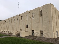 | Burlington Gymnasium | building | 2007 | 07001249 |
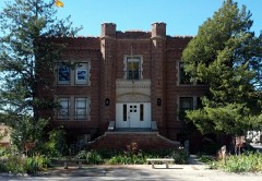 | Burlington State Armory | building | 1984 | 84000859 |
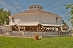 | Elitch Gardens Carousel | object | 1978 | 78000861 |
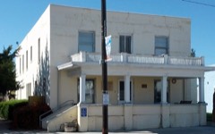 | Flagler Hospital | building | 1991 | 90001421 |
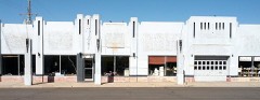 | Sim Hudson Motor Company | building | 2007 | 07001149 |
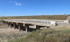 | Spring Creek Bridge | structure | 2002 | 02001143 |
| Winegar Building | building | 86001123 |
Every wildfire the federal occurrence database records inside this county: 87 of them, burning about 2,126 acres. 6 started naturally and none was recorded as arson. Each settlement page carries the fires within five miles of it.
| Reported cause | Fires |
|---|---|
| Missing data/not specified/undetermined | 67 |
| Equipment and vehicle use | 9 |
| Natural | 6 |
| Debris and open burning | 2 |
| Recreation and ceremony | 1 |
| Power generation/transmission/distribution | 1 |
| Fireworks | 1 |
The five largest, by the area the report gives. None of them was recorded as arson.
| Date | Cause | Size | Reported by | Name on the report |
|---|---|---|---|---|
| 7 November 2007 | Missing data/not specified/undetermined | 1,132 acres | Kansas Counties | BRADSHAW |
| 16 June 2011 | Missing data/not specified/undetermined | 510 acres | Colorado State Forest Service-State Headquarters | FLAGLER |
| 2 August 2016 | Equipment and vehicle use | 120 acres | Burlington Fire Protection District | UNKNOWN |
| 25 November 2011 | Missing data/not specified/undetermined | 60 acres | Colorado State Forest Service-State Headquarters | FLAGLER |
| 22 August 2011 | Missing data/not specified/undetermined | 50 acres | Colorado State Forest Service-State Headquarters | BURLINGTON |
| 24 June 2016 | Missing data/not specified/undetermined | 40 acres | Burlington Fire Protection District | UNKNOWN |
| 15 March 2011 | Missing data/not specified/undetermined | 30 acres | Colorado State Forest Service-State Headquarters | BURLINGTON |
| 6 July 2016 | Missing data/not specified/undetermined | 30 acres | Burlington Fire Protection District | UNKNOWN |
Every settlement page carries the fires within five miles of it - see the settlement index below.
The NOAA Storm Events Database holds 1,324 reports for this county, causing no deaths, 8 injuries and about $3,471,420 in recorded property damage. Each settlement page carries the reports that name it.
| Kind of event | Reports |
|---|---|
| Hail | 840 |
| Thunderstorm Wind | 307 |
| Tornado | 119 |
| Flash Flood | 36 |
| Flood | 14 |
| Funnel Cloud | 5 |
| Heavy Rain | 2 |
| Lightning | 1 |
The most serious of them, by death, then injury, then recorded damage. The accounts are quoted exactly as the forecast office filed them.
| When | Event | Place named | Harm | What the report says |
|---|---|---|---|---|
| May 1973 | Tornado (F2) | not stated | 5 hurt, $25,000 | no account filed |
| June 1998 | Thunderstorm Wind | Flagler | 1 hurt, $100,000 | Thunderstorm microburst winds estimated around 90 mph rolled and destroyed mobile home with man inside sustaining cuts and bruises. Another home in the vicinity suffered roof damage. Part of a shed wall was ripped apart and another part buckled. An empty grain bin was lifted and tossed into a tree windbreak. There was minor damage to trees and corrals. |
| May 1952 | Tornado (F2) | not stated | 1 hurt, $25,000 | no account filed |
| August 1991 | Thunderstorm Wind | not stated | 1 hurt | no account filed |
| June 2011 | Thunderstorm Wind | Burlington | $500,000 | A severe microburst destroyed two airport hangars and damaged several aircraft inside. The only hangars destroyed were those oriented north-south. Another hangar nearby received only minor damage. Peak winds measured were from the west. |
| July 1997 | Hail | Stratton | $500,000 | Up to golfball size hail with 20 mph winds damaged roofs, windows, siding, and autos. |
| June 2008 | Hail | Burlington | $325,000 | A report relayed from CoCoRAHS indicated leaves were shredded. Also, cars were dented and roof shingles were damaged. |
| June 2011 | Thunderstorm Wind | Stratton | $300,000 | A farmstead received severe wind damage as an intense Rear Flank Downdraft swept across Kit Carson county about 8 miles north of Stratton. An unoccupied trailer home, barn and grain bin were destroyed, and damage occurred to several vehicles and numerous light poles. Cattle feeders were also damaged, and a total of three irrigation pivots in the area were toppled. |
| July 2018 | Thunderstorm Wind | Seibert | $250,000 | A number of buildings in Seibert sustained damage. The post office roof had roughly half the shingles blown off. One machine shed was completely destroyed, with the foundation blown clean. A second machine shed, that was built using concrete blocks, only had a third of the roof blown off. A building in town had the entire roof blown off. A pine tree was uprooted and resting on the house next to it. A small machine shed was flipped over and blown onto a road in town. There were also many homes with vinyl siding destroyed on the windward side of the home from the hail and wind. |
| September 2021 | Thunderstorm Wind | Burlington | $170,000 | Intense straight line winds due to the microburst first occurred at 8:12 PM MDT near the Burlington airport. This began an area of intermittent damage consistent with wind speeds in the 100-115 mph range. The most intense winds occurred over an area 4.2 miles long and 600 yards wide, ending near Interstate 70 and the Kit Carson Correctional facility. The most significant damage occurred near the Burlington airport where a large evergreen tree was snapped at the trunk and near the Kit Carson Correctional Facility where four power poles were snapped and a nearby outbuilding was destroyed. Damage due to winds in the 60-80 mph range continued to the north of Interstate 70. Additional storm damage included: uprooted trees; damage to the wind and visibility sensors of the KITR ASOS, a camper trailer, overhead garage doors (blown in/dented), fences, windows, siding and roofs of outbuildings and a mobile home; and the flipping of shipping containers and semi-truck trailers. The city of Burlington also lost power as a result of the storm damage. |
| August 2008 | Flood | Stratton | $150,000 | Observer reported 5.35 inches of rain in 90 minutes which resulted in low land flooding, numerous flooded basements and county roads becoming impassible in northern Kit Carson and southern Yuma counties. This precipitation fell on already saturated soils after a week of heavy rain episodes. |
| August 2017 | Flash Flood | Vona | $100,000 | Highway 24 was closed between Vona and Stratton due to water over the road. In some places the water was three feet deep. Vehicles have been washed off the road from the flood waters, and motorists have been rescued. No injuries were reported. |
| June 2014 | Thunderstorm Wind | Stratton | $100,000 | Large tree blown down, damage done to irrigation pivots, and a grain bin was destroyed. |
| July 2010 | Hail | Seibert | $100,000 | Newspaper reports later described many vehicles on Hwy 24 and Interstate 70 suffering broken windshields and body damage. Hail also damaged crops in the area and the storm resulted in heavy runoff for a period of time. |
| June 1995 | Tornado (F1) | Bethune | $100,000 | Brief tornado heavily damaged farm shop and house and injured a horse. Spotter observed a funnel cloud shortly before and resident reported roaring sound. Vehicles, shed and windows were also damaged. |
| May 2018 | Tornado (EF0) | Flagler | $60,000 | This is the third of three tornadoes that were briefly ongoing at the same time. During the first five minutes or so of its lifetime it moved east toward CR 10, (possibly crossing this road). The tornado was stationary for another five minutes or so then headed south for the rest of its lifetime, ending between CR KK and CR JJ. Toward the end of its lifetime the tornado did damage an irrigation pivot south of CR KK. |
| June 2023 | Flood | Flagler Arpt | $50,000 | Park and Recreation reports County Road U is closed due to flooding. Other roads in the area are still closed due to flooding as well. The dam is overflowing excess water, but in no risk of failing. There is damage to the spillway at the dam due to excessive outflow. |
| July 2009 | Hail | Peconic | $50,000 | Large hail of unknown size (estimated at 1.75 in diameter based on nearby reports), and driven by strong winds, broke through windows of numerous vehicles on Interstate 70. |
| June 2022 | Thunderstorm Wind | Peconic | $40,000 | Winds from an isolated thunderstorm overturned four irrigation pivots in fields surrounding the location. |
| August 2009 | Thunderstorm Wind | Burlington Arpt | $34,000 | Two sheds were blown over by strong thunderstorm winds, killing two calves. One of the sheds was of steel construction. Several barns suffered roof damage or partial loss at a local dairy farm. |
| April 2007 | Tornado (EF0) | Bethune | $30,000 | Brief tornado produced damage to outbuildings at a farmstead on Road 37.5 and Road LL in extreme northern Kit Carson county. A 25x100 shed was lofted and flipped over. This resulted in damage to a hay bailer and two grain bins. |
| June 2015 | Tornado (EF2) | Seibert | $29,500 | A shed in an old stock yard was destroyed as well as two empty grain bins in the stock yard. At least one anchor for the bins was pulled out of the ground. Debris from the bins was found as far away as a half mile north on Road 12, which was northwest of where the bins were originally located. Some of the panels in the stock yard were also damaged. The general debris pattern was from southeast to northwest. In addition, three power poles were snapped near the old stock yard and three more to the northwest along Road 12. |
| June 2010 | Thunderstorm Wind | Burlington Arpt | $29,500 | Seven power poles were blown down on Road BB about 1.5 miles east of highway 385. A parked farm trailer was overturned near highway 385 approximately 3/4 mile north of road BB. A cherry tree was split in half and irrigation sprinklers were damaged. Numerous tree branches were down in and just east of Burlington. Time estimated from Doppler radar. This event appeared to result from an intense downburst with a path length of approximately 7 miles, with damaging laying down to the south and southeast. |
| July 2010 | Thunderstorm Wind | Seibert | $25,000 | Large pickup towing a long, flatbed trailer was blown over on Interstate 70 blocking the west bound lanes. |
| May 1991 | Tornado (F0) | not stated | $25,000 | no account filed |
| May 1988 | Tornado (F2) | not stated | $25,000 | no account filed |
| July 1969 | Tornado (F0) | not stated | $25,000 | no account filed |
| May 1965 | Tornado (F1) | not stated | $25,000 | no account filed |
| May 1960 | Tornado (F1) | not stated | $25,000 | no account filed |
| May 1955 | Tornado | not stated | $25,000 | no account filed |
| July 2019 | Thunderstorm Wind | Vona | $20,000 | Wind gusts to 60 mph were estimated. Two large semi trucks were reportedly blown over on Interstate 70 by the strong winds. |
| August 2009 | Thunderstorm Wind | Burlington Arpt | $20,000 | Center pivot sprinkler system overturned. |
| June 2011 | Thunderstorm Wind | Vona | $18,000 | This report was relayed via The Spotter Network. Shingles were blown off a roof, four-inch diameter tree branches were broken, a 30-foot tall spruce tree was toppled onto a house, and a grain bin was blown off its foundation and moved about one quarter of a mile. No injuries were reported. |
| August 2009 | Thunderstorm Wind | Stratton | $15,000 | Thunderstorm wind broke 4 inch limbs off trees, blew the top off a grain bin and blew down a shop door. |
| July 2007 | Tornado (EF1) | Seibert | $15,000 | Tornado developed near roads AA, 13 and dissipated near roads BB, 14. One electric pole was broken and metal debris from a grain bin was also seen. Several dead cattle were reported in the same area. This tornado was one of two observed simultaneously. |
| July 2007 | Tornado (EF0) | Seibert | $15,000 | Tornado developed near roads AA, 13 and dissipated near roads AA, 14. This tornado was one of two observed simultaneously. Over open fields...no known damage. |
| July 2009 | Hail | Burlington | $12,500 | Multiple vehicles received severe hail damage as wind-driven hail moved across Hwy 385 south of Burlington. One person received minor injuries. Hail was reported to have covered the ground. |
| July 2009 | Hail | Seibert | $10,000 | A slow-moving storm brought a prolonged period of large hail about 15 miles north of Seibert, Colorado. Cars were dented and shingles damaged. This event was reported by both the general public and a nearby cooperative observer. |
| August 2008 | Flash Flood | Burlington | $10,000 | The Kit Carson county fairgrounds was completely flooded by overnight heavy rainfall. |
| July 1997 | Hail | Stratton | $10,000 | Hail and wind damaged mobile homes in Stratton at 1854 MST. |
| October 1997 | Tornado (F1) | Stratton | $10,000 | Brief tornado damaged a large barn and a pole barn. |
| August 2008 | Thunderstorm Wind | Burlington | $9,000 | Strong outflow winds broke six power poles, tore away the porch supports from a house and removed the soffit. Three quarters of an inch of rain fell in 15 minutes. |
| April 2019 | Thunderstorm Wind | Seibert | $5,000 | A semi trailer was blown on its side on I-70. |
| June 2011 | Thunderstorm Wind | Burlington | $5,000 | Numerous tree limbs and privacy fences in town were downed or damaged. |
| August 2010 | Thunderstorm Wind | Stratton | $5,000 | Calving shed blown down towards the west at Road 30.5 and Road W which is one half mile north of Stratton. Power lines were also down just north of this location. |
| September 2007 | Thunderstorm Wind | Burlington | $5,000 | Metal building was knocked over and the contents inside the building were damaged. |
| August 2002 | Thunderstorm Wind | Bethune | $5,000 | Center-pivot irrigation system overturned by high winds. Large tree branches down. |
| August 1993 | Thunderstorm Wind | Bethune | $5,000 | no account filed |
| June 2022 | Hail | Peconic | $3,000 | Wind-driven egg sized hail broke several windows of a mobile home and destroyed the siding and under pining on the west facing side of the mobile home. Siding was stripped down to the plywood underneath. |
| May 2021 | Flash Flood | Burlington | $3,000 | A culvert was washed out from the heavy rainfall. |
| July 1963 | Tornado (F1) | not stated | $2,500 | no account filed |
| May 1961 | Tornado (F1) | not stated | $2,500 | no account filed |
| June 1960 | Tornado (F1) | not stated | $2,500 | no account filed |
| July 2024 | Hail | Vona | $2,000 | Ping pong ball sized hail created numerous dents and shattered a windshield of a vehicle traveling on I-70. |
| July 2019 | Hail | Stratton | $2,000 | Ping pong to golf ball hail reported. The wind blown hail broke two windows. |
| August 2019 | Hail | Stratton | $2,000 | A member of the public reported tennis ball size hail as well as window damage. |
| August 2023 | Thunderstorm Wind | Peconic | $1,000 | A few healthy 2 inch tree limbs were reported down. |
| April 2022 | Thunderstorm Wind | Burlington | $1,000 | Large live tree blown down as a line of storms moved through Burlington. |
| June 2022 | Hail | Burlington Arpt | $1,000 | Hail at least the size of golf balls smashed a windshield of a vehicle traveling on Interstate 70 between Bethune and Burlington, Colorado. |
| July 2021 | Flash Flood | Burlington | $1,000 | Report received of minor street flooding in and around Burlington, CO. Another report of 1.4 inches of storm total rain was received via social media with photo of a rain gauge at one location. This heavy rain produced enough rain for water to reach the running boards on a jeep (estimated 4-6 inches deep). |
The Survey's mineral resources record lists 48 workings inside this county. 4 still produce and 44 are closed or unrecorded. Each settlement page carries the workings within five miles of it.
| Commodity | Workings |
|---|---|
| Sand and Gravel, Construction | 46 |
| Gold | 1 |
| Lead, Zinc | 1 |
| Lead | 1 |
| Silver, Zinc | 1 |
The least common of them first, because a county's hundredth gravel pit says nothing its first ten did not.
| Where | Site | Commodity | Status | Recorded |
|---|---|---|---|---|
| Chicago | Gold, Lead, Zinc | Past Producer | ||
| Ponsardine Shaft | Lead, Silver, Zinc | Past Producer | ||
| Burlington Pit & Plant | Sand and Gravel, Construction | Producer | ||
| Erker Pit | Sand and Gravel, Construction | Producer | ||
| Johnson Pit | Sand and Gravel, Construction | Producer | ||
| Martens Pit | Sand and Gravel, Construction | Unknown | ||
| Parmer Pit | Sand and Gravel, Construction | Producer | ||
| Unk | Sand and Gravel, Construction | Unknown | ||
| Unk | Sand and Gravel, Construction | Unknown | ||
| Unk | Sand and Gravel, Construction | Unknown | ||
| Unk | Sand and Gravel, Construction | Unknown | ||
| Unk | Sand and Gravel, Construction | Unknown | ||
| Unk | Sand and Gravel, Construction | Unknown | ||
| Unk | Sand and Gravel, Construction | Unknown | ||
| Unk | Sand and Gravel, Construction | Unknown | ||
| Unk | Sand and Gravel, Construction | Unknown | ||
| Unk | Sand and Gravel, Construction | Unknown | ||
| Unk | Sand and Gravel, Construction | Unknown | ||
| Unk | Sand and Gravel, Construction | Unknown | ||
| Unk | Sand and Gravel, Construction | Unknown | ||
| Unk | Sand and Gravel, Construction | Unknown | ||
| Unk | Sand and Gravel, Construction | Unknown | ||
| Unk | Sand and Gravel, Construction | Unknown | ||
| Unk | Sand and Gravel, Construction | Unknown | ||
| Unk | Sand and Gravel, Construction | Unknown | ||
| Unk | Sand and Gravel, Construction | Unknown | ||
| Unk | Sand and Gravel, Construction | Unknown | ||
| Unk | Sand and Gravel, Construction | Unknown | ||
| Unk | Sand and Gravel, Construction | Unknown | ||
| Unk | Sand and Gravel, Construction | Unknown | ||
| Unk | Sand and Gravel, Construction | Unknown | ||
| Unk | Sand and Gravel, Construction | Unknown | ||
| Unk | Sand and Gravel, Construction | Unknown | ||
| Unk | Sand and Gravel, Construction | Unknown | ||
| Unk | Sand and Gravel, Construction | Unknown | ||
| Unk | Sand and Gravel, Construction | Unknown | ||
| Unk | Sand and Gravel, Construction | Unknown | ||
| Unk | Sand and Gravel, Construction | Unknown | ||
| Unk | Sand and Gravel, Construction | Unknown | ||
| Unk | Sand and Gravel, Construction | Unknown | ||
| Unk | Sand and Gravel, Construction | Unknown | ||
| Unk | Sand and Gravel, Construction | Unknown | ||
| Unk | Sand and Gravel, Construction | Unknown | ||
| Unk | Sand and Gravel, Construction | Unknown | ||
| Unk | Sand and Gravel, Construction | Unknown | ||
| Unknown | Sand and Gravel, Construction | Occurrence | Gravel | |
| Unknown | Sand and Gravel, Construction | Occurrence | Gravel | |
| Unknown | Sand and Gravel, Construction | Occurrence | Gravel |
Named settlements recorded in the Geographic Names Information System, each with the topographic sheets covering it. Villages, hamlets and abandoned places alike. Each is shown with the nearest named watercourse or landform and the survey quadrangle it falls on.
Stratton census division · 80836 · On Spring Creek · Tuttle quadrangle
11 sheets, 1954 to 1981
No longer a settlement
The vanished settlements of Kit Carson County: the places named above that are no longer on the map.