 Block
Bethany, Connecticut
34 topographic sheets cover this place, the earliest surveyed in 1892 and the latest in 1983. It stands in Bethany town. It lies in ZIP code area 06524. It lies near Meeting House Hill. The Survey maps it on the Mount Carmel quadrangle.
On record in Bethany
Buildings and businesses the archive holds for this place. Each opens its own page, with the source record it came from.
On the National Register 1 record
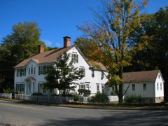 Wheeler-Beecher Houselisted 1977
Topographic sheets covering this place
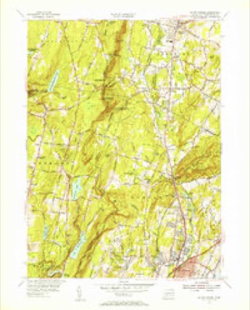
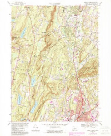
11 surveys from 34 printed sheetsMatched by testing this settlement's coordinate against the published boundary of every sheet in the United States Geological Survey's historical collection. Each opens the scanned sheet at the Survey.
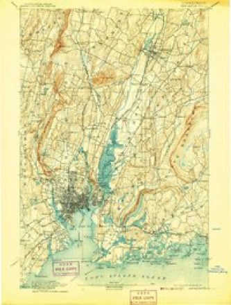
- 1892 USGS New Haven quadrangle1:62500, 13 printings
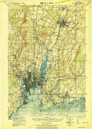
- 1921 USGS New Haven quadrangle1:62500
- 1947 USGS Hartford quadrangle1:250000, 2 printings
- 1948 USGS Hartford quadrangle1:250000, 2 printings
- 1954 USGS Mount Carmel quadrangle1:24000, 2 printings
- 1954 USGS Mount Carmel quadrangle1:31680
- 1961 USGS Hartford quadrangle1:250000
- 1962 USGS Hartford quadrangle1:250000, 3 printings
- 1965 USGS Hartford quadrangle1:250000, 2 printings
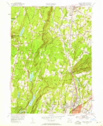
- 1967 USGS Mount Carmel quadrangle1:24000, 5 printings
- 1983 USGS New Haven quadrangle1:100000, 2 printings






In the county-history sources
8,893 words on this townshipHistory of New Haven County, Connecticut, published 1892 names this settlement in its chapter on Bethany Town. These are the passages that mention it, exactly as the scans read.
Bethany is one of the few towns which has no railroad within its bounds, but for 50 years the Watertown or Straits turnpike afforded comparatively easy communication. It is still one of the main highways in the northern and eastern parts, but for many years has been under the care of the town.
Passage source: History of New Haven County, Connecticut, published 1892.
The territory in Bethany was included in the purchases made from the Indians in behalf of the towns of New Haven and Milford. The early settlements, also, are a part of the history of these towns and of Woodbridge and are not here reproduced. Some of the principal families, in the different parts of the town, were: the Hotchkiss, Peck and Hitchcock, in the interior and southwest; the French and Lounsbnry, in the west; the Bradley, Beard and Perkins, in the north; the Tuttle, Beecher and Tolles, in the east; the Clark, Sperry and Hitchcock, in the south. The population of the town has steadily declined, as will be seen from the official tables.
Passage source: History of New Haven County, Connecticut, published 1892.
Bethany was constituted a civil and ecclesiastical district by the general assembly held at New Haven in October, 1762, which acted upon the memorial of Joel Hotchkiss and others living in the northern part of the parish of Amity. They represented that by reason of the length of the parish, from north to south, they (who lived in the northern part) were much inconvenienced to attend public worship, on account of the great distance, and prayed that the old parish be divided by an east and west line, drawn from the south end of the dwelling of the widow Hannah Sperry. This was done, and the northern part was constituted a distinct parish, with all the appertaining privileges, and received the name of Bethany.
Passage source: History of New Haven County, Connecticut, published 1892.
Machine-read from a century-old scan, so expect the errors a machine makes: misspelled names, dropped words, stray characters.
Read the whole chapter on Bethany Town - it names this place 38 more 38 times.
Fires near this place
285 since 1992Regional context, not property-specific evidence. The federal wildfire occurrence database lists 285 fires within 5 miles of Bethany between 1992 and 2020, burning about 449 acres in total. None started naturally. 48 were recorded as arson. Distance is straight-line from the map coordinates, so a fire counted here may appear on a neighbouring settlement's page as well.
| Reported cause | Fires |
|---|---|
| Missing data/not specified/undetermined | 160 |
| Arson/incendiarism | 48 |
| Debris and open burning | 29 |
| Recreation and ceremony | 28 |
| Misuse of fire by a minor | 9 |
| Smoking | 8 |
| Equipment and vehicle use | 3 |
The most recent of them, most recent first, with the day each was reported and the service that recorded it.
| Date | Cause | Size | Reported by | Name on the report |
|---|---|---|---|---|
| 8 September 2010 | Smoking | 1.0 acres | Connecticut Division of Forestry | not named |
| 7 September 2004 | Missing data/not specified/undetermined | under an acre | Connecticut Division of Forestry | not named |
| 7 September 2002 | Arson/incendiarism | 2.0 acres | Connecticut Division of Forestry | not named |
| 5 September 2010 | Missing data/not specified/undetermined | under an acre | Connecticut Division of Forestry | not named |
| 4 September 2009 | Missing data/not specified/undetermined | under an acre | Connecticut Division of Forestry | not named |
| 3 September 2017 | Missing data/not specified/undetermined | under an acre | Connecticut Division of Forestry | SKOKORAT ST |
| 25 September 2016 | Recreation and ceremony | 2.3 acres | Connecticut Division of Forestry | CHESTNUT HILL ROAD NAUGATCK SF |
| 25 September 2016 | Recreation and ceremony | 4.2 acres | Connecticut Division of Forestry | RIMMON RIDGE FIRE |
Settlements close enough to share some of these fires:
Mines and quarries near this place
10 of 27 shownRegional context, not property-specific evidence. The federal mineral resources record lists 27 workings within 5 miles of Bethany: 15 past producers, 8 producers, 3 occurrences, 1 unknown. 8 still produce. What was taken out: Sand and Gravel, Construction, Stone, Dimension, Copper, Limestone, General. Distance is straight-line from the map coordinates, so a quarry counted here may appear on a neighbouring settlement's page as well.
| Where | Site | Commodity | Status | Recorded |
|---|---|---|---|---|
| Copper Prospect No. Dk-008 | Sulfur, Copper | Past Producer | Void Fill And Replacement | |
| Crushed Trap Rock Quarry No. Dk-007 | Stone, Crushed/Broken | Past Producer | Diabase | |
| D & J Quarry | Stone | Producer | ||
| Limestone Quarry #Dk-009 | Limestone, Dimension | Past Producer | ||
| Mariano Pit | Sand and Gravel, Construction, Stone, Crushed/Broken | Producer | ||
| Silver Mine | Silver | Past Producer | ||
| Copper Occurrences No. Ek-003 | Copper, Iron | Occurrence | Disseminations In Metamor | |
| Copper Prospect No. Ek-002 | Copper, Iron | Occurrence | Disseminations In Metamor | |
| Limestone Quarry No. Dk-009 | Limestone, General | Past Producer | ||
| Limestone Quarry No. Dk-010 | Limestone, General | Past Producer |
Storms near this place
9 since 1996Regional context, not property-specific evidence. The National Weather Service names Bethany in 9 storm reports between 1996 and 2020: 5 thunderstorm wind, 1 lightning, 1 flash flood, 1 hail. The reports record 1 injury. Each account below is quoted exactly as the forecast office filed it, from the NOAA Storm Events Database, and each date opens the federal record of that event.
| When | Event | Place named | Harm | What the report says |
|---|---|---|---|---|
| June 2000 | Lightning | Bethany | 1 hurt | no account filed |
| August 2020 | Tornado (EF1) | Bethany | $500,000 | EF1 Tornado staring in Bethany, CT and ending in North Haven, CT. Maximum path width of 500 yards and a path length of 11.1 miles.||Based on a National Weather Service damage survey done in |conjunction with CT Division of Emergency Management and Homeland |Security and local CT town emergency managements, it has been |determined that a strong EF1 tornado, with maximum wind speed of |110 mph, tracked southeast from Bethany to North Haven CT. ||The tornado first touched down in a forested area to the |southeast of Judd Hill Rd in Bethany CT. The tornado tracked |southeast over primarily forested areas from Amity Rd, to Munson |Rd towards Litchfield Tpke, creating a path of damage about 75 |yards wide, with hardwood tree damage consistent with wind speeds |of 80 to 90 mph. ||The path of damage widened to around 300 yards as the tornado |tracked southeast towards Lake Bethany. Structural damage, |including significant roof damage to several homes, and snapped |hardwood trees indicated wind speeds of around 100 mph in this |area.||The tornado path continued southeast for another 4 miles to near |the town center of Hamden CT, with tree and structural damage |indicative of wind speeds of 70 to 80 mph. The intensity picked up|significantly as the tornado approached the center of Hamden, as |evidenced by extensive damage to numerous buildings, including the|flat roof of a 2 story building across from Hamden Town Hall |being torn apart. Wind speeds are estimated to be around 100 mph |based on the damage to these buildings, bent metal fencing around|town hall, and uprooted and snapped trees.||The tornado reached maximum strength and width from this point on|as it continued southeast across Wilbur Cross Parkway, Interstate|91, and down to the intersection of Arrowdale and Thompson St in |North Haven, CT. Tremendous hardwood tree damage and structural |damage was indicative of wind speeds of 110 mph and an expanded |width of 500 yards. It is a this point that the tornado appears to|have dissipated with its destructive straight line winds fanning |out to the coast. |
| May 2018 | Thunderstorm Wind | Bethany | $50,000 | Two barns destroyed. |
| August 2011 | Thunderstorm Wind | Bethany | $3,000 | A few trees and wires were reported down in Bethany. |
| July 2008 | Hail | Bethany | - | Quarter size hail was reported from 49 High Road to Bear Hill Road in Bethany. |
| May 2007 | Thunderstorm Wind | Bethany | - | Numerous trees down. |
| August 2004 | Flash Flood | Bethany | - | Significant basement flooding occurred due to torrential rainfall. |
| October 2003 | Thunderstorm Wind | Bethany | - | As a thunderstorm moved across Long Island Sound, it developed into a severe thunderstorm. This storm then produced damaging winds that knocked down a tree on Payne Road. This incident was reported by the local Police Department. |
| July 1996 | Thunderstorm Wind | Bethany | - | no account filed |
Nearest settlements
The eight closest, with where each one stands in the county. Distances are straight-line, computed from the Geographic Names Information System coordinates.
| Map | Place | Distance | Sheets |
|---|---|---|---|
| Davidsons Corner | 1.2 miles | 34 | |
| Bethany Wood | 2.4 miles | 34 | |
| Paynes Corners | 3.0 miles | 35 | |
| Pine Bridge | 3.8 miles | 35 | |
| Beacon Falls | 3.8 miles | 35 | |
| Straitsville | 3.8 miles | 35 | |
| Seymour | 4.5 miles | 35 | |
| Mountaincrest | 4.5 miles | 34 |
Provenance
This settlement is recorded in the Geographic Names Information System as feature 205469. The sheet list is computed by point-in-boundary test against the United States Geological Survey's historical topographic inventory. Both are works of the United States government and carry no copyright under 17 U.S.C. 105.
Wildfire. Short, Karen C. 2022. Spatial wildfire occurrence data for the United States, 1992-2020 [FPA_FOD_20221014]. 6th Edition. Fort Collins, CO: Forest Service Research Data Archive. https://doi.org/10.2737/RDS-2013-0009.6 Collected with United States Government funding and usable without additional permissions or fees.
Mines and quarries. USGS Mineral Resources Data System (MRDS) https://mrdata.usgs.gov/mrds/ A work of the United States government, no copyright under 17 U.S.C. 105.
Storms. NOAA National Centers for Environmental Information, Storm Events Database https://www.ncei.noaa.gov/stormevents/ A work of the United States government, no copyright under 17 U.S.C. 105. Narratives are quoted verbatim from the National Weather Service report and are not edited or summarised.