 Block
Bloomfield, Connecticut
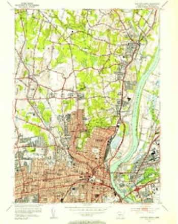
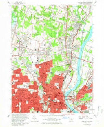
35 topographic sheets cover this place, the earliest surveyed in 1892 and the latest in 1994. It stands in Bloomfield town. It lies in ZIP code area 06002. It stands on Tumble Brook. The Survey maps it on the Hartford North quadrangle.
On record in Bloomfield
Buildings and businesses the archive holds for this place. Each opens its own page, with the source record it came from.
On the National Register 5 records
 Connecticut General Life Insurance Company Headquarterslisted 2010
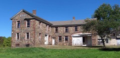 Capt. Oliver Filley Houselisted 2007
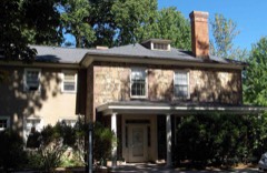 Francis Gillette Houselisted 1982
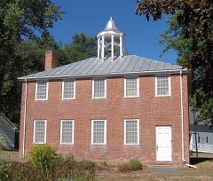 Old Farm Schoolhouselisted 1972
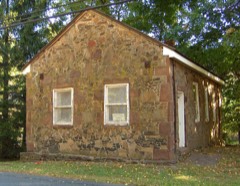 Southwest District Schoollisted 1992
Topographic sheets covering this place
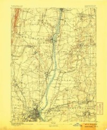
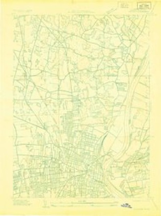
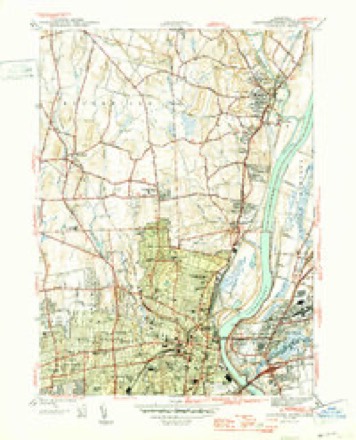
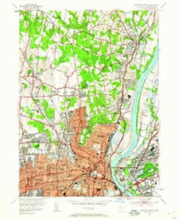
14 surveys from 35 printed sheetsMatched by testing this settlement's coordinate against the published boundary of every sheet in the United States Geological Survey's historical collection. Each opens the scanned sheet at the Survey.
- 1892 USGS Hartford quadrangle1:62500, 8 printings
- 1906 USGS Farmington quadrangle1:125000, 2 printings
- 1928 USGS Windsor quadrangle1:24000
- 1945 USGS Hartford North quadrangle1:31680, 2 printings
- 1947 USGS Hartford quadrangle1:250000, 2 printings
- 1948 USGS Hartford quadrangle1:250000, 2 printings
- 1952 USGS Hartford North quadrangle1:24000
- 1952 USGS Hartford North quadrangle1:31680, 2 printings
- 1961 USGS Hartford quadrangle1:250000
- 1962 USGS Hartford quadrangle1:250000, 3 printings
- 1964 USGS Hartford North quadrangle1:24000, 6 printings
- 1965 USGS Hartford quadrangle1:250000, 2 printings
- 1986 USGS Hartford quadrangle1:100000
- 1994 USGS Hartford quadrangle1:100000, 2 printings








In the county-history sources
4,787 words on this townshipThe Memorial History of Hartford County, Connecticut, 1633-1884;, published 1886 names this settlement in its chapter on Bloomfield Town. These are the passages that mention it, exactly as the scans read.
BLOO^IFIELD was incorporated in 1835, and consisted of Wintonbiiry Parish and a portion of Poquonnock Society in Windsor. In 1840 the town received an addition of a part of Simsburv known as Scotland Parish. As now constituted, it is bounded on the north and east by Windsor, on the south by Hartford, and on the west by Simsbury and Avon, and averages four miles in length and in breadth. On the cast border a forest a mile and a half broad extends the whole length of the township from north to south, and on the west is the range of hills called Talcott Mountain. Tlirough this broad, gently undulating valley run three large brooks, which unite in the south part to form Woods River ; and this, meeting another small river in the southwest part of Hartford, forms Park River, which flows through the city and empties into the Connecticut. These three Bloomfield streams are all of slow current, and overflow their banks several times a year, thus greatly enriching the soil.
Passage source: The Memorial History of Hartford County, Connecticut, 1633-1884;, published 1886.
Another fact favorable to Bloomfield as an agricultural town is that the climate is naturally warm for so high a latitude. Beyond the mountain there is often snow, when only rain falls here. Between these streams lie cultivated fields and orchards, with large intervals of excellent mowing-ground. It is a singular fact that on the opposite sides of these brooks in many places there is an entire difference of soil.
Passage source: The Memorial History of Hartford County, Connecticut, 1633-1884;, published 1886.
The east part of the town is quite level land, with a warm, sandy soil; the middle, from north to south, is principally a clay soil, covered with rich, deep loam, especially good f(jr mowing-land ; and as the ground grows higher, even to rolling hills toward the west, the soil is chiefly red loam, particularly well adapted to fruit culture, and has always produced the finest apples and pears. Formerly it yielded also cherries and plums, and, at certain periods, peaches in the greatest perfection. Appearances indicate the approach of anotiier of these peach-cycles, as they have been aptly called, and many farmers are once more setting out peach-orchards. All this fertile region aljounds in birds. A former resident of the town remembers counting forty-six kinds about her home, among them the scarlet tanager, cuckoo, rose-breasted grosbeak, kildeer, and indigo-bird. It was always the home of the fringed gentian, and of almost every other wild flower of southern New England. Here and there are woods of oak and chestnut, with alluring walks and bridlepaths, and roads intersecting each other in every direction, like Indian trails or cow-paths, as they doul)tless once were; so that the saying came about that every farmer had a road of his own to Hartford. With all this natural Ijeauty the little town seems fitly named. And now, since it wisely chose to accept the Connecticut Western Raih'oad, which Farmington rejected, the number of its admirers must have greatly increased. By this means the Tower in Avon, lying only four miles from the railroad station, has been brought within easy distance for excursionists from Hartford. Not far from the Tower are two mountain points, - one to the north and one to the east, both in Bloomfield, - called Big Philip and Little Philip. A tradition that on the latter of these King Philip was buried is still believed by many, and some have professed to be able even to locate the grave.
Passage source: The Memorial History of Hartford County, Connecticut, 1633-1884;, published 1886.
Machine-read from a century-old scan, so expect the errors a machine makes: misspelled names, dropped words, stray characters.
Read the whole chapter on Bloomfield Town - it names this place 9 more 9 times.
Fires near this place
32 since 1992Regional context, not property-specific evidence. The federal wildfire occurrence database lists 32 fires within 5 miles of Bloomfield between 1992 and 2017, burning about 110 acres in total. None started naturally. 8 were recorded as arson. Distance is straight-line from the map coordinates, so a fire counted here may appear on a neighbouring settlement's page as well.
| Reported cause | Fires |
|---|---|
| Missing data/not specified/undetermined | 14 |
| Arson/incendiarism | 8 |
| Debris and open burning | 6 |
| Recreation and ceremony | 3 |
| Misuse of fire by a minor | 1 |
The most recent of them, most recent first, with the day each was reported and the service that recorded it.
| Date | Cause | Size | Reported by | Name on the report |
|---|---|---|---|---|
| 9 August 2001 | Missing data/not specified/undetermined | 2.0 acres | Connecticut Division of Forestry | not named |
| 25 July 2000 | Missing data/not specified/undetermined | under an acre | Connecticut Division of Forestry | not named |
| 16 July 1999 | Missing data/not specified/undetermined | 1.0 acres | Connecticut Division of Forestry | not named |
| 22 June 2016 | Missing data/not specified/undetermined | under an acre | Connecticut Division of Forestry | TARRIFFVILLE ROAD |
| 12 June 2012 | Misuse of fire by a minor | under an acre | Connecticut Division of Forestry | BLOOMFIELD |
| 8 May 2001 | Arson/incendiarism | under an acre | Connecticut Division of Forestry | not named |
| 7 May 1992 | Arson/incendiarism | 1.5 acres | Connecticut Division of Forestry | not named |
| 13 May 2012 | Missing data/not specified/undetermined | under an acre | Connecticut Division of Forestry | BLOOMFIELD |
Settlements close enough to share some of these fires:
Mines and quarries near this place
10 within 5 milesRegional context, not property-specific evidence. The federal mineral resources record lists 10 workings within 5 miles of Bloomfield: 8 past producers, 2 plants. 2 still produce. What was taken out: Stone, Dimension, Stone, Crushed/Broken, Sand and Gravel, Construction, Iron. Distance is straight-line from the map coordinates, so a quarry counted here may appear on a neighbouring settlement's page as well.
| Where | Site | Commodity | Status | Recorded |
|---|---|---|---|---|
| Abbott Ball Co/ Hartford, Ct. | Corundum | Plant | ||
| American Steel & Aluminum/Hartford | Iron | Plant | ||
| Sandstone Quarry | Flagstone | Past Producer | ||
| Basalt Rock Quarry No. Di-010 | Stone, Crushed/Broken | Past Producer | Basalt | |
| Basalt Rock Quarry No. Di-011 | Stone, Crushed/Broken | Past Producer | Basalt | |
| Russo Brothers Pit | Sand and Gravel, Construction | Past Producer | Sedimentary | |
| Russo Brothers Pit | Sand and Gravel, Construction | Past Producer | ||
| Sandstone Rock Quarry No. Di-009 | Stone, Dimension | Past Producer | Sandstone | |
| Traprock Quarries | Stone, Dimension | Past Producer | ||
| Traprock Quarry | Stone, Dimension | Past Producer |
Storms near this place
11 since 1995Regional context, not property-specific evidence. The National Weather Service names Bloomfield in 11 storm reports between 1995 and 2020: 7 thunderstorm wind, 3 flash flood, 1 hail. No death or injury is recorded in these reports. Each account below is quoted exactly as the forecast office filed it, from the NOAA Storm Events Database, and each date opens the federal record of that event.
| When | Event | Place named | Harm | What the report says |
|---|---|---|---|---|
| September 2011 | Flash Flood | Bloomfield | $100,000 | Dozens of cars in Parking Lot E of the University of Hartford were floating after the north branch of the Park River overflowed its banks into the parking lot. University officials said it was only the second time in the past 15 years that flooding had been this bad. In addition, several mainstem rivers experienced flooding, including: the Farmington River at Simsbury and Unionville and the Connecticut River at Thompsonville and Hartford. No damage associated with this flooding was reported. |
| May 2005 | Thunderstorm Wind | Bloomfield | $20,000 | no account filed |
| May 2003 | Flash Flood | Bloomfield | $20,000 | no account filed |
| July 2009 | Thunderstorm Wind | Bloomfield | $15,000 | Trees on Mountain Road were downed by thunderstorm winds. |
| June 2008 | Thunderstorm Wind | Bloomfield | $7,000 | Numerous trees and wires down on Karkham Road and Route 23. A tree on Route 23 blocked the road. |
| May 2018 | Thunderstorm Wind | North Bloomfield | $5,000 | At 3:45 PM EST trees were reported down on both Duncaster Road and Hopkins Road in Bloomfield. |
| May 2010 | Thunderstorm Wind | Bloomfield | $1,000 | Five inch diameter tree limbs were downed by thunderstorm winds. |
| November 2020 | Thunderstorm Wind | Bloomfield | $500 | In Bloomfield, a tree was down on Tyler Street. |
| August 2018 | Flash Flood | North Bloomfield | - | At 8:50 PM EST, three feet of water was reported on Walts Hill road in North Bloomfield. |
| April 1995 | Thunderstorm Wind | Bloomfield | - | Five pine trees one foot in diameter were blown down. A TV meteorologist recorded a wind gust to 74 mph. |
| July 2004 | Hail | Bloomfield | - | no account filed |
Nearest settlements
The eight closest, with where each one stands in the county. Distances are straight-line, computed from the Geographic Names Information System coordinates.
| Map | Place | Distance | Sheets |
|---|---|---|---|
| Barber Corner (historical) | 1.8 miles | 31 | |
| Cottage Grove | 1.9 miles | 35 | |
| Blue Hills | 2.0 miles | 35 | |
| Case Corner | 2.2 miles | 31 | |
| Childrens Village of the Hartford Orphan Asylum | 2.9 miles | 35 | |
| West Hill | 3.1 miles | 35 | |
| Whitings Corner | 3.3 miles | 31 | |
| Westmoor Park | 3.4 miles | 31 |
Provenance
This settlement is recorded in the Geographic Names Information System as feature 205590. The sheet list is computed by point-in-boundary test against the United States Geological Survey's historical topographic inventory. Both are works of the United States government and carry no copyright under 17 U.S.C. 105.
Wildfire. Short, Karen C. 2022. Spatial wildfire occurrence data for the United States, 1992-2020 [FPA_FOD_20221014]. 6th Edition. Fort Collins, CO: Forest Service Research Data Archive. https://doi.org/10.2737/RDS-2013-0009.6 Collected with United States Government funding and usable without additional permissions or fees.
Mines and quarries. USGS Mineral Resources Data System (MRDS) https://mrdata.usgs.gov/mrds/ A work of the United States government, no copyright under 17 U.S.C. 105.
Storms. NOAA National Centers for Environmental Information, Storm Events Database https://www.ncei.noaa.gov/stormevents/ A work of the United States government, no copyright under 17 U.S.C. 105. Narratives are quoted verbatim from the National Weather Service report and are not edited or summarised.