 Block
Chester, Connecticut
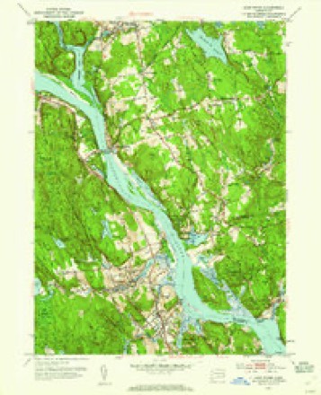
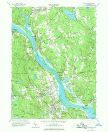
29 topographic sheets cover this place, the earliest surveyed in 1893 and the latest in 1983. It stands in Chester town. It lies in ZIP code area 06412. It stands on Pattaconk Brook. The Survey maps it on the Deep River quadrangle.
On record in Chester
Buildings and businesses the archive holds for this place. Each opens its own page, with the source record it came from.
On the National Register 5 records
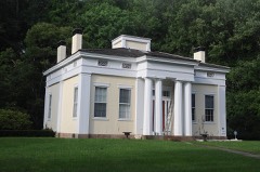 Charles Daniels Houselisted 1988
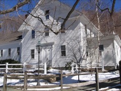 Old Town Halllisted 1972
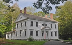 Dr. Ambrose Pratt Houselisted 1972
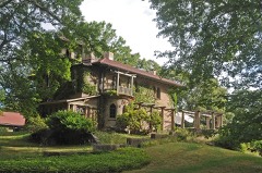 Villa Bella Vistalisted 2000
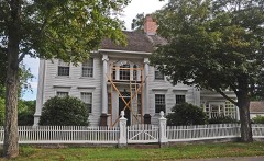 Jonathan Warner Houselisted 1978
Topographic sheets covering this place
11 surveys from 29 printed sheetsMatched by testing this settlement's coordinate against the published boundary of every sheet in the United States Geological Survey's historical collection. Each opens the scanned sheet at the Survey.
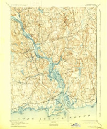
- 1893 USGS Saybrook quadrangle1:62500, 8 printings
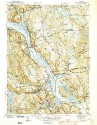
- 1944 USGS Deep River quadrangle1:31680, 2 printings
- 1947 USGS Hartford quadrangle1:250000, 2 printings
- 1948 USGS Hartford quadrangle1:250000, 2 printings
- 1952 USGS Deep River quadrangle1:31680, 2 printings
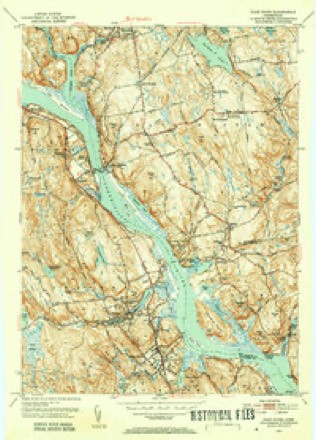
- 1952 USGS Deep River quadrangle1:24000
- 1961 USGS Deep River quadrangle1:24000, 4 printings
- 1961 USGS Hartford quadrangle1:250000
- 1962 USGS Hartford quadrangle1:250000, 3 printings
- 1965 USGS Hartford quadrangle1:250000, 2 printings
- 1983 USGS New Haven quadrangle1:100000, 2 printings






In the county-history sources
9,883 words on this townshipHistory of Middlesex County, Connecticut, with Biographical Sketches of Its Prominent Men, published 1884 names this settlement in its chapter on Chester Town. These are the passages that mention it, exactly as the scans read.
THE town was originally known as Pattaconk Quarter of Saybrook, and subsequently as the Fourth Ecclesiastical Society of that town. It is bounded on the north by Haddam, east by Connecticut River, south by the South or Saw Mill Cove, and by the brook running into it as far west as the center of the Deep River bridge on the county road; thence due west to the Kil- Hngworth line; and west by Killingworth; being about five miles long, east and west, and more than three miles wide between north and south. It was incorporated as a town in 1836, and in 1856 a small portion of the south part was re-annexed to Saybrook. The portion of the town lying north of Chester Cove was called Pattaconk, Pataquonk, or Pattakonck. According to Dr. Trumbull's definition, it means a round or wigwam-shaped hill, a sweating place. The hill from which this section of the town took its name is now known as Fort Hill, near Warner's ferry, where it is supposed the Indians had a fort, and a sweating place to which they resorted in case of sickness. The process of sweating was performed by digging a hole in the ground and placing hot stones in it, then laying the patient over the hole, covered with skins or blankets, and after sweating a sufficient length of time, plunging in the river. There were two other sweating places between the north end of the county and the , mouth of the river; one in Chatham (old boundary), at a place called Indian Hill, and the other in Lyme, nearly opposite Saybrook Point, at a place known as Hothouse Swamp.
Passage source: History of Middlesex County, Connecticut, with Biographical Sketches of Its Prominent Men, published 1884.
When the Indians sold the territory of Haddam to the white people, in 1662, it was claimed by both parties that it extended south to the Chester Cove or Pattaconk River, and the Indians reserved to themselves Thirty Mile Island, or Haddam Island, and forty acres in Pattaconk, Twenty Mile, or Lord's Island, having previously been sold to John Culiick. The forty acres reservation, it is supposed, extended from the south side of Pattaconk Hill to Parker's Point, bordering on the river. The Indians remained on these reservations many years; but a controversy arose between Saybrook and Haddam in regard to the boundary between the towns, and on the settlement of the matter by the General Court, in 1664, by giving Saybrook two miles north of the Pattaconk River, the Indian reservation was found to be in the limits of Saybrook. There has always been sorhe doubt in the minds of many in regard to the justice of this settlement of the boundary, but all parties had to abide by it, and the Indians, finding that their reservation of forty acres was in Saybrook, petitioned the authorities of that town to respect their rights in said reservation; but there is no evidence that they did so. In May 1705, Keepuquam and other Indians made application to the General Court for the quiet possession of the forty acres reservation, claiming it as an ancient right of their ancestors, and representing that they met with opposition to their claim from the inhabitants of Saybrook. The hearing of the matter by the General Court was deferred until the October session, and notice of the pending of the matter was served upon the selectmen of Saybrook, with orders to appear and answer to the complaint of the Indians. It is not known what disposition was finally made of the complaint.
Passage source: History of Middlesex County, Connecticut, with Biographical Sketches of Its Prominent Men, published 1884.
The tribe or clan owning or occupying the territory of Chester, Haddam, and East Haddam were called Wagunks or Wagams, and are supposed to have been subject to Uncas, as he complained to the General Court in 1701, that the inhabitants of Haddam had trespassed upon his rights, There is no evidence of any very serious trouble between the whites and Indians here, and about the year 1785 the tribe became extinct.
Passage source: History of Middlesex County, Connecticut, with Biographical Sketches of Its Prominent Men, published 1884.
Machine-read from a century-old scan, so expect the errors a machine makes: misspelled names, dropped words, stray characters.
Read the whole chapter on Chester Town - it names this place 16 more 16 times.
Fires near this place
198 since 1992Regional context, not property-specific evidence. The federal wildfire occurrence database lists 198 fires within 5 miles of Chester between 1992 and 2020, burning about 218 acres in total. None started naturally. 1 was recorded as arson. Distance is straight-line from the map coordinates, so a fire counted here may appear on a neighbouring settlement's page as well.
| Reported cause | Fires |
|---|---|
| Missing data/not specified/undetermined | 106 |
| Debris and open burning | 38 |
| Recreation and ceremony | 23 |
| Misuse of fire by a minor | 11 |
| Smoking | 9 |
| Railroad operations and maintenance | 4 |
| Power generation/transmission/distribution | 3 |
| Equipment and vehicle use | 2 |
| Arson/incendiarism | 1 |
| Other causes | 1 |
The most recent of them, most recent first, with the day each was reported and the service that recorded it.
| Date | Cause | Size | Reported by | Name on the report |
|---|---|---|---|---|
| 8 September 2020 | Missing data/not specified/undetermined | 1.5 acres | Connecticut Division of Forestry | 546 STEVENSTOWN ROAD |
| 5 September 2015 | Debris and open burning | under an acre | Connecticut Division of Forestry | not named |
| 3 September 2019 | Missing data/not specified/undetermined | under an acre | Connecticut Division of Forestry | not named |
| 25 September 2010 | Missing data/not specified/undetermined | 1.0 acres | Connecticut Division of Forestry | not named |
| 22 September 2019 | Missing data/not specified/undetermined | under an acre | Connecticut Division of Forestry | not named |
| 18 September 2020 | Missing data/not specified/undetermined | under an acre | Connecticut Division of Forestry | 34 WOODLAND TRAIL |
| 16 September 2017 | Missing data/not specified/undetermined | under an acre | Connecticut Division of Forestry | 2 DENNISON RD |
| 9 August 2015 | Smoking | under an acre | Connecticut Division of Forestry | not named |
Settlements close enough to share some of these fires:
Mines and quarries near this place
10 of 11 shownRegional context, not property-specific evidence. The federal mineral resources record lists 11 workings within 5 miles of Chester: 10 past producers, 1 producer. 1 still produces. What was taken out: Granite, Stone, Dimension, Sand and Gravel, Construction, Beryllium. Distance is straight-line from the map coordinates, so a quarry counted here may appear on a neighbouring settlement's page as well.
| Where | Site | Commodity | Status | Recorded |
|---|---|---|---|---|
| Sawmill Beryl Quarry | Beryllium | Past Producer | ||
| Connecticut Valley Sand and Stone | Sand and Gravel, Construction | Producer | ||
| Deep River Sand and Gravel Pit | Sand and Gravel, Construction | Past Producer | ||
| Joshua Granite Gneiss Rock Quarry | Stone, Dimension | Past Producer | ||
| Selden Neck Granite Gneiss Rock Quarry | Stone, Dimension | Past Producer | Unknown | |
| Gneiss Quarry | Granite | Past Producer | ||
| Gneiss Quarry | Granite | Past Producer | ||
| Granite Quarries | Granite | Past Producer | ||
| Joshua Rock Quarry | Granite | Past Producer | ||
| Long Hill Gneiss Quarries | Granite | Past Producer |
Storms near this place
10 since 1996Regional context, not property-specific evidence. The National Weather Service names Chester in 10 storm reports between 1996 and 2021: 5 thunderstorm wind, 2 hail, 1 tornado, 1 heavy rain. No death or injury is recorded in these reports. Each account below is quoted exactly as the forecast office filed it, from the NOAA Storm Events Database, and each date opens the federal record of that event.
| When | Event | Place named | Harm | What the report says |
|---|---|---|---|---|
| July 2009 | Thunderstorm Wind | Chester | $7,500 | Numerous trees were reported down. |
| September 2021 | Thunderstorm Wind | Chester | $3,000 | Multiple trees down. Time of event estimated from radar. |
| July 2013 | Thunderstorm Wind | Chester | $1,000 | Trees and wires were reported down along Route 9 between Exits 6 and 7. |
| July 2013 | Thunderstorm Wind | Chester | $1,000 | Multiple trees and wires were reported down along Wig Hill Road. |
| September 2018 | Flash Flood | Chester | - | The Liberty Street bridge in Chester was washed out due to flash flooding. |
| March 2008 | Thunderstorm Wind | Chester | - | Several trees were reported down in Chester. |
| September 2003 | Heavy Rain | Chester | - | no account filed |
| June 1998 | Tornado (F0) | Chester | - | no account filed |
| July 1996 | Hail | Chester | - | no account filed |
| July 1996 | Hail | Chester | - | no account filed |
Nearest settlements
The eight closest, with where each one stands in the county. Distances are straight-line, computed from the Geographic Names Information System coordinates.
| Map | Place | Distance | Sheets |
|---|---|---|---|
| Deep River | 1.5 miles | 29 | |
| Cedar Lake | 2.8 miles | 26 | |
| Tiffany Hill Corner | 3.2 miles | 29 | |
| Goodspeeds Landing | 3.3 miles | 29 | |
| Tylerville | 3.3 miles | 29 | |
| Winthrop | 3.5 miles | 28 | |
| East Haddam | 3.5 miles | 29 | |
| Ivoryton | 3.8 miles | 28 |
Provenance
This settlement is recorded in the Geographic Names Information System as feature 206228. The sheet list is computed by point-in-boundary test against the United States Geological Survey's historical topographic inventory. Both are works of the United States government and carry no copyright under 17 U.S.C. 105.
Wildfire. Short, Karen C. 2022. Spatial wildfire occurrence data for the United States, 1992-2020 [FPA_FOD_20221014]. 6th Edition. Fort Collins, CO: Forest Service Research Data Archive. https://doi.org/10.2737/RDS-2013-0009.6 Collected with United States Government funding and usable without additional permissions or fees.
Mines and quarries. USGS Mineral Resources Data System (MRDS) https://mrdata.usgs.gov/mrds/ A work of the United States government, no copyright under 17 U.S.C. 105.
Storms. NOAA National Centers for Environmental Information, Storm Events Database https://www.ncei.noaa.gov/stormevents/ A work of the United States government, no copyright under 17 U.S.C. 105. Narratives are quoted verbatim from the National Weather Service report and are not edited or summarised.