 Block
Clinton, Connecticut
27 topographic sheets cover this place, the earliest surveyed in 1893 and the latest in 1983. It stands in Clinton town. It lies in ZIP code area 06413. It lies near Meeting House Hill. The Survey maps it on the Clinton quadrangle. 3,441 people lived here at the 2020 count.
On record in Clinton
Buildings and businesses the archive holds for this place. Each opens its own page, with the source record it came from.
On the National Register 5 records
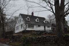 Hubbell Carter Houselisted 2018
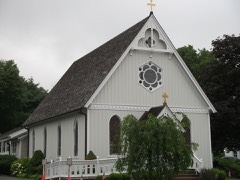 Clinton Village Historic Districtlisted 1994
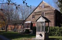 William Stevens Houselisted 1985
- Commerce Street Historic Districtlisted 2024
- High Street Historic Districtlisted 2020
Population over time
2 figuresClinton grew from 3,368 to 3,441 between 2010 and 2020. These are the recorded population figures Wikidata holds for this place, reached through the Geographic Names Information System number this page is keyed on rather than by name, so they belong to this place and not to another of the same name. Most are census counts, but not all are: an early figure may be a founding or settlement estimate, and an estimate published within five years of a census is left out. The change column is computed, and is left blank where more than 20 years separate a figure from the one before it, because a gap that long is not a change between two counts.
| Year | People | Change |
|---|---|---|
| 2010 | 3,368 | |
| 2020 | 3,441 | +73 (+2%) |
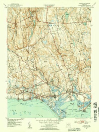
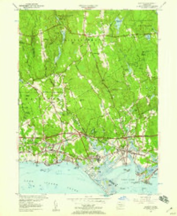
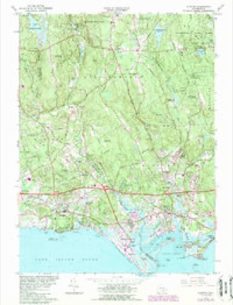
Topographic sheets covering this place
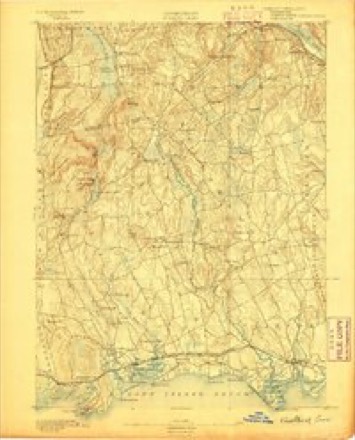
10 surveys from 27 printed sheetsMatched by testing this settlement's coordinate against the published boundary of every sheet in the United States Geological Survey's historical collection. Each opens the scanned sheet at the Survey.
- 1893 USGS Guilford quadrangle1:62500, 8 printings
- 1947 USGS Hartford quadrangle1:250000, 2 printings
- 1948 USGS Hartford quadrangle1:250000, 2 printings
- 1951 USGS Clinton quadrangle1:31680, 2 printings
- 1951 USGS Clinton quadrangle1:24000
- 1961 USGS Clinton quadrangle1:24000, 4 printings
- 1961 USGS Hartford quadrangle1:250000
- 1962 USGS Hartford quadrangle1:250000, 3 printings
- 1965 USGS Hartford quadrangle1:250000, 2 printings
- 1983 USGS New Haven quadrangle1:100000, 2 printings






In the county-history sources
12,768 words on this townshipHistory of Middlesex County, Connecticut, with Biographical Sketches of Its Prominent Men, published 1884 names this settlement in its chapter on Clinton Town. These are the passages that mention it, exactly as the scans read.
Main street, Clinton, is the original Killingworth, where the first settlers built their residences after laying out a street and locating 21 "homesteads." A committee from the General Court ordered and directed the affair. The persons who had pledged themselves to settle there, and signed a paper to that effect, were permitted to draw lots. Lot No. i was on the south side of Main street, next east of Indian River, and in front of the hill already selected as " Meeting House Hill." This lot was drawn by Thomas Smith and is now occupied and owned by George E. Elliott Esq. The 21st lot was drawn by Samuel Buel, and is located north of the residence of Henry A. Lyne. It was bounded on the north by the highway, which was the place of crossing the hill near where Mrs. John Buell lives. This road led up to the fording place on the Hammonassett River, above the crossing of the- Shore Line Railroad. There were no means of crossing the Hammonassett River, except by boats, until 1675 or 1676, when the bridge known so long as the " Farm Bridge " was built. For 12 years at least there was no communication with Guilford, except by fording or by boats. At the present time an iron bridge spans the Hammonassett River. It was built in 1882, at a cost of $2,200, one-half of which was paid by Madison and one-half by Clinton.
Passage source: History of Middlesex County, Connecticut, with Biographical Sketches of Its Prominent Men, published 1884.
Clinton was set off from the town of Killingworth by a special act of the Legislature, at its May session in 1838, on the petition of Henry Taintor, David Dibbell, and others. The causes of the separation and complaints were that Killingworth had a great many roads to repair, and that it was too far for those freemen living in the South Society to go to attend town meetings in Killingworth. By mutual consent State elections were held in the South Society and town meetings in North Society. But the animus of the movements for separation was political dissatisfaction. The North Society was strong- , ly democratic and the South Society was as strongly whig It was difficult to transport voters from the South Society to the North Society to attend to town affairs, so that the voters of North Parish had the disposal of town affairs wholly in their own hands.
Passage source: History of Middlesex County, Connecticut, with Biographical Sketches of Its Prominent Men, published 1884.
Toivn Clerks. - The town clerks of Clinton have been: David Dibbell jr., from 1838 to October 1841; Alfred Hull, from October 1841 to October 1877; Henry C. Hull, from October 1877 to October 1884; and Daniel W. Stevens, the present clerk, elected in October 1884.
Passage source: History of Middlesex County, Connecticut, with Biographical Sketches of Its Prominent Men, published 1884.
Machine-read from a century-old scan, so expect the errors a machine makes: misspelled names, dropped words, stray characters.
Read the whole chapter on Clinton Town - it names this place 39 more 39 times.
Fires near this place
47 since 1992Regional context, not property-specific evidence. The federal wildfire occurrence database lists 47 fires within 5 miles of Clinton between 1992 and 2020, burning about 131 acres in total. None started naturally. None was recorded as arson. Distance is straight-line from the map coordinates, so a fire counted here may appear on a neighbouring settlement's page as well.
| Reported cause | Fires |
|---|---|
| Missing data/not specified/undetermined | 23 |
| Recreation and ceremony | 8 |
| Debris and open burning | 5 |
| Smoking | 3 |
| Misuse of fire by a minor | 3 |
| Power generation/transmission/distribution | 3 |
| Railroad operations and maintenance | 2 |
The most recent of them, most recent first, with the day each was reported and the service that recorded it.
| Date | Cause | Size | Reported by | Name on the report |
|---|---|---|---|---|
| 8 September 2020 | Missing data/not specified/undetermined | 1.5 acres | Connecticut Division of Forestry | 546 STEVENSTOWN ROAD |
| 22 September 2020 | Missing data/not specified/undetermined | under an acre | Connecticut Division of Forestry | 1238 BOSTON POST ROAD |
| 18 September 2017 | Missing data/not specified/undetermined | under an acre | Connecticut Division of Forestry | 216 RIVER RD. |
| 12 September 2016 | Debris and open burning | under an acre | Connecticut Division of Forestry | 76 LAUREL RIDGE TRAIL KILLINGWORTH |
| 7 August 2002 | Missing data/not specified/undetermined | under an acre | Stewart B. McKinney National Wildlife Refuge | PUPIK |
| 6 August 2016 | Power generation/transmission/distribution | under an acre | Connecticut Division of Forestry | 140 FISKE LANE WESTBROOK |
| 24 August 1995 | Smoking | 2.0 acres | Connecticut Division of Forestry | not named |
| 20 August 2016 | Debris and open burning | under an acre | Connecticut Division of Forestry | 116 COW HILL ROAD KILLINGWORTH |
Settlements close enough to share some of these fires:
Mines and quarries near this place
4 within 5 milesRegional context, not property-specific evidence. The federal mineral resources record lists 4 workings within 5 miles of Clinton: 2 past producers, 2 producers. 2 still produce. What was taken out: Sand and Gravel, Construction. Distance is straight-line from the map coordinates, so a quarry counted here may appear on a neighbouring settlement's page as well.
| Where | Site | Commodity | Status | Recorded |
|---|---|---|---|---|
| Madison Mine and Plant | Sand and Gravel, Construction | Producer | ||
| Shore Line Concrete Sand Pit | Sand and Gravel, Construction | Past Producer | Sedimentary | |
| Shore Line Concrete Sand Pit | Sand and Gravel, Construction | Producer | ||
| Shoreline Washed Sandstone | Sand and Gravel, Construction | Past Producer |
Storms near this place
2 since 2001Regional context, not property-specific evidence. The National Weather Service names Clinton in 2 storm reports between 2001 and 2012: 1 lightning, 1 hail. The reports record 2 injuries. Each account below is quoted exactly as the forecast office filed it, from the NOAA Storm Events Database, and each date opens the federal record of that event.
Nearest settlements
The eight closest, with where each one stands in the county. Distances are straight-line, computed from the Geographic Names Information System coordinates.
| Map | Place | Distance | Sheets |
|---|---|---|---|
| Harbor View | 1.2 miles | 27 | |
| Kelseytown | 1.3 miles | 27 | |
| Ridgewood | 1.6 miles | 27 | |
| Clinton Beach | 1.7 miles | 27 | |
| Duck Island Roads | 1.7 miles | 27 | |
| Grove Beach | 2.4 miles | 28 | |
| Hawks Nest | 3.2 miles | 28 | |
| Westbrook | 4.3 miles | 28 |
Elsewhere
Matched on this settlement's Geographic Names Information System number rather than its name, so it cannot be a different place of the same name in another state.
| Wikipedia article on Clinton | An encyclopaedic summary. Its text is share-alike, so it is linked here rather than copied. |
| Wikidata item Q8346941 | The structured record the population and elevation above come from. Public domain (CC0). |
Provenance
This settlement is recorded in the Geographic Names Information System as feature 206320. The sheet list is computed by point-in-boundary test against the United States Geological Survey's historical topographic inventory. Both are works of the United States government and carry no copyright under 17 U.S.C. 105.
Wildfire. Short, Karen C. 2022. Spatial wildfire occurrence data for the United States, 1992-2020 [FPA_FOD_20221014]. 6th Edition. Fort Collins, CO: Forest Service Research Data Archive. https://doi.org/10.2737/RDS-2013-0009.6 Collected with United States Government funding and usable without additional permissions or fees.
Mines and quarries. USGS Mineral Resources Data System (MRDS) https://mrdata.usgs.gov/mrds/ A work of the United States government, no copyright under 17 U.S.C. 105.
Storms. NOAA National Centers for Environmental Information, Storm Events Database https://www.ncei.noaa.gov/stormevents/ A work of the United States government, no copyright under 17 U.S.C. 105. Narratives are quoted verbatim from the National Weather Service report and are not edited or summarised.