 Block
Westbrook, Connecticut
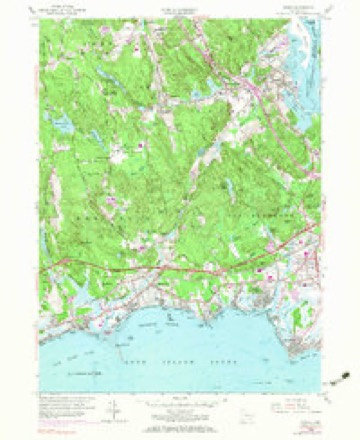
28 topographic sheets cover this place, the earliest surveyed in 1893 and the latest in 1983. It stands in Westbrook town. It lies in ZIP code area 06498. It lies near Salt Island. The Survey maps it on the Essex quadrangle.
On record in Westbrook
Buildings and businesses the archive holds for this place. Each opens its own page, with the source record it came from.
On the National Register 2 records
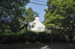 Lay-Pritchett Houselisted 1978
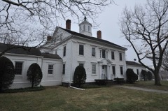 Westbrook Town Center Historic Districtlisted 2017
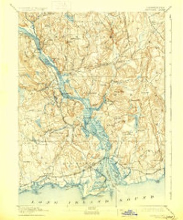
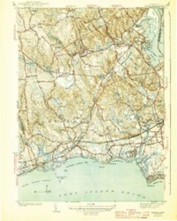
Topographic sheets covering this place
9 surveys from 28 printed sheetsMatched by testing this settlement's coordinate against the published boundary of every sheet in the United States Geological Survey's historical collection. Each opens the scanned sheet at the Survey.
- 1893 USGS Saybrook quadrangle1:62500, 8 printings
- 1944 USGS Essex quadrangle1:31680, 3 printings
- 1947 USGS Hartford quadrangle1:250000, 2 printings
- 1948 USGS Hartford quadrangle1:250000, 2 printings
- 1958 USGS Essex quadrangle1:24000, 5 printings
- 1961 USGS Hartford quadrangle1:250000
- 1962 USGS Hartford quadrangle1:250000, 3 printings
- 1965 USGS Hartford quadrangle1:250000, 2 printings
- 1983 USGS New Haven quadrangle1:100000, 2 printings






In the county-history sources
17,478 words on this townshipHistory of Middlesex County, Connecticut, with Biographical Sketches of Its Prominent Men, published 1884 names this settlement in its chapter on Westbrook Town. These are the passages that mention it, exactly as the scans read.
The unsurpassed fishing and bathing of its bay have drawn to Westbrook a new population, which, during the summer months, nearly doubles its census. The sound front is being rapidly covered with cottages,which now number about 100, erected and occupied during the summer months by families from abroad.
Passage source: History of Middlesex County, Connecticut, with Biographical Sketches of Its Prominent Men, published 1884.
The territory within the bounds and limits of Westbrook was a portion of the domain of the Mohegan chief, Uncas, his claim covering all the land lying between Connecticut River and Guilford and 12 miles north on the river. The title to this he assumed by right of conquest from the Pequots. To his complaint to the General Court in 1665 respecting his squaws' rights at " Homowoset " (Clinton), the committee replied that " Uncas had alienated all of it [his claim] to Mr.'Fenwick and the inhabitants of Saybrook and Guilford, except only six acres in Homonoset." George Fenwick quitclaimed his interest, with a small reservation to the colony, and the Colonial Legislature confirmed all previous titles by a grant in 1704.
Passage source: History of Middlesex County, Connecticut, with Biographical Sketches of Its Prominent Men, published 1884.
Robert Chapman, a resident of Saybrook, had his homestead not far from the Westbrook boundary line on the east. Mr. Chapman owned several tracts of land in this town, among them the meadow around Obed's Hammock. The Chalkers were also large proprietors in the same section, early in the fifties of 1600. The General Court, in May 1656, granted to Mr. James Fitch a compitent farm conteining bet. 2 & 300 acres at Menunketeseck."
Passage source: History of Middlesex County, Connecticut, with Biographical Sketches of Its Prominent Men, published 1884.
Machine-read from a century-old scan, so expect the errors a machine makes: misspelled names, dropped words, stray characters.
Read the whole chapter on Westbrook Town - it names this place 27 more 27 times.
Fires near this place
63 since 1995Regional context, not property-specific evidence. The federal wildfire occurrence database lists 63 fires within 5 miles of Westbrook between 1995 and 2020, burning about 63 acres in total. None started naturally. None was recorded as arson. Distance is straight-line from the map coordinates, so a fire counted here may appear on a neighbouring settlement's page as well.
| Reported cause | Fires |
|---|---|
| Missing data/not specified/undetermined | 37 |
| Recreation and ceremony | 8 |
| Debris and open burning | 8 |
| Smoking | 4 |
| Power generation/transmission/distribution | 3 |
| Railroad operations and maintenance | 2 |
| Misuse of fire by a minor | 1 |
The most recent of them, most recent first, with the day each was reported and the service that recorded it.
| Date | Cause | Size | Reported by | Name on the report |
|---|---|---|---|---|
| 8 September 2020 | Missing data/not specified/undetermined | 1.5 acres | Connecticut Division of Forestry | 546 STEVENSTOWN ROAD |
| 22 September 2020 | Missing data/not specified/undetermined | under an acre | Connecticut Division of Forestry | 1238 BOSTON POST ROAD |
| 15 September 2015 | Recreation and ceremony | 1.0 acres | Connecticut Division of Forestry | not named |
| 7 August 2002 | Missing data/not specified/undetermined | under an acre | Stewart B. McKinney National Wildlife Refuge | PUPIK |
| 6 August 2016 | Power generation/transmission/distribution | under an acre | Connecticut Division of Forestry | 140 FISKE LANE WESTBROOK |
| 5 August 2020 | Debris and open burning | under an acre | Connecticut Division of Forestry | PETTIPAUG ROAD/ESSEX ROAD |
| 3 August 2019 | Missing data/not specified/undetermined | under an acre | Connecticut Division of Forestry | not named |
| 24 August 1995 | Smoking | 2.0 acres | Connecticut Division of Forestry | not named |
Settlements close enough to share some of these fires:
Mines and quarries near this place
3 within 5 milesRegional context, not property-specific evidence. The federal mineral resources record lists 3 workings within 5 miles of Westbrook: 2 producers, 1 past producer. 2 still produce. What was taken out: Sand and Gravel, Construction. Distance is straight-line from the map coordinates, so a quarry counted here may appear on a neighbouring settlement's page as well.
| Where | Site | Commodity | Status | Recorded |
|---|---|---|---|---|
| Madison Mine and Plant | Sand and Gravel, Construction | Producer | ||
| Shore Line Concrete Sand Pit | Sand and Gravel, Construction | Past Producer | Sedimentary | |
| Shore Line Concrete Sand Pit | Sand and Gravel, Construction | Producer |
Storms near this place
1 since 1994Regional context, not property-specific evidence. The National Weather Service names Westbrook in 1 storm report in 1994: 1 hail. No death or injury is recorded in these reports. Each account below is quoted exactly as the forecast office filed it, from the NOAA Storm Events Database, and each date opens the federal record of that event.
| When | Event | Place named | Harm | What the report says |
|---|---|---|---|---|
| May 1994 | Hail | Westbrook | - | Police reported golf ball-size hail. |
Nearest settlements
The eight closest, with where each one stands in the county. Distances are straight-line, computed from the Geographic Names Information System coordinates.
| Map | Place | Distance | Sheets |
|---|---|---|---|
| Chapman (historical) | 1.4 miles | 28 | |
| Hawks Nest | 1.5 miles | 28 | |
| Grove Beach | 2.0 miles | 28 | |
| Saybrook Manor | 2.6 miles | 28 | |
| Clinton Beach | 3.1 miles | 27 | |
| Pond Meadow | 3.1 miles | 28 | |
| Plum Bank Beach | 3.2 miles | 28 | |
| Cornfield Park | 3.6 miles | 28 |
Provenance
This settlement is recorded in the Geographic Names Information System as feature 212009. The sheet list is computed by point-in-boundary test against the United States Geological Survey's historical topographic inventory. Both are works of the United States government and carry no copyright under 17 U.S.C. 105.
Wildfire. Short, Karen C. 2022. Spatial wildfire occurrence data for the United States, 1992-2020 [FPA_FOD_20221014]. 6th Edition. Fort Collins, CO: Forest Service Research Data Archive. https://doi.org/10.2737/RDS-2013-0009.6 Collected with United States Government funding and usable without additional permissions or fees.
Mines and quarries. USGS Mineral Resources Data System (MRDS) https://mrdata.usgs.gov/mrds/ A work of the United States government, no copyright under 17 U.S.C. 105.
Storms. NOAA National Centers for Environmental Information, Storm Events Database https://www.ncei.noaa.gov/stormevents/ A work of the United States government, no copyright under 17 U.S.C. 105. Narratives are quoted verbatim from the National Weather Service report and are not edited or summarised.