 Block
Durham, Connecticut
29 topographic sheets cover this place, the earliest surveyed in 1893 and the latest in 1983. It stands in Durham town. It lies in ZIP code area 06422. It stands on Ball Brook. The Survey maps it on the Durham quadrangle. 3,771 people lived here at the 2020 count.
On record in Durham
Buildings and businesses the archive holds for this place. Each opens its own page, with the source record it came from.
On the National Register 2 records
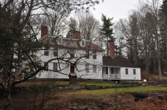 Thomas Lyman Houselisted 1975
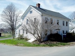 Main Street Historic Districtlisted 1986
Population over time
2 figuresDurham grew from 2,933 to 3,771 between 2010 and 2020. These are the recorded population figures Wikidata holds for this place, reached through the Geographic Names Information System number this page is keyed on rather than by name, so they belong to this place and not to another of the same name. Most are census counts, but not all are: an early figure may be a founding or settlement estimate, and an estimate published within five years of a census is left out. The change column is computed, and is left blank where more than 20 years separate a figure from the one before it, because a gap that long is not a change between two counts.
| Year | People | Change |
|---|---|---|
| 2010 | 2,933 | |
| 2020 | 3,771 | +838 (+29%) |
Topographic sheets covering this place
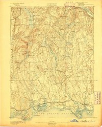
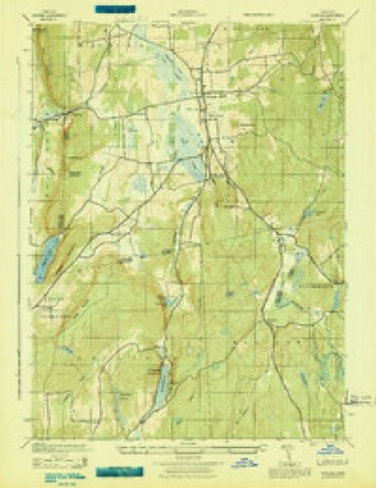
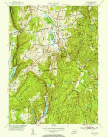
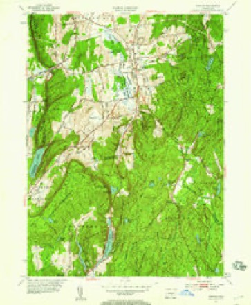
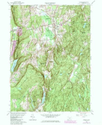
11 surveys from 29 printed sheetsMatched by testing this settlement's coordinate against the published boundary of every sheet in the United States Geological Survey's historical collection. Each opens the scanned sheet at the Survey.
- 1893 USGS Guilford quadrangle1:62500, 8 printings
- 1943 USGS Durham quadrangle1:25000
- 1947 USGS Hartford quadrangle1:250000, 2 printings
- 1948 USGS Hartford quadrangle1:250000, 2 printings
- 1953 USGS Durham quadrangle1:31680, 2 printings
- 1953 USGS Durham quadrangle1:24000, 2 printings
- 1961 USGS Hartford quadrangle1:250000
- 1962 USGS Hartford quadrangle1:250000, 3 printings
- 1964 USGS Durham quadrangle1:24000, 4 printings
- 1965 USGS Hartford quadrangle1:250000, 2 printings
- 1983 USGS New Haven quadrangle1:100000, 2 printings






In the county-history sources
15,218 words on this townshipHistory of Middlesex County, Connecticut, with Biographical Sketches of Its Prominent Men, published 1884 names this settlement in its chapter on Durham Town. These are the passages that mention it, exactly as the scans read.
The western part of the town was shut in between the swamp on one side and the mountain on the other; the passes at Reed's Gap and at the southwest corner of the town were the only ways of communication between it and Wallingford. There was no thought that the east erly and westerly parts of the town could be united, for an impassable and almost impenetrable morass, thickly studded with swamp maple and underbrush lay between. The then indispensable privileges of preaching and public worship would have been unattainable to occupants of almost any part of the town. The western part, called the West Side, was the most easily accessible to Guilford, and seems to have been considered in some sense as belonging to it. Many of the inhabitants of Guilford owned land in Durham. The first recorded meeting of proprietors of Durham was held in Guilford.
Passage source: History of Middlesex County, Connecticut, with Biographical Sketches of Its Prominent Men, published 1884.
From many points nearly the whole township of Durham can be brought wiihin visual range, and to the eye of a geologist its hills and valleys present an impressive illustration of the wonderful changes which have been wrought in the countless ages of the past.
Passage source: History of Middlesex County, Connecticut, with Biographical Sketches of Its Prominent Men, published 1884.
The glacial epoch is represented in Durham by polished surfaces upon the trap, traversed by scratches and groovings running nearly from northeast to southwest. A most interesting illustration may be seen south of the road on the hill near the West Side school house.
Passage source: History of Middlesex County, Connecticut, with Biographical Sketches of Its Prominent Men, published 1884.
Machine-read from a century-old scan, so expect the errors a machine makes: misspelled names, dropped words, stray characters.
Read the whole chapter on Durham Town - it names this place 71 more 71 times.
Fires near this place
144 since 1992Regional context, not property-specific evidence. The federal wildfire occurrence database lists 144 fires within 5 miles of Durham between 1992 and 2020, burning about 130 acres in total. 2 started naturally. 5 were recorded as arson. Distance is straight-line from the map coordinates, so a fire counted here may appear on a neighbouring settlement's page as well.
| Reported cause | Fires |
|---|---|
| Missing data/not specified/undetermined | 62 |
| Debris and open burning | 33 |
| Recreation and ceremony | 19 |
| Smoking | 11 |
| Power generation/transmission/distribution | 5 |
| Arson/incendiarism | 5 |
| Fireworks | 2 |
| Misuse of fire by a minor | 2 |
| Natural | 2 |
| Equipment and vehicle use | 2 |
| Other causes | 1 |
The most recent of them, most recent first, with the day each was reported and the service that recorded it.
| Date | Cause | Size | Reported by | Name on the report |
|---|---|---|---|---|
| 20 September 2015 | Missing data/not specified/undetermined | under an acre | Connecticut Division of Forestry | not named |
| 17 September 2017 | Missing data/not specified/undetermined | under an acre | Connecticut Division of Forestry | 600 MERIDEN RD. |
| 8 August 2020 | Power generation/transmission/distribution | under an acre | Connecticut Division of Forestry | WALLINGFORD ROAD/PENT ROAD |
| 8 August 2020 | Power generation/transmission/distribution | under an acre | Connecticut Division of Forestry | OXBOW RIDGE ROAD/OXBOW ROAD |
| 5 August 2015 | Debris and open burning | under an acre | Connecticut Division of Forestry | not named |
| 31 August 1995 | Recreation and ceremony | under an acre | Connecticut Division of Forestry | not named |
| 30 August 2019 | Recreation and ceremony | under an acre | Connecticut Division of Forestry | not named |
| 30 August 1995 | Recreation and ceremony | under an acre | Connecticut Division of Forestry | not named |
Settlements close enough to share some of these fires:
Mines and quarries near this place
10 of 14 shownRegional context, not property-specific evidence. The federal mineral resources record lists 14 workings within 5 miles of Durham: 11 past producers, 2 producers, 1 prospect. 2 still produce. What was taken out: Stone, Crushed/Broken, Stone, Dimension, Feldspar, Mica, Limestone, General. Distance is straight-line from the map coordinates, so a quarry counted here may appear on a neighbouring settlement's page as well.
| Where | Site | Commodity | Status | Recorded |
|---|---|---|---|---|
| Brownstone Quarries | Flagstone | Past Producer | ||
| Limestone Quarry No. Ck-008 | Limestone, General | Past Producer | Sedimentary Beds | |
| Roberts Mica Prospect | Feldspar, Mica | Past Producer | Muscovite, Plagioclase, Quartz | |
| Roberts Mica Prospect | Feldspar, Mica | Prospect | ||
| Stove Street Pit | Sand and Gravel, Construction | Past Producer | ||
| Basalt Rock Quarry No. Ck-006. | Stone, Dimension | Past Producer | ||
| Brownstone Sandstone Quarries No. Ck-004 | Stone, Dimension | Past Producer | Sandstone | |
| Reed Gap Traprock Quarries | Stone, Dimension | Past Producer | ||
| Traprock Quarries | Stone, Dimension | Past Producer | ||
| Basalt Rock Quarries No. Ck-006 | Stone, Crushed/Broken | Past Producer | Basalt |
Storms near this place
13 since 2001Regional context, not property-specific evidence. The National Weather Service names Durham in 13 storm reports between 2001 and 2021: 10 thunderstorm wind, 1 lightning, 1 flood, 1 hail. No death or injury is recorded in these reports. Each account below is quoted exactly as the forecast office filed it, from the NOAA Storm Events Database, and each date opens the federal record of that event.
| When | Event | Place named | Harm | What the report says |
|---|---|---|---|---|
| June 2015 | Thunderstorm Wind | Durham | $15,000 | Numerous trees and power lines were reported down throughout the entire town. |
| February 2016 | Thunderstorm Wind | Durham | $7,500 | Multiple trees and power lines were reported down throughout Durham. |
| November 2020 | Thunderstorm Wind | Durham | $5,000 | Large tree blocking the road on Route 17. |
| May 2018 | Thunderstorm Wind | Durham | $5,000 | Numerous trees down. |
| June 2021 | Thunderstorm Wind | Durham | $3,000 | Report from mPING, 1 inch tree limbs broken and shingles blown off. |
| October 2013 | Thunderstorm Wind | Durham | $3,000 | Wires were reported down along Route 68 at Pent Road. |
| June 2021 | Thunderstorm Wind | Durham | $2,000 | Tree and branches reported down in front of 15 Foot Hills Road just past Milbrook Road. |
| June 2019 | Thunderstorm Wind | Durham | $1,000 | Downed tree on Stage Coach Road in Durham. |
| July 2009 | Thunderstorm Wind | Durham | $500 | Thunderstorm winds downed a tree in Durham. |
| July 2009 | Hail | Durham | - | Penny size hail stripped the leaves off of trees at the intersection of Mountain Road and Route 68. |
| December 2008 | Flood | Durham | - | Flooding forced the closure of both ends of Pickett Lane, blocking access to Coginchaug High School and Korn School from both Maiden Lane and Main Street in Durham. |
| July 2006 | Thunderstorm Wind | Durham | - | no account filed |
| August 2001 | Lightning | Durham | - | no account filed |
Nearest settlements
The eight closest, with where each one stands in the county. Distances are straight-line, computed from the Geographic Names Information System coordinates.
| Map | Place | Distance | Sheets |
|---|---|---|---|
| Durham Center | 0.5 miles | 29 | |
| Middlefield | 2.9 miles | 36 | |
| Baileyville | 3.2 miles | 36 | |
| Long Hill | 3.6 miles | 36 | |
| Lakeridge Heights | 3.7 miles | 36 | |
| Beseck Lake | 3.8 miles | 36 | |
| Long HIll Estates | 3.9 miles | 36 | |
| Bretton Heights | 4.4 miles | 36 |
Elsewhere
Matched on this settlement's Geographic Names Information System number rather than its name, so it cannot be a different place of the same name in another state.
| Wikipedia article on Durham | An encyclopaedic summary. Its text is share-alike, so it is linked here rather than copied. |
| Wikidata item Q12163662 | The structured record the population and elevation above come from. Public domain (CC0). |
Provenance
This settlement is recorded in the Geographic Names Information System as feature 206760. The sheet list is computed by point-in-boundary test against the United States Geological Survey's historical topographic inventory. Both are works of the United States government and carry no copyright under 17 U.S.C. 105.
Wildfire. Short, Karen C. 2022. Spatial wildfire occurrence data for the United States, 1992-2020 [FPA_FOD_20221014]. 6th Edition. Fort Collins, CO: Forest Service Research Data Archive. https://doi.org/10.2737/RDS-2013-0009.6 Collected with United States Government funding and usable without additional permissions or fees.
Mines and quarries. USGS Mineral Resources Data System (MRDS) https://mrdata.usgs.gov/mrds/ A work of the United States government, no copyright under 17 U.S.C. 105.
Storms. NOAA National Centers for Environmental Information, Storm Events Database https://www.ncei.noaa.gov/stormevents/ A work of the United States government, no copyright under 17 U.S.C. 105. Narratives are quoted verbatim from the National Weather Service report and are not edited or summarised.