 Block
East Hartland, Connecticut
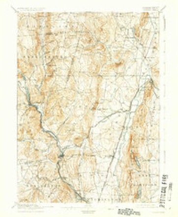
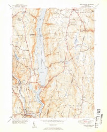
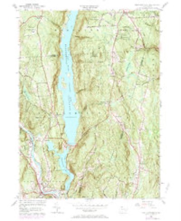
31 topographic sheets cover this place, the earliest surveyed in 1892 and the latest in 1994. It stands in Hartland town. It lies in ZIP code area 06027. The Survey maps it on the New Hartford quadrangle.
On record in East Hartland
Buildings and businesses the archive holds for this place. Each opens its own page, with the source record it came from.
On the National Register within a mile 1 record
The National Register names another town for these. They stand within one mile of this settlement's coordinate.
- Tunxis Forest Headquarters Houselisted 1986 · 0.5 miles away
Topographic sheets covering this place
11 surveys from 31 printed sheetsMatched by testing this settlement's coordinate against the published boundary of every sheet in the United States Geological Survey's historical collection. Each opens the scanned sheet at the Survey.
- 1892 USGS Granby quadrangle1:62500, 8 printings
- 1906 USGS Farmington quadrangle1:125000, 2 printings
- 1947 USGS Hartford quadrangle1:250000, 2 printings
- 1948 USGS Hartford quadrangle1:250000, 2 printings
- 1951 USGS New Hartford quadrangle1:31680, 2 printings
- 1956 USGS New Hartford quadrangle1:24000, 6 printings
- 1961 USGS Hartford quadrangle1:250000
- 1962 USGS Hartford quadrangle1:250000, 3 printings
- 1965 USGS Hartford quadrangle1:250000, 2 printings
- 1986 USGS Hartford quadrangle1:100000
- 1994 USGS Hartford quadrangle1:100000, 2 printings








In the county-history sources
2,505 words on this townshipThe Memorial History of Hartford County, Connecticut, 1633-1884;, published 1886 names this settlement in its chapter on Hartland Town. These are the passages that mention it, exactly as the scans read.
Moses Cowdrey came from East Haddam in 1756, and after several changes finally settled in the northeast district in the cast parish. He left three sons, Asa, Ambrose, and Moses. In 1760 Jonas Wilder and Consider Tiffany, also of East Haddam, settled on the West Mountain, and Thomas Beman, of Simsbury, made his home in East Hartland. Daniel Ensign, of Hartford, came in 1761. By that time the place had thirty-seven families, numbering two hundred and twelve persons. Uriel Holmes, another of the East Haddam people, arrived and built his house at the southeast corner of the green at the centre of East Hartland. It stands now, the oldest house in town. Colonel Holmes was a prominent citizen, and represented the town in thirty-six sessions of the legislature. Other early settlers were Josiah and Stephen Bushnell, from Saybrook, Phineas Kingsbury and Nehemiah Andrews, and a number of young men from East Hartford, among them Reuben Burnham, whose wife, Chloe Fitch, was a sister of the inventor of the first steamboat.
Passage source: The Memorial History of Hartford County, Connecticut, 1633-1884;, published 1886.
The first doctor in the town was Dr. Jeremiah Emmons, who came from East Haddam and settled in East Hartland. In 1775 Uriah Hyde, from Windsor, built the first blacksmith's shop in West Hartland, thouo-h before this, Jehiel Meacham had worked at the trade in East Hartland. The first tavern in the west parish was kept by Eldad Shepherd, who came from Hartford in 1770. About 1780 two brothers, Caleb and Timothy Olmsted, came from East Hartford to West Hartland. Timothy Olmsted was considered the most popular teacher and composer of church music in Connecticut at that time. He published a work of church music, " The Musical Oho," containing many original tunes, such as London, Vernon, etc., long familiar to lovers of church music.
Passage source: The Memorial History of Hartford County, Connecticut, 1633-1884;, published 1886.
The first post-office was located at East Hartland ; the second in West Hartland in 1827. First there was a weekly mail from West Hartland by Barkhamsted, North Canton, Simsbury, to Hartford. In 1850 this was made a semi-weekly service. In 1879 a daily mail was established between New Hartford and West Hartland, and Hartland Centre (the Hollow) was also made a post-office. It has four mails a week. The others have theirs daily.
Passage source: The Memorial History of Hartford County, Connecticut, 1633-1884;, published 1886.
Machine-read from a century-old scan, so expect the errors a machine makes: misspelled names, dropped words, stray characters.
Read the whole chapter on Hartland Town - it names this place 2 more 2 times.
Fires near this place
67 since 1997Regional context, not property-specific evidence. The federal wildfire occurrence database lists 67 fires within 5 miles of East Hartland between 1997 and 2020, burning about 95 acres in total. 1 started naturally. 3 were recorded as arson. Distance is straight-line from the map coordinates, so a fire counted here may appear on a neighbouring settlement's page as well.
| Reported cause | Fires |
|---|---|
| Missing data/not specified/undetermined | 41 |
| Debris and open burning | 10 |
| Recreation and ceremony | 8 |
| Smoking | 3 |
| Arson/incendiarism | 3 |
| Natural | 1 |
| Power generation/transmission/distribution | 1 |
The most recent of them, most recent first, with the day each was reported and the service that recorded it.
| Date | Cause | Size | Reported by | Name on the report |
|---|---|---|---|---|
| 30 September 2006 | Missing data/not specified/undetermined | under an acre | Connecticut Division of Forestry | not named |
| 20 September 2010 | Recreation and ceremony | under an acre | Connecticut Division of Forestry | not named |
| 5 August 2007 | Missing data/not specified/undetermined | under an acre | Connecticut Division of Forestry | not named |
| 30 August 2019 | Missing data/not specified/undetermined | under an acre | Connecticut Division of Forestry | not named |
| 30 July 2005 | Missing data/not specified/undetermined | under an acre | Connecticut Division of Forestry | not named |
| 25 July 1999 | Arson/incendiarism | 15 acres | Connecticut Division of Forestry | not named |
| 21 July 2006 | Missing data/not specified/undetermined | under an acre | Connecticut Division of Forestry | not named |
| 1 July 2020 | Recreation and ceremony | under an acre | Connecticut Division of Forestry | 280 SUNSET ROAD |
Settlements close enough to share some of these fires:
Mines and quarries near this place
7 within 5 milesRegional context, not property-specific evidence. The federal mineral resources record lists 7 workings within 5 miles of East Hartland: 5 past producers, 2 producers. 2 still produce. What was taken out: Sand and Gravel, Construction, Talc-Soapstone, Feldspar, Quartz, Stone, Dimension. Distance is straight-line from the map coordinates, so a quarry counted here may appear on a neighbouring settlement's page as well.
| Where | Site | Commodity | Status | Recorded |
|---|---|---|---|---|
| Mica Mines | Mica | Past Producer | ||
| Pegmatite Prospect No. Di-002 | Feldspar, Quartz | Past Producer | Feldspar | |
| Pegmatite Quarry | Stone, Dimension | Past Producer | ||
| Burkhart Pit | Sand and Gravel, Construction | Past Producer | Sedimentary | |
| Granville Pit | Sand and Gravel, Construction | Producer | ||
| Soapstone Quarry | Talc-Soapstone | Producer | Metamorphic | |
| Soapstone Quarry | Talc-Soapstone | Past Producer |
Storms near this place
5 since 2001Regional context, not property-specific evidence. The National Weather Service names East Hartland in 5 storm reports between 2001 and 2021: 2 hail, 2 thunderstorm wind, 1 tornado. No death or injury is recorded in these reports. Each account below is quoted exactly as the forecast office filed it, from the NOAA Storm Events Database, and each date opens the federal record of that event.
| When | Event | Place named | Harm | What the report says |
|---|---|---|---|---|
| June 2001 | Tornado (F0) | East Hartland | $20,000 | Brief F0 touchdown |
| July 2014 | Thunderstorm Wind | East Hartland | $10,000 | Trees and wires were downed by thunderstorm winds. |
| August 2021 | Thunderstorm Wind | East Hartland | $800 | In Hartland, a tree and wires were down on South Road. |
| August 2011 | Hail | East Hartland | - | no account filed |
| September 2008 | Hail | East Hartland | - | no account filed |
Nearest settlements
The eight closest, with where each one stands in the county. Distances are straight-line, computed from the Geographic Names Information System coordinates.
| Map | Place | Distance | Sheets |
|---|---|---|---|
| North Hollow | 2.7 miles | 39 | |
| Hampsted | 3.4 miles | 31 | |
| West Hartland | 3.5 miles | 39 | |
| Hartland | 3.9 miles | 31 | |
| North Granby | 4.0 miles | 31 | |
| West Granby | 4.4 miles | 31 | |
| Goodrichville | 5.1 miles | 31 | |
| Pegville | 5.5 miles | 31 |
Elsewhere
Matched on this settlement's Geographic Names Information System number rather than its name, so it cannot be a different place of the same name in another state.
| Wikidata item Q135800931 | The structured record the population and elevation above come from. Public domain (CC0). |
Provenance
This settlement is recorded in the Geographic Names Information System as feature 206822. The sheet list is computed by point-in-boundary test against the United States Geological Survey's historical topographic inventory. Both are works of the United States government and carry no copyright under 17 U.S.C. 105.
Wildfire. Short, Karen C. 2022. Spatial wildfire occurrence data for the United States, 1992-2020 [FPA_FOD_20221014]. 6th Edition. Fort Collins, CO: Forest Service Research Data Archive. https://doi.org/10.2737/RDS-2013-0009.6 Collected with United States Government funding and usable without additional permissions or fees.
Mines and quarries. USGS Mineral Resources Data System (MRDS) https://mrdata.usgs.gov/mrds/ A work of the United States government, no copyright under 17 U.S.C. 105.
Storms. NOAA National Centers for Environmental Information, Storm Events Database https://www.ncei.noaa.gov/stormevents/ A work of the United States government, no copyright under 17 U.S.C. 105. Narratives are quoted verbatim from the National Weather Service report and are not edited or summarised.