 Block
Yantic, Connecticut
30 topographic sheets cover this place, the earliest surveyed in 1892 and the latest in 1994. It stands in Norwich town. It lies in ZIP code area 06389. It stands on Bentley Brook. The Survey maps it on the Norwich quadrangle. It stands 115 feet above sea level.
On record in Yantic
Buildings and businesses the archive holds for this place. Each opens its own page, with the source record it came from.
On the National Register within a mile 2 records
The National Register names another town for these. They stand within one mile of this settlement's coordinate.
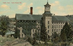 Yantic Woolen Company Milllisted 1996 · 0.1 miles away
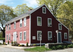 Bean Hill Historic Districtlisted 1982 · 0.8 miles away
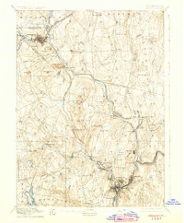
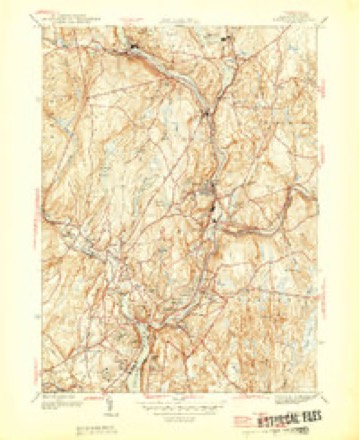
Topographic sheets covering this place
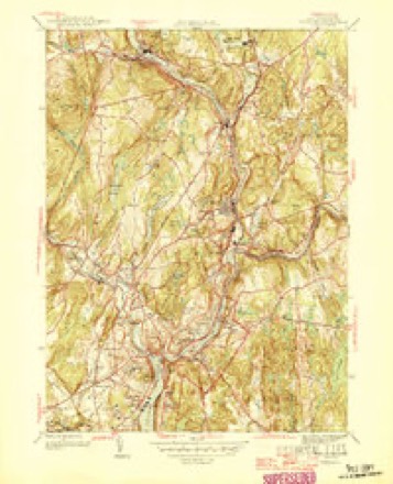
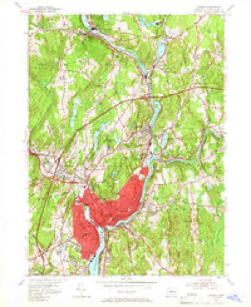
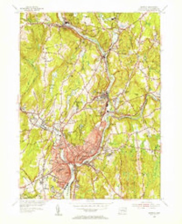
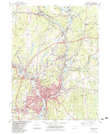
13 surveys from 30 printed sheetsMatched by testing this settlement's coordinate against the published boundary of every sheet in the United States Geological Survey's historical collection. Each opens the scanned sheet at the Survey.
- 1892 USGS Norwich quadrangle1:62500, 8 printings
- 1945 USGS Norwich quadrangle1:31680
- 1946 USGS Norwich quadrangle1:31680
- 1947 USGS Hartford quadrangle1:250000, 2 printings
- 1948 USGS Hartford quadrangle1:250000, 2 printings
- 1954 USGS Norwich quadrangle1:24000, 3 printings
- 1954 USGS Norwich quadrangle1:31680, 2 printings
- 1961 USGS Hartford quadrangle1:250000
- 1962 USGS Hartford quadrangle1:250000, 3 printings
- 1965 USGS Hartford quadrangle1:250000, 2 printings
- 1983 USGS Norwich quadrangle1:24000, 2 printings
- 1986 USGS Hartford quadrangle1:100000
- 1994 USGS Hartford quadrangle1:100000, 2 printings







In the county-history sources
37,554 words on this townshipHistory of New London County, Connecticut, with Biographical Sketches of Many of Its Pioneers and Prominent Men, published 1882 names this settlement in its chapter on Norwich Town. These are the passages that mention it, exactly as the scans read.
Stephen Backus. - The rights and privileges of William Backus, Sr., were transferred so soon after the settlement to his son Stephen that the latter is accounted the original proprietor. The house-lot was entered in his name, as to a first purchaser. It lay upon the pent highway by the Yantic, between the town green and the allotment of Thomas Bliss.
Passage source: History of New London County, Connecticut, with Biographical Sketches of Many of Its Pioneers and Prominent Men, published 1882.
A large number of the Backus family have acquired distinction in the various walks of life. Elijah Backus, whose iron-works at Yantic were so serviceable to the country in the Revolutionary war, was a grandson of Joseph. He married Lucy, daughter of John Griswold, of Lyme. His sons, and his son-in-law, Dudley Woodbridge, were among the first emigrants to the banks of the Ohio. James Backus, one of the sons, as agent of the Ohio Company, made the first surveys of Marietta, and is said to have built the first regular house in that town. He afterwards returned to Norwich, and died at the family residence, Sept. 29, 1816.
Passage source: History of New London County, Connecticut, with Biographical Sketches of Many of Its Pioneers and Prominent Men, published 1882.
He was at one time chaplain of the Ninth Regiment of Connecticut Volunteers in the war of the Rebellion. Previous to his appointment to the parish various projects looking to the erection of a new church were commenced and abandoned, and the people became almost dispirited. He, however, carefully considered the matter, and finally selected a plot on Broadway, the most beautiful portion of the city, which, with the buildings thereon, were purchased at a cost of $17,000. This location was chosen not only on account of its beautiful surroundings, but also because of its being so near the centre of the scattered parish, which extended from the village of Yantic on the north to Thamesville on the south and west, and Greeneville and a portion of the town of Preston on the east.
Passage source: History of New London County, Connecticut, with Biographical Sketches of Many of Its Pioneers and Prominent Men, published 1882.
Machine-read from a century-old scan, so expect the errors a machine makes: misspelled names, dropped words, stray characters.
Read the whole chapter on Norwich Town - it names this place 4 more 4 times.
Fires near this place
61 since 1997Regional context, not property-specific evidence. The federal wildfire occurrence database lists 61 fires within 5 miles of Yantic between 1997 and 2020, burning about 76 acres in total. None started naturally. 2 were recorded as arson. Distance is straight-line from the map coordinates, so a fire counted here may appear on a neighbouring settlement's page as well.
| Reported cause | Fires |
|---|---|
| Missing data/not specified/undetermined | 39 |
| Recreation and ceremony | 6 |
| Debris and open burning | 6 |
| Misuse of fire by a minor | 3 |
| Equipment and vehicle use | 2 |
| Arson/incendiarism | 2 |
| Smoking | 1 |
| Railroad operations and maintenance | 1 |
| Power generation/transmission/distribution | 1 |
The most recent of them, most recent first, with the day each was reported and the service that recorded it.
| Date | Cause | Size | Reported by | Name on the report |
|---|---|---|---|---|
| 2 September 2007 | Missing data/not specified/undetermined | under an acre | Connecticut Division of Forestry | not named |
| 1 August 1999 | Misuse of fire by a minor | 3.0 acres | Connecticut Division of Forestry | not named |
| 21 July 2016 | Missing data/not specified/undetermined | under an acre | Connecticut Division of Forestry | I 395 SB EXIT 18, LISBON CT |
| 18 July 2008 | Arson/incendiarism | under an acre | Connecticut Division of Forestry | not named |
| 10 July 2007 | Missing data/not specified/undetermined | under an acre | Connecticut Division of Forestry | not named |
| 26 June 2020 | Power generation/transmission/distribution | 1.0 acres | Connecticut Division of Forestry | 57 ROUTE 32 |
| 25 June 2020 | Missing data/not specified/undetermined | under an acre | Connecticut Division of Forestry | BROWNING RD/ GAGER RD |
| 4 May 2015 | Missing data/not specified/undetermined | 2.5 acres | Connecticut Division of Forestry | not named |
Settlements close enough to share some of these fires:
Mines and quarries near this place
10 of 24 shownRegional context, not property-specific evidence. The federal mineral resources record lists 24 workings within 5 miles of Yantic: 21 past producers, 3 producers. 3 still produce. What was taken out: Sand and Gravel, Construction, Stone, Dimension, Stone, Gold. Distance is straight-line from the map coordinates, so a quarry counted here may appear on a neighbouring settlement's page as well.
| Where | Site | Commodity | Status | Recorded |
|---|---|---|---|---|
| Gold Mine | Gold | Past Producer | ||
| Alaskite Gneiss Rock Quarry No. Aj-019 | Stone | Past Producer | ||
| Biotite Muscovite Schist Rock Quarry No. Aj-018 | Stone | Past Producer | ||
| Gneiss Rock Quarry No. Ak-001 | Stone | Past Producer | Gneiss | |
| Quartz Monzonite Rock Quarry No. Aj-016 | Stone | Past Producer | Unknown | |
| Building Stone Quarry | Stone, Dimension | Past Producer | ||
| Building Stone Quarry | Stone, Dimension | Past Producer | ||
| Building Stone Quarry | Stone, Dimension | Past Producer | ||
| Building Stone Quarry | Stone, Dimension | Past Producer | ||
| Quarry | Stone, Dimension | Past Producer |
Storms near this place
3 since 2006Regional context, not property-specific evidence. The National Weather Service names Yantic in 3 storm reports between 2006 and 2007: 2 flood, 1 flash flood. No death or injury is recorded in these reports. Each account below is quoted exactly as the forecast office filed it, from the NOAA Storm Events Database, and each date opens the federal record of that event.
| When | Event | Place named | Harm | What the report says |
|---|---|---|---|---|
| March 2007 | Flash Flood | Yantic | - | Roads closed due to flash flooding in Yantic. |
| May 2006 | Flood | Yantic | - | Minor flooding on the Yantic River. |
| April 2007 | Flood | Yantic | - | no account filed |
Nearest settlements
The eight closest, with where each one stands in the county. Distances are straight-line, computed from the Geographic Names Information System coordinates.
| Map | Place | Distance | Sheets |
|---|---|---|---|
| Norwichtown | 1.1 miles | 30 | |
| Fitchville | 1.6 miles | 30 | |
| Smith Corner | 2.2 miles | 30 | |
| Backus Corner | 3.3 miles | 30 | |
| Norwich | 3.5 miles | 30 | |
| Franklin | 3.6 miles | 30 | |
| Waterman Point (historical) | 3.7 miles | 30 | |
| Leffingwell (historical) | 3.8 miles | 30 |
Elsewhere
Matched on this settlement's Geographic Names Information System number rather than its name, so it cannot be a different place of the same name in another state.
| Wikidata item Q123262455 | The structured record the population and elevation above come from. Public domain (CC0). |
Provenance
This settlement is recorded in the Geographic Names Information System as feature 212305. The sheet list is computed by point-in-boundary test against the United States Geological Survey's historical topographic inventory. Both are works of the United States government and carry no copyright under 17 U.S.C. 105.
Wildfire. Short, Karen C. 2022. Spatial wildfire occurrence data for the United States, 1992-2020 [FPA_FOD_20221014]. 6th Edition. Fort Collins, CO: Forest Service Research Data Archive. https://doi.org/10.2737/RDS-2013-0009.6 Collected with United States Government funding and usable without additional permissions or fees.
Mines and quarries. USGS Mineral Resources Data System (MRDS) https://mrdata.usgs.gov/mrds/ A work of the United States government, no copyright under 17 U.S.C. 105.
Storms. NOAA National Centers for Environmental Information, Storm Events Database https://www.ncei.noaa.gov/stormevents/ A work of the United States government, no copyright under 17 U.S.C. 105. Narratives are quoted verbatim from the National Weather Service report and are not edited or summarised.