 Block
Groton, Connecticut
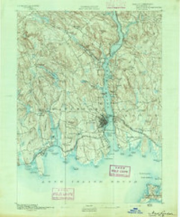
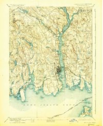
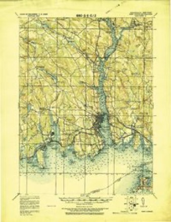
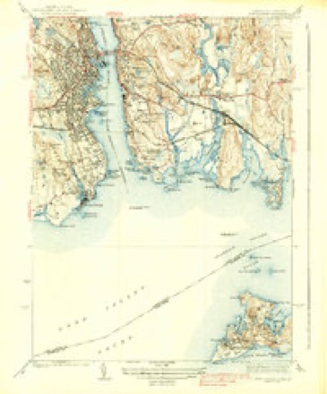
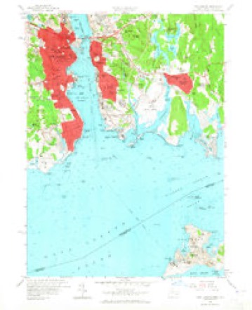
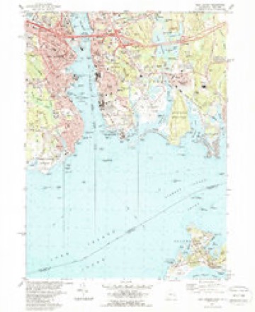
32 topographic sheets cover this place, the earliest surveyed in 1892 and the latest in 1984. It stands in Groton town. It lies in ZIP code area 06340. It lies near Fort Griswold Hill. The Survey maps it on the New London quadrangle. 9,326 people lived here at the 2021 count. It stands 79 feet above sea level.
On record in Groton
Buildings and businesses the archive holds for this place. Each opens its own page, with the source record it came from.
On the National Register 10 records
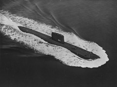 U.S.S. NAUTILUS (submarine)National Historic Landmark · listed 1979
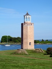 Avery Point Lighthouselisted 2002
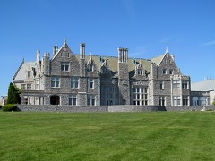 Branford Houselisted 1984
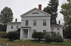 Burnett's Corner Historic Districtlisted 1997
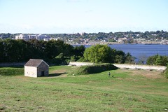 Fort Griswoldlisted 1970
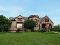 Groton Bank Historic Districtlisted 1983
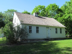 Jabez Smith Houselisted 1981
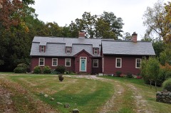 Edward Yeomans Houselisted 1978
- Eastern Point Historic Districtlisted 1979
- Shepherd of the Sea Chapellisted 2025
Population over time
7 figuresGroton fell from 9,955 to 9,387 between 1990 and 2020. These are the recorded population figures Wikidata holds for this place, reached through the Geographic Names Information System number this page is keyed on rather than by name, so they belong to this place and not to another of the same name. Most are census counts, but not all are: an early figure may be a founding or settlement estimate, and an estimate published within five years of a census is left out. The change column is computed, and is left blank where more than 20 years separate a figure from the one before it, because a gap that long is not a change between two counts.
| Year | People | Change |
|---|---|---|
| 1990 | 9,955 | |
| 1996 | 9,712 | -243 (-2%) |
| 1997 | 9,640 | -72 (-1%) |
| 1998 | 9,489 | -151 (-2%) |
| 1999 | 9,395 | -94 (-1%) |
| 2010 | 10,389 | +994 (+11%) |
| 2020 | 9,387 | -1,002 (-10%) |
Topographic sheets covering this place
12 surveys from 32 printed sheetsMatched by testing this settlement's coordinate against the published boundary of every sheet in the United States Geological Survey's historical collection. Each opens the scanned sheet at the Survey.
- 1892 USGS New London quadrangle1:62500
- 1893 USGS New London quadrangle1:62500, 10 printings
- 1921 USGS New London quadrangle1:62500
- 1938 USGS New London quadrangle1:31680, 3 printings
- 1947 USGS Hartford quadrangle1:250000, 2 printings
- 1948 USGS Hartford quadrangle1:250000, 2 printings
- 1958 USGS New London quadrangle1:24000, 3 printings
- 1961 USGS Hartford quadrangle1:250000
- 1962 USGS Hartford quadrangle1:250000, 3 printings
- 1965 USGS Hartford quadrangle1:250000, 2 printings
- 1983 USGS New Haven quadrangle1:100000, 2 printings
- 1984 USGS New London quadrangle1:24000, 2 printings






In the county-history sources
15,472 words on this townshipHistory of New London County, Connecticut, with Biographical Sketches of Many of Its Pioneers and Prominent Men, published 1882 names this settlement in its chapter on Groton Town. These are the passages that mention it, exactly as the scans read.
DuMNG this period a choice selection from these names will be found upon the roll of the Assembly from this town. We will hasten to show the patriotic part Groton also took in the agitation which preceded the battles of Concord, Lexington, and Bunker Hill, and the heroic action of her sons at Bunker Hill and during the entire war for independence, culminating in the battle on Groton Heights. We have already said that the town of Groton was settled by men and women that took an interest in the cause of education, and their successors, at the dawn of the Revolution, took a deep interest in the progress of liberty. They viewed with just indignation every measure of repression adopted by Great Britain tending to curtail independence of thought and action among the colonies. The presence of such men as Ebenezer, John, and William Ledyard, Silas Deane, Thomas Mumford, and the young men of the Avery, Morgan, Gallup, Allyn, Gere, Packer, Burrows, Billings, Fanning, Niles, Williams, Fish, Starr, Latham, Perkins, Stoddard, Hurlbut, Chester, Eldredge, and other families in the frequent town-meetings of Groton accounts for the bold and patriotic spirit which everywhere animates their public meetings. To begin with the year 1774, when the colonies were greatly excited by successive acts of Parliament, and especially by the act of Parliament which shut up the port of Boston, we copy the records, mostly verbatim, to justify the claim we make of enlightened patriotism in our country towns, and of this town in particular. At a town-meeting held in Groton on Monday, the 20th day of June, a.d. 1774, William AVilliams, Esq., moderator, -
Passage source: History of New London County, Connecticut, with Biographical Sketches of Many of Its Pioneers and Prominent Men, published 1882.
The Committee of Inspection for 1775 has Hon. William Williams for chairman, and the new names of Simeon Avery, Stephen Billings, Rev. Park Avery, and Nathan Gallup. The others are as before. In January, 1775, Thomas Mumford, Esq., and Lieut. Nathan Gallup were appointed agents of the town "to represent to the Honorable General Assembly the situation and circumstances of said town of Groton, the need and necessity of a Fortification on Groton Heights near the ferry, and to obtain an order to draw money out of the colonial treasury for whatever cost they have been or may be at for the purposes aforesaid, with officers to take care of the same." As the result of this movement, Fort Griswold was built, mainly by the hands of the patriotic citizens of Groton.
Passage source: History of New London County, Connecticut, with Biographical Sketches of Many of Its Pioneers and Prominent Men, published 1882.
Of Thomas Mumford, so often mentioned in townmeetings before, during, and after the war, a passing word may properly be said. He was first chosen to the office of selectman in 1759, and was termed Ensign Mumford as early as 1766. He was in the first, or Groton Bank company, there being five military companies in the town. He was one of the foremost and most efficient of the Sons of Liberty. The historian of New London, already quoted, says, "Thomas Mumford, of Groton, belonged to that company of gentlemen, eleven in number, who in April, 1775, formed the project of taking Ticonderoga. This undertaking, so eminently successful, was wholly concerted in Connecticut, without any authority from Congress. Mumford was first selectman through the earlier years of the war, and was the financial manager of the affiiirs of Groton; in constant communication with fellow-patriots in other towns and in other States, a man in whom Governor Trumbull trusted, and the confidential adviser with Deane and others. In 1778 he was one of a committee appointed by Congress to receive and sign emissions of bills. He was
Passage source: History of New London County, Connecticut, with Biographical Sketches of Many of Its Pioneers and Prominent Men, published 1882.
Machine-read from a century-old scan, so expect the errors a machine makes: misspelled names, dropped words, stray characters.
Read the whole chapter on Groton Town - it names this place 69 more 69 times.
Fires near this place
16 since 1992Regional context, not property-specific evidence. The federal wildfire occurrence database lists 16 fires within 5 miles of Groton between 1992 and 2020, burning about 90 acres in total. None started naturally. None was recorded as arson. Distance is straight-line from the map coordinates, so a fire counted here may appear on a neighbouring settlement's page as well.
| Reported cause | Fires |
|---|---|
| Missing data/not specified/undetermined | 10 |
| Recreation and ceremony | 3 |
| Debris and open burning | 2 |
| Power generation/transmission/distribution | 1 |
The most recent of them, most recent first, with the day each was reported and the service that recorded it.
| Date | Cause | Size | Reported by | Name on the report |
|---|---|---|---|---|
| 25 July 2016 | Missing data/not specified/undetermined | 4.2 acres | Connecticut Division of Forestry | 983 LONG COVE RD |
| 8 April 1992 | Debris and open burning | 2.5 acres | Connecticut Division of Forestry | not named |
| 4 April 1992 | Recreation and ceremony | 6.0 acres | Connecticut Division of Forestry | not named |
| 24 April 2016 | Missing data/not specified/undetermined | 2.0 acres | Connecticut Division of Forestry | BATES WOODS PARK/CHESTER STREET |
| 24 April 2016 | Missing data/not specified/undetermined | 3.0 acres | Connecticut Division of Forestry | MAMACOKE ROAD, QUAKER HILL, CT |
| 23 April 2018 | Missing data/not specified/undetermined | 1.0 acres | Connecticut Division of Forestry | FULLER ST. |
| 23 April 2018 | Missing data/not specified/undetermined | 2.5 acres | Connecticut Division of Forestry | 112 CHESTER ST. |
| 20 April 2005 | Missing data/not specified/undetermined | 3.0 acres | Connecticut Division of Forestry | not named |
Settlements close enough to share some of these fires:
Mines and quarries near this place
10 of 62 shownRegional context, not property-specific evidence. The federal mineral resources record lists 62 workings within 5 miles of Groton: 55 past producers, 5 producers, 1 occurrence, 1 prospect. 5 still produce. What was taken out: Stone, Dimension, Granite, Sand and Gravel, Construction, Stone. Distance is straight-line from the map coordinates, so a quarry counted here may appear on a neighbouring settlement's page as well.
| Where | Site | Commodity | Status | Recorded |
|---|---|---|---|---|
| Flatrock Quarry | Niobium (Columbium), REE | Occurrence | Monazite, Eschynite | |
| Alaskite Gneiss Rock Quarry No. Ak-040 | Stone | Past Producer | ||
| Gneiss Rock Quarries No. Ak- | Stone | Past Producer | Gneiss | |
| Gneiss Rock Quarry No. Ak-008 | Stone | Past Producer | Gneiss | |
| Gneiss Rock Quarry No. Ak-009 | Stone | Past Producer | Gneiss | |
| Gneiss Rock Quarry No. Ak-041 | Stone | Past Producer | Gneiss | |
| Gneiss Rock Quarry No. Ak-042 | Stone | Past Producer | Gneiss | |
| Gneiss Rock Quarry No. Ak-047 | Stone | Past Producer | Gneiss | |
| Granite Rock Quarry No. Ak-016 | Stone | Past Producer | Granite | |
| Groton Reservoir Dredge | Sand and Gravel, Construction | Past Producer | Sedimentary |
Storms near this place
4 since 2005Regional context, not property-specific evidence. The National Weather Service names Groton in 4 storm reports between 2005 and 2017: 2 thunderstorm wind, 1 flood, 1 flash flood. No death or injury is recorded in these reports. Each account below is quoted exactly as the forecast office filed it, from the NOAA Storm Events Database, and each date opens the federal record of that event.
| When | Event | Place named | Harm | What the report says |
|---|---|---|---|---|
| September 2017 | Thunderstorm Wind | Groton | $10,000 | Multiple trees were reported down over the western and middle sections of the town. Including a tree falling into a building at 1 Crouch Street, trees down across Eastern Point Road, and a utility pole and wires down on Thames Street. |
| July 2009 | Thunderstorm Wind | Groton | $5,000 | A boat was reported overturned at Eastern Point Beach, with minor damage. |
| March 2007 | Flash Flood | Groton | - | Multiple Basements flooded and roads closed with 3-4 FT of water across roadways. |
| December 2005 | Flood | Groton | - | no account filed |
Nearest settlements
The eight closest, with where each one stands in the county. Distances are straight-line, computed from the Geographic Names Information System coordinates.
| Map | Place | Distance | Sheets |
|---|---|---|---|
| Fort Trumbull | 0.9 miles | 32 | |
| New London | 1.2 miles | 32 | |
| Pequot Village | 1.2 miles | 32 | |
| Trails Corner | 1.3 miles | 32 | |
| Long Hill | 1.4 miles | 32 | |
| Pleasant Valley | 1.5 miles | 32 | |
| East New London | 1.6 miles | 32 | |
| Nautilus Park | 2.2 miles | 33 |
Elsewhere
Matched on this settlement's Geographic Names Information System number rather than its name, so it cannot be a different place of the same name in another state.
| Wikipedia article on Groton | An encyclopaedic summary. Its text is share-alike, so it is linked here rather than copied. |
| Wikidata item Q626038 | The structured record the population and elevation above come from. Public domain (CC0). |
Provenance
This settlement is recorded in the Geographic Names Information System as feature 207531. The sheet list is computed by point-in-boundary test against the United States Geological Survey's historical topographic inventory. Both are works of the United States government and carry no copyright under 17 U.S.C. 105.
Wildfire. Short, Karen C. 2022. Spatial wildfire occurrence data for the United States, 1992-2020 [FPA_FOD_20221014]. 6th Edition. Fort Collins, CO: Forest Service Research Data Archive. https://doi.org/10.2737/RDS-2013-0009.6 Collected with United States Government funding and usable without additional permissions or fees.
Mines and quarries. USGS Mineral Resources Data System (MRDS) https://mrdata.usgs.gov/mrds/ A work of the United States government, no copyright under 17 U.S.C. 105.
Storms. NOAA National Centers for Environmental Information, Storm Events Database https://www.ncei.noaa.gov/stormevents/ A work of the United States government, no copyright under 17 U.S.C. 105. Narratives are quoted verbatim from the National Weather Service report and are not edited or summarised.