 Block
East New London, Connecticut
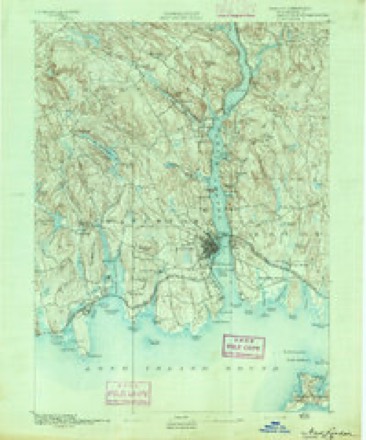
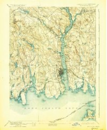
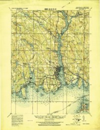
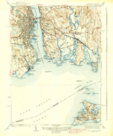
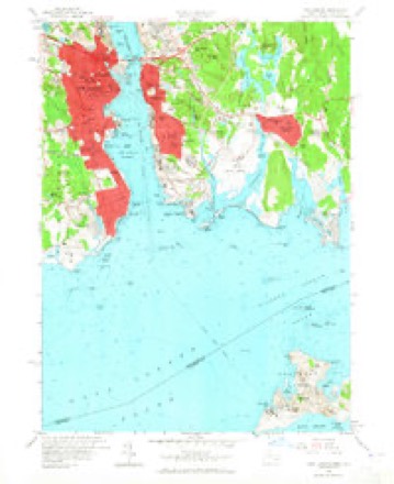
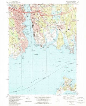
32 topographic sheets cover this place, the earliest surveyed in 1892 and the latest in 1984. It stands in New London town. It lies in ZIP code area 06320. It lies near Jacobs Rock. The Survey maps it on the New London quadrangle.
On record in East New London
Buildings and businesses the archive holds for this place. Each opens its own page, with the source record it came from.
On the National Register within a mile 12 of 27 shown
The National Register names another town for these. They stand within one mile of this settlement's coordinate.
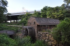 Winthrop Milllisted 1982 · 0.2 miles away
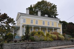 Post Hill Historic Districtlisted 1993 · 0.5 miles away
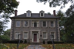 Deshon-Allyn Houselisted 1970 · 0.5 miles away
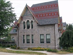 Bulkeley Schoollisted 1981 · 0.5 miles away
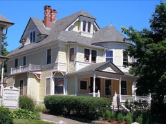 Nathan A. Woodworth Houselisted 1982 · 0.6 miles away
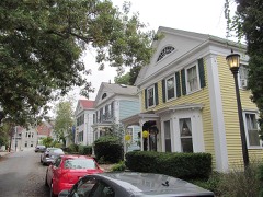 Prospect Street Historic Districtlisted 1986 · 0.6 miles away
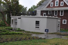 House at 130 Mohegan Avenuelisted 2009 · 0.6 miles away
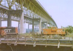 Central Vermont Railroad Pierlisted 2005 · 0.6 miles away
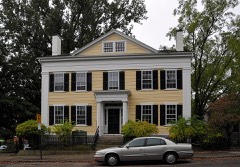 Acors Barns Houselisted 1976 · 0.7 miles away
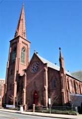 St. James' Episcopal Churchlisted 2004 · 0.7 miles away
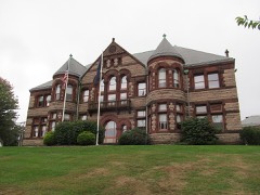 Williams Memorial Institutelisted 1978 · 0.7 miles away
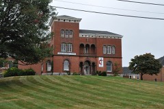 Jonathan Newton Harris Houselisted 1982 · 0.7 miles away
Topographic sheets covering this place
12 surveys from 32 printed sheetsMatched by testing this settlement's coordinate against the published boundary of every sheet in the United States Geological Survey's historical collection. Each opens the scanned sheet at the Survey.
- 1892 USGS New London quadrangle1:62500
- 1893 USGS New London quadrangle1:62500, 10 printings
- 1921 USGS New London quadrangle1:62500
- 1938 USGS New London quadrangle1:31680, 3 printings
- 1947 USGS Hartford quadrangle1:250000, 2 printings
- 1948 USGS Hartford quadrangle1:250000, 2 printings
- 1958 USGS New London quadrangle1:24000, 3 printings
- 1961 USGS Hartford quadrangle1:250000
- 1962 USGS Hartford quadrangle1:250000, 3 printings
- 1965 USGS Hartford quadrangle1:250000, 2 printings
- 1983 USGS New Haven quadrangle1:100000, 2 printings
- 1984 USGS New London quadrangle1:24000, 2 printings






In the county-history sources
55,345 words on this townshipHistory of New London County, Connecticut, with Biographical Sketches of Many of Its Pioneers and Prominent Men, published 1882 names this settlement in its chapter on New London Town. These are the passages that mention it, exactly as the scans read.
Josiah Crosby Waldo. - Rev. Josiah Crosby Waldo was born in Chesterfield, N. H., Dee. 5, 1803, His boyhood was passed in his native town, where also he was educated at the Chesterfield Academy. This was a locally celebrated institution, where the greater portion of the graduates from Dartmouth College were prepared. In 1824 he went to Saratoga Springs and taught school one year, when he returned to Chesterfield and placed himself under the training of the Rev. Hosea Ballou for the ministry. He soon after supplied various pulpits of the Universalist Church in and about Boston, and in 1828 removed to Cincinnati and became pastor of a young and growing church, since known as the First Universalist Society of Cincinnati. He entered into the work of the mmistry in that city with vigor and persistency, and succeeded in building up one of the most flourishing and powerful Universalist societies in the United States. It is not too much to say that the growth of that body from a small beginning to one of power and influence was due almost entirely to the earnest efforts in its behalf put forth by Mr. Waldo. Notwithstanding his pastoral duties demanded much of his attention, he established, soon after his settlement, the Sentinel and Star, a Universalist journal, and until 1831 was its managing editor. He wielded a graceful and trenchant pen, and under his able editorial management the paper secured a wide circulation and took prominent rank among the provincial press. In 1882 he resigned his pastorate and withdrew from the management of the Sentinel and Star and returned to Boston. He subsequently ofiiciated in the pastoral office in Lynn, Mass., which after a very successful labor of six years he resigned and located at Arlington, Mass., as pastor of the church at that place, where he remained eight years. He then removed to Troy, N. Y., where he preached until 1854, when, in consequence of the failing health of his wife, he gave up his pastorate and removed to New London, where he has since resided. Upon his removal to this city he supplied the pulpit of the Universalist Church for twelve years ; he then retired, and is now enjoying his otium cum dignitate at his beautiful villa in East New London.
Passage source: History of New London County, Connecticut, with Biographical Sketches of Many of Its Pioneers and Prominent Men, published 1882.
Machine-read from a century-old scan, so expect the errors a machine makes: misspelled names, dropped words, stray characters.
Fires near this place
17 since 1992Regional context, not property-specific evidence. The federal wildfire occurrence database lists 17 fires within 5 miles of East New London between 1992 and 2020, burning about 93 acres in total. None started naturally. None was recorded as arson. Distance is straight-line from the map coordinates, so a fire counted here may appear on a neighbouring settlement's page as well.
| Reported cause | Fires |
|---|---|
| Missing data/not specified/undetermined | 10 |
| Recreation and ceremony | 3 |
| Debris and open burning | 3 |
| Power generation/transmission/distribution | 1 |
The most recent of them, most recent first, with the day each was reported and the service that recorded it.
| Date | Cause | Size | Reported by | Name on the report |
|---|---|---|---|---|
| 25 July 2016 | Missing data/not specified/undetermined | 4.2 acres | Connecticut Division of Forestry | 983 LONG COVE RD |
| 13 May 2020 | Debris and open burning | 2.4 acres | Connecticut Division of Forestry | MAID MARION LANE |
| 8 April 1992 | Debris and open burning | 2.5 acres | Connecticut Division of Forestry | not named |
| 4 April 1992 | Recreation and ceremony | 6.0 acres | Connecticut Division of Forestry | not named |
| 24 April 2016 | Missing data/not specified/undetermined | 2.0 acres | Connecticut Division of Forestry | BATES WOODS PARK/CHESTER STREET |
| 24 April 2016 | Missing data/not specified/undetermined | 3.0 acres | Connecticut Division of Forestry | MAMACOKE ROAD, QUAKER HILL, CT |
| 23 April 2018 | Missing data/not specified/undetermined | 1.0 acres | Connecticut Division of Forestry | FULLER ST. |
| 23 April 2018 | Missing data/not specified/undetermined | 2.5 acres | Connecticut Division of Forestry | 112 CHESTER ST. |
Settlements close enough to share some of these fires:
Mines and quarries near this place
10 of 66 shownRegional context, not property-specific evidence. The federal mineral resources record lists 66 workings within 5 miles of East New London: 59 past producers, 5 producers, 1 occurrence, 1 prospect. 5 still produce. What was taken out: Stone, Dimension, Granite, Sand and Gravel, Construction, Stone. Distance is straight-line from the map coordinates, so a quarry counted here may appear on a neighbouring settlement's page as well.
| Where | Site | Commodity | Status | Recorded |
|---|---|---|---|---|
| Flatrock Quarry | Niobium (Columbium), REE | Occurrence | Monazite, Eschynite | |
| Alaskite Gneiss Rock Quarry No. Ak-040 | Stone | Past Producer | ||
| Gneiss Rock Quarries No. Ak- | Stone | Past Producer | Gneiss | |
| Gneiss Rock Quarry No. Ak-008 | Stone | Past Producer | Gneiss | |
| Gneiss Rock Quarry No. Ak-009 | Stone | Past Producer | Gneiss | |
| Gneiss Rock Quarry No. Ak-041 | Stone | Past Producer | Gneiss | |
| Gneiss Rock Quarry No. Ak-042 | Stone | Past Producer | Gneiss | |
| Gneiss Rock Quarry No. Ak-047 | Stone | Past Producer | Gneiss | |
| Granite Rock Quarry No. Ak-016 | Stone | Past Producer | Granite | |
| Groton Reservoir Dredge | Sand and Gravel, Construction | Past Producer | Sedimentary |
Storms near this place
2 since 2010Regional context, not property-specific evidence. The National Weather Service names East New London in 2 storm reports between 2010 and 2013: 1 flood, 1 hail. No death or injury is recorded in these reports. Each account below is quoted exactly as the forecast office filed it, from the NOAA Storm Events Database, and each date opens the federal record of that event.
| When | Event | Place named | Harm | What the report says |
|---|---|---|---|---|
| March 2010 | Flood | East New London | $260,000 | In Groton, many streams were above bankfull and numerous homes experienced basement flooding. |
| September 2013 | Hail | East New London | - | no account filed |
Nearest settlements
The eight closest, with where each one stands in the county. Distances are straight-line, computed from the Geographic Names Information System coordinates.
| Map | Place | Distance | Sheets |
|---|---|---|---|
| New London | 0.7 miles | 32 | |
| Harrisons | 1.4 miles | 33 | |
| Pleasant Valley | 1.4 miles | 32 | |
| Groton | 1.6 miles | 32 | |
| Fort Trumbull | 1.6 miles | 32 | |
| Nautilus Park | 1.7 miles | 33 | |
| Thames View | 2.0 miles | 33 | |
| Quaker Hill | 2.6 miles | 33 |
Provenance
This settlement is recorded in the Geographic Names Information System as feature 206840. The sheet list is computed by point-in-boundary test against the United States Geological Survey's historical topographic inventory. Both are works of the United States government and carry no copyright under 17 U.S.C. 105.
Wildfire. Short, Karen C. 2022. Spatial wildfire occurrence data for the United States, 1992-2020 [FPA_FOD_20221014]. 6th Edition. Fort Collins, CO: Forest Service Research Data Archive. https://doi.org/10.2737/RDS-2013-0009.6 Collected with United States Government funding and usable without additional permissions or fees.
Mines and quarries. USGS Mineral Resources Data System (MRDS) https://mrdata.usgs.gov/mrds/ A work of the United States government, no copyright under 17 U.S.C. 105.
Storms. NOAA National Centers for Environmental Information, Storm Events Database https://www.ncei.noaa.gov/stormevents/ A work of the United States government, no copyright under 17 U.S.C. 105. Narratives are quoted verbatim from the National Weather Service report and are not edited or summarised.