 Block
Jewett City, Connecticut
31 topographic sheets cover this place, the earliest surveyed in 1889 and the latest in 1984. It stands in Griswold town. It lies in ZIP code area 06351. It stands on Pachaug River. The Survey maps it on the Jewett City quadrangle. 3,328 people lived here at the 2020 count. It stands 154 feet above sea level.
On record in Jewett City
Buildings and businesses the archive holds for this place. Each opens its own page, with the source record it came from.
On the National Register within a mile 3 records
The National Register names another town for these. They stand within one mile of this settlement's coordinate.
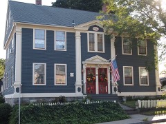 John Wilson Houselisted 1985 · 0.1 miles away
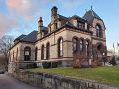 Slater Library and Fanning Annexlisted 2002 · 0.2 miles away
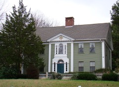 Andrew Clark Houselisted 1979 · 0.9 miles away
Population over time
2 figuresJewett City fell from 3,487 to 3,328 between 2010 and 2020. These are the recorded population figures Wikidata holds for this place, reached through the Geographic Names Information System number this page is keyed on rather than by name, so they belong to this place and not to another of the same name. Most are census counts, but not all are: an early figure may be a founding or settlement estimate, and an estimate published within five years of a census is left out. The change column is computed, and is left blank where more than 20 years separate a figure from the one before it, because a gap that long is not a change between two counts.
| Year | People | Change |
|---|---|---|
| 2010 | 3,487 | |
| 2020 | 3,328 | -159 (-5%) |
Topographic sheets covering this place
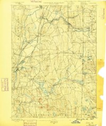
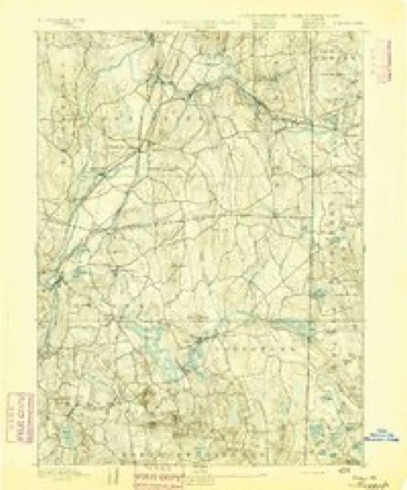
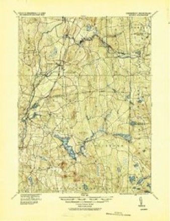
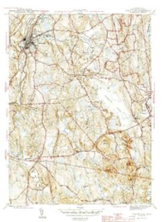
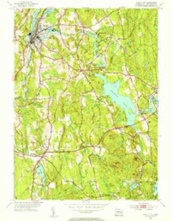
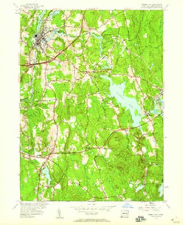
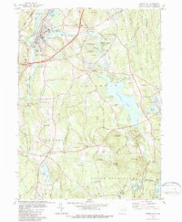
14 surveys from 31 printed sheetsMatched by testing this settlement's coordinate against the published boundary of every sheet in the United States Geological Survey's historical collection. Each opens the scanned sheet at the Survey.
- 1889 USGS Moosup quadrangle1:62500
- 1893 USGS Moosup quadrangle1:62500, 7 printings
- 1920 USGS Moosup quadrangle1:62500
- 1943 USGS Putnam quadrangle1:125000
- 1944 USGS Jewett City quadrangle1:31680, 3 printings
- 1947 USGS Providence quadrangle1:250000, 5 printings
- 1948 USGS Providence quadrangle1:250000
- 1953 USGS Jewett City quadrangle1:31680, 2 printings
- 1953 USGS Jewett City quadrangle1:24000, 3 printings
- 1957 USGS Providence quadrangle1:250000
- 1958 USGS Providence quadrangle1:250000
- 1963 USGS Providence quadrangle1:250000
- 1984 USGS Jewett City quadrangle1:24000, 3 printings
- 1984 USGS Providence quadrangle1:100000







In the county-history sources
13,789 words on this townshipHistory of New London County, Connecticut, with Biographical Sketches of Many of Its Pioneers and Prominent Men, published 1882 names this settlement in its chapter on Griswold Town. These are the passages that mention it, exactly as the scans read.
The first settlement in this town was made at Jewett City in 1771 by Eleazer Jewett, from whom the village of Jewett City derived its name. He was a persevering man, of a genial and kindly temperament, happy in doing good, and opening paths of enterprise for the benefit of others without laboring to enrich himself. Beginning with only a small farm and a mill-seat on the Pachaug River, he lived to see a flourishing village spread around him, enriched with mills, stores, mechanical operations, and farms in an improved state of tillage. His tombstone in the cemetery at Jewett City bears the following inscription :
Passage source: History of New London County, Connecticut, with Biographical Sketches of Many of Its Pioneers and Prominent Men, published 1882.
But a portion of the immense water-power at Jewett City is at present utilized. The Slater Mill and the Ashland Comiaany form in themselves a manufacturing interest of no small proportion, but within half a mile of the depot and post-ofiice is an unutilized water-power, cheaply available, capable, with an eighteen-feet dam, of operating one hundred and twenty thousand spindles.
Passage source: History of New London County, Connecticut, with Biographical Sketches of Many of Its Pioneers and Prominent Men, published 1882.
Mr. H. L. Reade. in speaking of Jewett City, says, " Long before its settlement by the whites it was a noted place of residence for the red men. Along the rapids of Pachaug they caught with curious contrivances the fish that frequented that beautiful stream ; in the lone forests along the shores of the Quinnebaug they found game of all kinds in abundance, and prob- Jibly one hundred years before the sound of the white man's axe disturbed the solitudes the number of inhabitants occupying the same territory was greater than that of the present day. No spot for scores of miles around (with one exception) has so long preserved so many and so curious samples of Indian husbandry and war as this.
Passage source: History of New London County, Connecticut, with Biographical Sketches of Many of Its Pioneers and Prominent Men, published 1882.
Machine-read from a century-old scan, so expect the errors a machine makes: misspelled names, dropped words, stray characters.
Read the whole chapter on Griswold Town - it names this place 19 more 19 times.
Fires near this place
125 since 1992Regional context, not property-specific evidence. The federal wildfire occurrence database lists 125 fires within 5 miles of Jewett City between 1992 and 2020, burning about 138 acres in total. None started naturally. 8 were recorded as arson. Distance is straight-line from the map coordinates, so a fire counted here may appear on a neighbouring settlement's page as well.
| Reported cause | Fires |
|---|---|
| Missing data/not specified/undetermined | 76 |
| Debris and open burning | 24 |
| Arson/incendiarism | 8 |
| Recreation and ceremony | 7 |
| Misuse of fire by a minor | 4 |
| Railroad operations and maintenance | 3 |
| Equipment and vehicle use | 2 |
| Smoking | 1 |
The most recent of them, most recent first, with the day each was reported and the service that recorded it.
| Date | Cause | Size | Reported by | Name on the report |
|---|---|---|---|---|
| 23 September 2020 | Missing data/not specified/undetermined | under an acre | Connecticut Division of Forestry | I395 NB |
| 22 September 2020 | Missing data/not specified/undetermined | 1.0 acres | Connecticut Division of Forestry | 333 EDMOND ROAD |
| 19 September 2020 | Missing data/not specified/undetermined | under an acre | Connecticut Division of Forestry | I395 NB EX21 |
| 13 September 2020 | Missing data/not specified/undetermined | under an acre | Connecticut Division of Forestry | 270 N BURNAHM HIGHWAY |
| 8 August 2016 | Missing data/not specified/undetermined | under an acre | Connecticut Division of Forestry | 229 S CANTERBURY RD, CANTERBURY CT |
| 6 August 2020 | Missing data/not specified/undetermined | under an acre | Connecticut Division of Forestry | 999 VOLUNTOWN ROAD |
| 28 July 2016 | Missing data/not specified/undetermined | under an acre | Connecticut Division of Forestry | 1531 GLASGO RD, GRISWOLD CT |
| 21 July 2016 | Missing data/not specified/undetermined | under an acre | Connecticut Division of Forestry | I 395 SB EXIT 18, LISBON CT |
Settlements close enough to share some of these fires:
Mines and quarries near this place
10 of 18 shownRegional context, not property-specific evidence. The federal mineral resources record lists 18 workings within 5 miles of Jewett City: 14 past producers, 4 producers. 4 still produce. What was taken out: Sand and Gravel, Construction, Stone, Dimension, Stone. Distance is straight-line from the map coordinates, so a quarry counted here may appear on a neighbouring settlement's page as well.
| Where | Site | Commodity | Status | Recorded |
|---|---|---|---|---|
| Biotite Gneiss Rock Quarry | Stone, Dimension | Past Producer | ||
| Biotite Gneiss Rock Quarry No. Aj-016 | Stone | Past Producer | Unknown | |
| Arpin Pit | Sand and Gravel, Construction | Past Producer | Sedimentary | |
| Arpin Pit | Sand and Gravel, Construction | Producer | ||
| Campbells Pit | Sand and Gravel, Construction | Past Producer | Sedimentary | |
| Campbells Pit | Sand and Gravel, Construction | Past Producer | ||
| Canterbury Pit | Sand and Gravel, Construction | Past Producer | Sedimentary | |
| Canterbury Pit | Sand and Gravel, Construction | Past Producer | ||
| Geer Pit | Sand and Gravel, Construction | Past Producer | Sedimentary | |
| Geer Sand and Gravel Company, Inc. | Sand and Gravel, Construction | Producer |
Storms near this place
10 since 1998Regional context, not property-specific evidence. The National Weather Service names Jewett City in 10 storm reports between 1998 and 2024: 5 thunderstorm wind, 3 hail, 2 flash flood. The reports record 1 injury. Each account below is quoted exactly as the forecast office filed it, from the NOAA Storm Events Database, and each date opens the federal record of that event.
| When | Event | Place named | Harm | What the report says |
|---|---|---|---|---|
| May 2014 | Hail | Jewett City | 1 hurt | A motorcyclist was injured due to falling hail, resulting in some cuts. The accident occurred near the intersection of Routes 138 and I-395, south of Jewett City. ||Hail size was estimated by nearby reports. |
| June 2020 | Thunderstorm Wind | Jewett City | $6,000 | Tree down on unoccupied car on Hill Street. |
| July 2015 | Thunderstorm Wind | Jewett City | $3,000 | Trees and wires were reported down at 5 Lincoln Square in Jewett City. |
| July 2008 | Thunderstorm Wind | Jewett City | $1,500 | Wires and 2 trees were reported down at 254 River Road in Preston. |
| May 2024 | Hail | Jewett City | - | Public reports 1 inch hail along interstate 395 near Taylor Hill Road. |
| September 2022 | Flash Flood | Jewett City | - | Route 138 is closed in both directions between Route 169 and Ross Road due to flooding in the Town of Lisbon. |
| June 2009 | Hail | Jewett City | - | Penny size hail was reported in Lisbon. |
| July 2005 | Thunderstorm Wind | Jewett City | - | Trees and power lines down. |
| August 2006 | Thunderstorm Wind | Jewett City | - | no account filed |
| June 1998 | Flash Flood | Jewett City | - | no account filed |
Nearest settlements
The eight closest, with where each one stands in the county. Distances are straight-line, computed from the Geographic Names Information System coordinates.
| Map | Place | Distance | Sheets |
|---|---|---|---|
| Dorrville (historical) | 0.5 miles | 31 | |
| Clayville | 0.7 miles | 31 | |
| Newent | 2.0 miles | 30 | |
| Hopeville | 2.3 miles | 31 | |
| Pachaug | 2.6 miles | 31 | |
| Versailles | 3.0 miles | 30 | |
| Occum | 3.8 miles | 30 | |
| Taftville | 4.3 miles | 30 |
Elsewhere
Matched on this settlement's Geographic Names Information System number rather than its name, so it cannot be a different place of the same name in another state.
| Wikipedia article on Jewett City | An encyclopaedic summary. Its text is share-alike, so it is linked here rather than copied. |
| Wikidata item Q753995 | The structured record the population and elevation above come from. Public domain (CC0). |
Provenance
This settlement is recorded in the Geographic Names Information System as feature 208160. The sheet list is computed by point-in-boundary test against the United States Geological Survey's historical topographic inventory. Both are works of the United States government and carry no copyright under 17 U.S.C. 105.
Wildfire. Short, Karen C. 2022. Spatial wildfire occurrence data for the United States, 1992-2020 [FPA_FOD_20221014]. 6th Edition. Fort Collins, CO: Forest Service Research Data Archive. https://doi.org/10.2737/RDS-2013-0009.6 Collected with United States Government funding and usable without additional permissions or fees.
Mines and quarries. USGS Mineral Resources Data System (MRDS) https://mrdata.usgs.gov/mrds/ A work of the United States government, no copyright under 17 U.S.C. 105.
Storms. NOAA National Centers for Environmental Information, Storm Events Database https://www.ncei.noaa.gov/stormevents/ A work of the United States government, no copyright under 17 U.S.C. 105. Narratives are quoted verbatim from the National Weather Service report and are not edited or summarised.